
Transit extensions: what site context does GenAnywhere add?
How a corridor study gains a shared 3D frame before station design starts.
An extension changes the blocks around every stop. Planners need to see how a station would sit among existing buildings, where access would land, and which lots would feel the pressure of new foot traffic. GenAnywhere can assemble a 3D site scene for a station area from map data, so a team can compare options in one shared frame. It supports the early conversation about land use and access. It does not predict ridership or replace an engineering study.
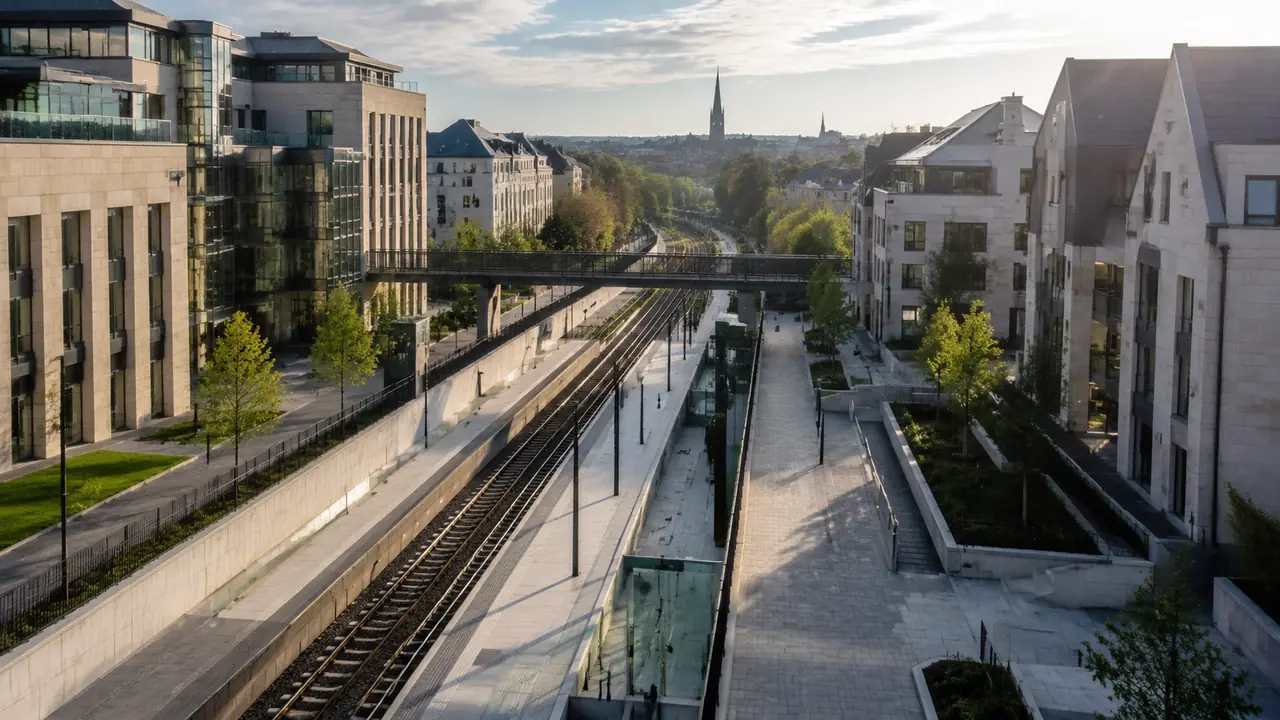
1 What an extension asks of the land around it
1.1 Which blocks change when a line arrives?
A new stop does not change every parcel in a district. It changes the ones within a short walk, the ones on the street that leads to the platform, and the ones where a parking lot could become something else. Those blocks deserve the closest look. A corridor study that treats every parcel the same misses the small cluster where the station's effect will concentrate. A site scene helps the team find that cluster and keep the review centered on it.
1.2 How far does a station area reach?
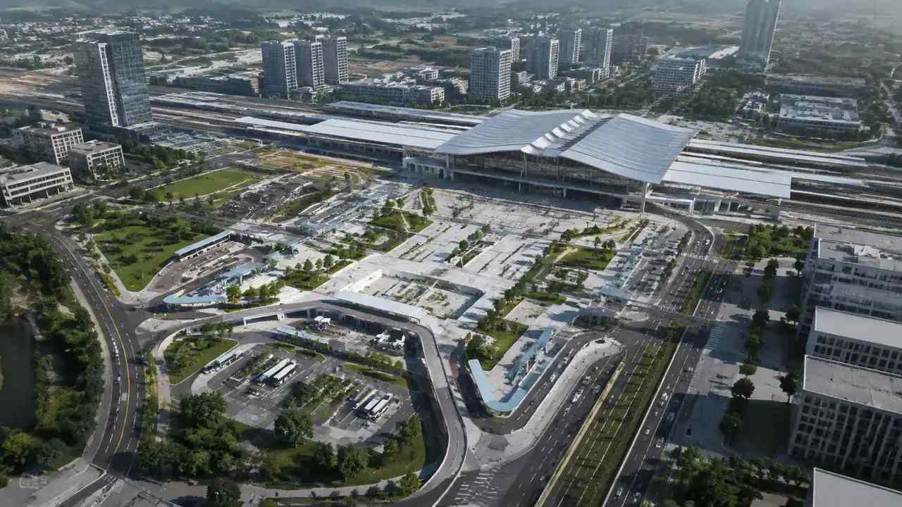
Agencies often define a station area by walking distance, and the exact boundary varies by city and by the type of service. The boundary matters because it decides which properties are studied and which are left out. A visual scene can show the walking routes, the barriers such as a highway or a rail yard, and the places where a short map distance is a long walk in practice. That is more useful than a circle drawn around the platform.
The boundary also changes the politics. A property inside the study area expects to be consulted, and one outside may not be. Showing the boundary on the same scene as the walking routes helps the team explain why a line was drawn where it was.
2 The context a corridor study keeps missing
2.1 What do aerial photos hide?
An aerial photo flattens height, and height is where much of the transit argument lives. A row of three-storey buildings and a row of towers can look similar from above, yet they create very different streets for someone walking to a platform. Photos also hide grade changes, retaining walls, and the small gaps that make a route feel safe or hostile. A 3D scene restores enough of that information to change how a team reads a block.
2.2 Why does building height matter along a route?
Height shapes daylight, wind, and the sense of enclosure on a street. It also shapes the development conversation, since taller parcels can absorb more of the growth a station is expected to attract. Planners do not need a measured model to discuss that. They need a consistent picture where the heights are estimated the same way across the corridor. Without that, each block gets argued on its own terms.
Height also affects the view from the platform. A passenger stepping off a train reads the street through the buildings around the station, and a low wall of shops feels different from a row of blank towers. The scene lets the team test that impression before a design team takes over.
3 Assembling an editable corridor scene
3.1 How does GenAnywhere cover a route?
A user selects an area on the map, and GenAnywhere generates a 3D site model from satellite and map data, including buildings, terrain, water, and vegetation. For a corridor, teams often build a scene around each station area and compare them as a set, or select a larger area when the map supports it. Terrain is matched to the surrounding ground, and building footprints are recognized with heights estimated and types inferred. That produces a consistent base for every stop, which a set of hand-drawn base maps rarely achieves.
3.2 What can be adjusted stop by stop?
Individual buildings can be replaced, moved, rotated, or resized, and their heights and types adjusted. Layers for buildings, terrain, and vegetation can be previewed separately, which helps when a team wants to study the street edge without the tree canopy. A planner can test a taller building near a platform, remove a low structure to open a sightline, or shift a proposed entrance. These edits are for discussion, and they should be labeled as tests rather than plans.
Keep the same equipment and furniture across options so the comparison stays about urban form. A bench, a shelter, or a row of trees can make one option look friendlier, which is fine for a final design but misleading in a shortlist review.
4 Comparing station-area options
4.1 How should alternatives be framed?
Frame each alternative around the decision it represents: more housing near the stop, a park-and-ride at the edge, a pedestrian route to a existing center. Show each option from the platform, from the street, and from the nearest residential block. Keep the base scene and the camera positions identical so the audience sees the choice rather than the rendering. Three well-chosen views usually beat a flythrough.
4.2 What makes a comparison fair?
A fair comparison uses the same assumptions about heights, the same level of detail, and the same treatment of uncertain parcels. It also states what is not included, such as future developments already approved but not built. Without that note, an option can look emptier or fuller than it would be in reality. A short assumptions page does more for credibility than another polished image.
5 Limits of a context scene
5.1 Which ridership questions need modeling?
Ridership forecasts depend on travel demand models, land use assumptions, service plans, and fare policy. A site scene contains none of those. It can show where people would walk and what the station area looks like, which helps explain a forecast to the public. It cannot produce the forecast, and a team should resist the temptation to imply that a good-looking station area will attract riders on its own.
5.2 When does a visual become misleading?
A visual misleads when it implies certainty the project does not have. A station entrance drawn as a finished structure, a plaza with no construction phase, or a block cleared of its current tenants all tell a story the team cannot support. Label proposals clearly, keep existing conditions visible, and avoid rendering people in ways that suggest a finished public realm. The scene should look like a working model, not a sales image.
The test is simple. If a viewer cannot tell what is existing, what is proposed, and what is unknown, the visual is doing more harm than good. Fix the labels before fixing the lighting.
6 Presenting the corridor to decision makers
6.1 Who needs to see it?
Transit staff, city planning, highway authorities, utilities, and community groups all have a stake in a corridor. Each tends to work from its own drawings, which is why meetings so often stall on basic orientation. A shared scene lets a highway engineer see the platform, a planner see the adjacent zoning, and a resident see the block behind their street. The conversation moves from where things are to what should happen.
Different audiences also need different views. A council member may look at the corridor on a map, while a resident wants the view from their street. Building both from the same scene keeps the story consistent.
6.2 What should the briefing include?
Include a corridor overview, one or two station areas in detail, the alternatives being compared, and a clear note on what the scene does not cover. Exported GLB files can go to design teams for use in 3D, BIM, GIS, or engine workflows, and the export carries a permanent commercial license under the platform's terms. Do not resell the source file or use it for AI training, and check third-party data rights before publishing images.
6.3 How do you keep the scene current?
Note the map date and the person responsible for the scene, then refresh it when a station area changes or a major development is completed. For a long corridor study, a refresh before each major milestone is enough. Keep the older versions labeled so the record shows how the thinking evolved. A dated model is easier to trust than a silent update.
To test a station area of your own, open GenAnywhere in a browser and follow the site workflow walkthrough. The American Public Transportation Association publishes background on transit planning and project delivery.
7 FAQ
FAQ-1 Can GenAnywhere forecast ridership?
No. Ridership forecasts come from travel demand models that use population, employment, service, and pricing assumptions. GenAnywhere builds a 3D site scene from map and satellite data. Use it to show station-area context and to explain a forecast, and keep the forecast itself with the planning team that owns the model.
FAQ-2 Can it model a whole corridor at once?
It depends on the area. Teams often build a scene for each station area and compare them as a set, which keeps the detail manageable. For a broader view, select a larger area if the map supports the scale you need. Check the result before relying on it, especially along the edges where data can thin out.
FAQ-3 How do you show walking routes in the scene?
Walking routes are usually drawn or described alongside the scene rather than generated by it. A team can mark a route on a plan, then use the 3D view to show the grade, the crossing, and the buildings along the way. That combination is more honest than implying that the model calculated walkability on its own.
FAQ-4 What can be exported to the design team?
The scene can be exported as a GLB file and opened in common 3D, BIM, GIS, or game engine tools, depending on the pipeline. Pair the export with a note on sources, date, and estimated heights, plus the assumptions behind each option. The export carries a permanent commercial license under the platform's terms. Confirm formats before the handoff.
Content and technical notes
This article was prepared by the GenAnywhere team with AI-assisted drafting and human review.
Product features, formats, and availability change as the platform evolves; refer to the official GenAnywhere website for current details.
For technical questions or corrections, contact support@genanywhere.com.
Last reviewed: 2026-11-15.