
Campus transition: how would GenAnywhere compare site options?
A shared visual method for weighing land, access, and phasing when a campus moves
A campus transition is rarely a single move. Programs shift between buildings, departments consolidate, and a satellite site may take on work that no longer fits the core. Comparing those options needs a common frame. GenAnywhere can build that frame from map data quickly, so a committee spends its time on tradeoffs instead of on assembling base maps.

1 Frame the transition before drawing buildings
1.1 What a campus move actually involves
A transition can mean a new building, a leased floor, or a full move to another site. Each path changes travel patterns, service delivery, and the identity of the campus. The physical question is often simpler than the political one: where can the program go without breaking what already works? That question deserves a site-level answer before any design begins. Put it on the table before the committee debates architecture, because the answer often narrows the options faster than any drawing. The committee can then test each option against the same question.
1.2 Rank criteria above building design
Access, parking, utilities, and room to phase construction usually matter more than the look of a facade. A site that is beautiful but hard to reach will struggle to serve students or staff. A site with good roads but no expansion room may repeat the problem in five years. Write the criteria down, and agree on their order before looking at options.
Rank them, and agree on what would cause a site to fail. A ranking agreed in advance is harder to bend later. The order matters more than the length of the list.
2 Comparing sites on equal terms
2.1 Build one shared checklist
Use one checklist for every option, even when the sites differ in size or ownership. Include travel time, transit, parking, utility capacity, land area, and the cost of swing space during construction. Add the academic calendar, because a move that overlaps a term costs more than one that does not. A shared list keeps the discussion comparable, and a checklist that fits on one page is easier to use than a spreadsheet nobody reads. Add the distance to transit and the quality of the walk.
2.2 Seeing each option the same way
A site shown from a drone height and another shown from the street cannot be compared fairly. Fix the camera positions and the scene extent for every option. Show the same layers, including the surrounding roads and buildings, so the context does not change with the option. Consistency is what turns a set of pictures into evidence.
Print the views at the same size and put them side by side, because a committee sees differences faster when the images do not jump in scale. The images should look like they belong to the same study. Keep the list visible during the meeting so the criteria stay in view, and let each option be described in the same order.
3 Using a site model for comparison
3.1 What GenAnywhere can produce
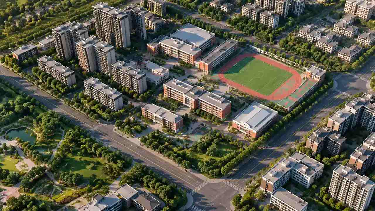
GenAnywhere generates an editable 3D site model from satellite and map data for a selected area. It identifies building footprints, estimates height, infers type, and reads nearby vegetation. Buildings, terrain, water, and planting arrive as separate layers that can be previewed and edited, and the result can be exported as GLB. For a transition study, a user can place a simple volume for the proposed program on each site and compare how it meets the ground, the roads, and the existing buildings. A simple block at the right floor area is enough to test the fit.
3.2 What it cannot settle
The scene does not calculate travel time, utility capacity, or construction cost. It does not replace a parking study or an accessibility review. Those questions need data from the institution and its consultants. The model gives the committee a shared picture and a way to test whether an option is worth the next round of analysis.
It does not choose the site. Say what the scene covers and what it leaves out, since a clear statement of limits makes the model more useful, not less. The model is a frame for questions, not a source of answers about travel or capacity.
4 Reading each site's surroundings
4.1 Test access and arrival
Arrival is more than a driveway. It includes transit stops, drop-off space, pedestrian routes, and the experience of walking in. A site with a fast road but a poor crossing can feel farther away than its distance suggests. Look at the routes people will actually use, and test them at the times when the campus is busiest. Walk the arrival route at the start and end of a class day if possible, because the experience changes with the crowd. Access is a daily experience, not a one-time check.
4.2 Check neighbors and room to grow
Check what surrounds each site and what those neighbors are likely to do. A vacant parcel next door may be an opportunity or a future construction site. Ask about noise, lighting, and evening activity. Then ask whether the site can add space later without repeating the current move.
Growth room is cheaper to preserve than to create. Check the zoning and the ownership of the parcels next door, since a friendly neighbor today can become a construction site tomorrow. Draw those parcels on the site plan so the boundary is visible.
5 Keeping the comparison honest
5.1 Hold assumptions and detail steady
Give every option the same level of modeling and the same assumptions about program size. A detailed option can look more credible simply because it has more work in it. Note where an option is still a sketch. The committee should compare the proposals, not the amount of effort behind each drawing.
Mark each option with the same program area and the same assumed height, otherwise the comparison rewards the most generous assumptions. A short note on the modeling level prevents that drift. A fixed camera height removes one more variable.
5.2 Documenting what changed
When a criterion or a site assumption changes, record the change and the date. A comparison that quietly updates itself is hard to audit. Keep earlier versions of the scene and the checklist. The record helps a new committee member understand why an option moved up or down. A short change log at the top of the checklist is enough, since anyone opening the file can see what moved and when. A version number helps when the file is shared outside the core team.
6 When one site should be dropped
6.1 Name the disqualifying conditions
Drop a site when access cannot be fixed, when the land cannot hold the program at a workable density, or when the phasing would displace core functions for too long. Those conditions are usually visible early. Keeping a weak option on the list consumes attention that the remaining sites need. Write the disqualifying condition next to the site and keep the evidence, because a clear reason makes the decision easier to explain. A weak option kept for comfort is still a weak option.
6.2 Keep the right record
Keep the scene, the checklist, and a short note on why the site was dropped. Include the date and the person who made the call. A record of rejected options is useful when the same site appears again in a later planning cycle. It also shows that the process considered alternatives.
The note does not need to be long. A paragraph and a date are enough to preserve the reasoning. Store it with the scene so the two travel together.
6.3 Hand a short package to leadership
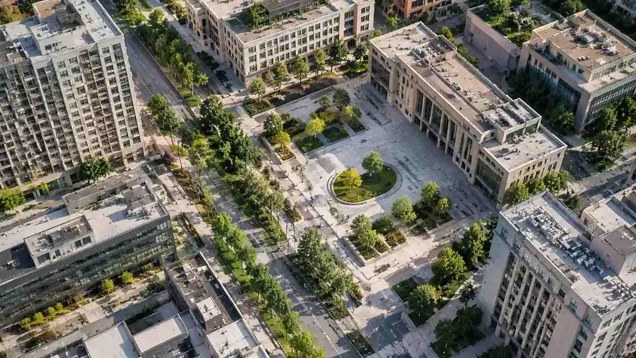
Leadership usually needs a small number of views and a clear statement of what each option requires. Prepare a short set of images from the fixed camera positions and a one-page summary of the tradeoffs. Keep the detailed scene available for questions. Keep the detailed scene available for questions, and let the summary carry the meeting. Leadership can ask for detail, but it should not have to ask for clarity. The Society for College and University Planning publishes material on campus planning that can help frame the discussion.
Generate a site model from a map
7 FAQ
FAQ-1 How can a team compare campus sites fairly?
Use one checklist, one set of camera positions, and one level of modeling for every option. Compare access, parking, utilities, phasing, and growth room rather than appearance. Record assumptions and dates. Fairness comes from a consistent method, not from an expensive rendering. Agree the method before the options are shown.
FAQ-2 Can GenAnywhere show a proposed building on each site?
Yes. A user can place or edit a simple volume in a generated site scene and view it against existing buildings, roads, and terrain. The scene is for context and comparison. It does not design the building or confirm that the program fits every technical requirement. It also does not replace a survey.
FAQ-3 Does the platform calculate travel time or parking demand?
No. Those calculations need local data, traffic studies, and institutional policy. The platform provides site geometry from map and satellite sources. Use the scene to frame the questions, then bring the numbers from the people who own them. Keep the scene and the study separate so each can be updated on its own schedule.
FAQ-4 Is a generated scene useful after the site is chosen?
Yes. The scene can carry into design as a context layer, and it can support early conversations with planners and neighbors. Export it as GLB for the design team, and keep the layered version for edits. It remains a reference rather than a substitute for design work. Label it with a date.
See how the site workflow fits together
Content and technical notes
This article was prepared by the GenAnywhere team with AI-assisted drafting and human review.
Product features, formats, and availability change as the platform evolves; refer to the official GenAnywhere website for current details.
For technical questions or corrections, contact support@genanywhere.com.
Last reviewed: 2026-11-14.