
Aircraft export: does GenAnywhere support GLB?
The export is GLB and the aircraft are not in it: the airfield travels, the fleet stays with the asset library.
Yes, GenAnywhere exports GLB, and the file opens in 3D, BIM, GIS and game engine workflows. No, the export does not contain aircraft, because aircraft are equipment and the platform generates site content. A workable airport deliverable combines the two: the airfield and its buildings from the scene, the aircraft from a library, placed where the review needs them. That combination is ordinary practice, and it is worth describing plainly before anyone opens the file.

1 What the GLB contains at an airport
1.1 Ground, apron, terminal and the land beyond
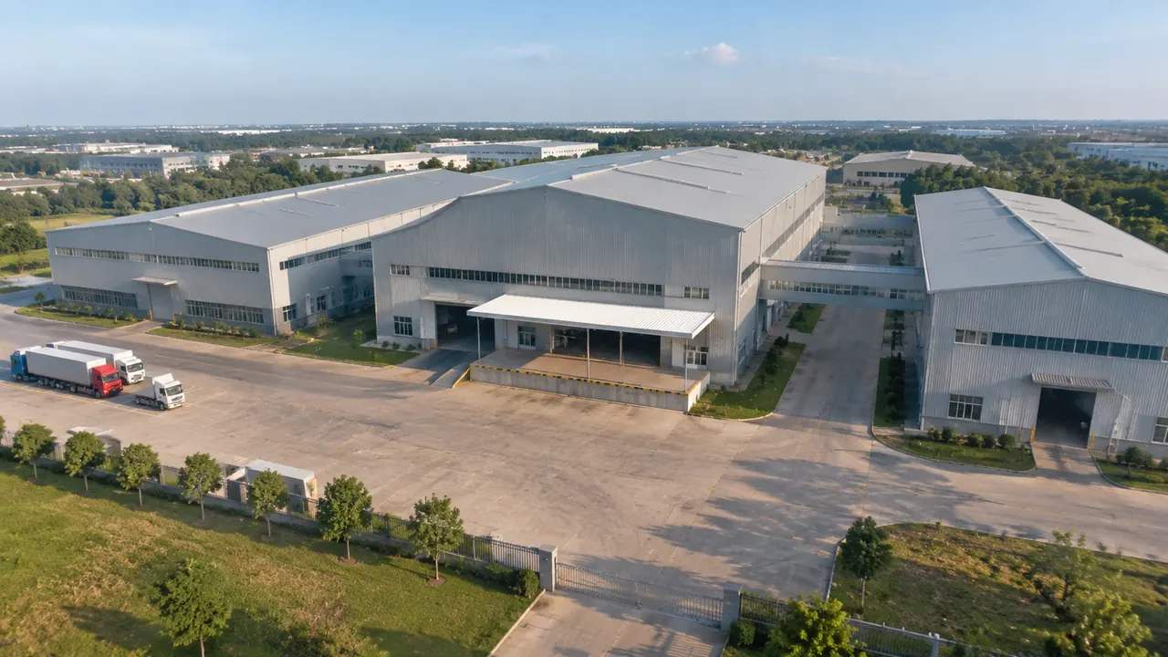
The file carries the terrain surface, the paved areas the map data records, the terminal and support buildings, and the vegetation around the boundary. Heights on buildings are estimated and types are inferred, so a cargo shed may arrive labelled as a warehouse. Both can be corrected before export, and the corrections travel with the file. What arrives is a setting with the airfield's arrangement in it, from the runway to the fields outside the fence. Apron limits and stand markings are not separate objects, so treat the paving as ground rather than as a layout drawing.

1.2 Layers and edits that travel
Edits to buildings and layer choices are part of what you export, so a corrected terminal footprint reaches the receiving tool. Terrain, water and vegetation usually stay separable as objects, which lets a receiving team switch planting off for a layout view. Import behaviour differs between applications, so check the object structure after opening the file rather than assuming it matches the scene you previewed. Two minutes of checking saves an afternoon of confusion later. If the object names mean nothing to the receiving team, rename the important ones before the file leaves your desk.
2 Where the aircraft come from
2.1 Assets, not generated geometry
Aircraft, ground support equipment, jet bridges and service vehicles are equipment, and the platform does not generate them. The product documentation describes buildings, terrain, water and vegetation. Teams bring aircraft models from a library or use simple blocks, then place them in the downstream tool where the rest of the airport design already lives. Planning for that step at the start avoids a review that waits for geometry which will not arrive. A library model at the right size is worth more than a placeholder that nobody trusts.
2.2 Scale reference and its limits
A placed aircraft is useful for scale. It tells a viewer how big the apron is, how far a stand sits from the terminal, and how much room a widebody needs. It says nothing about stand allocation, taxi routes, wingtip separation or servicing. Those depend on operational rules and on surveyed positions. Use the aircraft to make the picture readable, and keep the operational questions with the people who hold the data and the rules. One aircraft on one stand usually does more than a full apron of them.
3 Combining files in a receiving tool
3.1 Engine and DCC routes
In a game engine or a 3D application, the GLB imports as a scene with materials and transforms, and the aircraft asset drops in beside it. That combination supports walkthroughs, lighting studies and interactive reviews. The aircraft stays a separate object, so moving it to another stand is a matter of typing a position. Keep the site and the aircraft in separate collections, so a later export of the site does not overwrite the fleet. Name both collections with a date, and the file stays usable by whoever opens it next.
3.2 BIM and GIS routes
In a BIM authoring package, treat the scene as reference geometry and the design as the model. In a GIS project, the scene gives context for the airfield and the land around it. Both routes are workflow arrangements rather than conversions into a native format. Check what the receiving team expects before promising a specific format, because the shape of the handover changes with the tool they use. Ask for a sample import if the project is large enough to justify it.
4 Format behaviour to expect
4.1 Import checks worth doing
Open the file once before sending it. Check the scale, the origin and the orientation, because a scene that arrives rotated or offset will waste an afternoon. Check that the buildings you corrected still look right and that no layer was dropped. This is not an audit of the platform; it is the ordinary check anyone does before handing a file to a colleague who cannot see your screen. Write down what you checked, so the next person does not repeat it from scratch.
4.2 Materials, units and orientation
The GLB carries geometry with materials, and units depend on the exporting and importing conventions. Some applications read metres, others assume something else, and a factor of a thousand is a familiar surprise. North may not point where the receiving tool expects it either. Note the unit and the orientation in the handover, and set them in the receiving tool rather than guessing from a screenshot.
5 Review use
5.1 Stands, gates and apron discussions
A generated airfield with aircraft placed on it makes a good review of arrangement: which stands are visible from the lounge, where a new pier would sit, how the apron reads from the approach road. The scene holds the ground and the buildings, and the aircraft make the scale legible. For a terminal expansion discussion, that combination covers most of what a non-specialist audience needs in order to follow the argument.
5.2 Presenting to a mixed audience
Say what came from where. Ground and buildings from the site model, aircraft from a library, operational data from the airport. A caption that separates the three keeps a good image from becoming a claim. Audiences accept a composite when it is described, and they lose trust when they discover the mix afterwards. A legend costs nothing and settles the question before it is asked. The authorization statement sets out what the export permits when the file goes into client work.
6 Before you send
6.1 Name the parts
Before sending, list what the file contains and what it does not. Terrain, buildings, vegetation and water are in; aircraft, ground vehicles and airside systems are out. A short list in the covering note stops the receiving team from searching for objects that were never generated. It also makes the next handover faster, because the list can be reused with a new date on it.
6.2 Note the omissions
Add the caveats that matter for an airport: heights are estimated, types are inferred, imagery has a date, and no clearance or operational check is included. Those four lines cover most of the questions a receiving team will raise. They also protect the model from being asked to answer questions it was never built to answer, which is how site models end up blamed for decisions they did not inform.
6.3 Test the import
Import the GLB into the application the project uses and look at it with the aircraft in place. If the aircraft floats, the site is offset; if the terminal looks too tall, the height estimate needs a correction. Doing this before a meeting is dull and saves the meeting. Keep the tested file as the version you circulate, and note which copy was checked. A file tested on Monday and replaced on Thursday has not been tested, whatever the folder says.
Open the GenAnywhere app and frame an airfield scene
7 FAQ
FAQ-1 Does the export include aircraft?
No. Aircraft are equipment and are not part of the generated site. The GLB carries terrain, buildings, vegetation, water and any edits, and the aircraft come from an asset library in the receiving tool. That split is deliberate and worth stating in the review, because a picture with aircraft in it invites the assumption that they were generated. They were placed, not built from map data.
FAQ-2 Which tools open the GLB?
Common 3D applications, game engines, BIM packages with glTF import and GIS tools that read the format. Behaviour differs between them, and some need a plugin or a conversion step. The Khronos glTF pages describe the format and its extensions if the receiving team needs the detail. Test the file in the target application before a deadline, not during one, and keep a screenshot of a successful import.
FAQ-3 Can I export just the terminal?
Yes, in the sense that you choose the area before generating and export what you framed. The scene is built for a region, so a tighter frame gives a smaller file with less surrounding land. There is no object-level export of a single building. If a receiving team wants the terminal on its own, they can isolate it after import and save that selection in their own tool.
FAQ-4 Is the file licensed for client work?
The export carries a perpetual commercial licence for the work you use it in, with limits: no resale of the original files, no use for training AI models, and no claim to full ownership of the underlying data. Read the terms before a client deliverable. Most project uses sit comfortably inside them, provided the file is not redistributed as a product in itself.
See how a generated site moves into a GLB workflow
Content and technical notes
This article was prepared by the GenAnywhere team with AI-assisted drafting and human review.
Product features, formats, and availability change as the platform evolves; refer to the official GenAnywhere website for current details.
For technical questions or corrections, contact support@genanywhere.com.
Last reviewed: 2026-11-13.