
Aircraft export: where the GenAnywhere GLB goes next
The exported file is the airport site. The aircraft, the apron equipment and the runway geometry are added after it lands.
Export from GenAnywhere hands you one GLB holding the site around an airport: ground, terminal blocks, hangars, sheds and vegetation. Where it goes next depends on who needs it, and the choices are usually a design tool, a real-time engine or a GIS desk. In every one of those, the aircraft arrives separately from a design model or an asset library and is placed on the site rather than exported with it.

1 What leaves the platform
1.1 The site around the aircraft
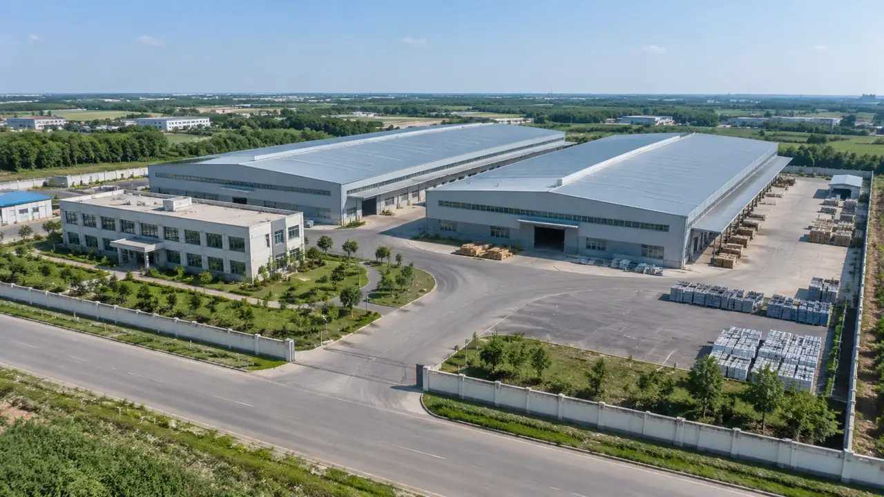
What the export carries is the setting: the terrain, the apron ground as a surface, the terminal and its piers as masses, cargo sheds, hangars, the fire station, the hotels outside the fence, and the vegetation between them. Those masses have footprints read from map data and heights estimated from the same source. Aircraft, tugs, fuel bowsers, jet bridges and ground support equipment do not travel in the file. Neither do apron markings or the runway and taxiway geometry, which belong to airport design data. Say this before the receiving team opens anything. The platform overview lists the generated set in full.

1.2 The file itself
The output is a GLB, the binary form of glTF, and the Khronos Group publishes the specification behind it. Most current 3D tools read it without a plugin. What differs between tools is how they treat units, up axis, material naming and object grouping, and those differences cause most of the confusion at handover. Check the importer notes for the tool you plan to use before you send a file to somebody who has a deadline. A two minute read there saves an hour of email later.
2 The design tool stop
2.1 Ground under the aircraft model
In Blender, SketchUp or Rhino the site works as a base surface for the aircraft model and the apron layout that sits on it. The aircraft comes from a manufacturer dataset or a library, gets positioned against the terminal, and the site provides the ground, the shadows and the sense of scale that a floating model lacks. Keep the site on its own layer or collection, so the aircraft can be moved without dragging a suburb along with it. Designers who work this way tend to keep the exported file untouched and treat edits as additions.
2.2 Checking scale on import
When the file arrives, measure a building you know: a hangar door, a terminal frontage, a road width. If the number looks wrong by a factor of a thousand, the importer has read millimetres as metres, which is common and quick to fix. This is a sanity check on the import, not a survey of the site. Note the setting that worked in the handover file, because the next person will hit the same question with the same tool and no memory of your afternoon spent on it.
3 The real-time engine stop
3.1 A stage for the site
Unreal Engine, Unity and Wings Engine take the same file and turn it into something an audience can walk through. The site gives the engine its ground plane, its building silhouettes and its vegetation, and the aircraft asset is dropped in as a separate object with its own materials. Lighting is where most of the work sits, since a flat matte surface reads as a diagram under a single directional light. Add a sky, a ground colour and one strong shadow direction, and the site starts to look like a place.
3.2 Keeping the scene manageable
A generated site can arrive with more objects than a walkthrough needs, and an engine will render every one of them. Merge the vegetation into fewer meshes, drop the buildings that sit outside the camera path, and keep the terrain whole. Do this in the engine rather than asking for a smaller export, because the full file stays useful when the camera path changes. Save the cleaned scene as a separate asset so the original import remains available for the next review, and name both files clearly enough that nobody confuses them.
4 The GIS and BIM stops
4.1 GIS context
ArcGIS Pro and GISBox treat the site as a local model that sits inside a wider set of layers. The GIS team aligns it to their own reference data, then reads it against boundaries, land use and service corridors that the platform does not generate. That alignment step is theirs, and it needs a conversation about the reference system before anyone drags the file into a project. The site contributes three dimensional form; the GIS layers contribute the administrative and network context around the airport's boundary.
4.2 BIM alongside the design model
In a Revit workflow the site is context that sits beside the design model, useful for massing conversations, sight lines from a terminal and the question of how a new building meets the ground. It is not a design model of the terminal, and it carries no internal structure, no services and no construction information. Teams that expect a coordinated BIM model from a GLB export are going to be disappointed, and they will be disappointed in the meeting rather than in private. Say what the file is on the slide where it appears.
5 Preparing the handover
5.1 Layers and edits before export
Correct the buildings you know have changed, then export with every layer visible. A receiving team can hide vegetation or terrain; it cannot recover a layer that was missing from the file. Confirm the edit list against the scene once more, because a rotated hangar is easy to forget and hard to explain when the aircraft ends up parked inside it. Preview the export view before the file leaves, and check that no building sits at an angle that the imagery does not support.
5.2 Naming and a short note
Name the file by site, purpose and date, for example airport north apron review. The note beside it should list the extent, the imagery date, the buildings you changed and the aircraft asset the receiving team is expected to place. Add the tool and the import setting you tested. Four lines is enough and beats the alternative, which is a chat message that says here is the file and leaves the rest to guesswork. Keep the note with the file in whatever system the team already uses.
Open the GenAnywhere app and generate an airport site
6 Choosing the destination
6.1 Ask who opens it next
The destination follows from the next person's job rather than from the tool you like. A designer needs the site in a modelling package; a communications team needs it in an engine; a planning department needs it in GIS. When two audiences need the file, send two files with two notes rather than one file with a long explanation. Splitting the delivery costs a few minutes and prevents the familiar situation where a GIS analyst opens a game engine project and concludes the export is broken.
6.2 What each destination will want to add
Each stop adds something different and expects the site to make room for it. The design tool adds the aircraft and the apron furniture; the engine adds lighting and a camera path; the GIS desk adds boundaries and networks; the BIM workflow adds the building design. None of them adds the aircraft by default, and none of them fills in the runway. Write the addition next to the destination in the handover note, so the file arrives with a job attached instead of as an attachment.
6.3 Next step
Decide the destination before you generate the scene. The extent of the scene follows from the destination: a camera path needs the apron and the buildings behind it, a GIS review needs the boundary and the neighbouring land, a design review needs the ground under the aircraft at a useful detail level. Working backwards from the destination keeps the boundary honest. It also stops the pattern where a scene is generated three times because the purpose was settled after the export.
7 FAQ
FAQ-1 Does the export include aircraft?
No. The GLB holds terrain, water, vegetation and building masses, with any edits made in the session. Aircraft, helicopters, ground support equipment and jet bridges are design assets that arrive from a manufacturer dataset or a library in the downstream tool. Plan that step before the review, because an apron with no aircraft in it looks unfinished to anyone who was expecting an airport scene, and the question will be asked in the meeting.
FAQ-2 Which tool should I pick?
Pick the tool the receiving team already uses. A file that opens in the wrong package gets re-exported, renamed and lost. If the audience is mixed, deliver a viewer-friendly engine build for the meeting and the raw GLB for the people who need to edit. Delivering two artefacts from one export is normal practice in airport work, and it keeps the conversation about the site rather than about software licences.
FAQ-3 What happens if I re-export?
A new export replaces the site with the current state of the scene, including any building edits made since the last one. Anything placed downstream, aircraft included, is not carried over, because it was never in the platform file. Keep a record of the transform you used to position the aircraft, so it can be repeated quickly against the new export. Teams that skip that record spend the afternoon lining aircraft up again.
FAQ-4 Can I check clearances from the file?
No. Clearance, obstacle limitation surfaces and apron geometry are engineering and regulatory questions with their own standards and their own reviewers. The site shows where a building stands and how tall the mass reads, which helps a discussion about obstruction without settling it. Take the numbers to the airport planning team and the applicable authority. Use the scene to frame the question, and leave the answer with the people who sign it.
See how an airport site moves into a GLB workflow
Content and technical notes
This article was prepared by the GenAnywhere team with AI-assisted drafting and human review.
Product features, formats, and availability change as the platform evolves; refer to the official GenAnywhere website for current details.
For technical questions or corrections, contact support@genanywhere.com.
Last reviewed: 2026-11-13.