
Site model existing conditions: what to check in GenAnywhere
The base records the site as the map knows it, which is useful and never the whole story.
Site model existing conditions are the starting point for every later decision, and a map-based base covers part of that ground. GenAnywhere generates buildings, terrain, water and vegetation from satellite and map data, then leaves the scene editable. This article sets out what the base records, what it misses, and how to check it before a team treats it as the record of the site.

1 What existing conditions means
1.1 Which conditions matter?
Existing conditions cover the ground, the buildings, the water, the vegetation and the access. They also cover the things a map does not hold: condition, ownership, levels and recent change. A team that separates those two groups will use the base well.
The useful question is not whether the base is complete, because no single source is. The useful question is which decisions the base can support today, and which ones need another record before they can move.
Write that split down. Two columns, one for what the scene answers and one for what it does not, saves a long argument later in the project.
1.2 What does the base record?
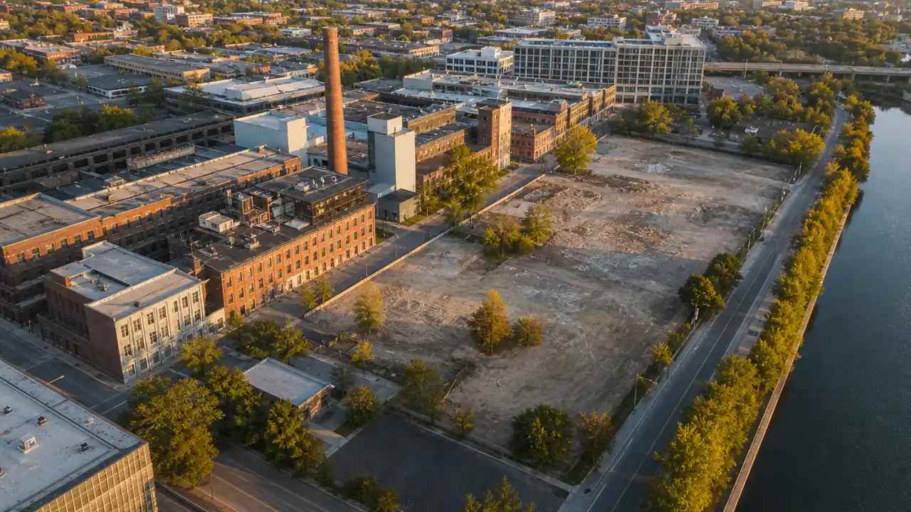
The base records footprints, estimated heights, inferred building types and the shape of the ground. It records water where the source shows it, and vegetation as a band around the buildings. Every item is a representation, and the note should say so.
That representation is enough to see how a site sits in its district. It is enough to see where the street is narrow and where the block is deep. Those observations shape an early scheme before anyone measures anything.
2 How the base is built
2.1 Where does the data come from?
The scene is drawn from map and satellite sources, and the user selects the area. Nothing is flown, and no drone is required for this step. The base is generated, reviewed in the browser and edited before export.
The source date travels with the data whether or not the team looks at it. Writing the date into the note is the habit that keeps the scene honest, because a reader who knows the date can judge what might have changed.
2.2 What is inferred?
Height, type and vegetation band are inferred from patterns in the source. The inference is reasonable at district scale and weak at the scale of a single plot. A tall shed and a low warehouse can read the same way until someone visits.
Treat every inferred value as a question rather than an answer. The scene is a prompt for the site visit, and the visit is where the inference gets corrected.
The pattern is worth watching on long blocks. Terraced housing can come through as one deep mass, and a row of workshops can flatten into a single shed. None of that ruins the scene, and all of it is worth a note when the block matters to the scheme.
3 What to check before use
3.1 Is the date recent enough?
Compare the source date with the last known change on the site. A new access road, a demolished building or a finished extension will be missing if the change came after the source. The base will look confident and be wrong.
If the site has changed, edit the scene before the review. A replaced building takes a moment and prevents a meeting from arguing about something that no longer exists. Record the edit so the reader knows what came from the map and what came from the team.
3.2 Does the coverage include neighbours?
Draw the area wider than the plot. The neighbours are often the argument, because height, overlook and street enclosure are relative. A base that stops at the boundary answers a narrower question than the one the team is asking.
Check the edge of the scene in particular. Coverage can fade at the boundary of a dataset, leaving a row of buildings half drawn. If the edge looks thin, extend the area and generate again.
Note which neighbours were included. A reviewer will ask whether the tall block across the road was part of the scene, and a coverage drawing answers that faster than a search through settings.
4 What the base cannot show
4.1 Which conditions are missing?
Condition, structure, services, levels and legal boundaries are missing. So are interior layouts, floor counts that differ from the estimate and any recent change the source has not caught. Those gaps are normal, and they need owners.
Professionals who record existing conditions use published guidance, such as the ASPRS standards for mapping practice, to define what a proper record contains. A generated scene is a different instrument, and it is most useful when that difference is stated.
4.2 How do you fill the gap?
A site visit, a measured survey or a set of drawings fills the gap. The base tells the team where to look, which is a real contribution. It can show that the rear yard is deeper than assumed or that the side street is narrower than the plan suggested.
Filling a gap does not require rebuilding the scene. Add the missing fact to the note, adjust the model where it matters, and leave the rest as context.
Where the gap is a measured level, keep it out of the geometry. A number typed into a scene without a source becomes a fact that nobody can trace, and those numbers travel further than they should.
5 How to document it
5.1 What belongs in the record?
Source, date, area, edits and checker belong in the record. A short line on each is enough. The record exists so a reader can tell what the scene knows and what it assumes, without a conversation.
Add one more line: what the scene was built to answer. That line is the difference between a model with a purpose and a model that gets used for everything and trusted for nothing.
5.2 How do you share it?
Share the file with the note attached, and share the preview link where the reader can orbit the scene. A still image invites a different conversation from a scene that can be turned. Choose the form that matches the question.
When the scene goes to a reviewer outside the project, name a contact. Questions will arrive, and a named route is faster than a search through old messages.
6 When existing conditions change
6.1 When do you rebuild?
Rebuild when the change affects the decision, not whenever the source updates. A new roof on a neighbour rarely matters to a massing study. A new road or a cleared plot usually does. Tie the rebuild to the question.
Keep the previous version until the new one is checked. A rebuild that fails a dimension check leaves the team with nothing if the old file has already gone.
6.2 When is a site visit needed?
A visit is needed when condition, access or a measured level drives the work. It is also needed when the source is thin, which happens at the edge of cities and in rural areas. The visit does not have to be long to be useful.
Plan the walk around the gaps rather than the whole site. Three stops, chosen from the scene, are usually enough to correct the parts that matter and to confirm the parts that do not.
Take the scene with you. A model on a tablet turns a walk into a check, and the corrections can be made the same day while the memory is fresh.
6.3 When does the record close?
The record closes when the design moves into documentation or when the site changes beyond recognition. Close it with a date and a line about what replaced it. Generate a scene from the map in the GenAnywhere app when a new question needs a fresh base.
See how existing conditions become an editable scene in the GenAnywhere workflow.
7 FAQ
FAQ-1 Is this a condition survey?
No. It is a context model built from map and satellite data, with estimated heights and inferred types. A condition survey measures the fabric of a building or the levels of a site, and it is carried out by a qualified team. The base can frame that survey and cannot replace it.
FAQ-2 How old can the data be?
There is no single answer, because the site decides. A stable residential district can tolerate older data; a site with active construction cannot. Check the source date against the changes the team already knows about, and rebuild when the difference affects the decision in front of you. When in doubt, keep both versions and name the date in the file.
FAQ-3 Does it include trees?
Vegetation is generated as a layer around the buildings, and it follows the pattern in the source rather than a tree survey. It is useful for shade, enclosure and the feel of a street. It is not a record of species, size or condition. Where a mature tree drives the scheme, mark it on the visit and add the detail in the design tool.
FAQ-4 What if a building is missing?
Replace it in the scene, or add a block at the right height and footprint. Then record the edit in the note with a line about why. A missing building is a normal gap in a map source, and the correction is part of preparing the base rather than a failure of the tool.
Content and technical notes
This article was prepared by the GenAnywhere team with AI-assisted drafting and human review.
Product features, formats, and availability change as the platform evolves; refer to the official GenAnywhere website for current details.
For technical questions or corrections, contact support@genanywhere.com.
Last reviewed: 2026-11-06.