
Settling pond export: does GenAnywhere support GLB?
Yes for the site, no for the works. The file carries the ground and the pond footprint; the embankment, liner, weir and pumps come from design.
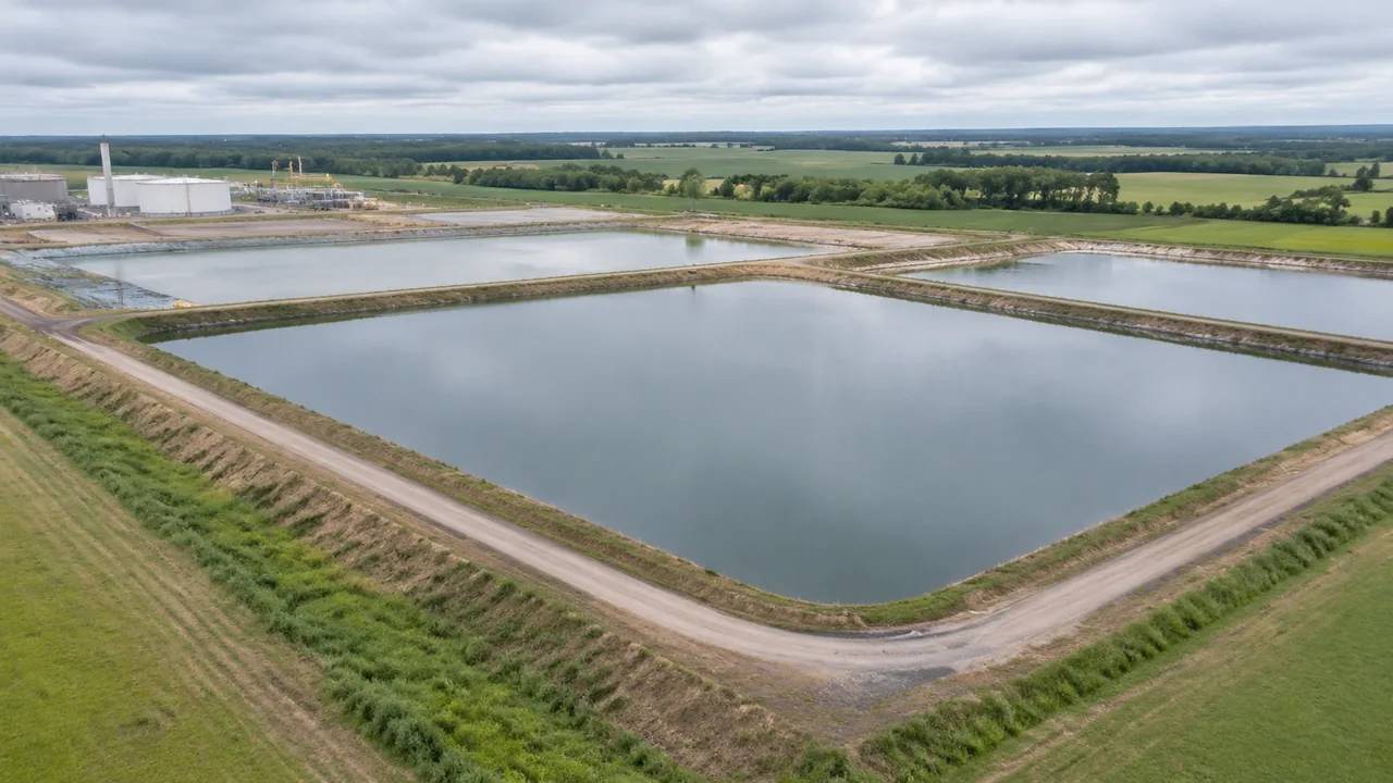
Yes. A scene previewed in GenAnywhere exports as GLB, and a settling pond site goes through the same step as any other scene. The file carries the site: terrain, the pond as mapped water inside that terrain, buildings and vegetation, plus any edits made before export. It does not carry the basin as built work, so an embankment profile, a liner, a weir, an outfall or a pump set is added from the design side.
1 The format answer
1.1 What the export step produces
Generate a scene, preview it, correct what is wrong, then export. The result is a GLB, a single file that 3D, BIM, GIS and game engine applications can open, and it holds the site as it stood at that moment rather than as it was generated. That distinction matters on a pond site, where a basin may have been decommissioned or a shed added since the imagery. Exports use the glTF family of formats, documented by the Khronos Group, which is why so many tools read the file without a plugin. An edit made after the export is not in the file, so the order of work is worth keeping.
1.2 What support means at file level
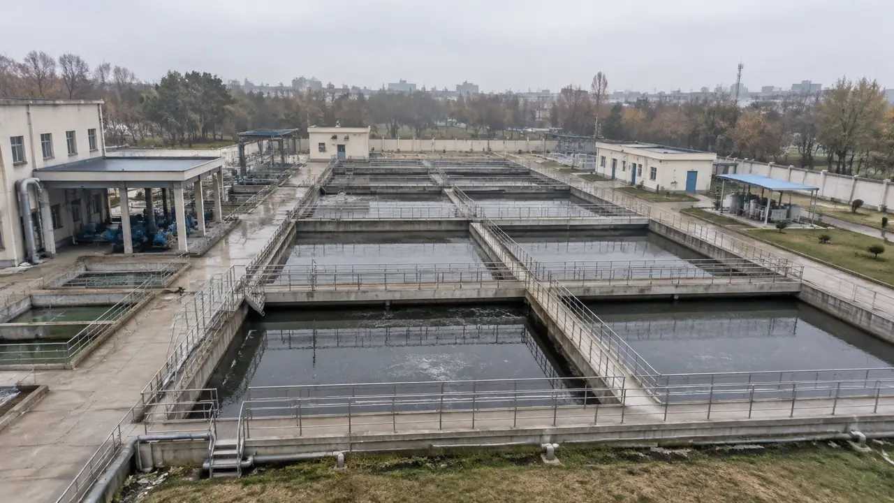
Support for GLB here means the platform can hand a site to another application, not that it produces a basin model. A team expecting a designed pond in the file will be disappointed, and the disappointment is avoidable with one sentence in the covering note. The export is the ground the pond sits in, the water the imagery records, and the neighbours around the fence. Everything that holds water, moves it or measures it is design or equipment. Saying that in the note is quicker than answering it in the room, and the room usually contains at least one person who expected a basin.
2 Inside a pond export
2.1 The pond arrives as water in the terrain
Water bodies inside the framed area are generated with the surface, so a settling pond appears as a shape in the ground rather than as an object with depth, volume or a level you can set. Turning terrain off in the preview takes the water with it. That behaviour is worth knowing before a capture is shared, because a view with terrain hidden looks like a hole where the pond used to be. Record which layers were visible on any image that leaves the team. A pond capture without the ground under it is the sort of image that gets forwarded to someone who never sees this article.
2.2 Buildings, vegetation and the edits
Plant buildings come through with traced footprints and estimated heights, and vegetation comes through as coverage at the fence line and around the cells. Both can be corrected before export, and corrections travel with the file. On a pond site the usual edits are small: a store read as a workshop, a screen of poplars that has been cut back. None of them change the pond. They change how the pond reads against the plant, which is often the point of the review. Two corrected buildings can settle a question about scale that an hour of explanation would not.
3 What the file leaves behind
3.1 The basin as built work
The embankment section, its crest width, the liner, the inlet and outlet structures, the weir, the decant tower and any sludge handling are all designed items. They are not generated and they are not in the export. That is a reasonable split, since a generated bank is a smooth slope read from imagery and a designed bank is a section with levels behind it. Presenting the two as one thing is where a review gets into trouble. Name the split in the caption of any image where a design bank sits over generated ground.
3.2 A missing list by discipline
Write the missing items down before the export, sorted by who supplies them. Civil usually owns the earthworks and the liner, process owns the pipework and the weir, operations owns the pumps and the monitoring points. A list with a name beside each line does more for the next meeting than a paragraph of explanation. It also stops the same question being asked three times by three teams, which is the usual cost of an unwritten list.
4 Checks after import
4.1 Is the water a separate object?
Whether the water arrives as its own object or as part of one merged surface depends on the receiving application and on the import settings. Check the object list after opening the file, because a team that plans to toggle the water needs to know before the meeting starts. If the water has to be separate for a study or a drawing, split it downstream and write down the step. Keep that note with the file, not in a chat thread. A receiving team that has to re-derive the object structure loses an afternoon and gains nothing.
4.2 Replace the generated bank with the section
Once the site is in the receiving tool, the designed embankment replaces the generated slope or sits beside it as a comparison. Decide which of the two the review is showing, because a smooth generated bank and a sectioned design bank read very differently at eye level. Keeping both visible is useful for one question: how much the design changes the profile a neighbour sees. After that question is answered, keep the design version alone. Mixing the two states in one image is how a proposed bank gets read as existing ground.
5 Two receiving teams
5.1 The civil and landscape side
Civil and landscape teams want the ground, the plant buildings and the vegetation, with the extent reaching the receiving water and the access road. They need the imagery date and the edit list more than they need a narrative about the tool. Send the file with the extent in its name and the date in the note. That pair answers most of the questions a new reader would otherwise send back within an hour. It also gives them a reason to open the file rather than file it.
5.2 The process and operations side
Process and operations teams want the same ground for a different reason: to see where pipe runs, access roads and the outfall sit relative to the cells. They add their own assets, so the exported water surface is a backdrop rather than a model of their basin. Say so when the file changes hands, because an operator reading a flat water surface may assume someone has checked the levels. Nobody has, and the note should make that plain.
Open the GenAnywhere app and frame a settling pond site
6 Before the export
6.1 Correct the scene, then export
Fix the buildings you know are wrong in the platform rather than in the receiving tool. An edit made downstream lives in one copy of the file and disappears the next time the scene is exported, which is a quiet way to lose a correction. If the site has changed since the imagery, generate again instead of patching. A fresh export with a date is easier to defend than an old file carrying invisible repairs.
6.2 Name, date and extent
Name the file for the site, the extent and the date, and put the same three facts in the note. For a pond, a workable extent runs from the cells to the point where the discharge meets the receiving water, plus enough margin to show the neighbours. Too tight a frame hides the outfall; too wide a frame turns the cells into grey rectangles. The platform overview describes what travels with the file.
6.3 Licence and distribution
Exports carry a permanent commercial licence for use in your own work, and it does not allow the raw files to be resold or used to train a model. Ownership of the underlying data stays where it was. Before the export goes to a contractor or a client, read the authorization statement and pass the relevant part on. Most arguments about an export turn out to be arguments about its terms, and they are cheaper to settle early.
7 FAQ
FAQ-1 Does the GLB include the pond?
It includes the pond as water inside the generated terrain, at the outline the map data records. It does not include the basin as a designed object with a level, a depth or a volume. If the receiving team needs the basin as geometry, that geometry comes from the design model and is placed in the same application. Check the object list after import and note what you find.
FAQ-2 Are pipes, pumps and the outfall in the file?
No. Those are equipment and design assets, so they are outside the generated content. The export carries terrain, water, buildings and vegetation, and nothing that moves water. List the missing items with an owner and a source before the file goes anywhere. That list is short on most pond sites and saves a round of questions from a team that opened the file expecting a plant.
FAQ-3 Can I export just the pond area?
Yes, frame the extent around the cells and export that. A tight frame gives more detail per building and a smaller file, and it loses the receiving water and the neighbours. Most reviews end up with two extents: one for the cells and one for the setting. Name them so the difference is obvious, and keep both versions rather than trimming one file to serve two purposes.
FAQ-4 Which application should open the export?
Whichever one the next team works in, and it is worth naming before the export rather than after. A civil team may open it in a BIM authoring tool, a landscape team in a visualisation package, an operations team in a GIS. Test the import in that application before the meeting. Import behaviour varies by tool and by version, and a file tested in the wrong one tells you nothing useful.
See how a pond site moves into an export workflow
Content and technical notes
This article was prepared by the GenAnywhere team with AI-assisted drafting and human review.
Product features, formats, and availability change as the platform evolves; refer to the official GenAnywhere website for current details.
For technical questions or corrections, contact support@genanywhere.com.
Last reviewed: 2026-11-13.