
Drone delivery routes: what do suburbs map with GenAnywhere?
How a route study can read the yards, roofs, and tree cover below a flight path.
Drone delivery routes over suburbs run above backyards, driveways, and rooflines that a flat map flattens away. A route study needs to know what sits under the corridor, where trees and wires crowd the path, and which streets would receive the most overflight. GenAnywhere can build a 3D scene of a neighborhood from map data, so a team can compare corridors before a trial. It gives a site picture. It does not approve a flight or assess airspace.
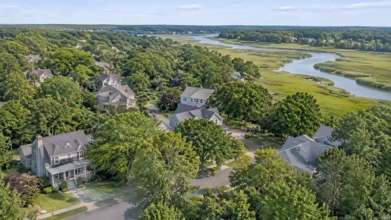
1 What a suburban route actually crosses
1.1 Which backyards, roads, and rooflines sit below?
A route drawn as a line on a map crosses property lines without showing them. In a suburb, that line may pass over a shed, a trampoline, a row of parked cars, and a bedroom window in the space of a few hundred meters. Residents notice that. A route study that ignores the ground below misses the part of the proposal people will talk about at the meeting. A 3D scene puts the corridor back into the neighborhood it crosses.
1.2 Where do trees and wires crowd the path?
Mature street trees and overhead lines are the practical obstacles in low-altitude suburbia. A row of oaks can close a corridor that looks open from above, and a power line can force a detour that pushes a route over more homes. Mapping tree cover and building heights together shows where the path is genuinely clear. It also shows where a small change in altitude would move the route over a park instead of a backyard.
Tree data from a map is a snapshot, and a suburban street can gain or lose canopy in a few years. Teams should note the date and check the corridor again before a trial. A route that relied on a row of young trees may look different after a storm or a pruning cycle.
2 The site data a route study needs
2.1 What does a flat map hide?
A flat map hides height, and height is most of the story at low altitude. Two routes that look identical in plan can differ sharply once roofs, chimneys, and tree crowns are included. A flat map also hides grade, which matters for the ground vehicles that support a delivery operation. Seeing the neighborhood in three dimensions gives the team a more honest picture of what a corridor would cross.
A flat map also hides where a street bends around a hill or a creek. Those bends can push a corridor over a different set of homes than the straight line suggests, and residents notice the difference.
2.2 Why does building height matter at low altitude?
At the heights where delivery drones operate, a two-storey house and a four-storey apartment block create different clearance questions and different privacy concerns. Heights also vary within a block, which means a route can pass over low garages and then meet a taller addition. Estimated heights are enough to sort corridors at the screening stage. They are not a substitute for measured obstacles, which a flight plan will need.
Height estimates also help a team decide where to ask for a site visit. A block of flat roofs is easier to read from above than a street of steep pitches and dormers, and the differences are where the difficult questions sit.
3 Building a suburban scene from map data
3.1 How does GenAnywhere capture a neighborhood?
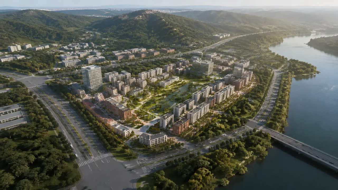
A user selects an area on the map, and GenAnywhere generates a 3D site model from satellite and map data. Buildings, terrain, water, and vegetation come into the scene, with terrain matched to the surrounding ground. Building footprints are recognized, heights estimated, and types inferred, so houses, shops, and small industrial buildings read as distinct forms. Vegetation around the site is analyzed in the same pass, which gives the team a view of tree cover along the corridor.
The scene is built from public map data, so recent changes may not appear. Verify anything that affects clearance with a site visit or a utility record before the team treats the corridor as settled.
3.2 What can a team change in the scene?
Individual buildings can be replaced, moved, rotated, or resized, and their heights and types adjusted. A team can test a taller building that is under construction, remove a structure to open a sightline, or shift a proposed delivery hub to another lot. Layers for buildings, terrain, and vegetation can be previewed separately, so the tree canopy can be studied on its own. These edits help a team ask better questions. They do not make a route safe or legal.
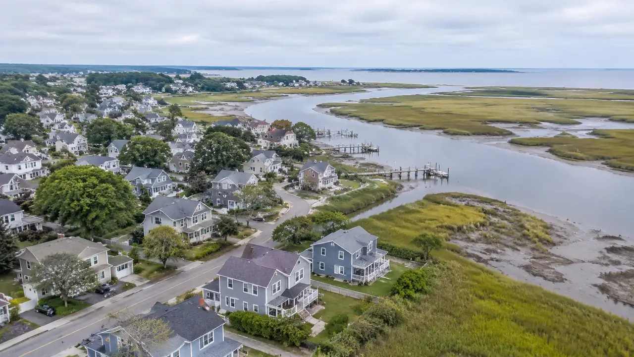
4 Comparing corridors before a flight trial
4.1 How should alternatives be compared?
Show each corridor over the same base scene and from the same set of viewpoints: a typical backyard, a school or park, and the busiest street crossing. Note what sits below each segment and how many homes the route passes over. Keep the comparison simple enough that a resident can follow it. A corridor that looks shorter on a map may cross more backyards than a longer route along a greenway.
4.2 What should the comparison avoid?
Avoid implying that a visual comparison settles the airspace question. Avoid showing a route as a fixed line when the team is still choosing between options. Avoid using a smooth animation that makes the corridor look effortless, since the point of the review is to find the difficult segments. A static set of views with honest labels is more useful than a polished film.
5 Limits: airspace and operations
5.1 Which questions belong to aviation authorities?
Airspace authorization, operating rules, and flight safety belong to the aviation authority and the operator. A site scene can show the ground below a corridor, but it cannot say whether a flight is permitted or safe. Teams should treat the scene as context for a conversation with the people who own those decisions. The scene can make the conversation specific. It cannot make the decision.
5.2 When should a team stop?
Stop when the question shifts from where a corridor would run to whether it can be flown. Stop when a proposed route depends on a waiver nobody has applied for. Stop when the site detail is too thin to judge what sits below. In each case, more rendering will not help. The team needs a different kind of answer, and the scene should step back.
That pause is not a failure. It keeps the visual in its proper role and protects the team from presenting a picture as a permission.
6 Presenting a route idea to a community
6.1 Who needs to see the corridor?
Residents, local officials, parks staff, and the operator all need to see the same corridor. Each will look at a different part of it: the segment over their street, the crossing near a school, the hub at the edge of the neighborhood. A shared scene lets the group move between those views without redrawing the map. That is often the difference between a productive meeting and a round of complaints.
6.2 What should the visuals show?
Show the corridor at a scale where roofs and trees are visible, and include a wider view that shows the neighborhood context. Mark where the route passes over public land and where it passes over homes. Note the assumptions about altitude and obstacle clearance, and keep them visible on the slide. Exported GLB files can support a later design discussion in 3D, BIM, GIS, or engine workflows, with a permanent commercial license under the platform's terms.
6.3 How do you keep the scene honest?
Record the map date, the height source, and the name of the person who built the scene. Say plainly that buildings and trees are estimated from map data. Refresh the scene when a large development appears along the corridor. A neighborhood scene that is clearly dated and clearly limited earns more trust than one that pretends to be a survey. Keep a copy of each version used in a public meeting so the record matches what people saw.
To test a corridor of your own, open GenAnywhere in a browser and follow the site workflow walkthrough. The FAA drone pages explain the operating rules that any route study has to respect.
7 FAQ
FAQ-1 Can GenAnywhere approve a drone route?
No. Route approval and flight safety belong to the aviation authority and the operator. GenAnywhere builds a 3D site scene from map and satellite data. Use it to see what a corridor would cross and to prepare questions for the people who assess airspace and operations. Keep the approval process entirely outside the model.
FAQ-2 Does the scene include power lines?
It does not map utility lines as a separate layer. Overhead wires are a real constraint at low altitude, and they have to be checked against utility records and site observation. The scene shows buildings, terrain, and vegetation, which helps a team narrow the corridors worth checking. Treat wire clearance as a separate task.
FAQ-3 Can residents understand a corridor view?
Yes, in most cases. A view from above a familiar street is easier to read than a plan drawing, and people quickly recognize their own block. Teams should label the route, note the estimated heights, and explain what the model does not show. A short conversation with a recognizable image often replaces a long technical explanation.
FAQ-4 What can be exported for a trial team?
The scene can be exported as a GLB file and opened in common 3D, BIM, GIS, or engine tools, depending on the pipeline. Pair the export with the corridor views, the map date, and the list of assumptions. The export carries a permanent commercial license under the platform's terms, but it should not be resold or used for AI training. Check third-party data rights before publishing images.
Content and technical notes
This article was prepared by the GenAnywhere team with AI-assisted drafting and human review.
Product features, formats, and availability change as the platform evolves; refer to the official GenAnywhere website for current details.
For technical questions or corrections, contact support@genanywhere.com.
Last reviewed: 2026-11-15.