
Terminal scale: what GenAnywhere covers in one view
One frame carries the ground a terminal stands on; the cranes and boxes that make it a terminal arrive from somewhere else.
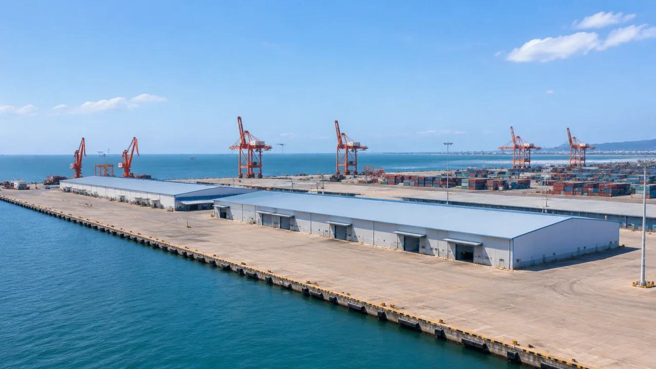
A single GenAnywhere view covers the site under and around a terminal: terrain, the water at the berth, vegetation along the fence and the building masses inside it. Gantry cranes, container stacks, trucks and rail do not appear, because they are equipment rather than ground. Read the frame as the setting for a terminal conversation, not as an operating terminal.
1 The extent a single view holds
1.1 Ground, water and building masses
The frame holds four things: terrain, open water, vegetation and building masses. Terrain follows the source map data, so the apron, the reclaimed edge and the ground behind the fence arrive as one continuous surface. Water sits inside that surface at the berth, and buildings inside the terminal are recognised as masses with a footprint, an estimated height and an inferred type. Vegetation is read from the same imagery around the perimeter. That inventory is shorter than most people expect when they open a port scene. Say so before the images are shown, not after.
1.2 Equipment the scene does not carry
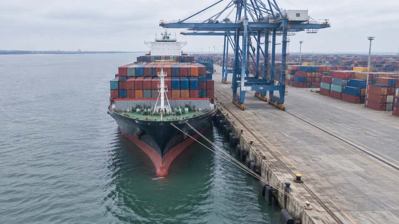
Cranes, straddle carriers, container stacks, reefer plugs, tank farms and rail tracks are absent. They are equipment and rolling stock, drawn from a design model or an asset library and placed on the site in a downstream tool. A scene without them looks empty to anyone who knows a working terminal, and the emptiness is honest: the ground is modelled, the operation is not. Decide early where the equipment geometry comes from, because a bare quay reads as a mistake to an audience that was not told. One sentence at the start of the session fixes that.
2 Reading terminal scale from the frame
2.1 The quay line and berth length
Berth length is where most terminal conversations start, and the frame shows it without anyone measuring. The quay line appears as the edge between land and water, and its run across the view gives a sense of how many vessel calls fit alongside. What the frame cannot tell you is the design length, the dredged depth or the condition of the wall. Port planning bodies such as PIANC publish guidance on berth and channel geometry that covers far more than a scene can, so use the view to orient the talk and the guidance to settle the numbers.
2.2 Yard depth and the buildings behind
Yard depth is easier to misjudge than berth length, because a wide apron and a shallow yard look similar from above. Orbit the view and the buildings behind the stacks give the ground a scale. Warehouses, workshops, gatehouses and office blocks arrive as masses, and their positions show how much land the terminal uses before the hinterland starts. If a scheme adds a rail yard or a second gate, that change belongs in the design model rather than in the generated scene. A second look from the water often settles a disagreement that a plan view starts.
3 Edits that change the picture
3.1 Building masses inside the fence
Building masses can be replaced, moved, rotated, re-typed and re-heighted after generation. On a terminal that matters for sheds scheduled for demolition, a new maintenance block, or a gate complex that has changed since the imagery was captured. Edits apply to individual buildings, so a row of warehouses can be corrected without rebuilding the site. Keep a note of what you changed, because the next person to open the scene will assume it matches the map. Three lines in a shared file are enough.
3.2 Layers as a reading aid
Terrain, water, vegetation and buildings can be turned on and off as separate layers. Hiding vegetation clears the view along the fence line; hiding buildings shows the ground the yard occupies. Reviewers use the toggles to compare a green buffer with a hard edge without generating a second scene. Layers are a reading aid rather than a design tool, and it is worth showing the choice in a workshop so nobody argues about a view they never saw. It costs nothing and prevents a familiar argument.
4 Where the terminal view stops
4.1 No operational or structural answers
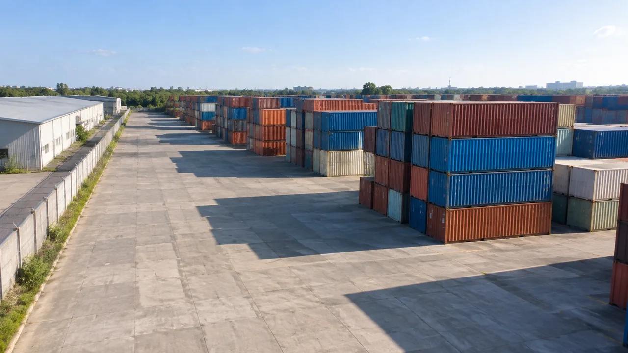
The scene does not answer operational questions. It has no berth occupancy, no crane productivity, no stacking capacity, no pavement loading and no structural information about the quay. Those answers come from terminal planning software, traffic studies and engineering assessment, each with its own data and its own qualified team. GenAnywhere contributes the setting for that work. Presenting a generated quay as an operational picture invites questions the file cannot survive, and the correction costs more than the caveat would have. Say what the file is for before anyone opens it.
4.2 Imagery date and recent works
Satellite and map data carry a date, and ports change faster than most sites. A berth extended two years ago, a yard created by reclamation or a shed demolished last spring may still be shown in its earlier state. Check the imagery date for the area before a review leans on a particular building. A dated view remains useful for orientation, but a review that treats it as current spends its time correcting the model instead of discussing the scheme. Put the date on the opening slide.
5 Passing the view to another team
5.1 Preview, then export
Preview is where a terminal scene earns its place. Walk the quay at eye level, step back to the yard, then look from the water towards the gate. Each of those views answers a different question and the sequence takes a few minutes. When the scene is right, export a GLB and send it with a note on the extent and the date. The platform overview describes what the generated scene contains, which is a useful paragraph to forward with the file.
5.2 What the receiving team supplies
The receiving team supplies the rest: crane models, container blocks, pavement design, rail alignment and whatever survey control the project uses. Agree who places that geometry before the export, or two teams will place it twice and then disagree about the result. A short list of what the scene holds and what the design model holds prevents most of that confusion. It also makes clear which parts of the picture are existing context and which are proposal, a distinction that holds up when the scene is shown outside the project team.
Open the GenAnywhere app and frame a terminal site
6 Before you frame the view
6.1 Pick the extent that answers the question
Terminals are large and one frame rarely covers a whole one at useful detail. Decide whether the review concerns the berth, the yard or the landside access, then frame that part. A tight view of one quay shows the buildings and the water edge clearly; a wide view shows relationships and loses the detail that started the argument. Two scenes are often better than one stretched scene, and they are easier to explain than a compromise. Name each one by the feature it covers.
6.2 Write down what is missing
List the equipment that is absent and name where it will come from. Cranes, stacks, trucks, rail and vessels all belong on that list. Say also what the scene cannot answer: capacity, loading, clearance and structural condition. A page of notes reads as care; a disclaimer buried in an email reads as an afterthought. The list takes ten minutes and usually saves a meeting, because the question about cranes arrives in every terminal review sooner or later.
6.3 Agree the next step
Name the next step and the person who owns it. A design team may want the terrain under a new apron; a planning team may want the quay for a stakeholder session. If no next step is clear, the scene has no job yet, and the honest move is to wait rather than to export because the file is ready. Exports are cheap, but files nobody opens become clutter, and clutter makes the next handover harder to trust. One scene, one question, one owner.
7 FAQ
FAQ-1 Does the view include cranes and containers?
No. The generated scene holds terrain, water, vegetation and building masses. Gantry cranes, container stacks, trucks and rail are equipment and rolling stock, supplied by a design model or an asset library and placed in the downstream tool. That split is deliberate, because equipment changes far more often than the ground does. If the review needs cranes, plan their source before the session rather than hoping the scene contains them.
FAQ-2 How much of a terminal fits in one view?
Usually the berth and the yard behind it, plus the buildings inside the fence. A large terminal with several berths and a rail yard will not fit at a detail that supports discussion. Frame the part under review, generate a second scene if another part matters, and keep the camera height consistent between the two so they compare fairly. Scale is easier to read when the viewer is not jumping between angles.
FAQ-3 Can I change the quay line?
Not as a design operation. The shoreline follows the source data, and buildings can be edited while the water edge stays where the imagery placed it. If a scheme moves the quay, that change belongs in design geometry downstream, where it can be measured against the scheme and checked by the engineers who own it. Keep the generated edge as existing condition and label the proposal separately.
FAQ-4 What leaves the platform?
A previewable scene and an exported GLB that carries site context into 3D, BIM, GIS or game engine workflows. The file holds terrain, water, buildings and vegetation plus any edits, and it holds no equipment, no design properties and no capacity data. Test the import in the receiving tool, confirm scale and origin, and keep the scene for the next revision. The authorization statement sets out how exports may be used.
See how a generated terminal site moves into a GLB workflow
Content and technical notes
This article was prepared by the GenAnywhere team with AI-assisted drafting and human review.
Product features, formats, and availability change as the platform evolves; refer to the official GenAnywhere website for current details.
For technical questions or corrections, contact support@genanywhere.com.
Last reviewed: 2026-11-13.