
Storage tank generation: how GenAnywhere builds a tank farm
The platform generates the ground, water and buildings around a tank farm; tank shells are equipment and arrive from somewhere else.
GenAnywhere generates a site from map and satellite data, and on a tank farm the site is the part that matters for context: terrain, water, access ground and the buildings inside and outside the fence. Tank shells, pipework and pumps are equipment, and the product documentation does not list them as generated content. That boundary is the useful answer, because it decides what the scene can support and what it cannot.
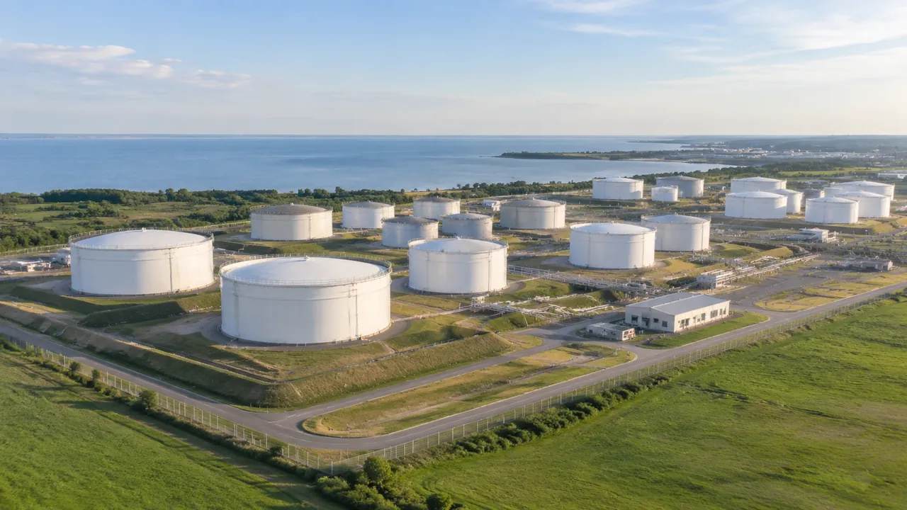
1 What is generated on a tank farm site
1.1 Ground, drainage channels and access
The ground comes from the terrain surface that the map data describes, and water appears wherever the source imagery shows it. On a farm site that often means a settling pond, a drainage channel or a shoreline beside the berth. Access roads appear as part of the surface rather than as engineered pavement with kerbs and markings. The result is a readable setting for the farm, not a construction drawing of it. Because the surface follows the map rather than a site survey, a channel or a pond can be simplified; that is usually fine for orientation and less so for a discussion about drainage capacity.
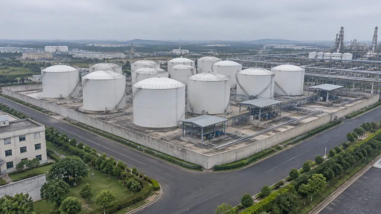
1.2 Buildings inside and around the fence line
Control rooms, warehouses, workshops and office blocks normally appear because they have footprints in the map data. Heights are estimated and types are inferred, so a low shed may be read as a warehouse and a small building may be read as an office. Both can be corrected after generation, which matters when a review depends on where the boundary sits. A quick pass through the buildings you know well is worth the time, because it turns a generic scene into something the site team recognises.
2 How tanks are represented
2.1 Tank shells are outside the generated set
The platform's documented output covers buildings, terrain, water and vegetation. Cylindrical tank shells, floating roofs, pipe racks and pump houses are process equipment, and equipment generation is not part of that list. Teams that need tank geometry bring it from a design model, a vendor file or their own asset library. Treat the scene as the ground the tanks stand on, and the question of what is missing becomes easier to answer. The site model still does useful work: it shows where a new tank would sit relative to water, roads and neighbours, which is often the question that starts the project.
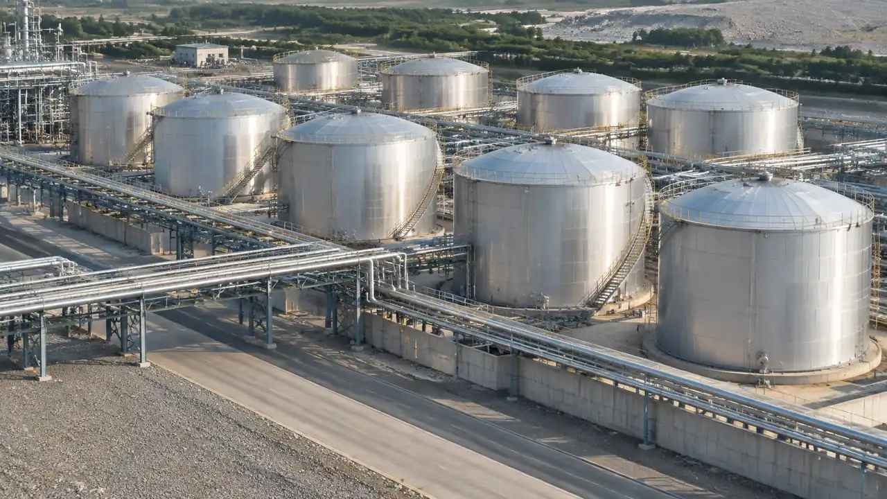
2.2 Ways teams show tank footprints anyway
A review still needs to see where the tanks go, so teams use a few honest workarounds. Some place simple cylindrical masses in the downstream tool and keep the generated scene as the base. Others mark tank centres on a plan and use the 3D view for the surrounding context. A third option is to adjust a nearby building to roughly the tank footprint and label it as a placeholder. Each approach has limits, and each should be labelled as an illustration. Whichever route you take, keep the placeholder out of any measurement, because a tank mass that looks real can quietly become a fact in the minutes.
3 Edits that matter on a farm site
3.1 Adjusting nearby buildings
Buildings near the farm can be replaced, moved, rotated and adjusted in height or type. That helps when an old workshop is due for removal, when a new control building changes the skyline, or when a warehouse has been extended since the imagery was captured. Edits apply to buildings rather than to the ground, so the terrain and the water stay where the source data placed them. Keep a record of what was changed, because a corrected building can look like original data to the next reader. If the change is a height adjustment, write the old and new values in the note; height is the edit most likely to be misread as survey data.
3.2 Layer views for ground and vegetation
Terrain, buildings and vegetation can be previewed and managed as layers. Hiding vegetation shows the ground shape more clearly; hiding buildings leaves the terrain and the water edge exposed. On a farm site the layer view is useful for checking whether a bund or a channel reads at all, and for showing a client the difference between what is built and what is proposed. State which layers are visible whenever a screenshot leaves the meeting. A layer view is also a quick way to check whether a bund line reads at all; if it disappears, the ground needs a closer look.
4 Limits to state before the meeting
4.1 No containment, spacing or compliance check
The scene does not check bund capacity, tank spacing, fire separation or any other regulatory requirement, and it should not be presented as if it did. Those questions need design data, the applicable code and a qualified reviewer. A 3D view can help a group discuss a layout, but it cannot certify one. The safest framing is that the scene supports the layout conversation while the compliance work runs on its own track with its own evidence. Organisations such as the American Petroleum Institute publish technical standards that belong with that work, not with a generated site model.
4.2 Imagery date and site changes
Tank farms change in visible ways: a new tank appears, a bund is raised, a road is rerouted. The imagery behind the scene has a date, and anything built after it will be missing. Check the date for the site and mention it when the scene is shown. A current layout drawing beside a dated scene is a workable pair; a dated scene presented as current invites mistakes that are hard to unwind later. If the site has changed recently, say which parts of the scene are older and which drawings supersede them.
5 Running the review
5.1 Start from the site, then the plant
Open with the farm in its landscape, then move to the fence line, then to the individual areas under discussion. The wide view answers where the site sits and how it relates to water and neighbours; the later views answer how the ground is arranged. Keeping that order stops the audience from arguing about tank detail before they understand the setting. It also makes the missing equipment obvious at the right moment. If the audience includes operations staff, spend a minute on what the scene does not show; they will ask anyway, and a straight answer builds trust.
5.2 Handing the scene downstream
Preview the scene and export a GLB when the review passes to another team. The file carries the site context into 3D, BIM, GIS and game engine workflows, where it can sit under the equipment model. Import behaviour differs between tools, so test the file before a meeting depends on it. Add a note that the export holds the site and not the tanks, or the next team will spend an hour looking for geometry that was never there.
Open the GenAnywhere app and frame a tank farm site
6 Before you export
6.1 Agree the farm boundary
Decide how much of the site the review covers and frame the scene to match. A single tank group shows the ground and the nearby buildings clearly; a whole terminal shows the relationship to water and roads. Choose the extent that answers the question, and write it into the agenda. If two questions need two extents, take two screenshots instead of one view that half-answers both.
6.2 Record the missing equipment
Tanks, pipes, pumps and loading arms are not in the generated scene. List them in the handover, with a note on where the geometry will come from. A short list prevents the next team from assuming the platform failed at something it never claimed to do. It also makes the division of labour clear: the site model comes from GenAnywhere, the equipment comes from the design side.
6.3 Set the next step
Decide who receives the scene and what they will do with it. A planning team may want the landscape and the access ground; an engineering team may want the site base under its tank model. Naming the next step keeps the export purposeful. If nobody can say what happens next, the review probably needs a question answered before it needs another file. Write the next step in the handover note rather than in the meeting chat, because the note survives.
7 FAQ
FAQ-1 Does GenAnywhere generate storage tanks?
No. The generated content covers terrain, water, buildings and vegetation. Tank shells and process equipment are separate assets that come from a design model or an asset library. The scene gives the farm its ground and surroundings, which is what most early reviews actually need. Say this at the start so nobody waits for geometry that will not appear, and keep the review focused on the ground and the layout.
FAQ-2 Can I change tank height or position?
Not as tank geometry, because the tanks are not generated. You can adjust nearby buildings, and you can place tank masses in the downstream tool that holds the equipment model. If a review depends on a height change, make it there and bring the result back beside the scene. Keep the two sources labelled so the audience knows which is which, and leave the site as it was generated so the comparison has an honest baseline.
FAQ-3 Can I check spacing or bund capacity?
No. The scene does not measure spacing, volume, containment or fire separation, and it does not apply a code. Those checks need design data and a qualified reviewer working with the applicable standard. A 3D view can support the conversation around a layout, but the conclusion belongs in a calculation and a checked drawing. A screenshot can illustrate the discussion; it cannot carry the conclusion.
FAQ-4 What file do I get?
A previewable 3D scene and an exported GLB carrying the site context for 3D, BIM, GIS or game engine workflows. The export does not include tanks or process equipment. Test it in the receiving application, then combine it with the equipment model and check the alignment. If the combined file is going to a formal review, record which parts came from which source. A short inventory of what came from where is enough.
See how a generated site moves into a GLB workflow
Content and technical notes
This article was prepared by the GenAnywhere team with AI-assisted drafting and human review.
Product features, formats, and availability change as the platform evolves; refer to the official GenAnywhere website for current details.
For technical questions or corrections, contact support@genanywhere.com.
Last reviewed: 2026-11-13.