
Campus master planning: how terrain shapes an early GenAnywhere test
Hills, drainage, and long views decide where a campus can grow before any building program is fixed.
Campus master planning usually starts with a program: more beds, more labs, a new dining hall. The land answers back. A slope that looks gentle on a plan can rule out a building footprint. A low corner can flood the sole service road. Long views across a quad can make or break a site. A generated 3D site model can put those constraints in front of the committee while the program is still flexible.

1 Why terrain comes before the campus plan
1.1 Slope decides where buildings and paths can go
A campus plan is a walking plan. Students cross it several times a day, often in bad weather. A building on a steep slope may be cheap to place on paper and expensive to serve with a level entrance, a service dock, and an accessible route.
Slope also sets the shape of the building. A long bar building wants level ground. A stepped building can follow a hill but costs more. A building that steps down a hill may need more retaining walls than one that sits on a bench. A parking deck may fit a slope that would defeat a surface lot. The terrain should be read before the footprint is drawn.
1.2 Drainage and tree cover shape the edges
Water collects in the same places on a campus as it does in a town. A low corner at the edge of a parking field may flood every spring. A creek may carry stormwater from upstream neighbors. A mature grove may be the reason a quad feels shaded and calm.
Tree cover is a planning asset and a constraint. Roots limit excavation. A canopy that shades a walk in September may hide a building from the campus entrance. The master plan should know which trees are worth designing around. A campus that ignores drainage spends every spring moving water.
2 Reading a campus site in three dimensions
2.1 Map the whole campus and its context
GenAnywhere starts with a map selection. The platform generates an editable 3D site model from satellite and map data, identifying building footprints, estimating heights, inferring building types, and analyzing vegetation. Terrain, water, and vegetation are matched automatically.
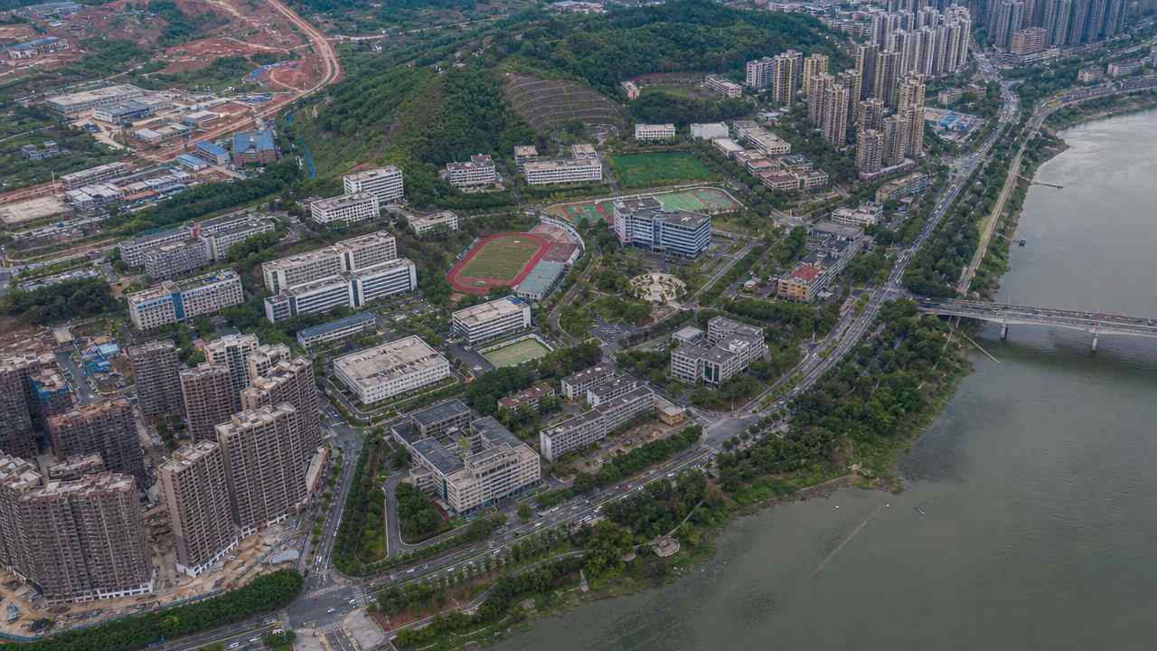
For campus master planning, the value is the whole setting. The model shows the academic core, the residence halls, the athletics fields, and the streets and neighborhoods around the edge. A committee can see how the campus meets the town, which is often where the hardest questions live. The model also shows the town streets that carry students to the gate.
2.2 Test building volumes on the slopes
Buildings sit on their own layer. You can replace a single building, move or rotate it, adjust its height or type, and preview the result before export. A new residence hall can be tested at two heights. A lab can shift to a flatter bench of land. A parking structure can move to a slope that suits it.
The test is not a design. It is a way to ask better questions. Does the new building block the view from the library? Does it sit above or below the main walk? Does the service entrance land on a grade that a truck can use?
The platform generates terrain, water, vegetation, and building volumes. It does not generate interior layouts, structural systems, utilities, or detailed architecture. Those come from design models and are added downstream.
The model is also a snapshot. A new building may be missing. A removed tree may still appear. Campus planning runs on a long horizon, so the model should be refreshed as the campus changes.
3 The questions a terrain model answers
3.1 Which sites are buildable without major earthwork
Every campus has land that looks available and land that is actually buildable. A parcel may be too steep, too wet, or too small once the fire access and accessible route are drawn. A terrain model makes those limits visible.
Staff can compare candidate sites on the same ground. One may need a retaining wall. Another may need fill. A third may fit with little grading. The comparison does not price the work, but it shows where the cost will come from.
3.2 How a new building sits in long views
Campuses care about views. A bell tower, a library facade, or a line of trees may be the image a student remembers. A new building can frame that view or flatten it.
Set the camera at eye level on the main walk and at the campus edge. Look toward the proposed building from the places people actually stand. A model that shows the mass in context prevents a surprise at the dedication.
4 Comparing growth options
4.1 Use one base for every option
A master plan often tests three paths: grow in the core, grow at the edge, or build on a satellite site. Each option should sit on the same base model, with the same terrain and the same surrounding streets.
That common base keeps the debate honest. Without it, each option arrives with its own map and its own assumptions. The committee ends up comparing drawings instead of comparing consequences. Name the base model version in every committee packet.
4.2 Weigh compact growth against edge expansion
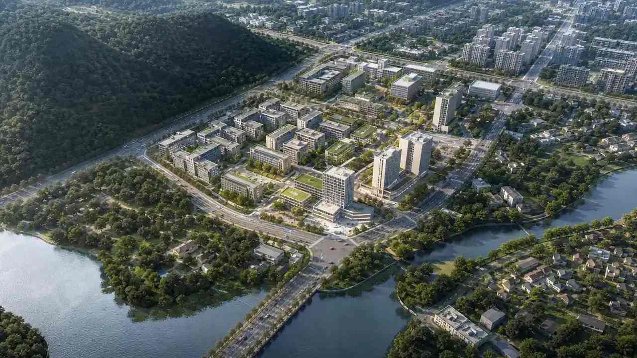
Compact growth uses existing roads, utilities, and walks. It may require demolition or a taller building. Edge growth uses open land and may need new infrastructure. Both have costs that a model can illustrate, even when it cannot calculate them.
Show the two options side by side from the same viewpoint. Let the committee see how much open land each one consumes, how far students would walk, and how the campus edge would change. Show the walking distance from the residence halls to the academic core.
5 Involving faculty, students, and neighbors
5.1 Show the same model to every group
Different groups ask different questions. Faculty ask about access to labs and offices. Students ask about walking distance and shade. Neighbors ask about parking, noise, and views from their street.
A single model, shown from a few fixed viewpoints, keeps those conversations consistent. Each group can point to the same place and describe what it needs. Staff spend less time explaining which drawing is current. Record the questions each group raises and answer them in the next meeting.
5.2 Keep the discussion on decisions
A model can generate endless what-if images. That is useful up to a point. Past that point, the committee needs to decide. Set the questions for each meeting and close them before opening new ones.
Planning guidance from the Society for College and University Planning stresses the link between academic mission and physical space. The model should serve that link, not become a separate project with its own momentum. A decision that is not written down will return as a new question.
6 Handing the work to designers
6.1 Export the site and massing
The output is a general GLB, previewed in the platform and exported for 3D, BIM, GIS, or game-engine work. Tutorials cover Revit, Rhino, SketchUp, Blender, Unreal Engine, Unity, ArcGIS Pro, GISBox, and Wings Engine.
Design teams can import the site and use it as a base for architecture, landscape, and infrastructure. The export carries geometry and materials, not engineering data. Confirm the import settings with each consultant before the kickoff. Ask each consultant to confirm the import settings in writing.
6.2 Commission the surveys and studies
A generated model does not replace a boundary survey, a geotechnical investigation, a wetland delineation, or a traffic study. Those are separate commissions with their own schedules.
Start them early. A master plan that assumes stable ground can lose a year when the borings find rock or fill. The model helps a team decide where to drill and what to test, which is a useful head start. A wetland line can move a building as surely as a slope can.
6.3 Set the next milestone
End the early phase with a decision, not a folder of images. Name the preferred growth path, the sites to study further, and the studies to commission. Assign an owner and a date to each item.
That list becomes the bridge to design. It also gives the next committee a clear starting point, which is worth more than another round of renderings. Keep the list short enough that the committee can review it in one sitting.
7 FAQ
FAQ-1 Can GenAnywhere plan a campus layout for us?
No. GenAnywhere generates an editable 3D site model of the campus and its surroundings. It helps a planning committee read terrain, test building volumes, and compare growth options. The layout itself comes from the campus team, architects, landscape architects, and engineers who understand the program and the institution. That team also owns the schedule and the budget.
FAQ-2 What campus features can the model show?
It shows terrain, water, vegetation, roads, and building volumes with estimated heights and inferred types. That covers the academic core, residence halls, athletics fields, parking areas, and the neighboring streets. Interior layouts, utilities, and structural systems are added later in design tools. The model does not show interior walls or room counts.
FAQ-3 Is the model current enough for a master plan?
It reflects the satellite and map data available when the area was generated, so recent construction may be missing. A master plan runs for years, and the campus will change. Refresh the model at major milestones, and verify conditions on the ground before a decision depends on them. Record the imagery date in the plan appendix.
FAQ-4 How does the export fit into our design workflow?
The export is a general GLB, and the tutorials cover Revit, Rhino, SketchUp, Blender, Unreal Engine, Unity, ArcGIS Pro, GISBox, and Wings Engine. Import behavior varies by tool, and a large campus may need splitting. Confirm settings with each consultant and treat the file as site context, not a design deliverable.
Content and technical notes
This article was prepared by the GenAnywhere team with AI-assisted drafting and human review.
Product features, formats, and availability change as the platform evolves; refer to the official GenAnywhere website for current details.
For technical questions or corrections, contact support@genanywhere.com.
Last reviewed: 2026-11-22.