
Hospital campus redevelopment: where GenAnywhere fits
A practical way to test phasing, access, and building swaps before the master plan hardens
A hospital campus redevelopment is mostly a problem of sequencing. Clinics keep running while old wings come down, parking shifts, and every new block changes how ambulances and staff move through the site. Teams need a shared picture of the ground before they argue about buildings.

1 Map the existing campus before drawing anything
A campus plan that ignores service yards and ambulance routes will fail in review, even when the massing looks tidy. The existing site already contains decisions about power, oxygen, waste, and staff parking that are expensive to move. Map those pieces early and the design conversation becomes more honest.
1.1 Read the buildings that already work
Start with the wings that carry the heaviest clinical load and the ones that have reached the end of their useful life. Height, floor plate, and structural depth tell you which structures can accept another floor and which should come down. A simple color code for keep, study, and remove is enough at this stage, as long as the team agrees on the criteria behind each label.
1.2 Note the service edges
Loading docks, medical gas yards, generator pads, and waste routes rarely appear on presentation drawings, yet they shape every later move. Walk the perimeter and mark where trucks turn, where deliveries stack up, and where noise reaches patient rooms. Those edges often decide whether a new wing can sit close to an existing building or needs a wider buffer.

GenAnywhere helps a team build that base picture from satellite and map data. You select an area, and the platform generates an editable site model with building outlines, estimated heights, inferred building types, and surrounding vegetation. It is a starting scene for discussion, not a replacement for current survey records, and the team still has to verify what the model shows. Staff who do not use design software can open the same scene in a browser.
2 Separate clinical growth from support growth
Clinical departments compete for the same corners of the site as kitchens, sterile processing, and storage. When both grow inside one boundary, corridors fill with carts and staff take longer routes. Treat the two as different systems with different rules, then test where they touch.
2.1 Test a bed tower against the block
Drop a notional bed tower onto the model and watch what it displaces. Parking, a service road, or a courtyard may be doing more work than the drawings suggest. Moving the block a few meters can preserve a route that would otherwise need a tunnel or a bridge. The aim is to compare a small set of options, not to settle a final design in one meeting.
2.2 Keep logistics on a separate loop
Deliveries, linen, food, and waste should not share the main patient entrance. Sketch a loop that reaches the loading area without crossing the drop-off zone, then test it against the proposed buildings. On tight urban sites, that loop may need to run under or beside a new wing. Seeing the conflict in three dimensions makes the cost of each option easier to explain.
3 Test access before density
Access problems surface late, usually when a traffic consultant joins the project. By then, the building layout may already be fixed in the client's mind. A rough access test early can save a redesign later, even if the numbers stay provisional.
3.1 Compare entry points in the scene
Place two or three entry points in GenAnywhere and look at how each one reaches the campus core. An entrance that works for cars may fail for pedestrians or emergency vehicles. Look at turning space, queue length, and the distance from the gate to the main doors. None of this replaces a traffic study, but it shows which options deserve one.
3.2 Check walking routes across the site
Staff, patients, and visitors use the campus in different ways, and a route that feels short on a plan can feel long on foot. Trace the paths from parking, transit stops, and drop-off areas to the main entrances. A new building can cut an existing path without appearing to do so. The model makes that break visible before construction drawings arrive.
4 Stage the vacant pieces
Most hospital sites have gaps: a lawn nobody uses, a closed wing, a surface lot that is too large for current demand. Those pieces are the cheapest places to test change. Give each one a role in the sequence and the master plan stops feeling like a single large bet.
4.1 Rank parcels by constraint
List the empty or underused parcels in the GenAnywhere scene and score them on access, utilities, flood risk, and adjacency to clinical functions. A parcel next to the emergency department may be valuable for expansion but hard to use during construction. A remote lot may be easy to build on but weak for patients. Ranking the parcels turns a long wish list into an order of work.
4.2 Give each gap a temporary use
Surface parking can host a temporary clinic module or a staging area for the next phase. A closed wing can hold administrative staff while its replacement is built. Temporary uses keep the campus working during construction and reduce the pressure to move everything at once. They also show reviewers that the team has thought about the years between today and the finished plan.
5 Bring facilities and finance into one view
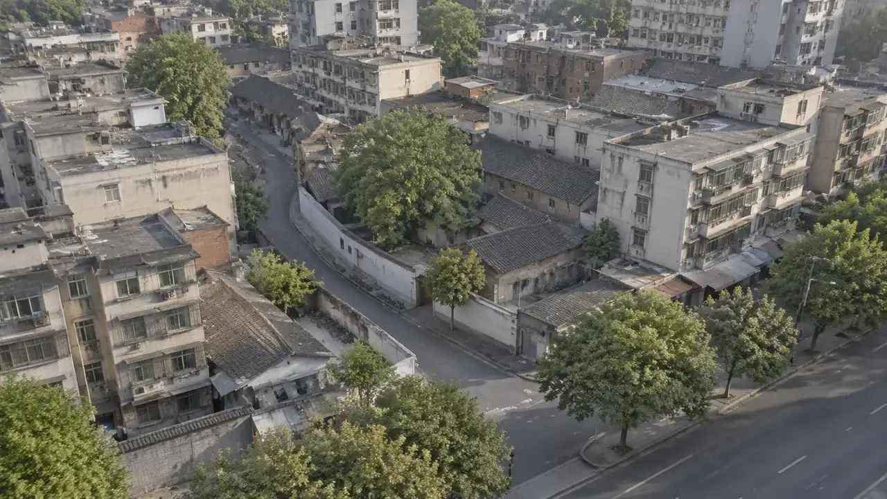
Design teams, facilities managers, and finance staff often work from different drawings and different assumptions. A single scene does not resolve those differences, but it gives everyone the same object to point at. That alone can shorten a meeting. Meetings move faster when everyone points at the same building.
5.1 Agree on a single base scene
Before any option is drawn, agree on the base model: site boundary, existing buildings, roads, parking, and the main service routes. Freeze that scene for the duration of the study and log every change. When two options are compared, both should sit on the same ground. Otherwise the debate drifts into arguments about the base rather than the proposal.
The platform keeps buildings, terrain, vegetation, and water in separate layers, so a team can hide or highlight one system at a time. Individual buildings can be replaced, moved, rotated, or adjusted in height and type. Someone has to own the base scene and keep it current, so assign that role before the workshops begin.
5.2 Record assumptions beside the geometry
Write down what the model assumes about floor plates, parking ratios, and service access, and keep those notes with the file. Reviewers will ask why a block is a certain height or why a road bends. If the answer lives in someone's memory, the study loses credibility. Short notes attached to the scene are enough, as long as they are updated when the option changes.
6 Turn the study into a review package
A campus study has done its job when it helps a board, a city reviewer, or a clinical group make a decision. That requires a clear package, not a pile of images. Decide what the review needs to see and build the package around those questions.
6.1 Write the questions the model must answer
List the decisions the review will face: where the next wing goes, how patients reach it, what happens to parking, and which buildings stay. Each question should map to one or two views of the model. If a view does not answer a question, it probably does not belong in the package. This discipline keeps the meeting focused and the file smaller.
6.2 Export after the scene settles
Preview the scene from the angles the review will use, then export a GLB for the teams that need it in a 3D, BIM, GIS, or game engine workflow. The export is a snapshot of the current scene, so label the version and the date. Teams using Revit, Rhino, SketchUp, Blender, Unity, Unreal Engine, ArcGIS Pro, GISBox, or Wings Engine can bring the file into their own tools. Check the result in the receiving software before the meeting, because formats and settings behave differently across applications.
6.3 Keep a record of what changed
Save the scene, the assumptions, and the exported file together. When the next phase begins, the team can see what was tested and why some options were dropped. That record is more useful than a polished render, because it explains the reasoning behind the plan. It also protects the team when a new reviewer asks a question that was answered months earlier.
A review package built this way does not need to be large. One base scene, a handful of options, and a short list of open questions will carry most conversations. The GenAnywhere app is where a team can build that scene, and the workflow page shows how the export fits into common design tools. For background on how built environment professionals document site constraints, the RICS guidance library is a useful reference.
7 FAQ
FAQ-1 Where should a hospital expansion study begin?
Begin with the existing site, not with a new building. Map the service edges, the routes that must stay open, and the wings that are near the end of their life. That base picture shows which parcels can absorb change and which are already carrying too much. Once the constraints are visible, a small set of building options can be tested against them. Starting with massing usually produces attractive images that ignore the operating hospital underneath.
FAQ-2 Can a site model replace a topographic survey?
No. A model built from satellite and map data gives a useful starting scene, but it cannot stand in for a current survey or for utility records held by the hospital. Treat it as a discussion tool and verify levels, boundaries, and buried services with the responsible parties. On a live hospital site, those checks are part of patient safety and construction planning. The model helps a team ask better questions before it commissions survey work, which is a different and more limited role.
FAQ-3 How many building options should a team compare?
Three or four options are usually enough for an early review. Fewer options make the study look predetermined, while more options overwhelm the group and slow the decision. Each option should test a distinct idea, such as a compact tower, a low bar building, or a phased replacement. Keep the base scene fixed so the comparison stays fair. If a fifth option appears, ask what question it answers that the others do not.
FAQ-4 What file format works for a review meeting?
A GLB export is a practical choice for a review because it opens in many 3D, BIM, GIS, and game engine tools. Export after the scene has settled, label the file with a version and date, and test it in the software the reviewers will use. If the meeting needs still images, take them from the same scene so the views match. Keep the source scene alongside the export in case a question requires a change.
Content and technical notes
This article was prepared by the GenAnywhere team with AI-assisted drafting and human review.
Product features, formats, and availability change as the platform evolves; refer to the official GenAnywhere website for current details.
For technical questions or corrections, contact support@genanywhere.com.
Last reviewed: 2026-11-18.