
Redevelopment site comparison: how teams narrow options, GenAnywhere
How a consistent site model helps a shortlist stay honest
A redevelopment site comparison rarely fails for lack of ideas. They fail when two candidates are judged on different drawings, different assumptions, and different memories of the site. A common 3D view of each parcel puts the options on the same footing, which makes the trade-offs easier to name and easier to defend.
1 What makes a redevelopment site hard to read
1.1 How do former uses complicate the ground?
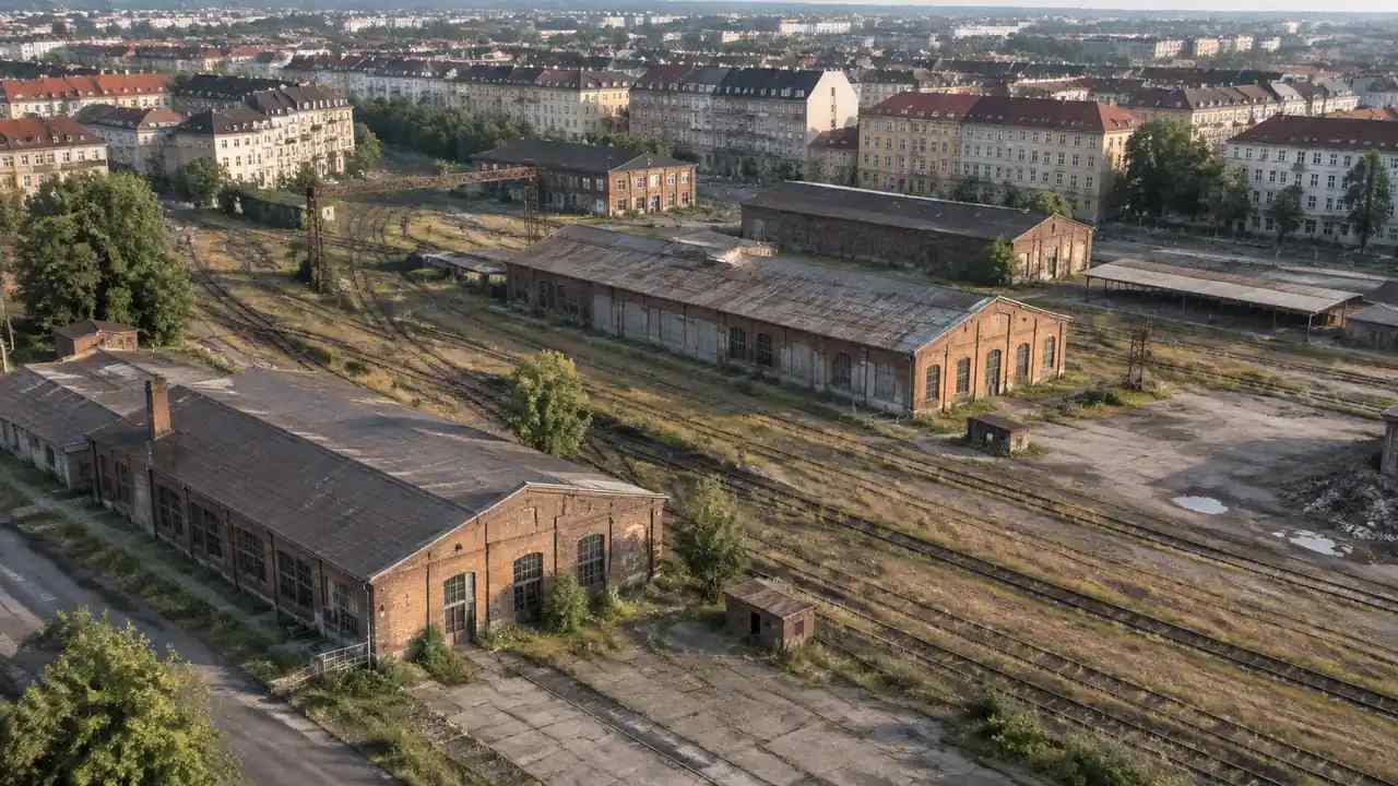
An old rail yard, a closed factory, or a strip mall leaves traces that a plan does not show well. Building footprints overlap, grades were cut for uses that no longer exist, and service yards sit where a new street might need to go. Reading those layers takes time, and a flat drawing compresses them into lines that are hard to separate.
Surface clues help. Retaining walls, loading docks, and paved areas that no longer match the buildings are signs of how the site worked before. A scene that shows the current buildings and the ground together lets a team point at those clues and ask what each one means for demolition and regrading.
1.2 Which surrounding blocks shape the edge?
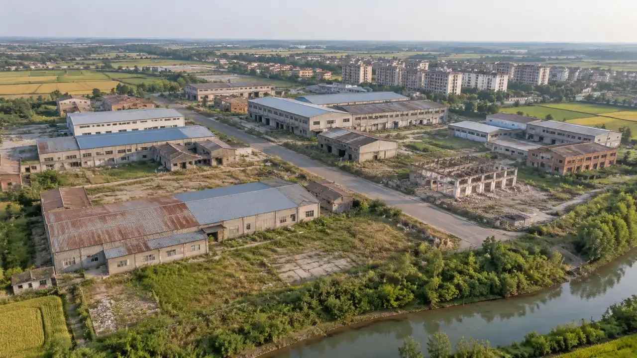
The edge of a redevelopment site is defined by its neighbors as much as by its fence. A row of houses, a school, a busy intersection, or a rail corridor can limit hours of operation, access points, and building height. Those conditions change from parcel to parcel, and they often decide which candidate is easier to advance.
Neighbors also set expectations. A site next to low houses will face questions about shadow, noise, and traffic that a site beside warehouses will not. Recording those conditions per candidate keeps the comparison from turning into a debate about which neighborhood is more accommodating.
2 Constraints that decide feasibility
2.1 How do access and parking change the options?
Access is often the deciding constraint on a redevelopment parcel. A site may touch a road but lack the width for a proper entrance, or the driveway that makes sense may cross a floodplain. Parking adds another layer: structured parking costs more than surface parking, and surface parking consumes the land that made the site attractive.
Testing two or three access and parking arrangements early is cheaper than defending one later. On a shared model, a team can show where the entrance would sit, how service vehicles would turn, and how much land the parking would take. The numbers can wait; the spatial conflict shows up right away.
2.2 What do utilities and easements do to a layout?
Utilities are the quiet constraint. A sewer main, a gas line, or an easement can cut through the middle of a parcel and rule out the obvious building position. The information usually exists in utility records and survey drawings, but it rarely sits beside the massing study where the conflict would be obvious. Data exchange conventions such as those published by the Open Geospatial Consortium can help when records arrive from several systems.
Easements have the same effect. A drainage channel or a transmission corridor may allow building nearby but not on top, and the required setback can remove more land than expected. Drawing those zones on the site view, even as simple bands, gives the team a shared reference for what cannot move.
3 Setting up a fair comparison
3.1 What should stay fixed across candidates?
Camera height, viewing direction, layer settings, and the question list should be identical for every candidate. If one site is shown from a low street view and another from a high angle, the group will react to the camera rather than the plan. Fixing the settings removes that bias before the meeting starts.
The same logic applies to detail. If one candidate has trees and the other is bare, the greener one will feel more finished. Either add vegetation to both or hide it on both. Small differences in presentation can outweigh real differences in the scheme.
3.2 How should assumptions be recorded?
Write the assumptions down before anyone looks at the images. Building height, floor area, parking ratio, and the amount of demolition assumed are common places where candidates drift apart. A short list of assumptions in the memo is more useful than a longer narrative, because readers can compare rows.
Each assumption needs a source or a label. If a height comes from a zoning limit, say so. If it comes from a guess, say that too. Reviewers can work with a stated guess; they cannot work with an unstated one that quietly shapes the conclusion.
4 Turning views into a decision
4.1 Which questions separate the options?
Good comparison questions are answerable from the scene and relevant to the decision. Does the scheme fit the parcel without pushing into the floodplain? Does it leave room for the parking the program needs? Can service vehicles reach the back of the building? Does the massing overwhelm the houses next door?
Score each candidate against the same questions and note where the answer is unclear. An unclear answer is useful, because it identifies the study that has to happen next. A comparison where everything looks fine usually means the questions were too easy.
4.2 When does a visual review mislead?
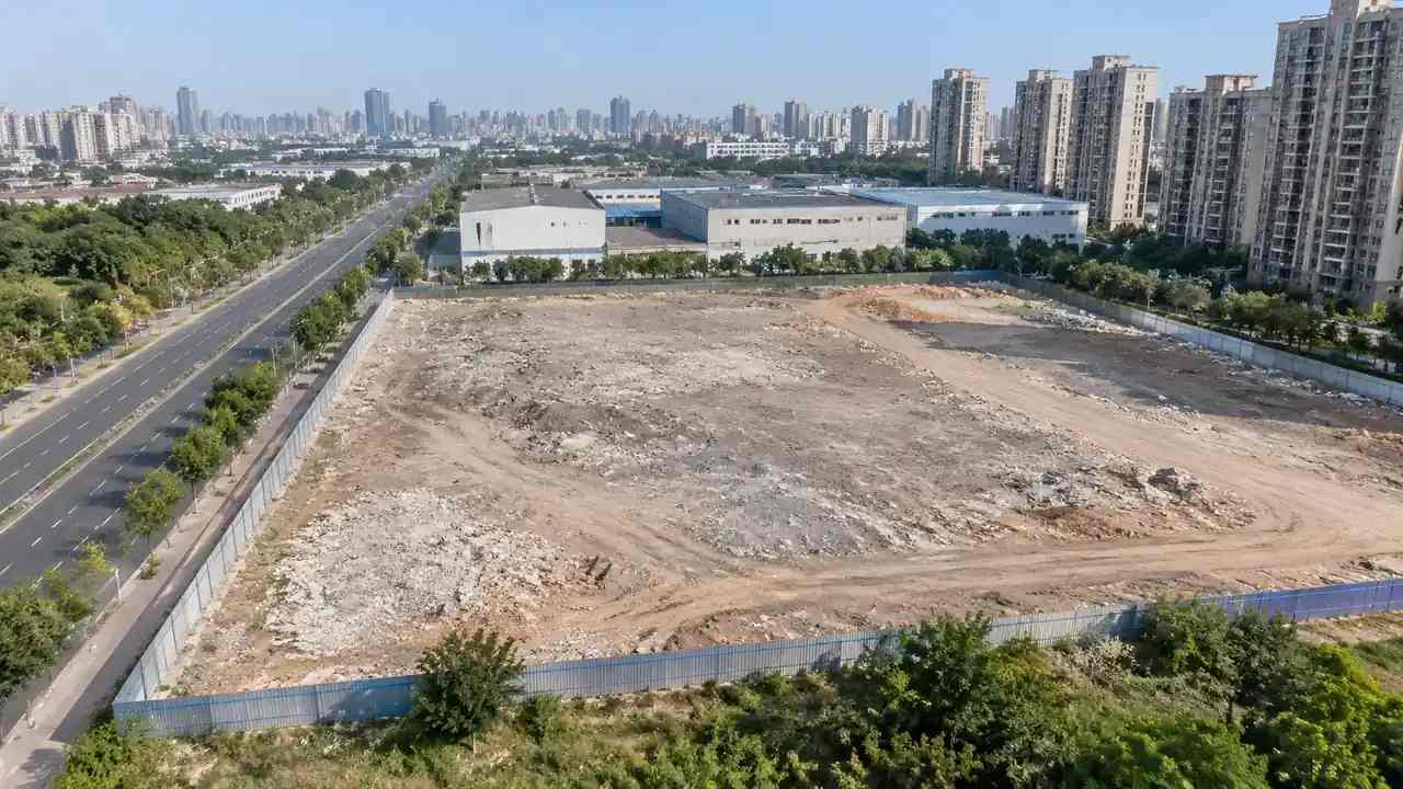
A visual review misleads when it is treated as a finding. The scene shows shape and arrangement, not soil, groundwater, or title. A parcel that looks clean can carry contamination, and a boundary that looks generous can be reduced by an easement that was not drawn.
It also misleads when the group overweights the rendering. A polished scene can make a weak scheme feel settled. Keep the discussion on the question list, and use the images to illustrate answers rather than to decide them.
5 Building the comparison in GenAnywhere
5.1 How does a site enter the model?
A team selects an area on the map, and GenAnywhere generates a site model from map and satellite data. Buildings arrive with outlines, estimated heights, and inferred types, and the terrain, water, and vegetation are generated around them. For a comparison, that gives each candidate a starting scene built the same way.
The opening pass will contain errors. A demolished building may still appear, a new one may be missing, and a roof may be the wrong shape. Those errors are fixable, and fixing them is part of the review rather than a separate task.
5.2 What can teams edit and export?
Buildings can be replaced, moved, rotated, and resized in height or type, and the terrain follows the ground rather than staying flat. Layers for buildings, terrain, and vegetation can be shown or hidden per view, which helps when one question needs the ground and another needs the massing.
Layers make the comparison easier to run. Show terrain alone when the question is about grade, add buildings when it is about massing, and bring vegetation back when the question is about screening. Each candidate keeps its own scene, so a change on one parcel does not leak into the other.
When the comparison is ready, the scene exports as a general GLB file for 3D, BIM, GIS, and game engine workflows. It is a review asset, not a survey product, and the receiving team handles coordinates and any conversion. Open the browser app to build a candidate, then use the site workflow for the review pass.
6 Limits and next steps
6.1 When is a site model the wrong tool?
The model is the wrong tool when the answer depends on records it does not contain. Zoning entitlements, ownership, contamination, and utility capacity all live in documents and databases outside the scene. It is also a poor fit for a decision that hinges on a single engineering value, such as whether a retaining wall can hold a given load.
The model is also wrong when the team has not agreed on the question. A comparison without a shared question list becomes a tour of renderings, and the group leaves with impressions rather than reasons. Agree on the questions before the scenes are built.
6.2 What belongs in the comparison memo?
The memo should carry one page per candidate, the shared question list with answers, the assumptions table, and a note on source dates. Add a short paragraph on what each candidate would need next: a geotechnical study, a traffic count, a title review, or a conversation with the utility owner.
Keep the images small and consistent. Four to six views per candidate is enough for a decision meeting, and a consistent set is easier to compare than a large album. End with the open questions, because those are what the next meeting has to resolve.
6.3 How does a team begin?
Choose two candidates and build both before the next meeting. Keep the opening pass coarse, and resist the urge to model every detail. The goal is to see whether the land can hold the program, not to produce a finished visualization.
Then run the same question list against both scenes with the same people in the room. Disagreements will surface quickly, and most of them will be about assumptions rather than geometry. Record those disagreements, because they tell you what the comparison still needs.
7 FAQ
FAQ-1 Can GenAnywhere tell me what a site is zoned for?
No. Zoning comes from the local jurisdiction and its adopted maps and ordinances, and the platform does not interpret those rules. What the scene can do is show the site as it exists and as a proposed scheme, so the team can compare massing with the limits it has already looked up. Treat zoning as an input to the review, not an output of it.
FAQ-2 How current is the imagery behind the scene?
The scene reflects the map and satellite data available in the platform at the time it was built. Conditions on the ground may have changed since that source was captured, especially on a site with active demolition or construction. Check the capture date, and send someone to the site before a decision that depends on a recent change.
FAQ-3 Can the model show two candidates side by side?
Yes. Build each candidate from its own map selection, then present them with the same camera, layer, and question settings. The platform does not decide which is better; it gives the group a consistent view. Keep the two scenes separate rather than merging them, so each parcel keeps its own terrain and surroundings.
FAQ-4 What does the GLB file support downstream?
The export is a general GLB file that can enter 3D, BIM, GIS, and game engine workflows, including the tools covered in the official tutorials. Import behavior varies by application, and units, materials, and origin placement may need adjustment. Test the path with one candidate before the whole shortlist depends on it, and confirm coordinate handling with the team that receives the file.
Content and technical notes
This article was prepared by the GenAnywhere team with AI-assisted drafting and human review.
Product features, formats, and availability change as the platform evolves; refer to the official GenAnywhere website for current details.
For technical questions or corrections, contact support@genanywhere.com.
Last reviewed: 2026-11-11.