
Offshore wind port: what can GenAnywhere help preview?
A site-level way to test port layouts before the heavy engineering starts.
An offshore wind port has to move very large objects through a very tight waterfront. Blades, towers, nacelles, and foundations arrive by sea and leave by sea, often on a schedule set months ahead. GenAnywhere can build an editable 3D view of the port and its landside connections, so a team can preview layouts and conflicts before the specialist studies begin.
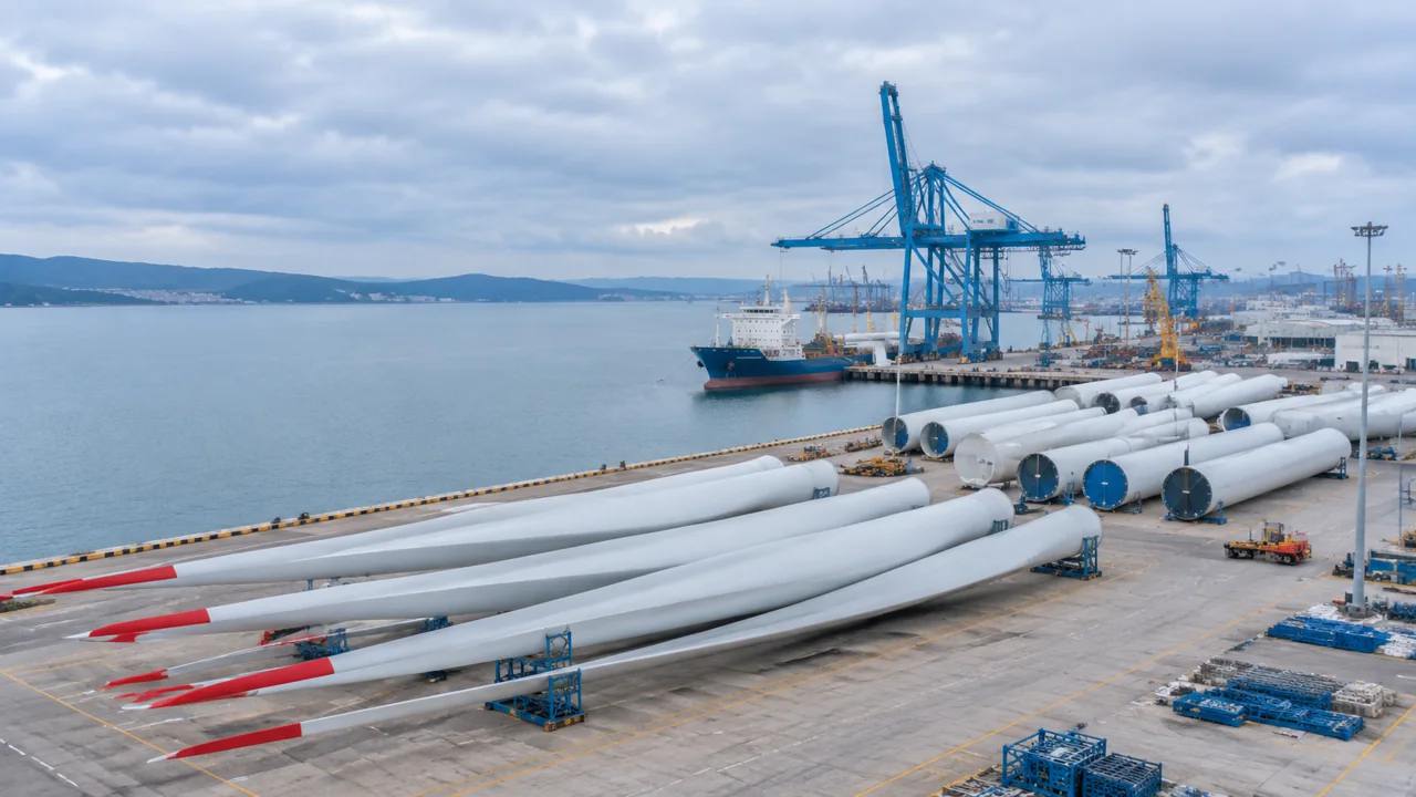
1 What a wind port has to handle
The port is a logistics machine with a public edge. It needs deep water, heavy-lift quay space, laydown area, and road or rail connections. It also sits next to towns, wetlands, and other marine users. A preview should show those conditions together. The berth alone is too narrow a frame.
1.1 Inventory the waterfront
List the berths, the quay lengths, the water depths as recorded by the port, and the crane capacity. Mark the areas that can take heavy loads and the areas that cannot. Note the channels and the turning basins used by the vessels. Ask the port for the latest berth and channel records before the preview. A public map may not show a recent dredging project or a closed berth. The preview should use the operator's data where it exists.
1.2 Read the landside connections
Trace the routes from the quay to the main road and the rail line. Look for bridges, weight limits, and intersections that would constrain a convoy. Note the nearest sensitive uses: homes, schools, and protected habitat. Check the route at the time of day when the town is busiest. A convoy that moves at night may avoid a conflict, but it may also create noise. The timing belongs in the review.
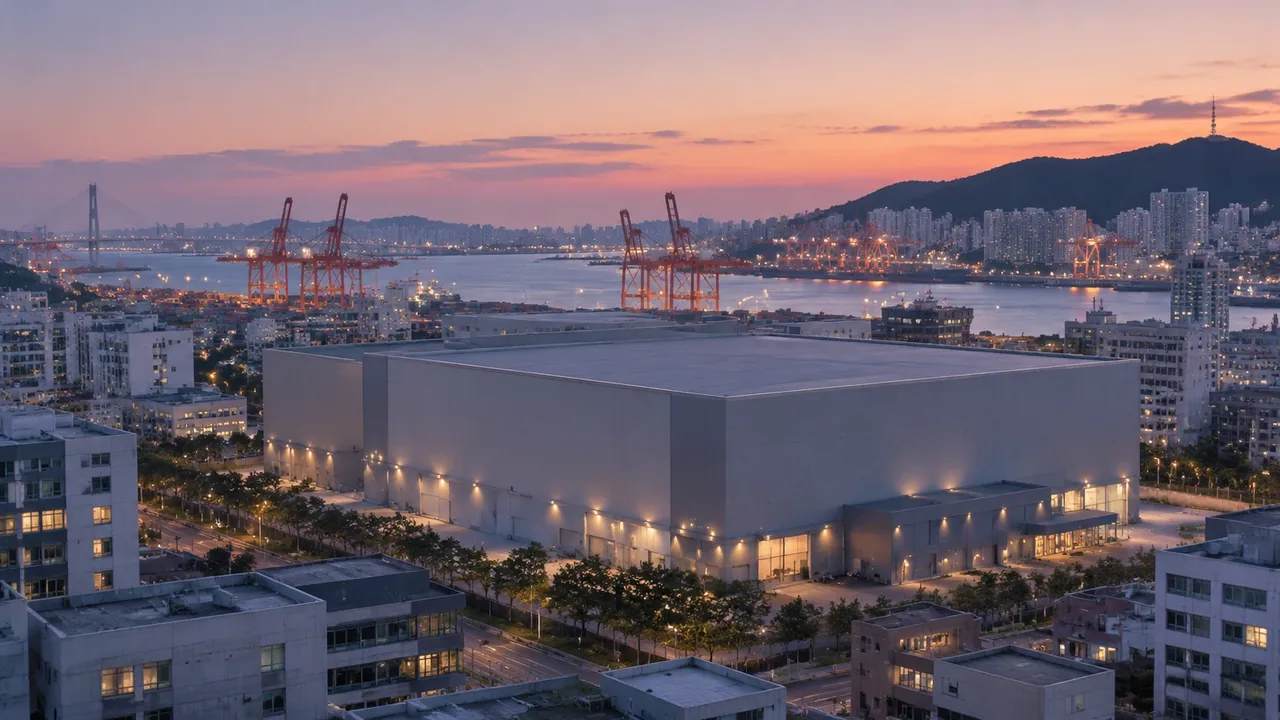
2 Previewing a port layout
A layout preview is a way to test the arrangement of quay, laydown, and access before committing capital. It is not a construction plan. The goal is to find the conflicts that a plan view hides and to compare options on the same terms.
2.1 Test component staging
Place the largest components on the laydown area and check the turning paths for the transporters. A blade that fits on the quay may not fit through the gate. Move the staging blocks and note how the circulation changes. Mark the no-go zones for the largest components. A turning path that clips a shed or a light pole is a real constraint, not a drawing error. The preview should show those conflicts clearly.
2.2 Compare berth and laydown options
Test at least two arrangements: one that concentrates activity at a single berth and one that spreads it across the quay. Compare the travel distances, the interference with other cargo, and the land take. Use the same camera and scale for both. Write the criteria for the comparison before testing the layouts. Land take, travel distance, and community edge are a reasonable starting set. Keep the same criteria for every option.
3 How the port concept uses site context
A site model gives the port team a shared view of the waterfront and the surrounding land. It shows the relationship between the quay, the laydown area, and the town. GenAnywhere can build that view from map data and keep it editable as the concept changes.
3.1 Generate the port and surroundings
Select the port area and a band of the surrounding land and water, then generate the scene. GenAnywhere produces terrain, water, buildings, and vegetation as separate layers. A planner can add a test warehouse, move a laydown block, or adjust a building height to study the view from a nearby street. The port context arrives without a new drone campaign, which makes early comparison practical. Keep the water and land layers separate so the review can test a new quay edge without rebuilding the town. A clean layer structure also helps the engineering team import the scene.
3.2 Review conflicts with nearby uses
Look at the edge between the port and the town. Mark the places where a new laydown area would remove a buffer or block a view. Note the routes that residents use to reach the waterfront. Ask the port's neighbors what they see and hear. A view from a nearby street may reveal a problem that the plan view hides. Add those viewpoints to the comparison.
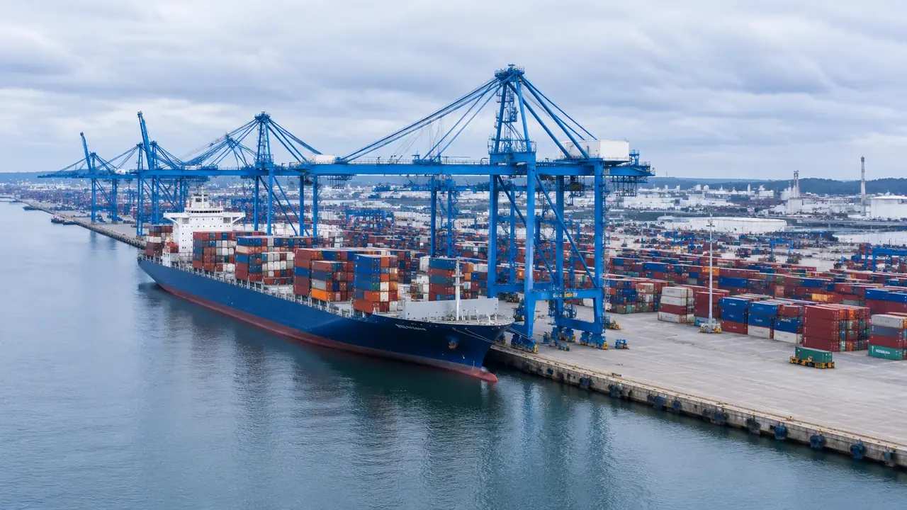
4 Questions for port and community review
Port projects attract questions about traffic, noise, jobs, and the marine environment. A preview can inform some of those questions and must leave the rest to the specialists. Clear labeling is the difference between a useful tool and a misleading one.
4.1 Separate site context from engineering
A site model shows the arrangement of space. It does not design quay structures, confirm load capacity, or model vessel motions. Bureau of Ocean Energy Management guidance on offshore wind is a useful reference for the regulatory context. Give the engineers the port boundary and the vessel assumptions in a short note. The two teams can then work against the same base. The note should say which assumptions are placeholders.
4.2 Name the studies still needed
List the studies that the preview does not replace: geotechnical, structural, metocean, traffic, noise, and environmental. Assign an owner to each and note the decision it informs. Put the study list in the same document as the concept options. A reader should see what the preview covers and what it does not. The pairing prevents the visual from being read as a finding.
5 Handing a concept to specialists
The concept team's output should be a clean brief, not a competing engineering package. That means a readable scene, a clear set of options, and a record of assumptions. The specialists can then work against a common base instead of rebuilding the port.
5.1 Export a layout the engineers can open
Name the layers, remove test variants, and keep the camera sequence used in the review. GenAnywhere can export the scene as GLB for common 3D, BIM, GIS, and game-engine workflows. The engineering team can add its own survey and marine data to the same geometry. Ask the receiving team to open the file before the handover meeting. A quick test catches missing layers and scale issues. The fix is cheaper before the file becomes the base for new work.
5.2 Record assumptions and sources
Attach a note with the port boundary, the source dates, and the assumptions about vessel size and cargo. Record which items came from port records and which are placeholders. Keep the note with the model in the same folder. A note that lives in an email will be lost. The folder structure should match the way the next team works. Review the workflow when the package is assembled.
6 A measured approach to port preview
A port concept can generate excitement and opposition at the same time. A measured process keeps both in the same conversation. GenAnywhere can support the spatial part of that process while the technical and community work proceeds in parallel. Open the app when the port boundary is ready.
6.1 Start with existing conditions
Model the port as it is before testing any new layout. A base that ignores current operations will produce options that cannot be built. Walk the quay and the gate with the model in hand. Photograph the quay and the gate before modeling. The photos help the team check the model against the real edge. They also give the community a familiar reference.
6.2 Compare before committing
Test more than one arrangement before selecting a preferred layout. Compare the land take, the circulation, and the community edge. Keep the comparison and the rejected options in the decision record. A reviewer may ask why a layout was dropped, and the comparison answers that question. Hiding the alternatives makes the preferred option look arbitrary.
6.3 Keep public trust
Explain what the model shows and what it leaves out. Avoid claims about jobs, schedules, or environmental effects that the preview cannot support. Invite the community to point out the places where the model is wrong. Say what the preview cannot show at the start of every session. The audience changes, and the caveat needs to travel with the images. A short statement is enough if it is repeated.
7 FAQ
FAQ-1 Can the model confirm water depth or quay capacity?
No. Water depth, quay strength, and crane capacity belong to the port's engineering and survey records. The model shows the arrangement of space and the surrounding context. Ask the port to confirm the records used and the date they were issued. Treat the preview as a spatial question and keep the engineering answer with the port team.
FAQ-2 How much of the town should be included?
Include the streets and buildings that face the port and the routes residents use to reach the waterfront. A band wide enough to show the nearest sensitive uses is usually enough for an early preview. Extend it where a taller building or a school sits close by. Record the boundary for later comparisons.
FAQ-3 Is the preview useful before a site is selected?
Yes. It can compare candidate ports on visible factors such as quay length, laydown area, and landside access. Use one set of criteria for each port, and state which item is still unknown. Those gaps belong in the comparison rather than in a later surprise. The preview will not rank the ports by itself, but it makes the trade-offs visible.
FAQ-4 What should the engineering team receive?
A clean GLB scene, a short note on assumptions and sources, and the option views that were compared. Confirm the format and coordinate needs before export. The goal is a shared base that the specialists can extend with their own data. A clear handover saves the next team from rebuilding the port context.
Content and technical notes
This article was prepared by the GenAnywhere team with AI-assisted drafting and human review.
Product features, formats, and availability change as the platform evolves; refer to the official GenAnywhere website for current details.
For technical questions or corrections, contact support@genanywhere.com.
Last reviewed: 2026-11-19.