
Factory siting in Fort Worth: a map-based early look, GenAnywhere
How industrial teams compare parcels before booking a drone or a field crew
A map-based site model can settle a good share of early siting questions before anyone books a flight. It shows the ground, the buildings, and the access pattern around a parcel, which is enough to compare options and catch obvious conflicts. It does not replace a survey, a wetland delineation, or a geotechnical report.
1 Site screening before a commitment
Industrial searches usually begin with a list that is too long. A development team may have a dozen parcels that meet the acreage and utility criteria, and it needs to cut that list to two or three before due diligence money starts moving. Most of that cut comes down to geometry: can the building, trailer parking, and stormwater ponds fit, and can trucks reach the road without crossing a neighbor's land?
1.1 What a desktop pass can answer
A desktop pass handles questions about shape and adjacency well. You can see whether a parcel has room for a large footprint plus circulation, whether a rail spur would have to cross a public road, and whether nearby houses sit close to the fence line. These are the questions that decide whether a site deserves a second look.
Comparing two parcels side by side beats arguing from memory. The same view, the same scale, and the same set of layers make the trade-offs easier to explain to a finance lead who has never walked the land. A sketch that takes an afternoon beats a debate that runs for a week.
1.2 Where field data still decides
Soil bearing capacity, buried utilities, easements, wetland boundaries, and flood elevations belong to field work and record research. A model built from map and satellite data can point to a wet area or a drainage channel. It cannot tell you what a geotechnical boring will find.
Treat the desktop pass as a filter, not a finding. If the geometry works, the next spend should go to the specialists who can confirm what lies under the surface. Skipping that step because a model looks convincing is how a cheap screening exercise turns into an expensive surprise.
2 Reading the Fort Worth context
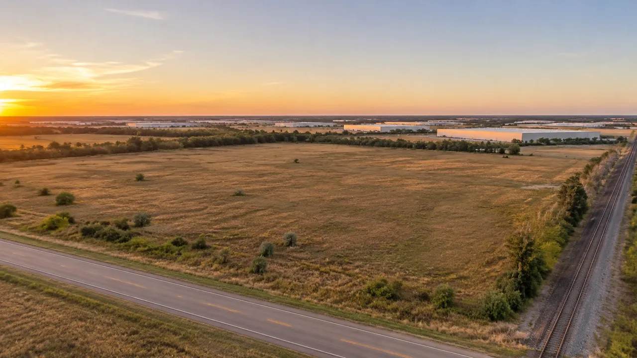
Fort Worth spreads across prairie, ranch land, and older industrial corridors, and those settings behave differently for a plant site. A parcel near Alliance looks nothing like a tract south of I-20, even when the acreage matches.
2.1 Flat terrain and drainage edges
Much of the land around Fort Worth is flat enough that drainage is easy to miss from a car. Small creeks and drainage ditches cut through fields, and a pad that ignores them will create problems later. A terrain view makes those low edges visible before a civil engineer starts grading studies.
Flat ground also changes how a site reads in three dimensions. A low building can disappear behind a levee or a tree line, and a tall silo can be visible from a road two miles away. Looking at the model from several angles gives the design team a more honest picture than a single plan drawing.
2.2 Airfield, rail, and highway adjacency
Airport proximity can help parts movement and constrain building height at the same time. The FAA publishes airspace review guidance that site teams should read early, and a model that shows runway orientation and nearby structures helps frame that conversation. Rail access and highway interchanges work the same way: useful on a map, but subject to their own engineering and ownership checks.
A parcel can look well connected on a small screen and turn out to have one narrow farm road as its access. Checking the surrounding road network at a wider zoom avoids that mistake. It also shows whether a new driveway would land on a curve, a bridge, or a stretch with no shoulder.
3 Turning a shortlist into a shared model
Screening notes in a spreadsheet are hard to discuss with a room of people. A model gives everyone the same picture, and it lets the team test a layout without redrawing a site plan for every option.
3.1 What the GenAnywhere model contains
GenAnywhere builds an editable 3D site model from an area selected on a map, using satellite and map data. It identifies building footprints, estimates heights, infers building types, and reads surrounding vegetation. Terrain, water, and vegetation arrive as separate layers, so a team can preview the site, edit individual buildings, and decide what each layer shows.
The output is a GLB file that can move into 3D, BIM, GIS, or game engine workflows. That makes it useful for a massing conversation with an architect or a quick scene for a planning review. The model is a planning aid, not a survey product, and it does not carry survey coordinates.
3.2 How to test pads and access routes
One exercise is to place a building mass, rotate it, and change its height to see how the site reads from the road and from the air. Teams can replace a single building, move it, or change its type, which helps when a parcel has an obsolete structure that would come down. Previewing the result before export keeps every option on the same base model.
Try two pad positions and one access road alignment, then compare them in the same view. The point is not to design the final layout. It is to find the constraint that makes one option clearly worse, such as a wetland edge, a steep bank, or a road that cannot take trailers.
4 Working with consultants and landowners
4.1 What to send before a site walk
A short PDF with the model view, the assumption list, and the questions you want answered is more useful than a link to a file share. Surveyors and civil engineers react to a picture faster than to a parcel ID. Ask them to mark what the model gets wrong.
Landowners and brokers can use the same document to correct boundaries or point out a building that has been removed. That exchange often surfaces facts that never appear in a listing. It also sets expectations about what the model is for, which matters when the project moves into design.
4.2 Questions to settle with the survey lead
Ask which control datum the field work will use, whether the parcel has a recent boundary survey, and which utilities need locating. The ASPRS pages on geospatial standards are a reasonable reference for terminology, especially when a team is writing a scope for photogrammetry or lidar.
It is worth asking how the field team will handle vegetation and roof edges, since those are the places where a map-based model tends to be coarse. A short conversation about method saves a round of revisions later. The survey lead can also say which parts of the site need a closer look than the rest.
5 Documenting assumptions for review
5.1 A simple assumption log
Keep a one-page log with the imagery date, the source, the parcel boundary used, and a note that heights are estimated. Anyone who reviews the model later should be able to see which parts came from data and which came from a designer's judgment.
The log does not need to be formal. A table would work, though a short paragraph per assumption is easier to paste into an email. What matters is that the reasoning travels with the file when it leaves the team.
5.2 What to keep out of the model
Do not dress up a planning model as a construction document. Avoid showing utility lines you have not confirmed, flood limits you have not checked, or property lines you have not surveyed. If a layer is uncertain, label it that way and keep it out of any drawing that leaves the team.
This matters when a model is shown in a public meeting. A viewer may read a clean render as a promise about what will be built. A brief note on the slide, or a spoken caveat, keeps the conversation about options rather than commitments.
6 Bringing the site conversation together
6.1 When a map-based pass is enough
A map-based pass is enough for an internal shortlist, an early community conversation, or a quick check on whether a broker's site plan matches the ground. It also helps when a team needs to brief people who will never visit the parcel.
GenAnywhere fits that stage because the model is quick to assemble and easy to share. A team can open it in a browser, review the layers, and export a file for a colleague who works in another tool. It is less useful when the question turns to soils, title, or utility capacity.
6.2 When to commission field work
Commission field work when the decision depends on something the map cannot show: soils, utilities, wetlands, title, or access rights. The desktop model can help write a tighter scope, but it should not delay the specialists.
A workable rule is to spend on field work once the geometry has been tested and the site still looks viable. Doing it earlier wastes money on parcels that will not fit. Doing it later puts the schedule at risk.
6.3 A practical next step
Pick one parcel from the shortlist and model the surrounding half mile. Select the area in GenAnywhere, review the layers, and look at the export workflow before you commit to a site visit.
7 FAQ
FAQ-1 Can GenAnywhere replace a drone survey when screening a plant site?
No. It provides a map-based planning model for early comparison, not measured survey data. Teams still need field survey, utility locating, and environmental studies before design or permitting. Use it to narrow options and brief colleagues, then hand the shortlist to the specialists who will do the field work on site.
FAQ-2 Does the model show flood zones or zoning?
No. GenAnywhere builds terrain, buildings, water, and vegetation from map and satellite data. Regulatory flood maps, zoning districts, and easements come from the relevant agency or record source and should be checked separately. A model can help you ask better questions about drainage, but it does not determine permit status.
FAQ-3 What file do teams get for design review?
The platform exports a GLB model that can be opened in common 3D, BIM, GIS, and game engine tools. Teams often use it for massing studies, view comparisons, and early coordination with consultants. Check the current export options on the site before promising a specific format to a partner or a review board.
FAQ-4 How current is the imagery?
Imagery dates vary by location, so the model reflects the source data available for that area rather than a live view. For a fast-moving site, confirm the imagery date and visit the parcel. Treat visible conditions as a starting point, not a record of what exists today at the time of your review.
Content and technical notes
This article was prepared by the GenAnywhere team with AI-assisted drafting and human review.
Product features, formats, and availability change as the platform evolves; refer to the official GenAnywhere website for current details.
For technical questions or corrections, contact support@genanywhere.com.
Last reviewed: 2026-11-07.