
Settling pond models: what GenAnywhere includes in the build
A water surface, the ground around it, and the plant that drains into it. Not the depth, the volume or the chemistry.
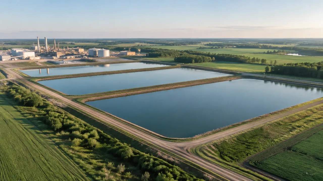
A settling pond appears in a GenAnywhere scene as a water surface set into generated terrain, with the vegetation and buildings around it. That is what the map supports, and it is enough to discuss where a pond sits, how big it looks beside the plant and what stands between it and the fence. It is not a hydraulic model, a capacity calculation or a water quality assessment, and the difference matters before anyone puts the scene in front of a regulator.
1 What the water in the scene is
1.1 A surface and the ground holding it
The pond arrives as a flat surface at the mapped water edge, sitting in terrain generated from the same source. Where the ground rises around it, the embankment reads as a slope; where the land is flat, the pond reads as a shallow pan. The edges follow the water the imagery recorded, which is a snapshot rather than a design line. In a plant with several lagoons, each one appears separately, and the arrangement between them is visible from above. That arrangement is often the thing an operator corrects before anything else, because the map may lag a decade of small works.
1.2 What the surface does not tell you
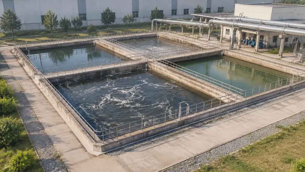
There is no depth in the scene, no bed profile, no volume and no freeboard. The surface is a plane, not a body of water with a shape underneath. Nothing in the file describes what the pond contains, how it is lined or where the inlet and outlet sit. Those facts live in the design drawings and the operating records, and they do not travel with a map-derived scene. A pond that looks generous from above may be nearly full, and the scene cannot say so. What it can say is where the water reached on a given date, which is still worth having.
2 Reading the pond in context
2.1 Embankments and the surrounding ground
The terrain either side of the water is often the more useful half of the picture. A bund that separates two lagoons, a channel running to a river and a yard that sits slightly above the water level all read in the model. So does the awkward strip of ground between a pond and a boundary fence, which is where expansion usually runs out of room. Read the levels from two directions before drawing conclusions, since a single view flattens a bank. Where the ground is unclear, hide the planting and look again at the bare surface.
2.2 Vegetation and the plant around it
Vegetation comes through as a layer, grouped rather than surveyed, and around a settling pond it usually marks the wet margins and the undisturbed ground beyond the bund. That pattern is worth noticing, because it often shows where the ground stays damp. The buildings nearby, whether a pump house, a control room or a warehouse, appear as masses at their mapped height. Together they show the pond as part of a working site rather than a shape on a plan. That difference is what makes a photograph of the scene usable in a meeting about expansion, where a plan alone tends to hide the constraint.
3 Working around the water
3.1 Buildings at the water's edge
What you can change in the scene is the built fabric: a pump house moved, a store extended, a shed removed to open a view across the water. That covers most early questions about a pond, which tend to be about access, screening and what sits between the water and the neighbours. The water outline itself follows the source data, so treat it as a reading rather than something to redraw. If the pond has been reshaped since the imagery, say so rather than trying to model it. A note that says the east bund was raised last spring is more useful than a plausible guess built into the geometry.
3.2 Isolating layers for a clearer read
Buildings, terrain and vegetation toggle as layers, which is unusually useful around water. Hide the vegetation and the bank shape appears; hide the buildings and the pond's relationship to open ground becomes clear. A view with the planting on shows the screening a neighbour would see. Prepare two or three of these states before a review, and the meeting spends its time on the pond rather than on the interface. Save the views so anyone can return to them without hunting.
4 Where the water's edge stops being enough
4.1 No depth, volume, quality or flow
The platform does not calculate storage volume, settlement behaviour, residence time, discharge quality or embankment stability. It does not model flow between lagoons or the effect of a storm. Those studies belong to civil and process engineers and to the guidance published by bodies such as the USGS on water measurement. In the scene, a pond is a surface in the landscape. Asking it for a capacity figure is asking the wrong tool. The right answer in a review is a drawing and a name, not an estimate drawn from a picture.
4.2 Water level and the imagery date
A pond is the most seasonally variable thing on most industrial sites. The mapped edge may reflect a wet winter, a dry summer or a period of maintenance, and the scene will carry whichever the imagery caught. Check the date and say it. If the water level is the subject of the discussion, note that the scene shows the level at capture rather than a design level, and bring the survey or the operating record alongside it. Two documents in the same meeting usually settle the question in minutes.
5 A settling pond review
5.1 What the scene settles
It settles the setting: how the pond relates to the plant, the boundary, the watercourse and the neighbours. It shows whether a proposed store would block a view of the water, whether an access route would pass along the bund, and how much open ground is left on the far side. Those are the questions that stall a project early, and they are visual questions with visual answers. Get agreement on them and the technical work has a frame to sit in. That frame is worth more than another iteration of the model, because it is what the other disciplines will use to place their own work.
5.2 What belongs to the engineer
Capacity, liner design, freeboard, inlet and outlet arrangement, monitoring and emergency spillway all belong to the engineer and to the consenting process. The scene can host that conversation by showing where each element would sit, once somebody supplies the design. It cannot decide any of it. Say that plainly at the start of a review, and the technical questions land where they belong instead of being aimed at the picture. A named owner for each question is the cheapest way to keep a review moving.
Open the GenAnywhere app and frame a settling pond
6 Handover for a water scene
6.1 Export and receiving tools
Preview the scene, then export a GLB carrying the terrain, water surface, vegetation and buildings into a 3D, BIM, GIS or game engine workflow. Water surfaces are handled differently by different tools, so check how the receiving application draws the surface and whether it needs a material or a plane adjustment. The platform overview lists what the export contains. A quick import test saves a surprise in front of an audience. If the surface reads as a hole in the ground, it is usually a normal or a material setting rather than a fault in the scene.
6.2 Notes that matter for water
Add three facts to the note: the imagery date, the water level at capture if it is known, and anything built or excavated since. Those three lines explain most of the discrepancy a reviewer will notice. They also protect the scene from being read as a statement about capacity or condition. A short note costs a minute and prevents an argument that can run for a whole meeting. The note also tells the next reader which version of the pond they are looking at.
6.3 When to regenerate
Regenerate when the pond itself has changed: a new lagoon, a bund raised, a lagoon taken out of service and drained. Do not regenerate for a new shed or a changed fence line, since those are edits. Keeping the pond's source date stable makes comparisons between versions meaningful. When you do regenerate, archive the earlier scene, because a drained lagoon is the kind of change someone will want to trace later.
7 FAQ
FAQ-1 Does GenAnywhere model settling ponds?
It includes a water surface where the map shows one, set into generated terrain with the surrounding vegetation and buildings. It does not model depth, volume, lining, inlets or water quality, and it does not assess condition. For a discussion about where a pond sits and what surrounds it, that is enough. For anything about how it performs, the scene is context and the design is elsewhere. Say which of the two a meeting needs before you open the file.
FAQ-2 Can I change the shape of the pond?
The outline follows the mapped water rather than an editable object, so reshaping it is not a modelling operation in the platform. If a lagoon has been extended or partly filled since the imagery, note the change and describe it. For a designed outline, use the civil model and place it against the exported scene. That keeps the map reading and the design intent separate, which matters when the two disagree.
FAQ-3 Is the water level reliable?
It reflects the water present when the imagery was captured, which may be a wet season, a dry season or a maintenance period. Check the imagery date and, where you know it, record the level at capture. Do not read a freeboard or a capacity figure from the scene, because neither is in the data. If the level matters, ask for the gauge record and put the date beside the picture.
FAQ-4 What can I show a review?
The setting: the pond's size relative to the plant, the bunds, the ground between the water and the boundary, the vegetation and the buildings nearby. That supports conversations about access, screening and expansion space. Bring the design drawings for anything about capacity, discharge or condition, and say which is which. A review that keeps the picture and the drawing in their own roles tends to reach a decision faster than one that blends them.
See how a water scene moves into a design workflow
Content and technical notes
This article was prepared by the GenAnywhere team with AI-assisted drafting and human review.
Product features, formats, and availability change as the platform evolves; refer to the official GenAnywhere website for current details.
For technical questions or corrections, contact support@genanywhere.com.
Last reviewed: 2026-11-13.