
City vertiport planning: what should teams test in GenAnywhere?
A site-first way to compare vertiport parcels before the aviation studies begin.
A city vertiport concept starts with a parcel question, not an aircraft question. Teams need to know whether passengers can reach the site, whether the surrounding buildings constrain the layout, and whether the neighborhood can absorb the activity. GenAnywhere can build that site context as an editable 3D model, giving planners and aviation reviewers a shared base before the specialist studies start.

1 What a city needs before a vertiport concept
A vertiport is a transport facility with a small footprint and a large set of interfaces. It touches streets, transit, utilities, emergency services, and the airspace above. A city should define the service idea and the parcel constraints before it draws a pad. Otherwise the concept answers a question nobody asked.
1.1 Define the service idea
Decide what the facility is for: passenger transfer, cargo, emergency response, or a mix. Each purpose implies a different daily rhythm and a different set of users. Write the service idea in one paragraph and test later decisions against it. Write down the users and the times they arrive. A commuter service and an emergency service have different peaks and different access needs. The service idea should name both if the site is expected to serve both.
1.2 Inventory the parcel and its neighbors
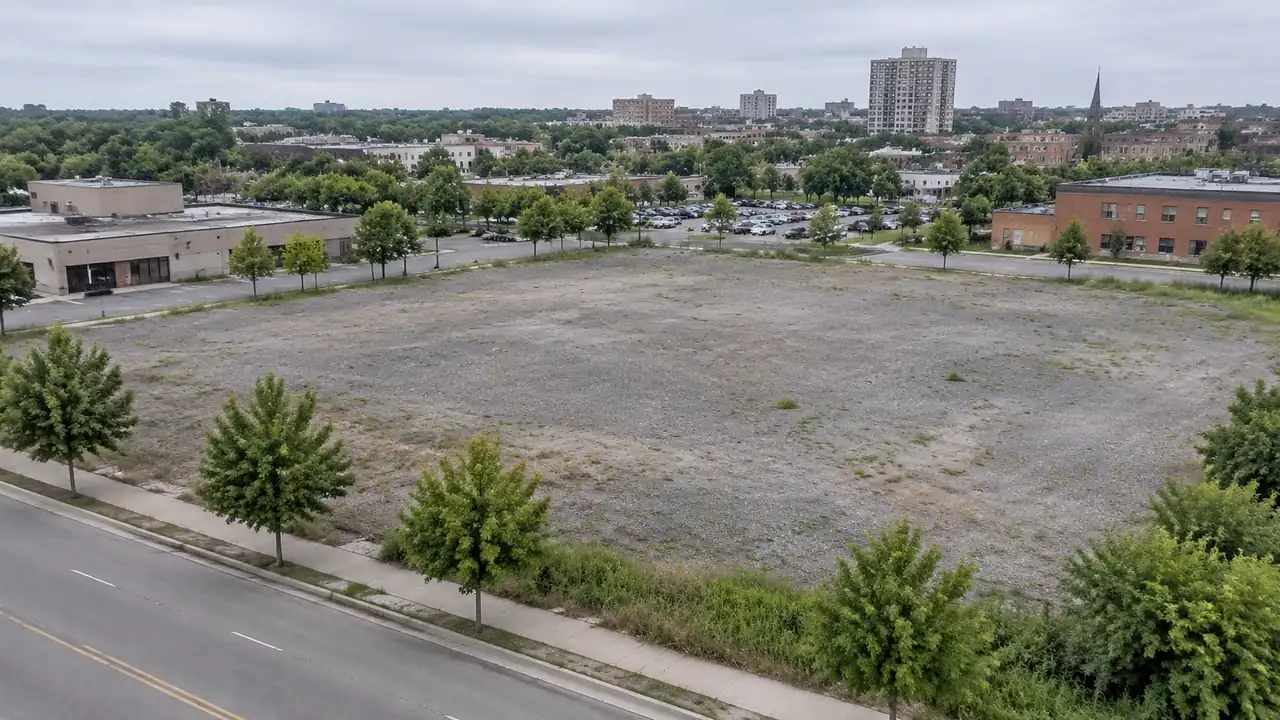
List the parcel size, the existing uses, the access points, and the buildings within a short radius. Note schools, hospitals, and residential blocks that may be sensitive to noise or traffic. Note the uses that are sensitive to noise, shadow, or traffic. A school may care about the morning peak, while a clinic may care about emergency access. Put those notes on the model so the review can see the conflict.
2 Ground access decides more than the pad
A vertiport that works on paper can fail at the curb. Passengers arrive by car, transit, shuttle, bicycle, and on foot. Service vehicles need a separate route. The ground plan has to handle those flows without turning the adjacent street into a queue.
2.1 Trace passenger and service routes
Draw the route from the nearest transit stop to the gate, and from the gate to the pad. Do the same for fuel, maintenance, and emergency vehicles. Look for conflicts where a passenger crossing meets a service lane. Test the route at the busiest hour, not the quiet one. A curb that works at midday may fail when a shuttle and a delivery van arrive together. The model can show the space; the team must supply the timing.
2.2 Check the edge conditions
Walk the perimeter and note fences, walls, grades, and drainage channels. A small change in grade can separate a passenger path from a service yard. A wall can block the view between the gate and the pad.
Photograph the edge at eye level. The plan view will not show the barrier a passenger feels. The experience of arriving on foot often reveals a barrier that the drawing hides. Add those photos to the review notes.
3 How a parcel study uses 3D context
A site model is a comparison tool for parcels and layouts. It shows the surrounding massing, the terrain, and the access points in one view. It does not analyze airspace, noise, or structural loads, and a team should not ask it to.
3.1 Generate surrounding massing and terrain
Select the parcel and a wide band around it, then generate the scene. GenAnywhere identifies nearby buildings, estimates heights, and reads vegetation, while terrain and water stay on separate layers. A planner can test a terminal location, move a parking block, or adjust a building height to study the visual relationship with the neighborhood. The surrounding context arrives without a custom survey campaign, which makes early comparison practical.
Keep a separate layer for test layouts and remove it before export. A clean base is easier for the design team to use. The layer discipline also makes the comparison repeatable.
3.2 Compare candidate parcels
Use the same camera, scale, and assumptions for every site. Show the usable area, the access points, and the nearest sensitive uses. Rank the parcels on those visible factors and note what remains unknown. Write one sentence for each parcel explaining why it advanced or dropped. The sentence should refer to a visible factor, not a preference. That record is useful when the shortlist is challenged.
4 Questions for aviation and planning reviewers
Aviation and land-use reviewers look at the same site through different lenses. The planning team should prepare one shared picture and a clear list of separate studies. That structure keeps the conversation from collapsing into a debate about the render.
4.1 Separate site context from airspace analysis
A site model shows ground context. It does not show approach surfaces, obstacle limits, or air traffic procedures. Federal Aviation Administration guidance on vertiport planning is the reference for those questions. Give the aviation reviewer the ground context in a format that can be imported into the aviation tools. The two teams do not need the same software, but they do need the same site boundary.
4.2 List the studies the model does not replace
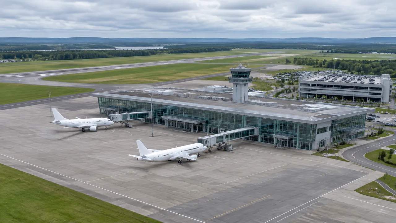
Noise, structural design, fire access, wind, and environmental review are separate efforts. List them at the start of the review and assign an owner to each. The model can show where those studies will need to focus, but it cannot produce their conclusions. A clear list prevents the visual from being mistaken for a finding.
5 Handoff to the design team
The handoff should give the designer a clean base and a readable set of constraints. It should also give the city a record of what was compared. A tidy package shortens the next phase and keeps the assumptions visible.
5.1 Export a clean base
Name the layers and remove test variants before export. GenAnywhere can export the scene as GLB for common 3D, BIM, GIS, and game-engine workflows. The design team can then add its own terminal, pad, and access layouts against the same context. Ask the design team to open the file before the handoff meeting. A quick test catches missing textures, layers, or scale issues. The fix is cheaper before the file becomes the base for new work.
5.2 Keep assumptions visible
Attach a short note that lists the parcel boundary, the service idea, and the unresolved questions. Include the date of the source imagery and any known gaps. A designer who understands the assumptions is less likely to build on a weak premise. Keep the date at the top and remove assumptions that are no longer in play. An outdated note is worse than no note, because it looks authoritative. The next reader should see the current position at the start.
6 A workable path for city teams
A vertiport conversation can move faster when the city controls the site narrative. Start with public context, invite the right reviewers, and keep the claims modest. GenAnywhere can support that site narrative with a scene the whole group can open. Start a parcel study when the shortlist is ready, and follow the workflow for a consistent review.
6.1 Start small and public
Begin with one parcel and one service idea. A small, well-documented study is easier to explain than a citywide map with no priorities. Publish the comparison criteria before the results. Invite one neighborhood group to the opening session, not every group at once. A small conversation surfaces issues that a large meeting cannot. The lessons can then be carried into the wider review.
6.2 Invite the right reviewers
Bring aviation, planning, fire, transit, and neighborhood representatives into the same room early. Each group will see a different risk. Give them the model view that matches their concern. A short, focused session is more useful than a broad presentation with no decisions.
6.3 Avoid overpromising
A site model does not prove that a vertiport is feasible. It shows whether a parcel can hold a layout and how that layout meets its edges. Keep the language clear about that role. Say what the model is for in one sentence at the start of every meeting. Repetition is useful when the audience changes. It keeps the conversation from drifting into questions the model cannot answer.
7 FAQ
FAQ-1 Can GenAnywhere show flight paths or approach surfaces?
No. Airspace design and approach surfaces belong to aviation specialists and the relevant authorities. The model shows ground context, surrounding buildings, and site access. Use it to prepare the site questions those specialists will need to answer. Do not treat the scene as an airspace study or a safety finding.
FAQ-2 How large an area should a parcel study include?
Include the parcel, the access streets, and the buildings that affect the visual and operational setting. A band of several blocks is usually enough for an early comparison. Extend it where a taller building or a sensitive use sits close by. Record the boundary so every candidate is compared on the same terms.
FAQ-3 Is the model enough for a public meeting?
Use it to explain site context and the comparison logic. Noise, traffic, and safety questions need other material. Pair the model with a plain-language summary and a list of studies still to come. That combination gives the public a clear picture without overstating what is known. Keep the summary short and specific to the site.
FAQ-4 What format should the design team receive?
A clean GLB scene plus a short note on layers, assumptions, and source dates. Confirm that the receiving team can open the format in its own tools. If it needs a different exchange format, agree on that before export. The goal is a usable base, not a file that has to be rebuilt.
Content and technical notes
This article was prepared by the GenAnywhere team with AI-assisted drafting and human review.
Product features, formats, and availability change as the platform evolves; refer to the official GenAnywhere website for current details.
For technical questions or corrections, contact support@genanywhere.com.
Last reviewed: 2026-11-19.