
Campus planning: can teams phase buildings using GenAnywhere?
How a campus team can test construction phases against the ground it already owns.
A campus plan is a sequence, not a picture. Each phase has to work while the previous one is still under construction, with parking, paths, and services kept alive. GenAnywhere can build a 3D scene of the existing campus from map data, so a team can test where a new building would sit and what it would displace. The scene supports phasing conversations before design work commits the site.

1 The phasing problem on a live campus
1.1 Which buildings can move without disruption?
Few campuses have spare land, and the land they do have is often a parking lot or a lawn that people use. A phasing plan has to decide which building comes down, which goes up, and where the displaced activity goes in between. Those decisions are easier when the team can see the whole campus at once instead of a set of separate site plans. A shared scene makes the chain of moves visible, and it exposes the point where the chain breaks.
The chain often depends on one building being empty before another can start. If that vacancy slips, every later phase slips with it. Putting the sequence on one base makes the dependency easy to point at.
1.2 How do you sequence work around a term calendar?
Construction on an active campus runs against the academic year. Work that closes a path in July can be impossible in October. A phase plan has to show when each change takes effect and what remains open through the busy months. Plotting the phases against the same campus scene helps the team spot a closure that lands at the wrong time. It also helps facilities staff see what they will have to manage.
2 What a phasing drawing usually leaves out
2.1 Where does the site context disappear?
A phasing drawing often shows the buildings and the construction fence, and little else. The surrounding neighborhood, the slope behind the hall, and the trees that screen the service yard fall away. That missing context is precisely what neighbors and staff respond to in a review. A scene that keeps the surroundings visible gives those concerns somewhere to land, instead of turning them into objections raised late.
Neighbors also read the campus from the outside. The edge along a public street, the service entrance, and the parking lot are the parts they experience, and those are the parts a building-only drawing tends to crop. A scene that includes the edge gives the review a fairer subject.
2.2 Why does terrain matter on a campus?
Many campuses sit on ground that slopes more than the drawings suggest. A new building placed on a flat plan can require a retaining wall, a longer ramp, or a service entrance that does not work. Terrain also shapes how people walk between buildings, and a route that looks short on paper can climb a flight of steps in practice. Seeing the grade in three dimensions raises those questions early, when they are still cheap to answer.
3 Building a campus scene from the map
3.1 How does GenAnywhere capture an existing campus?
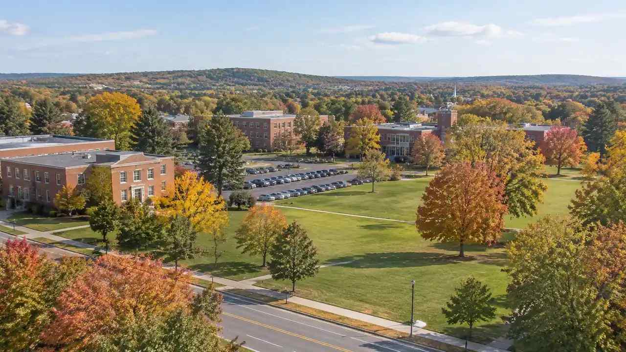
A user selects the campus area on the map, and GenAnywhere generates a 3D site model from satellite and map data. Buildings, terrain, water, and vegetation come into the scene, with terrain matched to the surrounding ground. Building footprints are recognized, heights estimated, and types inferred, so residence halls, labs, and service buildings read as different forms. That gives the team a base that matches the campus people know, without waiting for a full survey of every structure.
The result is a diagrammatic base, not a measured record. That distinction matters on a campus with historic buildings, where a flat roof and a pitched roof carry very different meanings. Confirm the forms that matter before the scene goes into a public document.
3.2 What changes are easy to test?
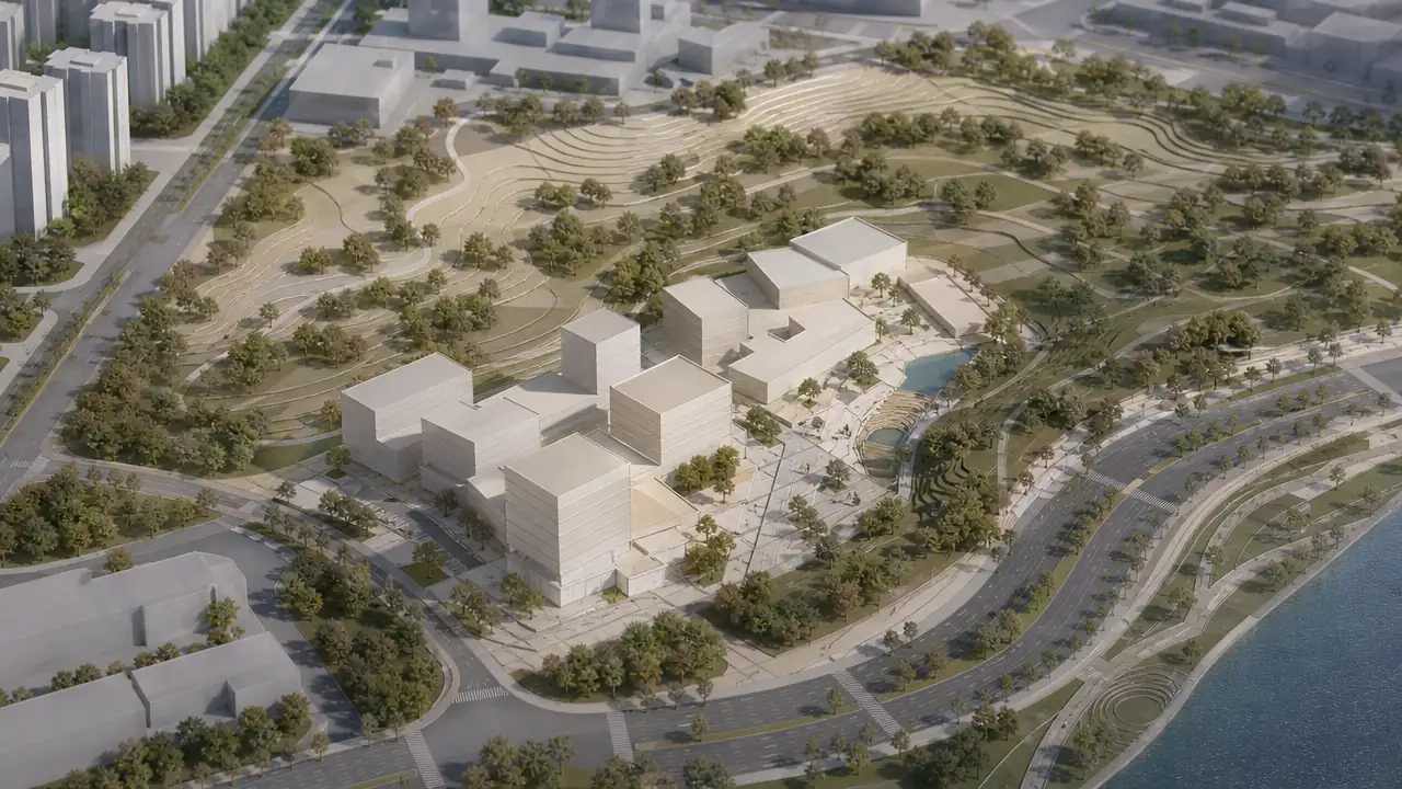
Individual buildings can be replaced, moved, rotated, or resized, and their heights and types adjusted. Layers for buildings, terrain, and vegetation can be previewed separately, which helps when the question is about the ground under a proposed hall or the tree canopy along a path. A team can remove a structure to see the open space, raise a proposed building to test its bulk, or shift a service yard. These are diagrammatic moves, useful for comparison rather than construction.
4 Comparing phase plans on the same base
4.1 How do you keep options comparable?
Use the same base scene, the same camera, and the same level of detail for each phase plan. Show the campus at the end of each phase, then show the sequence that gets there. If one option is rendered with mature trees and another with bare ground, the audience will compare the trees. Consistency keeps the review on the sequence, which is the actual decision.
4.2 What should each option show?
Each option should show what stays, what goes, and what arrives in each phase. It should also show where displaced parking, offices, or classrooms go during construction. Those temporary moves are where phasing plans often fail, and they are rarely drawn. A scene that includes them gives facilities staff something to react to before the schedule is fixed.
Label temporary uses clearly, since a parking lot pressed into service for offices is easy to mistake for a permanent change.
5 Where the visual stops being enough
5.1 Which questions need a program study?
Room counts, departmental adjacencies, and space standards come from a program study, not a site scene. The scene can show where a building sits and how big it looks, but it cannot say whether the floor plates suit a lab, a library, or a lecture hall. Teams should bring the program into the conversation early, so the visual test is measuring the right option. Otherwise the scene becomes a beauty contest between shapes.
5.2 When should the team pause?
Pause when the decision depends on cost, structural capacity, or a planning approval that has not been granted. Pause when the phase plan assumes a building will be vacant by a date nobody has confirmed. A scene can keep a discussion moving, and that momentum can carry a team past a question it should have answered. Knowing when to stop is part of using the tool well.
Write down the open questions and give each one an owner. A list with names moves a project forward; a list without names becomes a recurring agenda item. The scene can hold the visual context while the list does the work.
6 Getting a phase plan through review
6.1 Who reviews it?
Facilities, academic departments, finance, and often the local planning authority all review a phase plan. Each looks for something different: disruption, space, money, and approvals. A shared scene gives the group a common reference, which reduces the time spent explaining which drawing is current. It also makes it harder for an objection to hide in a plan nobody else can read.
Reviewers should see the phase they are being asked to approve, not the finished campus on the cover of the master plan. Showing the intermediate state keeps the discussion honest about disruption.
6.2 What should the package include?
Include the existing campus, each phase, the temporary moves, and a short note on assumptions and estimated heights. Exported GLB files can go to the design team for use in 3D, BIM, GIS, or engine workflows. The export carries a permanent commercial license under the platform's terms, and it should not be resold or used for AI training. Check third-party data rights before publishing any image.
6.3 How do you keep it aligned with the master plan?
Keep the master plan as the reference and use the scene to test what the plan implies on the ground. When a phase changes, update the scene and note the change against the plan, so the two documents do not drift. Review the pair before each capital request. A campus plan that lives in a PDF alone tends to be forgotten; a scene that gets updated stays part of the working conversation. Keep the version numbers aligned with the capital plan so a reviewer can match a request to a scene.
To test a phase plan of your own, open GenAnywhere in a browser and follow the site workflow walkthrough. The Society for College and University Planning publishes material on campus planning practice.
7 FAQ
FAQ-1 Can GenAnywhere design a building?
No. The scene represents buildings as massing, and it can move, resize, or replace those forms. Architectural design, structural systems, and code review happen in other tools with other specialists. Use the scene to test how a proposed building fits the campus, then hand the question to a design team.
FAQ-2 Does it show construction sequencing?
Not automatically. The team creates a view for each phase and puts the views in order, with a short note on what changes between them. That manual step is useful because it forces someone to state what happens in each period, including the temporary moves that keep the campus running. The scene provides the consistent base; the sequence itself is the team's work, and it should be reviewed like any other project document.
FAQ-3 Can we include buildings not yet on the map?
A scene is built from current map and satellite data, so a building under construction may not appear. A team can add a simple massing block to represent it and label that block as proposed. Keep such additions in a separate layer or a clearly labeled option so the difference between existing and proposed stays visible.
FAQ-4 What can facilities staff do with the export?
Facilities teams can open the GLB file in common 3D, BIM, GIS, or engine tools and use it to discuss access, service routes, and temporary closures. Pair the export with the phase notes and the assumptions page. The export carries a permanent commercial license under the platform's terms, but it should not be resold, and third-party data rights still need checking.
Content and technical notes
This article was prepared by the GenAnywhere team with AI-assisted drafting and human review.
Product features, formats, and availability change as the platform evolves; refer to the official GenAnywhere website for current details.
For technical questions or corrections, contact support@genanywhere.com.
Last reviewed: 2026-11-15.