
Offshore wind port staging: what planners can test in GenAnywhere
A marshalling yard is a logistics problem drawn on real ground, and the ground decides what fits.
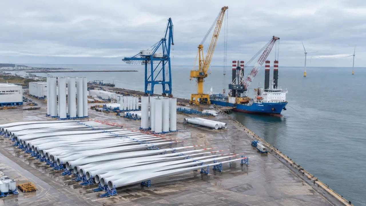
Offshore wind port staging sounds like a schedule question. In practice it is a space question. Towers, blades, nacelles, and foundations arrive by ship or truck and wait for installation vessels. Each component has a footprint, a turning radius, and a lift plan. A generated 3D site model of the port and its surrounding district can show whether a layout has room to work before anyone commits to a lease.
1 What port staging has to prove
1.1 Laydown space and component flow
A marshalling port is a yard with a schedule. Components arrive in a sequence, sit for a period, and leave on a vessel. The yard needs space for each stage of that flow, plus room to move between them.
A plan that shows just the storage area misses the aisles, the crane paths, and the turning circles. Those are the places where a layout fails. The model should show the whole working area, including the routes between the quay and the storage rows. A yard that looks full on paper may still lack a clear path to the berth.
1.2 Quay, vessel, and road interfaces
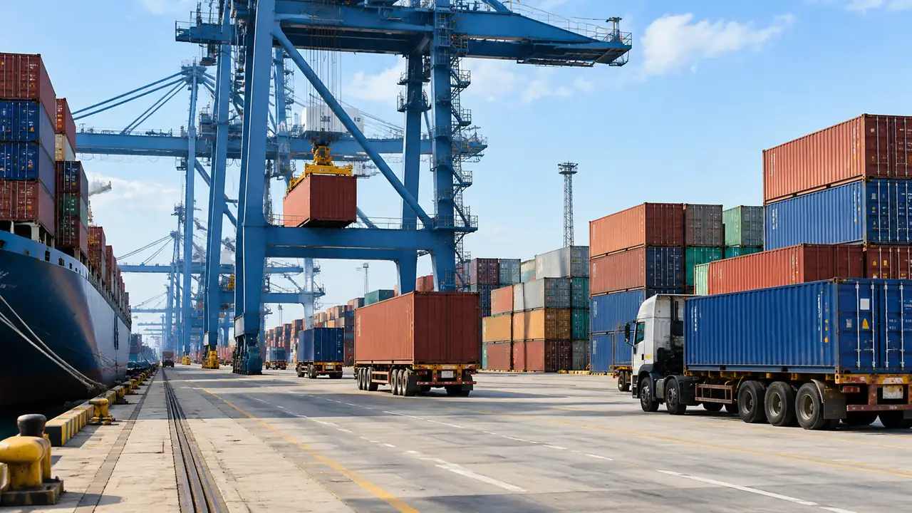
The quay is a shared edge. Installation vessels need water depth, berth length, and a load path that reaches the yard. Heavy trucks need a road that can take the weight and a gate that does not block the public street.
Those interfaces set the capacity of the port. A large yard behind a short berth cannot load a vessel faster than the berth allows. A strong quay behind a weak access road has the same problem in reverse. Ask the port authority for the current berth and depth limits.
2 Reading an existing port site
2.1 Map the working waterfront and its neighbors
Ports sit beside towns, wetlands, and working waterfront businesses. A staging yard may be the quietest neighbor in one direction and the loudest in another. The site model shows that context in three dimensions.
Look at the buildings around the port, the roads that serve it, and the water that borders it. A row of houses may face the laydown area. A marina may share the channel. A fishing cooperative may use the same access road at dawn. The model also shows the roads that carry components from the gate.
2.2 Identify the constraint that sets capacity
Every port has one constraint that decides how much it can handle. It may be berth length, water depth, yard area, road access, or crane capacity. The rest of the layout follows from that constraint.
Find it before drawing a new layout. A plan that expands the yard but ignores the berth is a plan for a bottleneck. A plan that adds a berth without yard space is the same mistake in a different place. Write that constraint at the top of the layout brief.
3 Testing layouts in a generated model
3.1 Generate the port and surrounding district
GenAnywhere starts with a map selection. The platform generates an editable 3D site model from satellite and map data, identifying building footprints, estimating heights, inferring building types, and analyzing vegetation. Terrain, water, and vegetation are matched automatically.
For offshore wind port staging, that gives planners a base that includes the quay, the sheds, the roads, and the town edge. The model shows the working waterfront as it stands, which is the right place to start a layout test. Open water beside the quay is part of the same view.

3.2 Move components and compare congestion
Buildings sit on their own layer. You can replace a single building, move or rotate it, adjust its height or type, and preview the result before export. Component stacks can be represented as volumes and moved between layouts.
Test two arrangements on the same ground. One may put the tallest components near the berth. Another may split them across two rows. The model shows the aisles and the turning space each arrangement leaves, which is the difference that matters on a working day. That is where a layout usually fails on the working day. Mark crane paths and turning areas as volumes, then test them again.
The platform generates terrain, water, vegetation, and building volumes. It does not model quay strength, crane capacity, vessel motions, or lifting plans. Those require engineering and operational studies.
The model is also a snapshot. A new shed, a dredged channel, or a changed road may not appear. Use it to frame the layout question, then confirm the operational details with the port authority and the engineers.
4 Environmental and community review
4.1 Wetlands, air, noise, and traffic
A port expansion touches permits for water, air, and land. Dredging, fill, and stormwater are regulated. Construction traffic and operating noise affect the town. Those reviews have their own processes and their own evidence.
The model can show where the work would sit relative to wetlands, homes, and roads. That helps the project team prepare a clear application and helps the public see what is proposed. It does not replace the studies or the permits. Early conversations with the regulators save a rewrite later.
4.2 Fishing and waterfront businesses
Working waterfronts support more than wind. Fishing crews, boatyards, and seafood businesses may share the channel and the road. A staging layout can disrupt them even when it does not take their land.
Map those uses before the layout is fixed. Ask where the boats tie up, when they leave, and which road they use. A model that includes those details produces a better conversation than one that shows an empty yard. A port that keeps the fishing fleet informed keeps a useful ally.
5 A staged approach to expansion
5.1 Phase the yard before the berth
Ports rarely expand all at once. A phased plan may start with a new laydown area, then add a berth, then upgrade the road. Each phase should work on its own, because funding and demand rarely arrive together.
Test the phases in the model. Show the yard after phase one, after phase two, and at full build. The sequence reveals temporary bottlenecks and the point where the next investment becomes necessary. A phase that cannot operate on its own is not a phase.
5.2 Plan for the largest component
Turbines are getting larger, and the largest component sets the yard. A blade that is longer than the available aisle forces a redesign. A nacelle that is heavier than the quay rating forces a different berth.
Ask the turbine supplier for the current and projected dimensions before the layout is fixed. Then test those dimensions in the model. A yard designed for the last generation of equipment may not serve the next one. Test the largest blade at the tightest turn in the yard.
6 Deciding whether to bid or wait
6.1 Match the site to the turbine class
Not every port can serve every project. Water depth, berth length, and yard area set a practical limit on the turbine class a port can handle. A site that fits a smaller unit may not fit a larger one without dredging and new quay.
Compare the site against the project requirements before bidding. The model helps with the landside layout, while the port authority and the engineers confirm the marine and structural limits. The port authority can confirm depth and berth limits in writing.
6.2 Check the workforce and utilities
A staging port needs workers, power, water, and waste service. It also needs a road network that can carry abnormal loads. Those are regional questions that a site model cannot answer.
Talk to the workforce board, the utility, and the state transportation agency early. A port with a perfect yard and no housing for workers has a problem that no layout can solve. A short list of gaps is better than a long list of hopes.
6.3 Set decision gates
A port expansion is a sequence of commitments, not a single yes. Set gates for land control, permits, utility capacity, and customer commitments. At each gate, decide whether to continue.
Guidance from the Bureau of Ocean Energy Management covers offshore wind leasing and environmental review at the federal level. State and local processes add their own requirements. Read the current rules for the project's jurisdiction before relying on a summary. Write the gate criteria before any application.
7 FAQ
FAQ-1 Can GenAnywhere design a marshalling port layout?
No. GenAnywhere generates a 3D site model of the port and its surroundings for context and comparison. The layout comes from port planners, logistics specialists, and engineers who understand vessel operations, quay capacity, and lifting plans. The model helps those teams see the ground and test options. That team owns the operating plan.
FAQ-2 What can the model show around an existing port?
It shows terrain, water, roads, buildings, and vegetation, including the quay area and the neighboring district. That helps planners understand available space, nearby homes, and access routes. It does not show bathymetry, quay strength, crane capacity, or vessel movements. Those require marine and structural studies and the port's own operating data.
FAQ-3 How current is the imagery for a working port?
The model reflects the satellite and map data available when the area was generated. Ports change quickly, with new sheds, paving, and equipment. Treat the model as a snapshot, verify conditions with the port authority, and refresh it before a layout decision. Ask the port for its latest layout drawing.
FAQ-4 Can the export go into our planning and engineering tools?
The export is a general GLB, and the tutorials cover Revit, Rhino, SketchUp, Blender, Unreal Engine, Unity, ArcGIS Pro, GISBox, and Wings Engine. Import behavior varies by tool, and a large port area may need splitting. The file carries geometry and materials, not operational or engineering data. Agree on the import settings before the upload.
Content and technical notes
This article was prepared by the GenAnywhere team with AI-assisted drafting and human review.
Product features, formats, and availability change as the platform evolves; refer to the official GenAnywhere website for current details.
For technical questions or corrections, contact support@genanywhere.com.
Last reviewed: 2026-11-22.