
Data center siting: what GenAnywhere shows about terrain
How terrain, drainage, and site edges shape an early shortlist
A data center siting decision starts long before a parcel is bought. Terrain sets how much earthwork a pad needs, where stormwater moves, and whether the land can hold halls, yards, and cooling equipment together. GenAnywhere turns a map selection into an editable 3D site model so those constraints can be read in one view instead of four separate reports.
1 What terrain review answers early
1.1 How does slope change the usable pad?
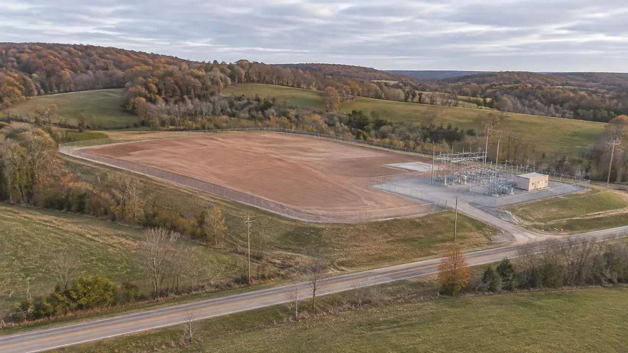
A data center needs large flat areas for halls, switchyards, generators, and truck courts. A few degrees of slope across a hundred meters produces cut on one side and fill on the other, and both change cost and drainage. A pad pushed into the hill may need a retaining wall; a pad built out from it may need imported fill and a longer stormwater path. Seeing the ground in 3D makes that trade visible while the shortlist is still flexible, before a civil team spends weeks on a concept the land cannot hold.
1.2 Where does stormwater go during a storm?
Water follows the low line, not the property line. A parcel that looks dry in a satellite image may sit below a road embankment or beside a ditch that drains a much larger catchment. Reading the land around the site, not just the site, shows where runoff arrives from and where it has to leave. That shapes pond siting, culvert assumptions, and the opening conversation with the local drainage authority. It also explains why two parcels a kilometer apart can carry very different drainage obligations.
2 How power, water, and access sit on the land
2.1 Which nearby infrastructure matters at this stage?
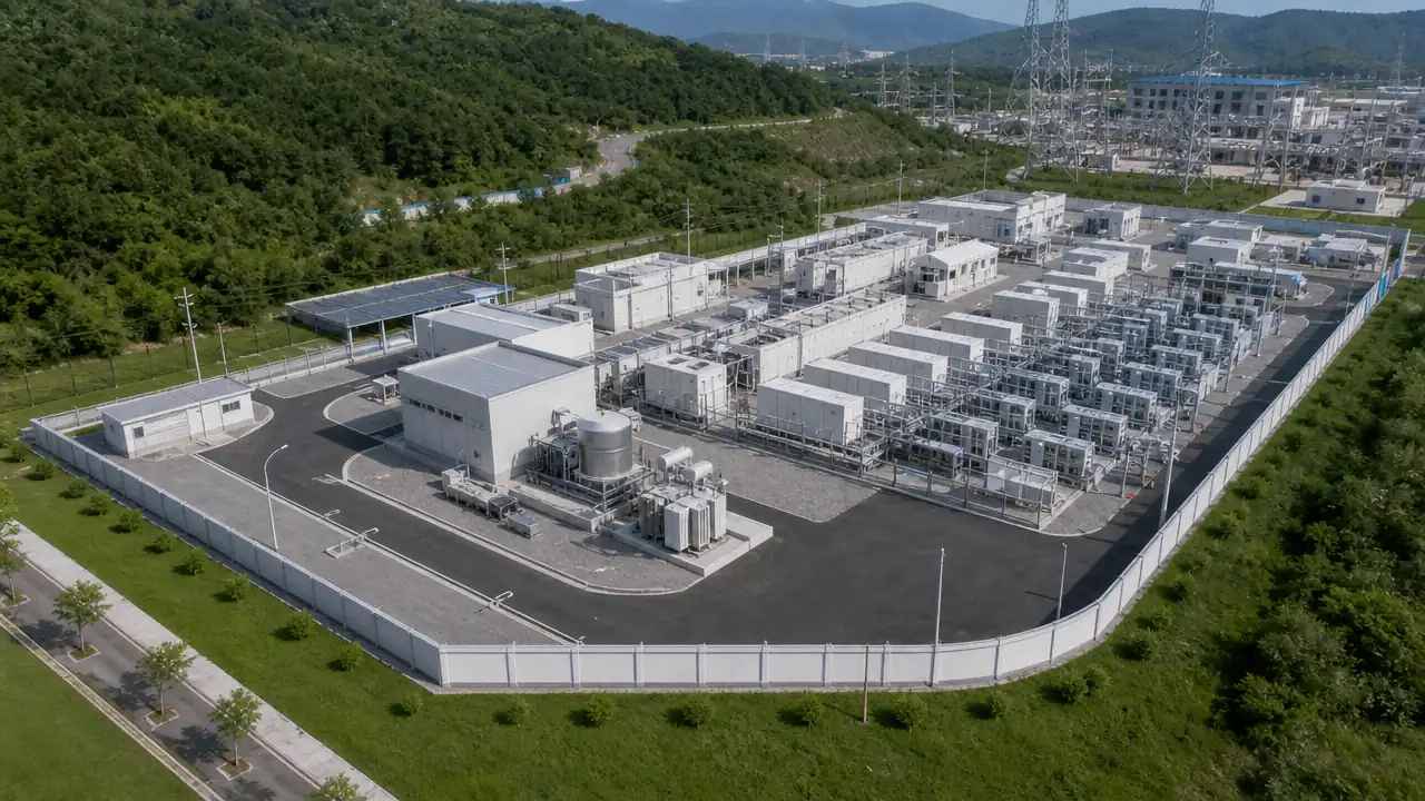
Transmission lines, substations, fiber routes, and water mains are easier to judge when they are drawn on the same picture as the parcel. Distance matters, but so does the path: a line on the far side of a ridge or a highway crossing can change the connection cost more than raw distance suggests. The IEA tracks how data centre electricity demand is moving, and that work is one reason power conversations now start earlier in site selection. A scene with the parcel, the roads, and the visible utility corridors gives the team a common starting point for those talks.
2.2 How do access roads fit the grade?
Construction traffic and staff commuting put different demands on a road. A temporary haul route can accept steeper grades than a permanent entrance, and turning space for long vehicles often decides where the gate goes. On a slope, a short switchback may cost less than a long cut, while a steep direct approach may save land and create a queue at the gate. Putting the road on the model beside the pad shows which arrangement keeps haul routes off nearby lanes and keeps the entrance visible from the highway.
3 Reading the model without overselling it
3.1 What does the model show, and what does it leave out?
The model shows surface shape, building footprints and heights, vegetation, and water as interpreted from map and satellite sources. It does not show soil, groundwater, buried utilities, or what a geotechnical rig will find. That division is useful: the model frames the questions, and field work answers them. When a team can point at a slope and ask whether it will hold a loaded yard, the geotechnical brief writes itself. Teams that treat the scene as a shared picture of the site, rather than a set of measured facts, tend to get more from the review.
3.2 How should teams handle flood and wetland questions?
Flood and wetland boundaries come from regulatory maps, hydrology studies, and site visits, not from a generated scene. The model can show where low ground sits relative to a proposed pad, which helps a team ask better questions of the map. It should not be used to decide a floodplain limit or to argue that a wetland is absent. Keep those calls with the specialists and the responsible agency, and record the source of any boundary shown in a review. A useful habit is to label the discussion as context until the regulatory map arrives.
4 Comparing two parcels on the same terms
4.1 What should stay constant in a comparison?
Camera height, viewing direction, layer settings, and the list of questions should be the same for every candidate. If one parcel is shown from a low angle and another from above, the comparison tells you more about the views than about the land. A fixed set of views also makes it harder to favor the site someone already likes. Write the view settings down so a later reviewer can repeat them, and keep the same building assumptions in each scene. Consistency is what turns a set of pictures into a decision aid.
4.2 How do teams record what they see?
A short note per parcel works better than a long report. Record the pad size the terrain can support, the direction water leaves, the access options, and the constraints that would need study. Add the date of the source imagery and the name of the person who built the scene. These notes become the spine of the shortlist discussion, and they keep the team from re-litigating the same view in every meeting. When a parcel drops out, the note explains why, which matters later if the land comes back into play.
5 Where GenAnywhere fits the siting conversation
5.1 What can a team adjust before export?
GenAnywhere builds the scene from a map selection, then lets a team replace a single building, move or rotate it, and change its height or type. Terrain, water, and vegetation are generated and matched to the ground, and buildings, terrain, and planting can be handled as separate layers. For a data center study, that means a team can test a larger hall, shift a yard, or clear a tree line and see the effect on the pad and the approaches. The point is not a finished design. It is a way to find the layout questions that the land will not forgive.
5.2 What does the GLB handoff support?
After preview, the scene exports as a general GLB file. That file can enter 3D, BIM, GIS, and game engine workflows, including the directions covered in the official tutorials. It is a visualization and review asset, not a survey deliverable, and how coordinates are handled depends on the software that receives it. Test the import on a small scene before a production pipeline depends on it. If a team needs a native format for a downstream tool, confirm that path with the tool's own documentation.
6 Limits, review habits, and next steps
6.1 When is a site model the wrong tool?
When the question is about soil strength, groundwater, contamination, or a regulatory boundary, a surface model adds little and can mislead if it is treated as evidence. The same applies when the decision hinges on a utility that is not visible from above. In those cases, start with the specialist study and use the model to show where the findings sit. A model is a way to organize a conversation, not a way to skip one. Saying that early keeps the review honest and keeps the later studies funded.
6.2 What should a review packet contain?
A packet that travels well has one page per parcel, a fixed set of views, a short constraint list, and a note on source dates. Include the assumptions behind the layout, such as hall size and yard depth, so readers know what was tested. Add the questions that remain open, and say who owns each one. That structure lets an executive, an engineer, and a planning official read the same material without needing a guided tour. It also shortens the next meeting, because the group starts from the same facts.
6.3 How does a team start?
Pick two candidate areas and build both before the next siting meeting. Keep the opening pass rough, and resist the urge to decorate it. The aim is to see whether the land supports the kind of project under discussion, and to find the questions that need field work. From there, the team can decide which parcels deserve a deeper study and which can leave the list. A short written note on each scene is enough to carry the work forward.
Start with a map selection in the browser app, then follow the site workflow when the shortlist is ready for review.
7 FAQ
FAQ-1 Can a site model replace a geotechnical study?
No. A site model shows surface context, not borings, groundwater, or bearing capacity. Geotechnical work still decides foundation design and earthwork quantities. What the model can do is frame the questions: where cuts and fills are likely, which corners look wet, and where a rig may struggle to reach. Teams often bring the scene to the geotechnical kickoff so the discussion starts from the same picture of the land. Treat it as a conversation aid, not a substitute for field investigation.
FAQ-2 How current is the imagery behind the model?
The scene is built from map and satellite data available in the platform, so it reflects conditions at the time that source was captured, not the ground today. New grading, temporary stockpiles, or a cleared lot may not appear. For an early shortlist that gap is usually acceptable. Before design or permitting work, confirm current conditions with a site visit or recent imagery, and note the source date in the review file.
FAQ-3 Can teams compare two parcels side by side?
Yes. A team can build more than one area and switch between them, and the comparison is easier to trust when the camera, layers, and question list stay the same. Write down what changed between the two scenes. A side-by-side view can hide differences in source data as easily as it reveals differences in terrain, so the notes matter as much as the picture.
FAQ-4 What format comes out of the platform?
The platform exports a general GLB file after preview. That file can move into 3D, BIM, GIS, and game engine workflows, including the tools covered in the official tutorials. It is a scene for review and visualization, not a native survey deliverable, and coordinate handling depends on the receiving software. Test the import path with a small scene before a production pipeline relies on it.
Content and technical notes
This article was prepared by the GenAnywhere team with AI-assisted drafting and human review.
Product features, formats, and availability change as the platform evolves; refer to the official GenAnywhere website for current details.
For technical questions or corrections, contact support@genanywhere.com.
Last reviewed: 2026-11-08.