
Stormwater mapping: what Ulster County gains with GenAnywhere?
Where a shared 3D site scene helps county staff sort drainage problems before design.
Ulster County's drainage problems appear as washed-out shoulders, flooded intersections, and culverts that cannot keep up after a heavy storm. A county team gains a shared 3D picture of the places where those problems begin, built from map and satellite data, so highway, planning, and engineering staff can look at the same ground. GenAnywhere does not replace drainage studies or design work. It gives the county a quicker way to frame where to look.
1 What a county actually needs from a drainage picture
1.1 Which catchments send water onto problem roads?
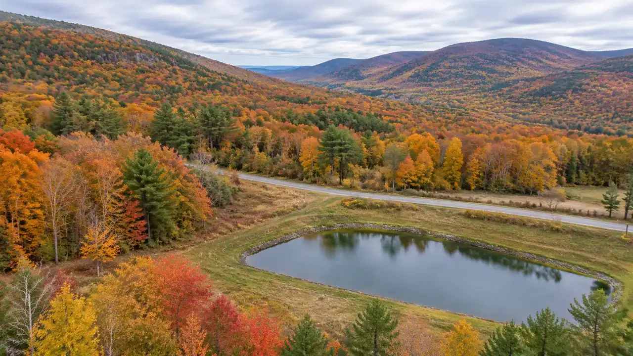
Road crews know the complaints by address: a shoulder that erodes every spring, a low spot that closes after a storm, a culvert that backs up with debris. What they often lack is a view of the ground above those places. In the Catskills, water gathers on wooded slopes, runs into roadside ditches, and arrives at a crossing in a hurry. A picture that connects the complaint to its catchment changes the conversation from patching a spot to understanding a small system. That shift is useful even before anyone opens a design file.
1.2 Where does new hard surface change the picture?
New roofs, parking areas, and driveways add runoff, and the effect is cumulative across a town. County reviewers see each site plan on its own, which makes it hard to judge what several approvals add up to on one stream. A shared scene of the corridor shows where new impervious cover sits in relation to ditches and channels. It will not calculate the added flow. It does show the pattern that a reviewer might otherwise miss.
Most counties cannot afford to study every ditch and culvert, so the work starts with a list of recurring problems. A shared scene helps a small team compare those problems without commissioning new mapping for each one. It keeps the conversation on the handful of places where spending would make a difference.
2 The Catskill setting and its drainage patterns
2.1 How do steep slopes change where water collects?
Steep ground moves water quickly, and narrow valleys concentrate it. A storm that is mild on a ridge can arrive as a surge at a road crossing a few minutes later. Culverts sized for a gentle grade can be overwhelmed by a short, intense burst. Looking at terrain in three dimensions makes those relationships easier to explain to people who do not work with contours. It also shows why two crossings a mile apart may behave quite differently.
2.2 What should a county planner see at once?
A planner needs buildings, roads, terrain, water, and vegetation in one view. Separating those layers into different maps forces a mental merge that most people do badly. A single scene keeps the relationships visible: the school beside the culvert, the new lot above the ditch, the wooded slope that slows the water before it reaches town. That is the practical value of a model over a stack of drawings.
3 From a map selection to an editable terrain scene
3.1 How does GenAnywhere assemble terrain and buildings?
A user selects an area on the map, and GenAnywhere generates a 3D site model from satellite and map data. Terrain is matched to the surrounding ground, and the scene includes buildings, water, and vegetation. Building footprints are recognized, heights estimated, and types inferred, so the model reads like the place rather than a flat tracing. Vegetation around the site is analyzed as part of the same pass. This is enough to give county staff a working picture before any field visit is scheduled.
3.2 What can a reviewer adjust in the scene?
Individual buildings can be replaced, moved, rotated, or resized, and their heights and types adjusted. Layers for buildings, terrain, and vegetation can be previewed and managed separately, which helps when a reviewer wants to see the ground without the clutter of roofs and trees. A planner can remove a structure to check what the open ground looks like, or shift a proposed building to test a different arrangement. These are sketching moves, not design decisions, and the scene should be read that way.
The base scene also gives new staff a way to learn the ground that long-serving crews know by memory. A young engineer can see the slope above a crossing before visiting it, and a planner can check the surrounding lots without pulling three separate maps. That shared starting point makes a field visit more productive.
4 Comparing retrofit options before funding review
4.1 How do teams line up candidate parcels?
Start with the same base scene and the same camera position for every option. Then place each candidate in turn and note what changes: access, the distance to the stream, the neighbors who would notice, and the ground that would be disturbed. Keeping the base constant is what makes a comparison fair. If each option is shown from a flattering angle, the meeting turns into a sales pitch instead of a review.
4.2 What makes a comparison readable in a meeting?
Fewer views work better than many. One overview, one close view of the problem spot, and one note on assumptions will usually carry a funding conversation. Label what is known and what is estimated, and leave the uncertain items on the page. A comparison that hides its weak points invites questions it cannot answer. A comparison that names them tends to earn more trust.
5 Limits: what a scene cannot tell a county
5.1 Which drainage questions need field data?
Pipe condition, soil permeability, inlet capacity, and actual flow during storms all require field work or monitoring. A scene built from map data cannot see inside a culvert or measure how much water passes through it. Those facts decide whether a retrofit will work. The scene can tell a team where to dig and what to measure, which is a useful role but a limited one.
5.2 When should a team stop and call an engineer?
When the question shifts from where to how much, it is time for an engineer. Sizing a culvert, setting a detention volume, or judging whether a channel can take more flow are design tasks with consequences. A visual model can support that work by showing context. It cannot take responsibility for the answer, and county staff should be clear about that boundary in every meeting.
That boundary is easier to hold when it is written into the project brief. Naming the questions a scene cannot answer keeps a meeting from drifting into speculation, and it gives the engineer a clean list of work to price. A short paragraph in the brief is enough to prevent most confusion later.
6 Preparing a county-ready briefing
6.1 Who should be in the room?
Highway crews, planners, soil and water staff, and town representatives each hold part of the picture. Bringing them together around one scene saves the usual round of map translations. A crew member can point to the spot that floods, a planner can point to the approved lot above it, and the group can see the connection without arguing about which drawing is right. The meeting gets shorter when everyone is looking at the same thing.
6.2 What should the visual package show?
A base scene, a handful of marked views, and a short note on sources and assumptions will cover most county briefings. Exported GLB files can go to a design consultant for use in 3D, BIM, GIS, or engine workflows. The export carries a permanent commercial license, subject to the platform's terms, and the original file should not be resold or used for AI training. Check third-party data rights before publishing any derived image.
6.3 How do you keep the model honest?
Record the date of the map data and the name of the person who built the scene. Refresh it when a major site changes or a new subdivision is approved. State plainly that heights are estimated and that the model is not a survey. Those small habits prevent a sketch from being quoted later as if it were a measured record. A scene is as useful as the limits printed beside it.
To try this on a corridor in your own county, open GenAnywhere in the browser and review the site workflow guide. The EPA stormwater program pages explain the permit context that shapes local drainage work.
7 FAQ
FAQ-1 Does this replace a drainage study?
No. A drainage study uses field data, flow estimates, and engineering judgment to size and test improvements. GenAnywhere provides a 3D site scene built from map and satellite data, which helps a county decide where to focus a study. Treat the scene as the opening frame of the conversation, and keep the study as the source for design decisions and permit submissions.
FAQ-2 Can county staff use it without GIS training?
Yes, for basic viewing and sketching. The scene opens in a browser, and moving around it takes little instruction. Staff who want to edit buildings or compare layouts will need a short walkthrough, but they do not need to be GIS analysts. Keep a trained person responsible for the base scene so that edits stay consistent across departments.
FAQ-3 What about private property in the scene?
The model is built from map and satellite data, which may include private parcels. County staff should follow their own rules for showing property in public meetings and check the data provider's terms before publishing images. Avoid presenting the scene as a record of ownership or boundaries. If a view reveals something sensitive, use a wider camera angle or omit that view.
FAQ-4 What can be handed to a design consultant?
The scene can be exported as a GLB file and opened in common 3D, BIM, GIS, or engine tools, depending on the consultant's pipeline. Pair the export with a short note on sources, date, and known limits. The export carries a permanent commercial license under the platform's terms, but the consultant should still verify anything that affects design. Confirm formats before the handoff.
Content and technical notes
This article was prepared by the GenAnywhere team with AI-assisted drafting and human review.
Product features, formats, and availability change as the platform evolves; refer to the official GenAnywhere website for current details.
For technical questions or corrections, contact support@genanywhere.com.
Last reviewed: 2026-11-15.