
Zoning pause lines: how Dade City can test a boundary with GenAnywhere
A short building pause is a map question before it is a legal one, and the map can be tested.
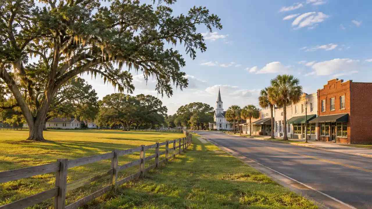
If Dade City's council opens a debate about pausing new development, the hard part will be the line. A pause that covers too much stops projects the town needs. A pause that covers too little leaves the underlying problem untouched. A generated 3D site model can help staff and residents see what each boundary would include, without deciding the policy for them.
1 What a development pause can and cannot do
1.1 Define the problem before the boundary
A zoning pause is a tool, not a diagnosis. A city may want time to finish a comprehensive plan update, repair a sewer line, or study school capacity. It may want to stop a particular kind of application while rules catch up. Each reason points to a different boundary.
Start by writing the problem in one sentence. If the sentence is about infrastructure, the boundary should follow service areas. If it is about a corridor, the boundary should follow the corridor. If it is about the whole city, that is a much larger decision with a much larger cost.
1.2 Check the legal footing with counsel
A pause affects property rights, and the rules that govern it come from state law and the city charter. Some pauses apply to new applications and leave approved projects alone. Others treat different uses differently. The details matter, and they belong to the city attorney.
Planning guidance from bodies such as the American Planning Association can help staff frame the question. It cannot replace a legal opinion on what Dade City may do, for how long, and under what procedure. That opinion should be in writing before the boundary is published.
2 Mapping the line: which parcels belong inside
2.1 Start from infrastructure and service areas
Infrastructure gives a pause its strongest shape. A sewer lift station at capacity serves a defined area. A school attendance zone has edges. A road with a failing intersection has a reach that can be drawn.
Map those service areas before drawing a district boundary. Where the two overlap, a pause has a defensible reason. Where they do not, the city should be able to explain why the boundary goes where it does. A map of service areas also gives residents a reason the line stops where it does.
2.2 Separate existing rights from new applications
A pause usually targets new applications, not projects already approved. That distinction changes the map. A parcel with a filed site plan may sit inside the boundary and still proceed. A vacant parcel next door may be frozen because no application has been filed.
Staff should mark the status of every parcel inside the proposed line. Approved, pending, and unsubmitted are three different categories, and residents will ask about each one. A map that shows the difference prevents a hundred individual phone calls. A short list in the staff report can carry that status without a separate map.

3 Testing the boundary in a site model
3.1 Generate the town edge as it stands
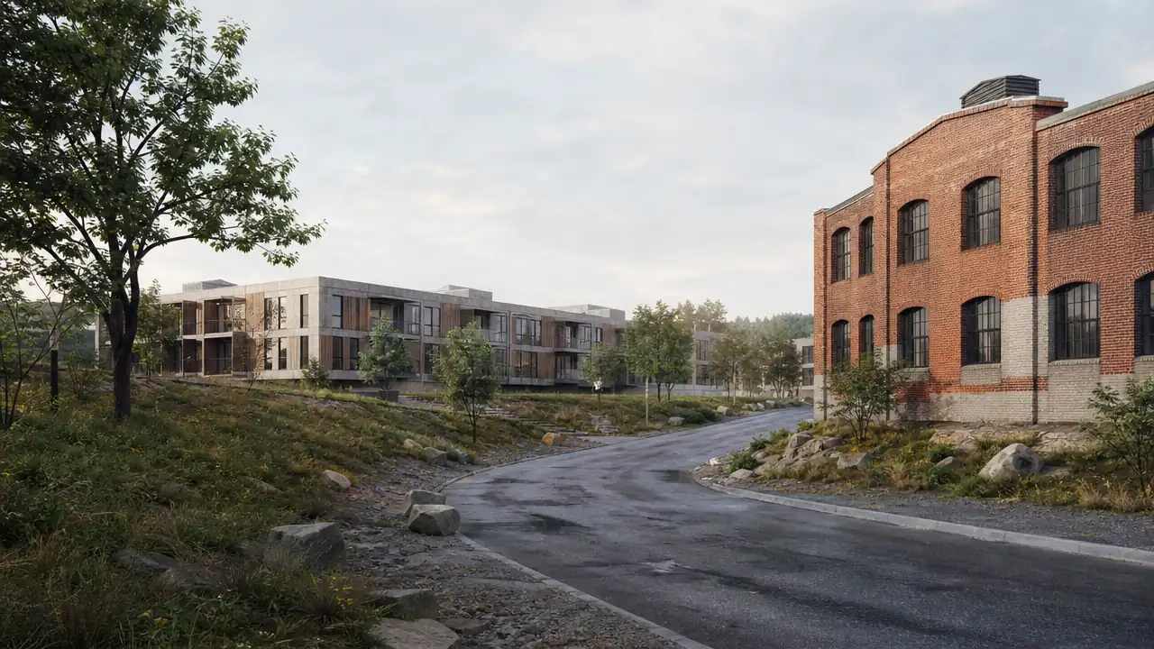
GenAnywhere starts with a map selection. The platform generates an editable 3D site model from satellite and map data, identifying building footprints, estimating heights, inferring building types, and analyzing vegetation. Terrain, water, and vegetation are matched automatically.
That gives staff a current picture of the edge, block by block. You can see where the town grid ends, where larger lots and pasture begin, and which roads carry the traffic between them. The model does not show parcel ownership, which must come from the county appraiser. It also shows how the street grid meets the open land.
3.2 Compare inside and outside scenarios
Buildings sit on their own layer. You can replace a single building, move or rotate it, adjust its height or type, and preview the result before export. That makes it possible to sketch what a boundary would allow on one side and defer on the other.
Try two versions of the same edge. In one, the parcels inside the line stay as they are. In the other, a few plausible projects fill them. The comparison shows residents what a pause would hold back and what it would leave open, without arguing for either outcome.
A generated model is not a survey, a parcel map, or a legal description. It cannot establish ownership, zoning, or development rights. Those come from county records and the city's own files.
Use the model in working sessions and public workshops. Keep the official boundary on a surveyed parcel map, adopted by the body with the authority to adopt it. A clear split between the conversation tool and the legal document protects everyone.
4 Questions residents will ask
4.1 Growth, taxes, and school capacity
Residents will ask what a pause does to tax revenue, housing supply, and school enrollment. Those are budget and demographic questions, not geometry. Staff should bring the finance director and the school district into the conversation early.
The model can still help. It shows how much land sits inside the line and what kind of development it could hold. That gives the finance office a physical basis for its estimates, rather than a number pulled from a table. A model view can also show the difference between the land inside the line and the land outside it. Bring the school district's projections, not just the city's.
4.2 What happens to pending applications
A pending application is the most sensitive case. The owner has spent money and may have a legal right to a decision. The city needs a clear rule for pending files before the pause is adopted, not after.
Publish that rule in plain language. Say which applications are covered, which are exempt, and what happens to a file that is incomplete. Ambiguity here turns a planning decision into litigation.
5 A short working sequence for staff
5.1 Assemble the evidence in one place
Collect the comprehensive plan, the future land use map, utility capacity reports, school enrollment projections, and the county parcel layer. Put them beside the site model so every claim has a source.
Then write a one-page summary of what the evidence shows and what it does not. A pause is easier to defend when the record is short and specific. A binder with no summary invites suspicion. Note the date of each document, since capacity reports age quickly.
5.2 Publish a clear map and a plain explanation
The public map should show the boundary, the parcels inside it, and the status of each one. Use color and labels that survive a photocopy. Add a short explanation of why the line runs where it does.
Do not rely on a web map alone. Print copies for the counter and the meeting room. Some residents will read the map on a phone, and others will bring a paper copy to the podium. Keep the same map on the city website and at the counter. A model view can sit beside the parcel map as an orientation image. It shows the buildings and the open land as they stand, while the parcel map carries the legal lines.
6 Before the vote
6.1 Confirm parcel data with the county
Parcel lines change. A split may have been recorded last month. A right-of-way may be wider than the city's map shows. Confirm the boundary against the county's current parcel layer and the city's own right-of-way records. Ask the county for the recorded plat of any parcel that looks ambiguous.
Walk the line where you can. A fence, a ditch, or a row of trees often marks a boundary better than a screen. Note what you see and add it to the record.
6.2 Brief the applicants
Call the owners and developers whose parcels fall inside the line. Tell them what the pause would do, what it would not do, and when the city expects to revisit the question. A short call prevents a long fight.
Ask them what they have filed and what they plan to file. That information belongs in the staff report, because it changes the practical effect of the boundary. If the city wants a three-dimensional view for the workshop, GenAnywhere can generate the edge from a map selection and export a general GLB for the city's GIS staff. The model is a conversation aid, not the ordinance map.
6.3 Set a review date
A pause without an end date becomes a permanent rule by default. Set a date for review and name the work that must be finished by then: the plan update, the utility project, the capacity study.
Put that date in the ordinance and on the public map. It gives residents something to hold, and it gives staff a deadline that is not tied to the next election. A review date also gives the council a reason to revisit the evidence.
7 FAQ
FAQ-1 Can GenAnywhere decide where Dade City's pause line should go?
No. The platform generates a 3D site model that helps staff and residents see what a boundary would include. The decision belongs to the city council, with legal advice and evidence from utilities, schools, and the comprehensive plan. The model supports the conversation but does not interpret the law or set policy.
FAQ-2 What can the model show about parcels inside a proposed pause?
It can show buildings, terrain, vegetation, roads, and water within the selected area. That helps a team see the character of the edge and how much development a boundary might cover. Parcel ownership, zoning, and application status come from county and city records, which the model does not replace. That record is the source for the official boundary.
FAQ-3 Is a generated model accurate enough for an ordinance map?
No. A legal boundary belongs on a surveyed parcel map tied to county records. The model uses satellite and map data with estimated heights and inferred building types, and it is not a survey product. Use it for workshops and comparison, then prepare the official map with the city's survey and GIS staff.
FAQ-4 How should a small city explain a pause to residents?
Start with the problem the pause addresses, then show the boundary and the parcels affected. Name the work that must finish before the review date. Be clear about approved projects, pending applications, and unsubmitted land. A short map and a one-page explanation do more than a long ordinance summary. Invite questions in writing and answer them in the next staff report.
Content and technical notes
This article was prepared by the GenAnywhere team with AI-assisted drafting and human review.
Product features, formats, and availability change as the platform evolves; refer to the official GenAnywhere website for current details.
For technical questions or corrections, contact support@genanywhere.com.
Last reviewed: 2026-11-22.