
Water treatment scale: what GenAnywhere covers in one view
A single frame holds the works, its ground and its neighbours; the process inside the fence stays with the design.
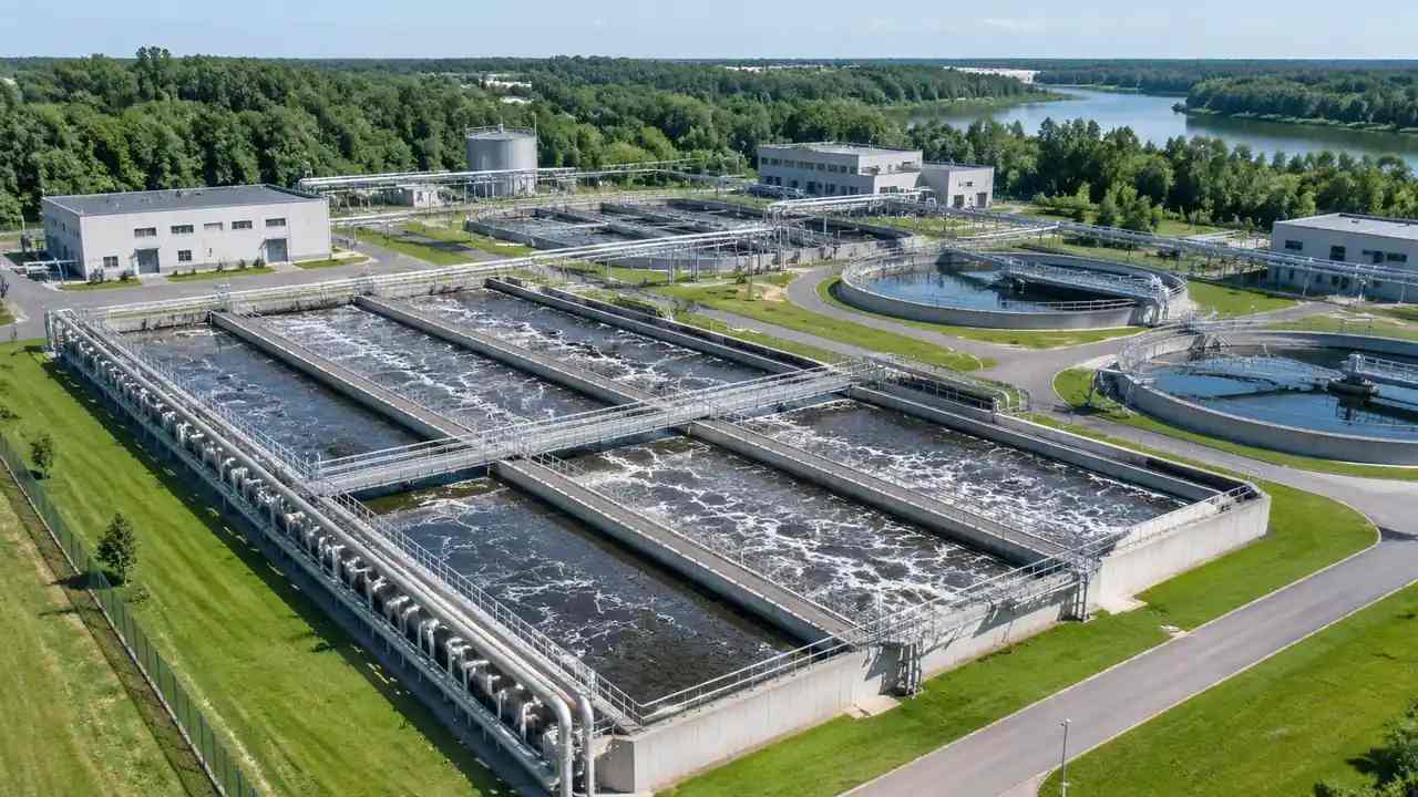
A single view of a water treatment works shows the site as a place: the ground it stands on, the water it draws from and returns to, the buildings inside the fence and the land around them. It does not show the process, because clarifiers, filters, blowers and pipework are equipment and design that a scene built from map and satellite data cannot describe. What the view does settle is the set of questions that come before process design.
1 What the one view holds
1.1 Ground, water and the fall across the site
Terrain arrives with the scene, and terrain decides how a works sits in its valley or on its flat coastal plot. The ground surface also shows which way the site falls, even when no level is labelled anywhere in the file. What the surface does not carry is a hydraulic profile, because the levels through a treatment train are a design output rather than a property of the land. Reading a fall across a site from a generated surface and calling it a hydraulic gradient is the mistake worth naming out loud before a review starts.
1.2 Buildings, footprints and inferred types
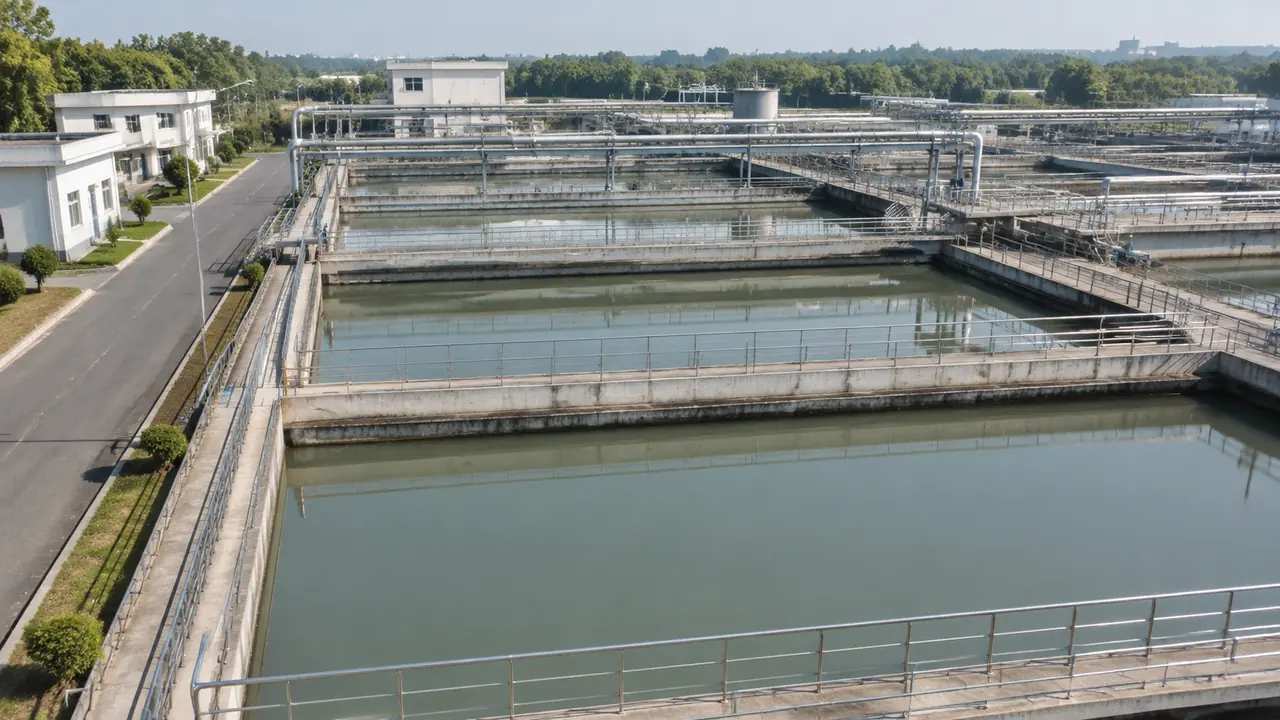
A works is legible through its buildings: the intake house, the blower hall, the control room, the sludge building, the store. Footprints come from map data, heights are estimated and types are inferred, so a filter hall may arrive labelled as a warehouse. Each of those volumes can be replaced, moved, rotated, re-typed or raised after generation, which is the correction path for a plant that has changed since the imagery was captured. Fix the two or three buildings the audience will recognise at once, and leave the rest alone.
2 What the view leaves out
2.1 Process units and the equipment inside them
Clarifier mechanisms, filter beds, aeration blowers, pumps, dosing skids and sludge thickeners are equipment. They belong to a vendor package or a design model, they carry performance data, and the platform does not generate them. A generated works therefore shows basins as water and buildings as volumes, with the machinery inside left unrepresented. Treat that as a scope statement rather than a defect, since a convincing looking mechanism would invite questions about capacity and process behaviour that no site picture can answer, and the questions would arrive in the wrong meeting.
2.2 Pipework, channels and the hydraulic profile
Nothing in the scene represents pipes, channels, weirs, gates or the levels that connect one basin to the next. A plant is largely a set of connections, and the connections are absent by design. That matters when someone asks whether a works could be rearranged, because rearrangement is mostly a question about flow and about the head available at each step. Keep those discussions with the process drawings, where the levels have been set, checked and signed, and let the scene carry the land questions.
3 Choosing the scale of the one view
3.1 Works extent or catchment extent
A frame drawn tight to the fence answers questions about layout, access and room to expand. A frame that includes the river, the outfall and the nearest houses answers questions about setting, and about how the works is seen from outside. Those are different reviews, and one frame rarely serves both well. Terrain behind either frame comes from national elevation products, and USGS explains how those products are built and revised when a team needs to judge the vintage of a surface.
3.2 Height of the camera
Most treatment reviews are decided at two heights: from above, the plant reads as a diagram of land and water, and at eye level it reads as a place somebody drives past on the way to work. Take both before the meeting, because switching height live while a room watches is a quick way to lose the thread of an argument. The eye level frame usually carries the room, since it is the view the objectors already hold in their heads. Add a third frame from the far bank when the outfall is part of the discussion.
4 What the review can settle
4.1 Land, access and room to expand
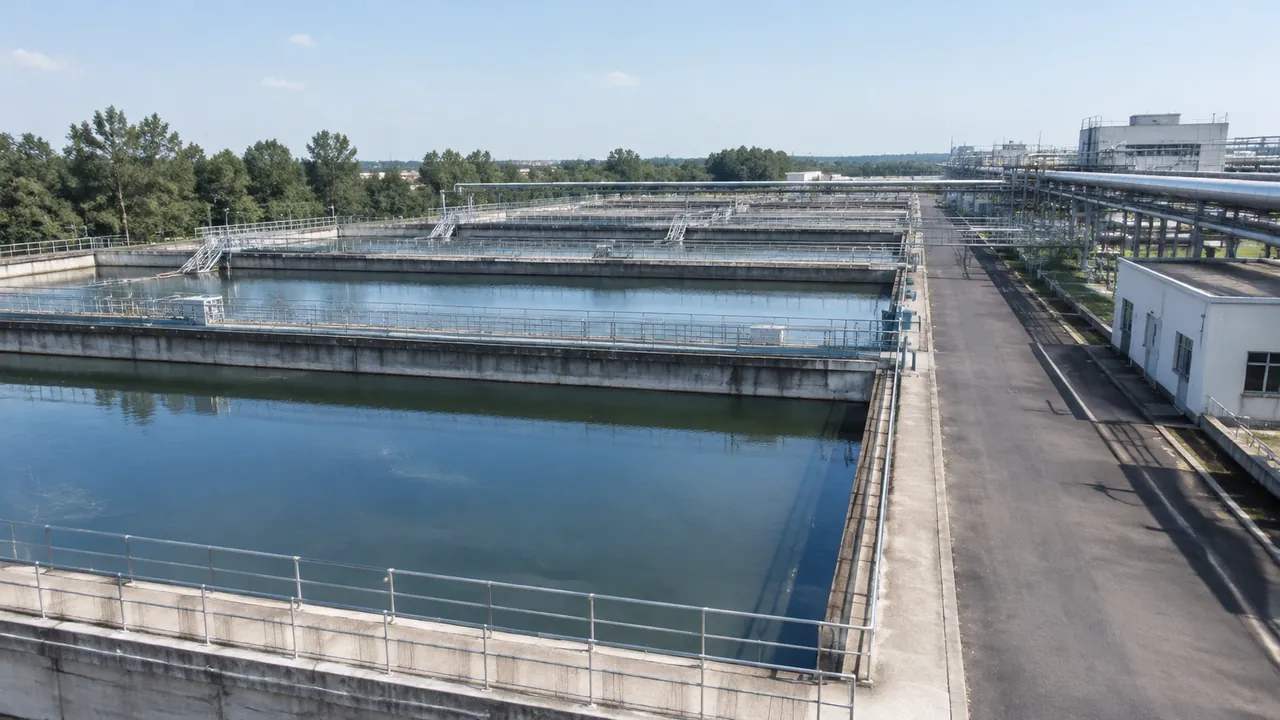
A works review often turns on space: where a new stage would go, whether the access road can take construction traffic, whether the neighbouring plot is available. A generated site answers those at the level the question is asked. It shows ground, boundaries, buildings and vegetation, and it lets a team test a variation by moving a block rather than by redrawing a layout. That is enough to choose which option deserves design effort, which is usually the decision the meeting was called for.
4.2 Neighbours, screening and appearance
Vegetation in the scene is inferred from imagery, so a mature screen of trees appears as a mass rather than as a species list. That is useful for judging how much of a works a house across the road would see, and how much of the house the works would see back. It says nothing about odour, noise or emissions, which belong to environmental assessment. Say which of those questions the picture addresses, or the picture will be asked to answer all three and will fail at two of them.
5 Layers and corrections that keep the view readable
5.1 Layer states worth recording
Terrain, water, buildings and vegetation are managed as layers, so a review can compare a works with and without its planting, or read the ground under a basin without moving the camera. The platform overview sets out those controls and how the layers are edited. Two people describing the same site from different layer states will contradict each other, so write the state into the minutes beside the screenshot. It takes one line and prevents a long argument about a tree that was simply hidden.
5.2 Correcting before judging scale
A wrong height changes how large a works looks, and scale is the point of this kind of review. Spend the correction time on buildings that dominate the skyline and on any structure the audience will recognise from the road. Moving a tank hall two hundred metres to test an option is a legitimate use of the edit tools, since the question is about space rather than about the building. Doing it without noting the move is not, because the next reader will assume the site is drawn as built.
6 Export and handoff
6.1 What the GLB carries
Preview the scene and export a GLB, and the file holds the site as geometry: terrain, water, the buildings with the edits applied, and the vegetation layer. It holds no process data, no basin parameters and no pipe network. That is the right payload for a site context file, and describing it that way stops the receiver from hunting for a plant model inside it. Say what is in the file in the covering note, and say what is not.
6.2 What the process designer adds
The receiving team adds the treatment train: units, channels, pipe runs, levels and the equipment schedule. Their tools are built for that work, and the exported scene is the setting they place it in. Agree early who owns each half, because a site file and a process model that arrive separately tend to be combined by whoever is least busy that week. A named owner for the combination keeps the composite honest and keeps the argument about scope short.
6.3 Three lines in the note
Write the imagery date, the buildings you changed and the purpose of the file. Those three lines answer most of what a new reader asks, and they survive being forwarded to people who never joined the call. Add the extent if the file covers less than the whole works, because a tight frame read as a full site will make the plant look smaller than it is. A file with no note gets read as a statement about the site, which is more than a generated scene can support.
Open the GenAnywhere app and frame a treatment works
7 FAQ
FAQ-1 Does one view show the whole treatment process?
No: the view shows the site, meaning ground, water, buildings and vegetation. The process lives in units, pipework and levels that the platform does not generate. A reader who wants to follow flow from intake to outfall needs the process drawings and the hydraulic profile, not a site picture. Use the scene to set the works in its landscape, and to agree where the process has to be shown at all.
FAQ-2 Can I add a new clarifier or filter block?
Not as generated geometry. A new unit is a design asset, so it is modelled in the design tool and placed against the exported scene. You can shift the buildings around it and open the ground where it would sit, which is often enough to test whether the option is worth developing further. Keep the new unit labelled as proposed, or a reader will take it for plant that already exists.
FAQ-3 Is the ground detailed enough for earthworks design?
No. Terrain is generated from elevation and imagery data, and it carries the shape of a site rather than a set of levels for construction. Earthwork volumes, cut and fill and retaining design come from a ground survey and a civil model. The scene is useful for seeing where the ground falls away and for framing the options, and it should not be used to set formation levels or to price a move of soil.
FAQ-4 What does the export include?
A GLB of the site as geometry: terrain, water, buildings with your edits and the vegetation layer, for 3D, BIM, GIS or game engine workflows. It does not include treatment units, pipework or process data. Test the file in the receiving application, note the imagery date, and list the design assets still to be placed before the file is passed to another team.
See how one site view moves into a GLB workflow
Content and technical notes
This article was prepared by the GenAnywhere team with AI-assisted drafting and human review.
Product features, formats, and availability change as the platform evolves; refer to the official GenAnywhere website for current details.
For technical questions or corrections, contact support@genanywhere.com.
Last reviewed: 2026-11-13.