
Vessel export: where GenAnywhere sends a GLB next
A vessel export carries the water and the quay a ship would approach; the hull itself arrives from a design or library asset.
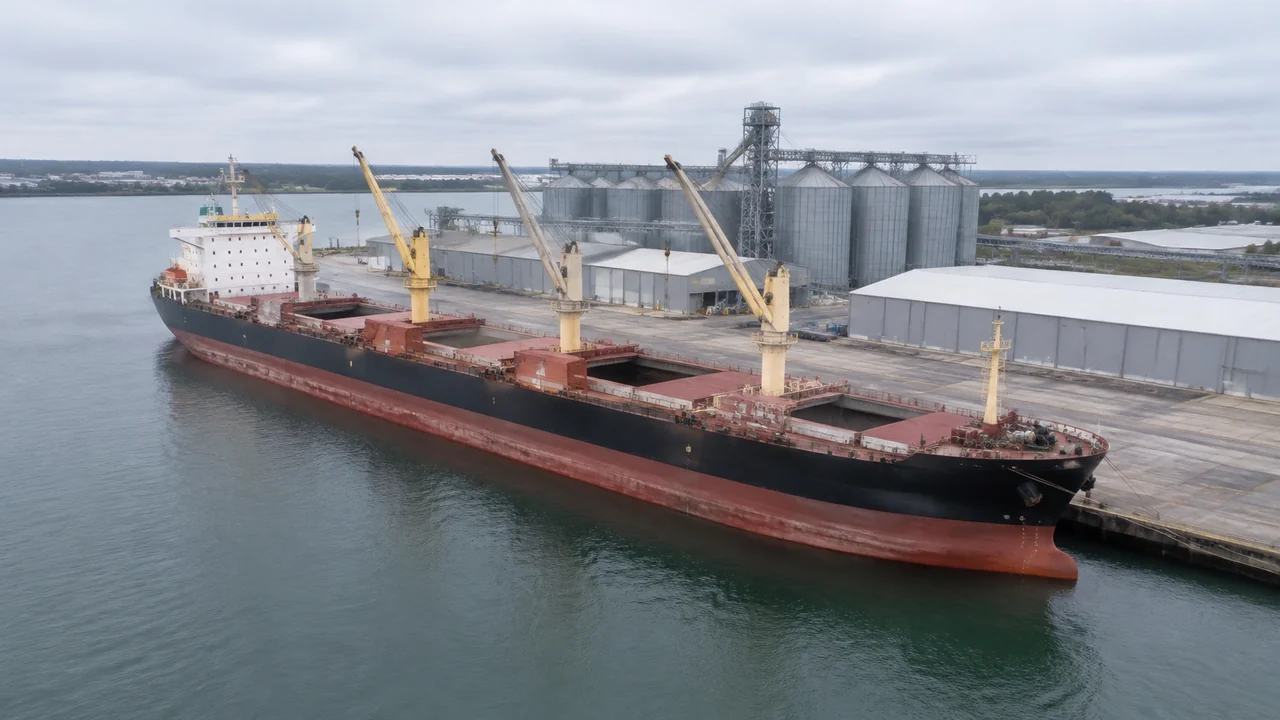
A vessel scene is generated from map data like any other site, then exported as a GLB. It holds the water surface, the quay line, the sheds and cranes behind it and the shoreline either side of the berth. It does not hold a ship. The vessel model is placed on that water in the receiving tool, where a naval architect, a simulator team or a port planner can review it against a setting that came from real geography. The geography is the product here, and the ship is the guest.
1 What the scene carries
1.1 Water, quay and approach
Open water is part of the generated surface, so the approach to a berth reads as one continuous sheet rather than a flat plane placed beside the land. That join is what a berth view is really about. The quay line appears where water meets the terminal ground, and its run gives the berth its length in the view. Channels and basins come through in the same way, at the width the imagery shows. Where a breakwater or a training wall stands, the scene simplifies it into a shape rather than a structure.
1.2 Buildings and shoreline context
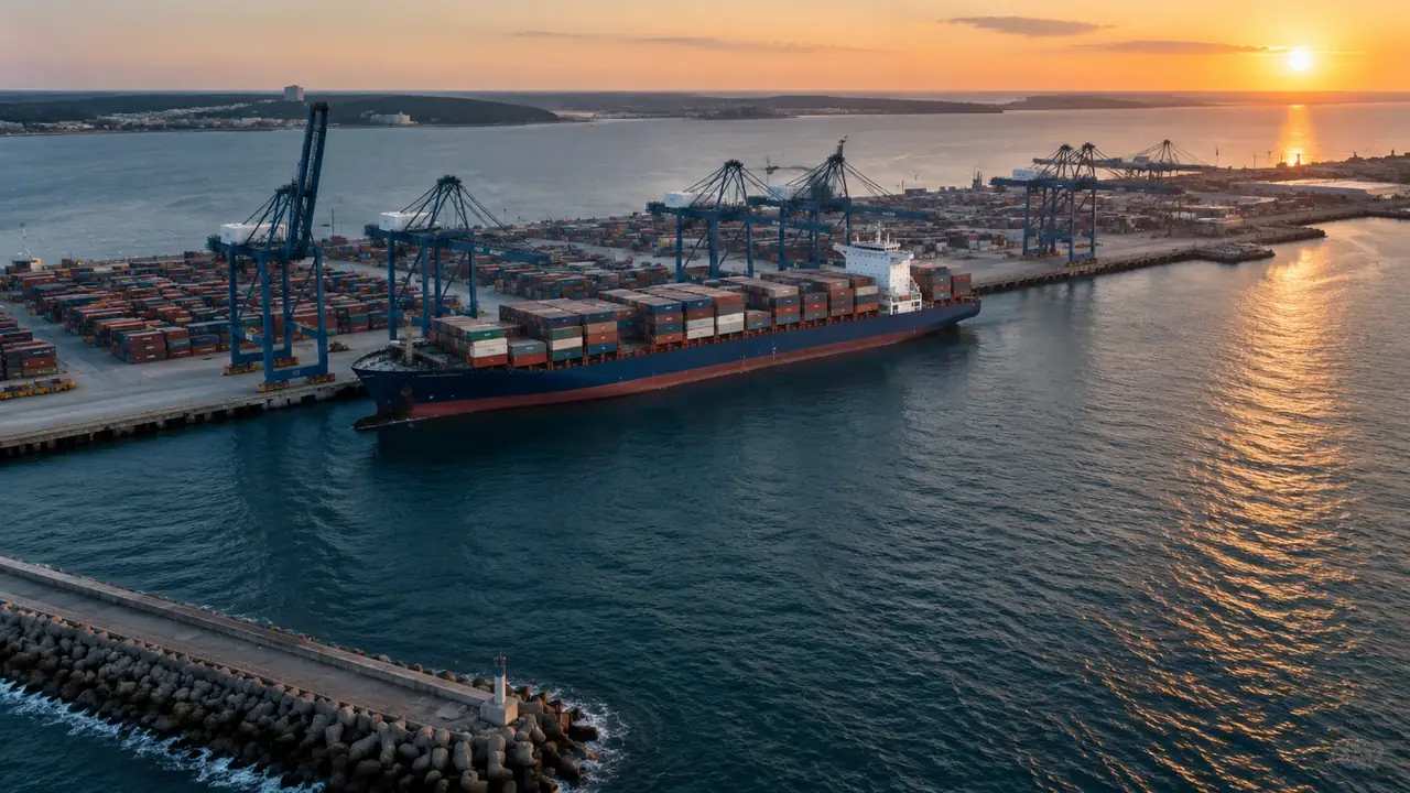
Buildings behind the quay are generated as masses with footprints, heights and inferred types, which is enough to give a ship a backdrop when the view is taken from the water. Warehouses, silos, workshops and office blocks all read as volumes rather than drawings. Vegetation along the shoreline is carried in as coverage. This context is the part a simulator or a planning study usually wants, because it tells the viewer where the vessel is, not just how it looks. It also gives a scale reference that a bare water plane cannot.
2 What the vessel model adds
2.1 Hull, superstructure and gear
The hull, superstructure, funnel, cranes on deck and cargo are design assets. They come from a ship design model, a classification package or an asset library, and they are placed on the exported site. Nothing about the vessel is generated by the platform, and nothing about its hydrostatics, stability or powering is present in the file. A ship dropped onto the water is a visual composition, not a naval architecture result. Say that before the image is shared, because a good picture invites the wrong question.
2.2 Placement and scale
Placement is where a vessel scene goes wrong most often. A hull at the wrong scale sits in the water like a toy, and one at the wrong draft looks like it is hovering above the bed. Check the model against a known length, such as the quay or a shed frontage, before the review starts. Agree the unit convention with the receiving team early, because a metre and a foot look identical until somebody measures the berth. Write the convention in the handover note and the argument never starts.
3 Where the file usually goes
3.1 Simulator and training environments
Real-time engines are a common destination for a vessel export, because a GLB opens in them without a converter and a site scene is light enough to run at frame rate. A training environment wants the quay, the sheds and the water in the right relative position, which is what the export provides. The ship handling model and the hydrodynamic response come from the simulator, not from the file. Keep the two sources separate when the visual is tuned. A change in the scene should never move the ship, and the other way round.
3.2 Planning and GIS review
Port planning teams also take the export, usually into a GIS or a design tool where the proposed berth layout can be laid over the existing site. The file gives them the shoreline and the buildings as they are, which is the baseline a proposal needs. Hydrographic offices and survey providers publish the data standards behind nautical charts, and the International Hydrographic Organization is one place to read about them. A generated shoreline is context, not chart data. Label it that way in any drawing that reaches a navigational audience.
4 What the scene cannot answer
4.1 Depth, tide and water behaviour
The scene shows a water surface, not a water body. It carries no bathymetry, no tide, no current, no salinity and no wave climate, so under-keel clearance and manoeuvring behaviour are outside it. Those answers need survey data, tidal records and a simulation with a validated model. A viewer standing on the quay in the scene sees a plausible surface, and plausible is where the misunderstanding starts. Name the missing study before somebody assumes the surface is a depth, and keep the survey file close to hand during the review.
4.2 Channel and berth geometry
Design depths, channel widths, turning circles and berth pockets are engineering and hydrographic products. The scene shows the water as the imagery recorded it, which may include a dredged area, a silted corner or a recent reclamation. It cannot tell you what the design profile is or whether a vessel of a given length can turn. Bring the chart and the design drawing to the same review and let the scene show where they disagree. The disagreement itself is often the useful finding of the meeting.
5 Preparing a vessel scene
5.1 Preview from the water
Preview the scene from the water before you export it. A view from the berth towards the sheds answers a different question from a view from above, and the water level view is the one most audiences recognise. Walk the approach, look at the quay from the channel and check the buildings that will sit behind the ship. If a shed is missing or misplaced, fix it in the scene while the edit is cheap. A missing shed is easier to replace than to explain.
5.2 Export and naming
Export the GLB and open it in the receiving tool before anyone else does. Name the file by port, berth and date, and add the imagery date to the note. The platform overview describes what the generated scene holds, which is useful when a simulator team asks why there is no ship in the file. Keep the scene until the composition downstream is agreed. Re-export rather than patching the file by hand.
Open the GenAnywhere app and frame a berth for a vessel review
6 Before the export
6.1 Extent around the berth
A vessel review needs water as well as land. Frame enough of the approach that the ship can be seen arriving, and enough of the terminal that the backdrop is recognisable. Too tight and the scene becomes a backdrop for one camera angle; too wide and the quay detail disappears. Write the extent in the handover note so the next version can match it. A saved note beats a remembered camera position.
6.2 The asset list
List what the file does not contain: the vessel, tugs, mooring equipment, fenders, cranes, containers and any floating plant. Say where each will come from. A simulator team will care about the ship and the tugs; a planning team will care about the cranes and the yard. One list serves both if it says who supplies what. Add the contact for each source, not just the file name.
6.3 Next step
Name the review the scene supports. A berth feasibility study, a training scenario and a stakeholder visual all use the same water in different ways, and each wants a different camera height. If the next step is a simulator build, agree the engine and the unit convention at the outset. If it is a planning study, agree the coordinate frame. The export is the same file either way. What changes is the camera, the scale and the story told around it.
7 FAQ
FAQ-1 Does the scene include a ship?
No. The generated site holds terrain, water, vegetation and buildings. A vessel is a design asset and is placed on the water in the downstream tool. That separation keeps the site reusable across ship types and sizes, which matters when a berth is reviewed for more than one vessel class. Plan the ship model before the session rather than after it, and keep the same hull for every review of that berth.
FAQ-2 Can I check under-keel clearance?
Not from this file. Clearance depends on bathymetry, tide, squat and the loaded draft of a specific vessel, and none of those are in the scene. Use hydrographic survey data and a validated calculation or simulator for that question. The scene helps a team agree which berth and which approach are under discussion, which is where that calculation starts. Bring the chart and the survey to that session as well.
FAQ-3 Which tools open the export?
Any application that reads GLB, which covers many game engines, viewers, design packages and GIS applications. Import behaviour differs between them, so test the file in the target tool before a meeting depends on it. Check scale, origin and material handling on import. A two minute test prevents a long conversation about why the quay looks small. Save the import settings with the file note.
FAQ-4 Is it suitable for simulator visuals?
Often yes, as the static environment. A simulator needs a light scene with the quay, the sheds and the water in the right place, and that is what the export provides. The dynamic parts, from ship response to tug behaviour, come from the simulator's own models. Confirm the engine's import settings and texture expectations before the build starts, and keep the site scene free of decoration the engine will discard anyway.
See how a generated berth moves into a GLB workflow
Content and technical notes
This article was prepared by the GenAnywhere team with AI-assisted drafting and human review.
Product features, formats, and availability change as the platform evolves; refer to the official GenAnywhere website for current details.
For technical questions or corrections, contact support@genanywhere.com.
Last reviewed: 2026-11-13.