
RV park zoning: can Butte County test sites with GenAnywhere?
A three-dimensional preview can settle grade, access, and neighbor questions before a county pre-application meeting.
Yes, a site can be tested before a county meeting, as long as the test is framed as a design aid rather than a finding. Butte County reviews RV park proposals through its zoning ordinance and a discretionary permit process, and most early questions are about grade, access, and the edges shared with neighbors. A model built from map data gives those questions a visual frame that staff, applicants, and residents can read together.
1 Start with what the county will ask
1.1 What does the parcel look like in three dimensions?
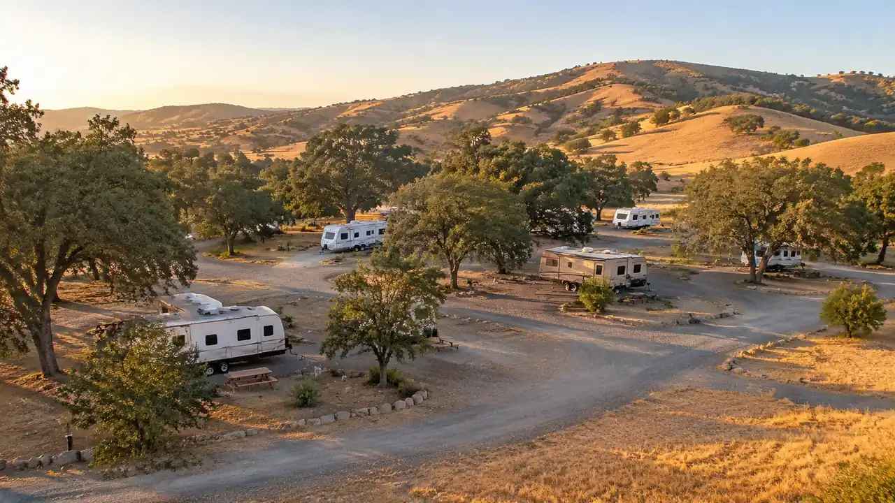
The zoning file describes acreage and a legal description. Neither tells you how the ground moves across the parcel or where a pad would need fill. A terrain surface built from map data shows the fall of the land, the low corner that collects water, and the slope that limits where a rig can sit.
Orientation is the gain. Staff can see the parcel as a place rather than a polygon, and the applicant can stop guessing about which half of the site is usable. That shift in the conversation is worth more than any single drawing.
1.2 Which surrounding uses shape the review?
RV parks sit next to farms, creeks, county roads, and homes on large lots. Each edge carries its own question, from dust and noise to access and visual buffering. Pulling those neighbors into the same scene makes the relationship visible without implying that the county has decided anything.
Local code, not the model, sets the standards. The model helps the team ask better questions about setbacks, screening, and hours of operation before an application is drafted. Bring the questions to staff and let them point to the sections that govern the answer.
2 Test access and circulation early
2.1 How do grades affect site entry?
Driveway grades are a common source of trouble on hilly parcels. A model that carries terrain lets the team check where a road can leave the county road at a workable slope and how it turns inside the property. A route that looks fine on a flat plan can turn into a steep cut once the ground is real.
Run the route on screen before hiring a civil engineer for the layout. If the entry looks doubtful, adjust the concept while changes cost little. If it looks workable, the engineer starts from a defined idea instead of a blank page.
2.2 Where do utilities and drainage cross the site?
Sewer, water, and power routes rarely follow the path the applicant imagines. Overlaying the site context with terrain shows where a line would run uphill or cross a drainage. Those observations tell the team what to ask a utility locator. They do not replace the locate itself.
The same view flags where stormwater would pond. That is useful for siting pads and for the drainage conversation that follows. Note the low spots on the exhibit and ask the county which drainage requirements apply to the parcel.
3 Read the natural constraints
3.1 Where does the ground fall away?
Contours on a plan are easy to misread. A perspective view makes a slope obvious, including the break where a flat bench ends and a steeper face begins. That break often decides how many pads fit without major earthwork.
Vegetation and water bodies appear as layers in the same scene, so the team can see which trees frame the entry and where a creek runs close to a proposed loop. County maps and county planning resources should confirm what the model suggests.

3.2 Which trees and water features constrain layout?
Tree cover matters for shade, screening, and the feeling of the park from the road. Water matters for setbacks and for the questions a county will ask about flood risk. Both belong in the conversation early, before a loop road is fixed in place.
Treat both as constraints to discuss with staff, not as clearances the model grants. Local maps and a site visit still carry the final word. A model that points to a grove worth keeping has done its job even if the design changes.
4 Compare options in one frame
4.1 How do you keep options comparable?
Two layout sketches drawn at different scales are hard to compare. A shared camera position fixes that. Save two views of the same parcel with pads shifted, and the trade-off becomes visible in a way a plan set does not show.
Keep the terrain and surrounding context fixed while you move the pads, the office, and the loop road. The comparison then isolates what the team actually changed. Fewer variables make a sharper discussion at the meeting.
4.2 What should a review exhibit show?
An exhibit for a neighborhood meeting needs the parcel edge, the access point, the pads, and enough context to locate the site. It does not need every internal detail. Too much information invites arguments about things the county will not decide at that stage.
Show the view from the county road as well as the aerial. Neighbors judge a park from the road, and that view answers more questions than a plan view alone. Pair it with a short note on data sources and the date of the model.
5 Match the model to the review stage
5.1 What belongs in a pre-application conversation?
Before a formal submittal, the useful question is whether the concept fits the land. Bring a model that shows terrain, access, and the general arrangement, then ask staff which issues they want addressed in the application. That list is the real output of the meeting.
Leave engineering detail to the professionals who will produce it. A concept model that pretends to be a construction document invites the wrong kind of scrutiny and can undermine trust in the parts that are sound.
5.2 When does the model stop being enough?
A map-based model is a starting point, and the limits deserve a plain statement. It does not replace a boundary survey, a geotechnical report, or a utility locate, and the data behind it has a date. None of that changes because the picture looks convincing.
Say so in the meeting. Reviewers respond better to a team that knows where its picture ends. The credibility gained usually matters more than another render.
6 Put the preview to work
6.1 What should the team prepare?
GenAnywhere lets a team select an area on a map and generate an editable 3D site model from map and satellite data. Buildings arrive as editable volumes with estimated heights, types, and surrounding vegetation. For an RV park study, the parcel, the neighbors, and the tree cover can be inspected together before anyone draws a pad.
Use the model to frame the questions you will bring to the county: the access slope, the low corner, the buffer along the shared fence. Then open the site context features with the team and agree on which questions matter most.
6.2 How do you hand the scene to designers?
Export the scene as GLB and open it in the tools the design team already uses, including Revit, Rhino, SketchUp, Blender, Unity, Unreal Engine, or a GIS environment such as ArcGIS Pro or GISBox. Keeping one site context across disciplines avoids rebuilding it several times.
Layers for buildings, terrain, and vegetation can be toggled while the concept is still fluid, so an architect and a civil engineer can look at the same ground. A shared starting point reduces the chance that two drawings describe two different sites.

6.3 What limits should everyone accept?
The exported model carries a commercial license for use, but the team should not treat it as a survey product. Check data currency, verify boundaries, and confirm local requirements with the county. Third-party data rights may also apply depending on the source.
Used with those caveats, the preview turns a zoning question into a shared picture of the site. Nobody should mistake that picture for an approval. It helps the people involved decide what to ask next.
Preview a Butte County site in GenAnywhere
See how the site workflow fits a county review
7 FAQ
FAQ-1 Does a site model replace a survey or a civil engineer's work?
No. A model built from map data is a planning aid. It can show terrain, access options, and surrounding context, but it does not establish property lines or settle engineering questions. A licensed surveyor and a civil engineer remain responsible for the documents a county requires. Use the model to prepare better questions for both, and keep their findings separate from the concept exhibit.
FAQ-2 Can the model show RV pads, roads, and hookups?
The platform generates a site model from map data, and its buildings, terrain, and vegetation can be edited. Proposed pads and roads are design content that the team adds in its own modeling tool after exporting the scene as GLB. Utility hookups belong to the civil design, not to the base model. Plan the handoff so the designer receives the site context with a note on its limits.
FAQ-3 What if the county asks for plans in a specific format?
Ask early. Counties often publish submittal requirements, and a concept exhibit is usually separate from the stamped plan set. The GLB export feeds common design and GIS tools, so the team can produce the required drawings in its usual software. Confirm the format with the planning department before the meeting, and bring the exhibit as a supplement rather than a substitute.
FAQ-4 How current is the map data behind the model?
Map and satellite sources update on their own schedules, so the model reflects the data available when the area was generated. Treat it as a snapshot. For a proposal, compare it with recent imagery and a site visit, and note any change that affects access, vegetation, or buildings. The team should state the date of the model in its exhibit so reviewers can weigh it.
Content and technical notes
This article was prepared by the GenAnywhere team with AI-assisted drafting and human review.
Product features, formats, and availability change as the platform evolves; refer to the official GenAnywhere website for current details.
For technical questions or corrections, contact support@genanywhere.com.
Last reviewed: 2026-11-10.