
Massing options for RFK campus neighbors in GenAnywhere
What residents can compare when a large campus redevelopment is still a set of alternatives.
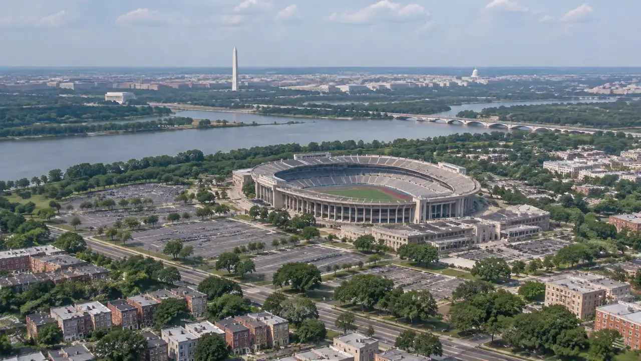
Massing options for a large campus usually reach neighbors as plan drawings, a few aerial renderings, and numbers about height and floor area. Those materials show intent, but they rarely show how bulk lands on the streets around the site. A site model built from map data lets residents and planners rotate the same scene, check heights against nearby blocks, and compare schemes from viewpoints they recognize.
1 What neighbors actually want to compare
1.1 Bulk and height in the existing skyline
People who live near a large site learn its edges by walking them. They know where the view opens, where the wind moves, and which corners feel exposed at night. A massing comparison should attach those impressions to geometry, so a proposal can be judged against the place people already know.
Height is the easy part to show. Bulk is harder because it involves the length of a facade, the depth of a block, and the gaps between buildings. Two schemes with the same maximum height can feel completely different at street level if one presents a continuous wall and the other breaks into towers.
1.2 The gap between a rendering and a map
A rendering is composed to make a point. It picks a viewpoint, a time of day, and often a favorable foreground. A map based model is less flattering, which is why it can be useful in a neighborhood meeting. The scene shows the site where it sits, with the blocks, trees, and water that people see every day.
That does not make the model neutral. Someone still chooses the viewpoints and the assumptions. What changes is that the choices are visible and can be questioned.
2 Build the campus and its edges
2.1 Select the site boundary and surrounding blocks
GenAnywhere generates an editable site model from an area drawn on the map. Buildings, terrain, water, and vegetation come in as separate layers, and each building can be selected and changed. For a campus question, include a margin of surrounding blocks, because the comparison depends as much on the neighbors as on the site.
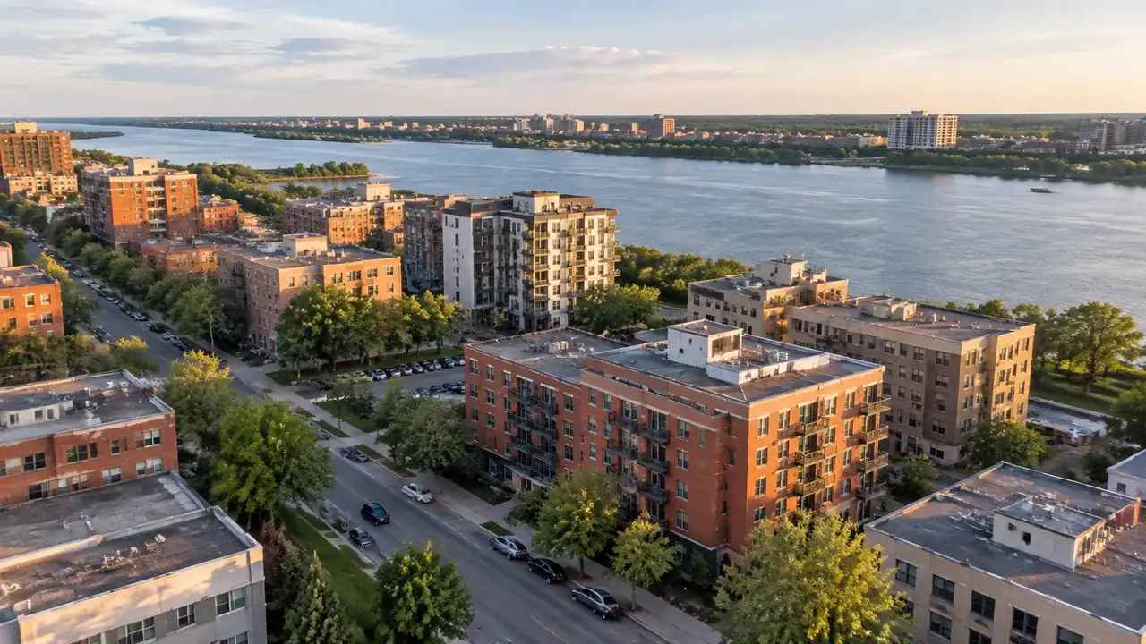
The margin should reach the places where people will notice change. A residential street along one edge, a bridge approach, and a waterfront path may all matter more than the middle of the campus. Drawing a generous boundary costs little and prevents a common mistake: judging a scheme from inside the fence.
2.2 Adjust heights and footprints to match a scheme
Each scheme can be approximated by editing building heights and footprints, replacing blocks, and adding simple volumes where a proposal introduces new structures. The result is a massing study, not an architectural model. Surfaces, facades, and detail stay out of it, which keeps attention on scale and arrangement.
Where a scheme is still vague, use ranges rather than a single figure. A height range and a footprint range show the envelope a proposal might occupy, and the conversation can focus on what those ranges mean for the surrounding streets.
3 Make two schemes readable
3.1 Keep one variable fixed
The most common confusion in a comparison comes from changing several things at once. If one scheme is taller, deeper, and viewed from a different angle, the audience cannot tell which change caused the effect. Pick a variable, hold the rest, and compare from the same camera.
Height is a good starting variable because it is easy to explain. Compare the same footprint at two heights, then move to bulk, then to the gap between buildings. Each step adds one idea that people can carry into the next.
3.2 Walk the perimeter before the center
A campus can look orderly from above and awkward at its edges. Set several cameras along the perimeter at eye level, including the corners where a new building would meet an existing street. Walk the sequence in order so the viewer experiences the edge as a route rather than a set of fragments.
The perimeter view also reveals scale in a way that an aerial cannot. A retaining wall, a service entrance, or a blank side wall may dominate a nearby sidewalk even when the overall massing looks reasonable from a distance.
4 Bring the comparison into a meeting
4.1 Use one model, one viewpoint
A neighborhood meeting works better when everyone looks at the same scene. One screen, one camera, and a clear label for the scheme on display. Switching between schemes in place lets people see the difference instead of comparing two handouts from memory.
Assign someone to drive the model and someone else to take questions. That division keeps the session moving and prevents the presenter from defending a design when the audience is still trying to understand it.
4.2 Answer what-if questions live
The useful moment in these meetings often arrives as a question: what if the building stepped back, what if the parking moved, what if the tower sat on the other corner. A model that can be edited in the room turns that question into a test. The answer may be rough, but it keeps the discussion on the issue people care about.
Live editing has limits, and it is worth saying so. A quick volume change is not a revised scheme, and the team should note which questions were explored and which need a proper study.

5 What a massing model will not tell you
5.1 Program, cost, and approvals sit elsewhere
Massing is one layer of a redevelopment proposal. It says nothing about what happens inside the buildings, how the project is financed, or whether it meets the rules that govern the site. Those questions belong to the applicant, the planning office, and the bodies that review the application.
Neighbors sometimes read a model as a promise. It is better to frame it as a way to understand scale. The model can show that a scheme is large; it cannot show whether the scheme is acceptable or likely to proceed.
5.2 Data currency and site conditions
The base model comes from map and satellite data, which has a date. New construction, demolitions, and changes in vegetation may not appear. For a campus with active construction, the team should correct the visible edges before a public session, or at least state which version of the site the model reflects.
Ground conditions, utilities, and contamination are outside the scope of a surface model. If those issues are part of the neighborhood conversation, they need their own sources and their own explanation.
6 Prepare a neighborhood session
6.1 Choose three views people know
Pick viewpoints that residents can place without a map: the corner where they catch the bus, the path along the water, the intersection at the school. Three well chosen views carry more weight than a dozen aerials. Each one should answer a specific question about height, bulk, or the edge of the site.
Test the views before the meeting. Stand at each location in the model and check that the proposal is actually visible. A view that shows little but trees or a blank wall wastes the audience's attention.
6.2 Label assumptions in plain language
Write a short note for each scene: what was modeled, what was left out, and which figures came from the applicant's material. Avoid technical shorthand. A sentence such as the towers are shown at the upper end of the stated range is more useful than a table of floor area ratios.
The National Capital Planning Commission publishes materials on planning in the capital region, including how federal and local interests intersect on large sites. That background can help a neighborhood group frame its questions.
6.3 Leave room for disagreement
A comparison is not a vote. Some people will prefer the taller scheme because it preserves open space, and others will object to any increase in bulk. The model's job is to make those trade-offs visible, not to settle them.
End the session with a list of what people want tested next. That list is a better record than a count of raised hands.
You can build the same kind of comparison by opening the GenAnywhere app, drawing the campus and its surrounding blocks, and testing one scheme against the existing condition. The platform workflow overview explains how a scene moves from map selection to export.
7 FAQ
FAQ-1 Can the model show proposed buildings at the scale of surrounding blocks?
Yes. Each new volume can be sized and placed against the existing buildings, and the scene keeps the surrounding blocks visible. That makes it possible to compare a proposed height with the roofs next door or across the street. The result is approximate, because the proposal is represented as a mass rather than a designed building. Use it to discuss scale and arrangement, then check the architectural drawings for detail.
FAQ-2 Where does the base map data come from?
The scene is generated from satellite and map data for the area you select. Buildings are identified as separate objects, heights are estimated, and building types are inferred. Vegetation around the site is picked up as well. Because the data has a date, recent changes may be missing. Add or replace the buildings that matter for your comparison, and note the date of the base data in any material you share.
FAQ-3 Can a neighborhood group run a session without a planner?
A group can present a prepared scene, switch between saved schemes, and take questions without editing anything. The session stays manageable when one person drives and another records the questions. Editing live is a separate skill and should be left to someone who knows the model. For an initial meeting, prepared views and a clear handout usually work better than improvisation.
FAQ-4 Does a massing comparison predict what will be approved?
No. It shows what a scheme would look like at a given height and footprint, using stated assumptions. Approval depends on the applicable rules, the review process, and the judgment of the bodies involved. A model can help neighbors understand a proposal and ask sharper questions, but it cannot forecast an outcome or substitute for the official record.
Content and technical notes
This article was prepared by the GenAnywhere team with AI-assisted drafting and human review.
Product features, formats, and availability change as the platform evolves; refer to the official GenAnywhere website for current details.
For technical questions or corrections, contact support@genanywhere.com.
Last reviewed: 2026-11-12.