
Vertiport planning: can GenAnywhere preview a downtown site?
What a downtown scene shows about a vertiport, and what it leaves to airspace and engineering
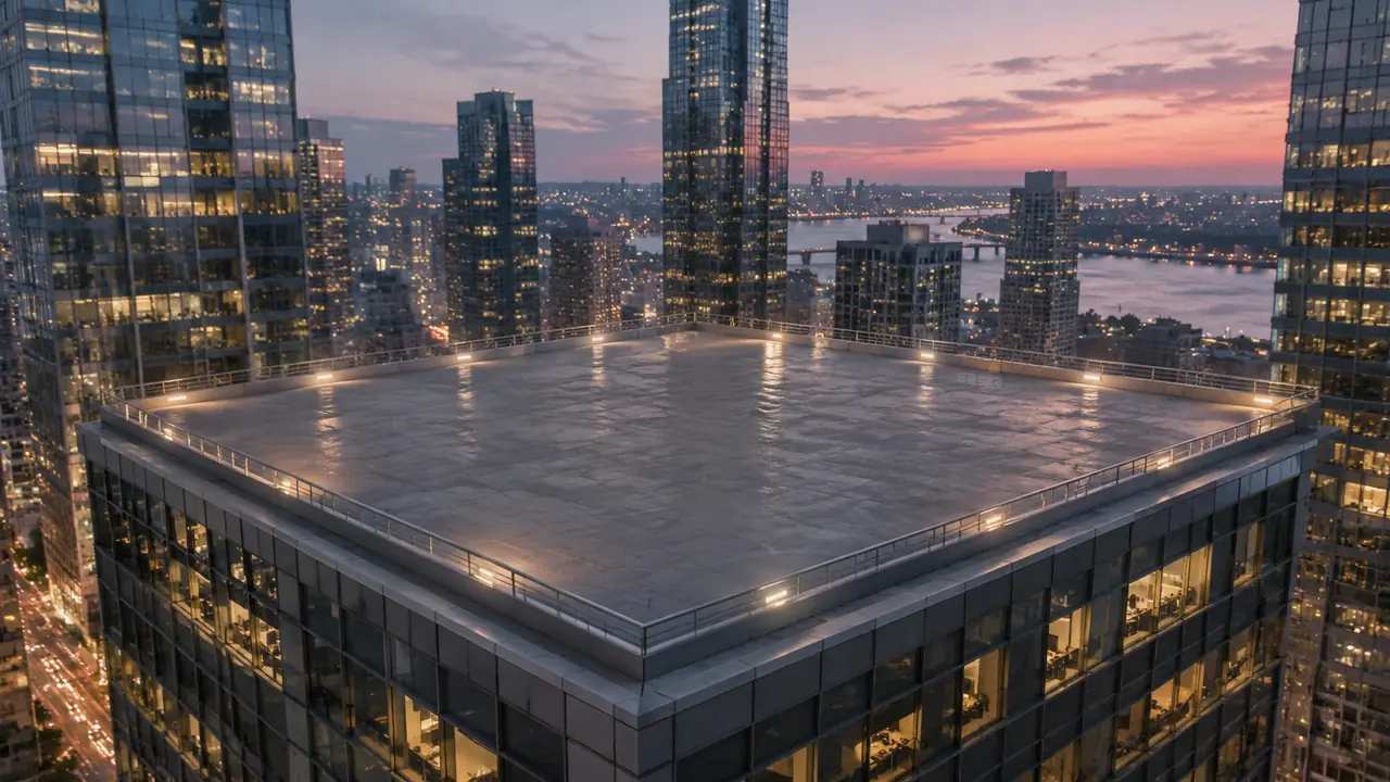
A downtown vertiport is a study in vertical relationships. The pad sits above the street, the approach passes between towers, and passengers move from curb to aircraft through a building designed for something else. A 3D scene puts those relationships in one view. GenAnywhere builds the scene from a map selection, and the view is useful because it shows the obstacles as well as the opportunity.
1 What a downtown vertiport study has to see
1.1 The approach path across the skyline
An approach path is a corridor through airspace, and in a dense downtown that corridor is shaped by the buildings around it. A tower being planned two blocks away can matter as much as the one next door. Maps show footprints. A scene shows height, and height is the constraint that decides whether a corridor is plausible. Nothing else in the downtown moves as much as a new tower.
You do not need a flight procedure to look at this. Stand at the pad, look along the corridor, and see what interrupts the line of sight. The observation is qualitative, and it is the kind of thing a planning meeting needs before it starts arguing about procedures. The goal is to agree on what the corridor crosses.
1.2 Ground space for passengers and vehicles
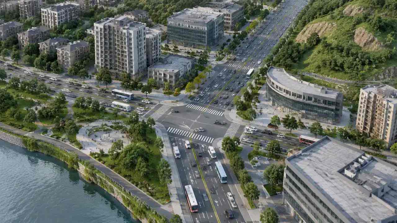
The ground level is where a vertiport meets the city. Passengers arrive by car, taxi, transit, or on foot. They need a place to wait that is not the traffic lane, and vehicles need a place to stop that is not the crossing. In a downtown block, those spaces compete with everything else. A service entrance and a taxi stand can want the same ten meters.
A scene shows the competition. A curbside that looks generous in plan can be one lane wide in reality, and a lobby that seems large can be filled by a security queue. Seeing the block in three dimensions makes the shortage obvious. It also shows where a queue would block a fire lane.
2 Building the downtown block in a scene
2.1 Selecting a site that includes the surrounding towers
Select an area that covers the candidate building, the street grid, and the towers along the likely approach. A boundary drawn too tightly hides the very obstacles the study is about. In GenAnywhere, the selection generates an editable site model with buildings, terrain, water, and vegetation, and heights estimated from available data. That context is the reason a downtown study is worth building in 3D at all.
Check the skyline from several directions before placing anything. The downtown looks different from the river, from the highway, and from the roof of the candidate building. Each view raises a different question about the pad. Write the questions down before you move the camera again.
2.2 Placing the pad, the terminal, and the access
Represent the pad as a flat surface at roof level or at grade, the terminal as a simple block, and the access as a lane. GenAnywhere lets you replace a building, move or rotate it, and change its height and type, which is enough to test a pad on an existing roof or a surface site two blocks away.
Keep the model coarse. A vertiport study is deciding where the pieces go, not how they are built. Detail at this stage hides the spatial argument under questions about cladding. A pad and a box are enough to start.
3 Testing options at street and roof level
3.1 Rooftop against surface options
A rooftop pad uses land that already exists, and it inherits a building that may not want the load. A surface pad is easier to build and consumes a block the city may want for something else. The two options fail in different ways, and a scene shows the failures. One fails against the building, the other against the street.
Put both in the same view, then walk the street between them. The rooftop option changes the skyline. The surface option changes the sidewalk. Which change the neighborhood notices is a political question as much as a technical one. That is worth knowing before the design hardens.
3.2 The trip from curb to aircraft
Follow a passenger from the curb to the pad. Count the doors, the elevators, the security point, and the wait. In a converted office building, the route may pass through a lobby designed for a different flow, and the conflict shows up at the elevator bank.
A scene will not time the trip. It will show whether the route is coherent and whether a passenger can see where to go. Those are the parts of the experience that a plan drawing tends to flatten. It also shows where a passenger would wait outdoors in bad weather.
4 What the scene leaves to specialists
4.1 Airspace, structure, and fire
Airspace approval, structural capacity, fire strategy, and noise all sit outside a site scene. The aviation authority decides whether an approach is acceptable. The structural engineer decides whether a roof can carry a pad. The fire consultant decides how people leave.
A scene can frame those conversations by showing the geometry they depend on. It cannot conclude them, and a team that treats a good-looking preview as an approval will waste time later. Frame the questions, then let each specialist answer the one they own.
4.2 Keeping expectations in check
Say what the scene is: a context model built from map data, with estimated heights. When a stakeholder asks whether the site can host a vertiport, the answer is that the geometry allows certain options and that the specialist studies will decide the rest.
That honesty is not a weakness in a planning process. It is what keeps the preview from becoming a promise the project cannot keep. It also gives the operator a realistic picture of what a preview can do.
5 Sharing the preview
5.1 Exporting the scene
GenAnywhere exports a general GLB that opens in Unreal Engine, Unity, Blender, Revit, Rhino, SketchUp, ArcGIS Pro, and similar visualization and design tools. An operator can use it for a briefing, and a designer can use it as the starting context for the terminal.
The export carries the block and the skyline, not the airspace. Anyone presenting the file should say so, especially to an audience that may read a rendering as a plan. A one-line caption is usually enough.
5.2 Reviewing with operators and the city
Operators care about the passenger route and the aircraft turnaround. The city cares about the street, the skyline, and the neighbors. A shared scene lets the two groups look at the same corner without redrawing it for each meeting.
Keep the review to a few fixed views. The pad, the approach, and the curb cover most of the ground, and a short list of views keeps the conversation from drifting into design detail. Leave the design conversation for the session that has the drawings.
6 Where this fits
6.1 Teams that benefit
Urban aviation planners, building owners testing a rooftop, and city staff reviewing a proposal all get value from a downtown scene. So do community groups that want to see what a new pad would mean for the skyline. Airport landside teams are another group, since a downtown pad changes the curb they manage.
6.2 When a map is enough
If the question is whether a city allows vertiports at all, a map will not help and the policy will. A scene earns its place when the site is dense, the approach crosses other buildings, or two options are being compared. When the answer depends on heights, the scene is the faster way to see them.
6.3 A short checklist
Confirm the candidate building, the street grid, and the towers along the approach. Decide whether you are comparing roof and surface options. Set the views before the meeting, and note the estimated heights. Then build the block. Keep the pad and the terminal as simple volumes until the location is settled.
You can preview a site at the GenAnywhere app and see how the scene moves into design tools on the workflow pages. For airport and vertiport planning context, FAA airports publishes guidance that a site scene does not replace.
7 FAQ
FAQ-1 Can the scene check airspace?
No. It shows buildings and terrain, which is the physical context an airspace study uses. It does not model airspace, procedures, or approval. Use the scene to see what the corridor passes, then take the geometry question to the aviation authority and its process. The scene gives that conversation a shared reference.
FAQ-2 Does the model include surrounding towers?
Yes. The map selection includes nearby buildings, with heights estimated from available data. That context is the point of a downtown preview. Treat the heights as estimates and confirm anything critical against the source data before a meeting. It is also the part most often missing from a plan set. A short note on the source saves an argument later.
FAQ-3 Can a rooftop pad be placed on an existing building?
You can place a pad surface on a modeled roof and see how it sits against the skyline and the neighbors. Whether the roof can carry it is a structural question. The scene shows the spatial option, and the engineer answers the load question. Keep the two answers separate in the record.
FAQ-4 Can noise be simulated?
No. Noise depends on aircraft type, procedures, and atmospheric conditions, which a site scene does not contain. The scene can show how close the pad sits to houses and where the approach passes. Use that geometry to frame a noise study, not to replace one. The study will need aircraft types and procedures the scene does not hold.
Content and technical notes
This article was prepared by the GenAnywhere team with AI-assisted drafting and human review.
Product features, formats, and availability change as the platform evolves; refer to the official GenAnywhere website for current details.
For technical questions or corrections, contact support@genanywhere.com.
Last reviewed: 2026-11-13.