
Utility undergrounding: reading route terrain early, with GenAnywhere
Why the ground under a proposed corridor deserves attention before the trench is drawn.
Undergrounding a utility line is a corridor problem before it is an engineering problem. The route crosses slopes, tree roots, driveways, and intersections, and each crossing shapes cost and disruption. A three-dimensional site model helps a team read that corridor before the design hardens, so the questions reaching the utility owner and the city are specific rather than generic.

1 Map the corridor before the trench
1.1 What does the route cross?
A straight line between two substations looks efficient on a map. On the ground it may cross a park, a school yard, a rail spur, or a dozen private lots. Each crossing brings a permission, a constraint, or a detour. Seeing the corridor in three dimensions makes those interruptions visible before the alignment is fixed.
Start with the existing condition and trace the proposed path across it. Mark the places where the route leaves public right of way, because those are the places where the project's schedule and politics usually change.
1.2 Where do poles come down?
Overhead lines have a rhythm: poles every few hundred feet, guys, transformers, and service drops. Removing them changes the street's appearance and its practical geometry. The team needs to know which poles carry more than the line being buried and which sit in places where a vault would be difficult.
The model will not identify every attachment. It can show where poles stand relative to buildings, trees, and driveways, which is enough to start a conversation with the utility about what comes down and what stays.
2 Read the ground along the route
2.1 How does slope change trench access?
Trenching equipment needs room and a workable grade. A route that follows a flat street for a mile and then climbs a short, steep block creates a different construction problem than a uniform corridor. Terrain in the model makes those breaks obvious, and the team can decide whether to reroute or to plan for the constraint.
Check the route at intersections as well as mid-block. Corners often combine a grade change with a turn radius problem, and that combination is easier to see in a perspective view than in a plan.
2.2 Which trees and roots are in the way?
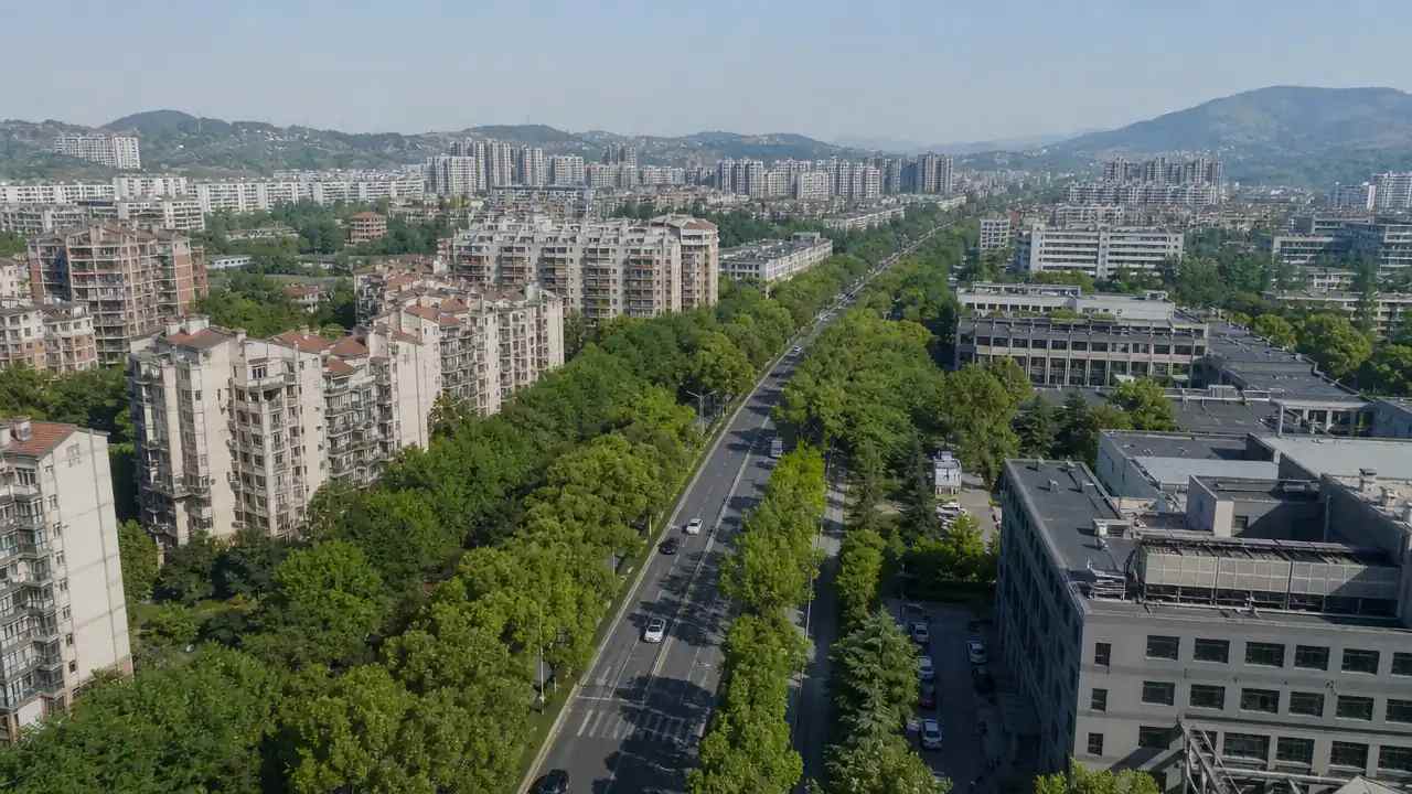
Street trees are among the most sensitive features of an undergrounding project. Residents value them, and roots complicate trenching. A model with a vegetation layer shows where the canopy sits along the corridor and which blocks are heavily planted.
The layer is inferred from map data, so an arborist still needs to assess individual trees. Use the scene to decide where the conversation should start, not to decide which trees stay.
3 Fit the route into the street
3.1 How does the corridor meet driveways and intersections?
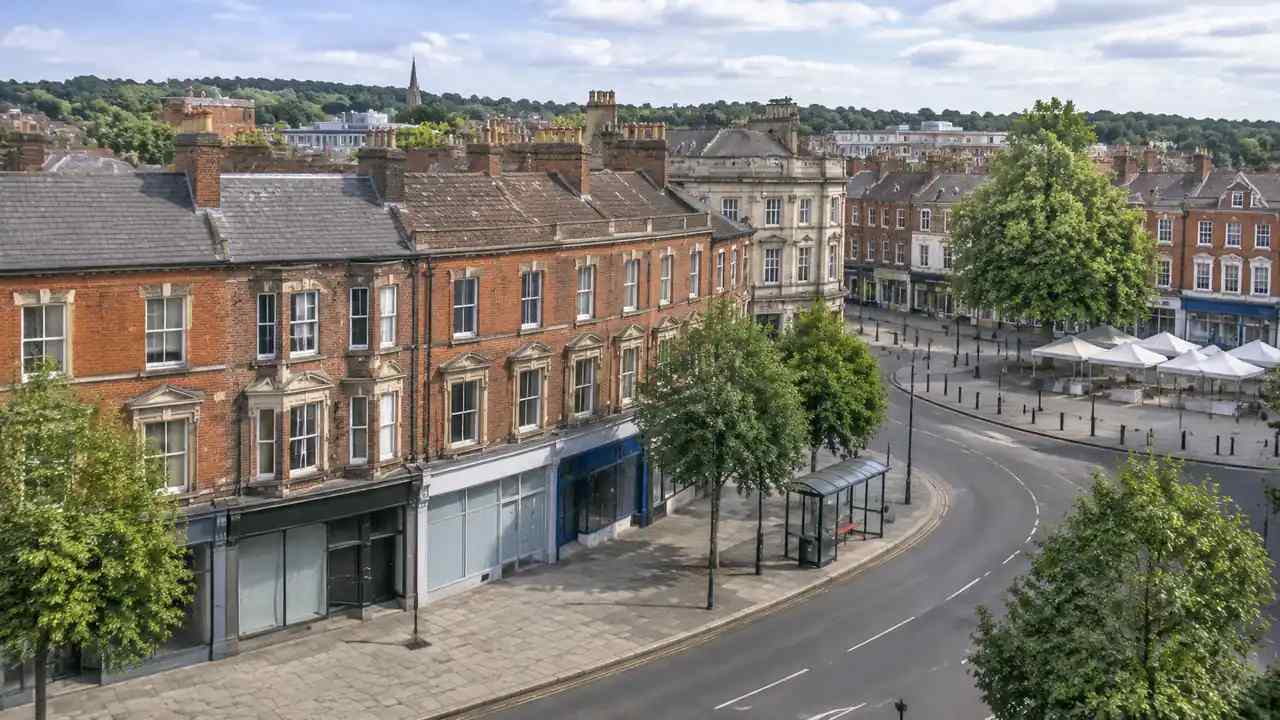
Every driveway crossing is a disruption and a potential conflict with drainage, mailboxes, and access. A corridor view lets the team count those crossings and see where they cluster. A block with six driveways deserves a different approach from a block with one.
Intersections bring traffic control, signal conduits, and pedestrian routes into the same small area. Seeing the intersection as a place, rather than as a node on a diagram, helps the team anticipate where the work will be most visible.
3.2 Where would equipment and staging sit?
Undergrounding needs space for spoil, conduit, vaults, and equipment. In a narrow street, that space comes from parking lanes or frontage. The model helps the team test where staging could sit without blocking access to homes and businesses.
Staging belongs in the design conversation from the start. A route that works technically but leaves no room for equipment will generate complaints and delays that a slightly different alignment could avoid.
Sequence matters too. A corridor built in short blocks may need temporary parking restrictions, alternating traffic, and a place to store conduit overnight. The model shows the block lengths and the driveways within them, which helps the team plan a phasing scheme that keeps access open. That plan belongs to the contractor, but the site reading makes it possible.
4 Compare route options
4.1 How do you keep alternatives comparable?
Route alternatives often get drawn at different levels of detail, which makes comparison unfair. Fix the site context and the camera, then change the corridor and nothing else. The differences that remain are the ones the team actually chose.
Score each option against the same criteria: driveway crossings, tree canopy, grade changes, and staging room. The model supplies the visual evidence, and the team supplies the judgment about which constraint matters most in that neighborhood.
4.2 What should a public exhibit show?
Residents want to know what the street will look like when the work is done. An exhibit should show the corridor from eye level, with poles removed and the streetscape otherwise unchanged. It should also show the construction zone in general terms so people understand the disruption.
Keep the promise modest. The image is an illustration of intent, not a rendering of a final design, and the project should say so. That honesty protects the utility and the city from accusations of bait and switch later.
5 Match the model to the project stage
5.1 What belongs in early scoping?
Early scoping is about route feasibility and community impact. A model with terrain, buildings, and vegetation is sufficient. It helps the team identify the hard spots, estimate the length of the corridor, and prepare questions for the utility owner about capacity and existing infrastructure.
Bring a simple map of the corridor with the hard spots marked, and ask the utility owner which of them are already known. Owners often have records that change the route before any design begins, and an early conversation prevents a concept from being built on a wrong assumption.
Leave conduit sizing, ampacity, and vault design to the engineers. Those decisions depend on load studies and standards that the site model does not contain, and pretending otherwise weakens the credibility of the whole exercise.
5.2 What does the model not settle?
The model does not show underground utilities, easements, or property lines. It does not establish what can be dug or where a vault can legally sit. Those facts come from utility records, surveys, and title work, and they often override a route that looks clean on screen.
Name those gaps in the scoping memo. The team that knows what it does not know will commission the right studies at the right time, instead of discovering a conflict during construction.
6 Put the preview to work
6.1 What should the team prepare?
GenAnywhere generates an editable 3D site model from a map selection, with buildings, terrain, water, and vegetation in separate layers. A project team can trace a corridor through the scene, compare it with the streetscape, and view the route from above or at eye level. For undergrounding studies, that combination shows how a trench would sit relative to the place people actually use.
A single building along the corridor can be replaced or adjusted, which helps when a property has changed since the map data was captured, and terrain and vegetation can be toggled while the route is discussed. Prepare a short list of hard spots before the utility meeting. Then open the site review workflow and walk through them with the owner's engineers, who can confirm or correct each one.
6.2 How does the scene reach utility designers?
Export the model as GLB for use in Revit, Rhino, SketchUp, Blender, Unity, Unreal Engine, or GIS tools such as ArcGIS Pro and GISBox. Designers can align their corridor, vaults, and sections against the same context the planning team used, which reduces the chance of a mismatch between the exhibit and the drawings.
Name the layers clearly and include the data date in the file notes. The receiving team needs to know which surfaces are context and which are proposed.
6.3 What limits should the team state?
The model is built from map and satellite data, so it reflects a moment in time and an inferred level of detail. It is not a survey, a utility record, or a construction document. Third-party data rights may apply, and the commercial license for the exported scene has conditions on resale and training use.
Stated plainly, those limits do not weaken the preview. They define its role: a shared way to read the corridor before the expensive studies begin, and a better basis for the questions that follow.
Preview an undergrounding corridor in GenAnywhere
See how corridor context reaches design teams
7 FAQ
FAQ-1 Can the model show overhead lines and poles?
Not as engineered assets. The platform generates buildings, terrain, water, and vegetation from map data. Poles and wires are utility infrastructure that the model does not inventory. You can use the scene to show where poles stand relative to trees, driveways, and buildings, then confirm attachments, ownership, and removal scope with the utility. Treat the image as streetscape context, not a record of the network.
FAQ-2 How detailed is the terrain along a street?
Terrain comes from map data and is general in built-up areas. It is useful for spotting grade changes between blocks and at intersections, and it should not be read as a survey of the right of way. For trench design, the engineer will rely on survey and utility records. Use the model to decide where those investigations should focus.
FAQ-3 Can the model support community meetings?
Yes. An eye-level view of the corridor with poles removed helps residents understand the intent, and an aerial view locates the work. Keep the exhibit simple, label it as illustrative, and separate the finished condition from the construction period. The model cannot answer questions about timing, cost, or service interruptions, so route those to the project team.
FAQ-4 What should be checked with the utility owner?
Confirm the existing network, including lines that share poles and any infrastructure the project would affect. Ask about capacity, standards, and the owner's preferred corridor. Verify easements and access rights with the property records. The Department of Energy publishes background on grid and distribution work that can help a team frame those questions.
Content and technical notes
This article was prepared by the GenAnywhere team with AI-assisted drafting and human review.
Product features, formats, and availability change as the platform evolves; refer to the official GenAnywhere website for current details.
For technical questions or corrections, contact support@genanywhere.com.
Last reviewed: 2026-11-10.