
BIM modeling existing conditions: what to check in GenAnywhere
A generated site scene covers part of the existing record, and the useful work starts where that coverage ends.
BIM modeling existing conditions usually begins with a question about what is already there. A map-based scene answers part of it: footprints, estimated heights, ground, water and planting, generated from satellite and map data and kept editable. This article sets out what the scene records, what it cannot, and how to check it before a modeller relies on it.

1 What BIM needs from existing conditions
1.1 What must the model carry?
A building model needs authored elements with properties, levels and a documented relationship to the site. Existing conditions enter that model as constraints: a boundary, a neighbouring structure, a level that cannot move. Each constraint needs a source before it can be trusted.
The modeller also needs to know which constraints are approximate. A neighbouring block set from a map outline is useful for coordination and useless as a legal boundary. The note has to make that difference visible.
A short constraint list helps. Three or four lines naming the boundary, the neighbouring structure and the level that matters give the modeller a place to start, and the list is easy to update when the design moves.
1.2 What can context supply?
Context supplies the shape of the district and the relationship between the site and its neighbours. It shows where the street is narrow, where the ground falls away and where a new building would be seen. Those facts shape the model before any wall is placed.
It also supplies a starting geometry for the wider area. A modeller can use the scene to check that a proposal sits in the right place relative to the street, without modelling the whole district by hand.
That starting geometry is a reference rather than a deliverable. It should not be copied into the model as authored content, because a copied outline loses its source and starts to look like a survey.
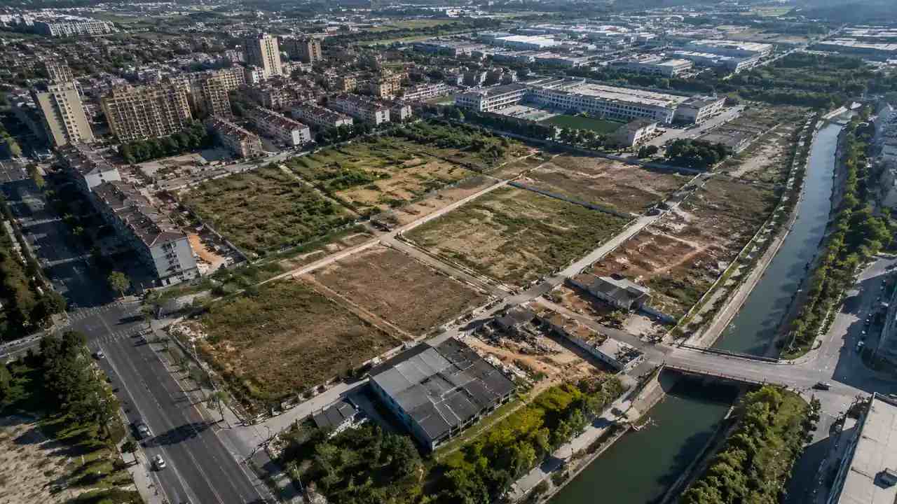
2 What the scene records
2.1 Which footprints and heights appear?
Building outlines follow the footprints in the map source. Heights are estimated from the source and the surrounding pattern, and types are inferred rather than verified. The scene presents a coherent district, and the coherence is part of its value.
The estimate is good enough to judge massing and weak enough to be wrong on a single building. A modeller who needs a real height should not lift one from the scene, and the note should say so before the question is asked.
Footprints carry their own uncertainty. A map outline can include a canopy, a boundary wall or a covered yard, and the shape reads as a building. Check the odd ones against an image before they enter a coordination model.
2.2 What about ground, water and planting?
Ground is generated from terrain data and matched to the surrounding land. Water appears where the source records a river, canal or lake, and planting forms a band around the site. Each sits in its own layer and can be reviewed alone.
The layers are useful for coordination because they separate what is built from what is grown. A landscape lead can look at the planting without the buildings, and a modeller can link the buildings without carrying the trees.
Water is worth a check of its own. The surface follows the source, so a rebuilt bank or a new quay will sit in the wrong place, and the error is easy to accept because a blue shape looks settled.
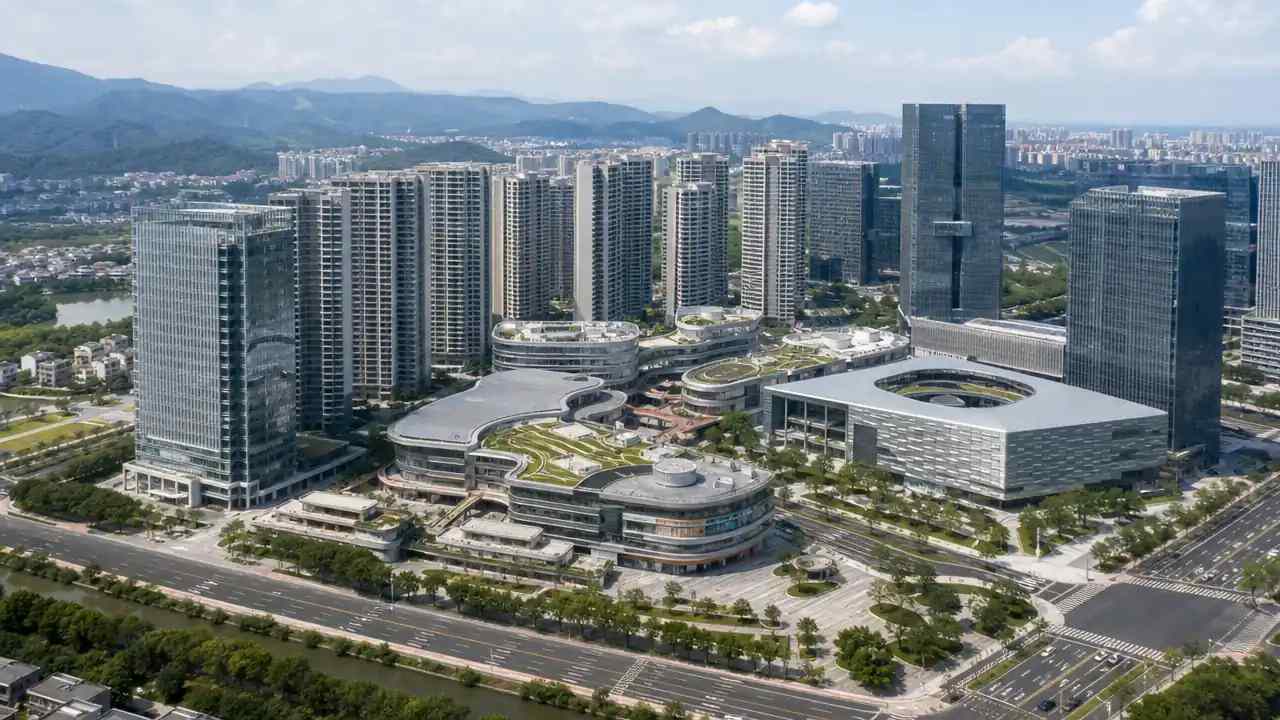
3 What to check
3.1 Is the source date and coverage right?
Check the date against recent change on the site. A new access road, a demolition or a finished extension will be missing if it came after the source, and the scene will look confident while being wrong. The date is the cheapest check available.
Check the coverage next. The area should include the neighbours and the street, because coordination questions usually involve both. A scene that stops at the plot line answers a narrower question than the one the model is asking.
3.2 Which gaps and edits matter?
List the gaps that affect the model: a missing building, a changed boundary, a level that the source cannot supply. Each one needs an edit or a line in the note. Gaps that do not affect the model can stay in the record without further work.
Put the list where the modeller will see it. A gap recorded in a message is lost by the next meeting, while a gap in the note is read when the file is opened.
Record the edits you make. A replaced building or a raised terrain edge changes the scene, and the change should be traceable. An edit without a record becomes a fact that nobody can defend.
4 Where the scene stops
4.1 What about condition and structure?
Condition, structure, services and floor levels are outside the scene. A building that looks sound can be derelict, and a plot that looks empty can hold foundations. The scene describes shape and says nothing about what the shape is made of.
Professionals who record existing buildings work to published guidance, such as the RICS professional standards, and a generated scene does not replace that work. It can point at the buildings that need a closer look.
4.2 What about legal and measured facts?
Boundaries, ownership, rights of way and measured levels sit outside the scene. So do planning constraints and any question that depends on a legal record. The model can frame those questions and cannot answer them.
This is the limit that causes the most trouble, because a line drawn from a map looks authoritative. Treat every boundary as a representation until a legal or measured source confirms it, and keep the scene out of that argument.
5 Documenting the base
5.1 What goes in the note?
The note covers the source, the date, the area, the edits and the checker. It also says what the scene is for and what it does not carry. Five or six lines are enough, and they travel with the file.
Records conventions such as the FGDC metadata standards exist because sources need to outlive the people who made them. A short note in that spirit keeps the scene usable after the team changes.
5.2 How do you hand it to a modeller?
Hand over the file with the note and agree an anchor. A corner, a road centreline or a surveyed point gives both files a common position, and the anchor is worth drawing as well as writing. A coordinate alone is easy to misread.
State what the modeller should do with the scene. A linked reference, a traced outline and a merged background are three different uses, and each one carries a different risk. The brief takes a minute and prevents a wrong assumption.
If the scene is linked, agree where the link sits and who can move it. A reference that drifts is worse than no reference, because the model looks correct while its context has shifted.
6 Change over time
6.1 Do you rebuild or edit?
Rebuild when the change affects the question and edit when it does not. A new roof on a neighbour rarely matters to a massing study, and a new road usually does. Tie the decision to the model's purpose rather than to the calendar.
6.2 When is a survey needed?
A survey is needed when a measured fact drives the design: a level, a boundary, a structural span or an existing opening. The scene can frame the brief and cannot supply the number. Commission the survey before the model depends on it.
6.3 When does the record retire?
The record retires when the model is documented or when the site changes beyond recognition. Generate a scene from the map in the GenAnywhere app when a new question needs a fresh base, and keep the old note with the archive.
See how the existing site becomes a scene in the GenAnywhere workflow before the modeller starts on the district.
7 FAQ
FAQ-1 Is this a condition survey?
No. It is a context scene built from map and satellite data, with estimated heights and inferred types. A condition survey records the fabric of a building, and it is carried out by a qualified team. The scene can frame that survey and cannot replace it. Treat the two as different records.
FAQ-2 How current is the data?
The scene is as current as the source it was generated from. That date travels with the data and belongs in the note. A stable district can tolerate older data and a site under construction cannot, so check the date against the changes the team already knows about. Rebuild when the difference affects the model.
FAQ-3 Does it include services?
No. Underground services, drainage runs and utilities are not part of a surface scene, and they cannot be inferred from one. Those records come from the asset owners and from a survey. The scene can show where a service question is likely to matter, which helps scope the search before anyone lifts a cover.
FAQ-4 Can it feed a Revit model?
It can be imported as context by tools that read GLB, and the workflow direction is listed on the site. What arrives is geometry with materials rather than native elements. Use it as a linked reference, test the import, and keep authored content in the authoring tool. The two records stay separate and traceable.
Content and technical notes
This article was prepared by the GenAnywhere team with AI-assisted drafting and human review.
Product features, formats, and availability change as the platform evolves; refer to the official GenAnywhere website for current details.
For technical questions or corrections, contact support@genanywhere.com.
Last reviewed: 2026-11-06.