
Oblique photography limits: what to check in GenAnywhere
What an angled aerial capture can prove, where it fails, and how a map-derived base covers the rest.
Oblique photography is strong evidence of surfaces and weak evidence of structure. It records what the cameras could see on the flight day, and it becomes unreliable where light, water or movement confuse the reconstruction. A review that knows those limits can use the capture for what it proves and a map-derived site model for the arrangement around it.

1 Set the expectation
1.1 What does the capture record well?
It records surfaces at an angle. Several cameras capture façades, roofs and the ground between them, and photogrammetry turns the overlap into a textured mesh. For a condition survey, a heritage record or a check on completed work, that texture is the evidence.
It also records the awkward parts of a site: the lean-to, the retaining wall, the yard behind the shop. A drawn map simplifies those features and a capture keeps them.
What it does not record is intent. A wall looks the same whether it is permanent, temporary or about to be demolished, and nothing in the mesh tells a reviewer which. None of that is a fault in the capture; it is the nature of a surface record. Industry guidance such as the material published by ASPRS covers oblique imaging and photogrammetric processing in more depth.
1.2 Where does it stop being reliable?
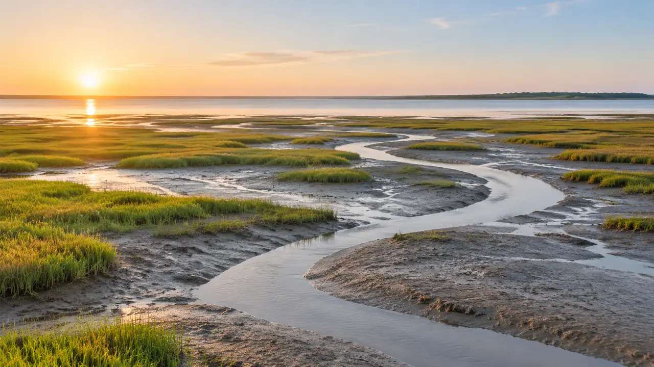
It stops where the camera could not see clearly. Water absorbs and reflects light, glass returns the sky, moving vehicles appear as smears, and dense vegetation hides the ground beneath it. Those areas come back as holes, noise or smooth guesses.
It also stops at the edge of the flight. A capture that covers the site but not the neighbour's yard leaves a blank where a boundary or overlooking argument tends to sit.
And it stops at the date. The mesh records one moment, and a site that changes weekly will outrun it. A record that is honest about those three edges is more useful than one that appears to have none.
2 Check the surfaces
2.1 Which surfaces fail?
Water is the usual place to start. A river, a pond or a wet yard returns a surface that looks plausible in a still frame and behaves badly when measured or viewed from another angle.
Glass and polished metal come next. A curtain-wall façade can return the sky or the building opposite, so the texture is real but the position is not.
Then come the moving parts: cars, pedestrians, cranes, foliage in wind. Photogrammetry assumes a static scene, and anything that moved leaves a ghost. A ghost is easier to spot in a still frame once you know to look for the doubled edge.
2.2 How do you spot a failure in the scene?
Open the scene and orbit it. Failures usually show as a surface that changes shape when the view changes, a texture that repeats, or a hole with a soft edge.
Compare the same feature from two directions. A wall that looks solid from the front and dissolves from the side was never reconstructed.
Look at the ground near water and under trees. Those are the places where a reviewer's question will land, so they are worth checking before the meeting rather than during it. Where a failure sits on the point the decision turns on, mark it in the scene rather than relying on memory.
3 Check the geometry
3.1 How do you test alignment?
Pick two dimensions you can verify independently: a door width, a parking bay, the gap between two buildings. Measure them in the scene and compare them with the drawing or a tape measure on site.
If both agree, the alignment is probably sound within the tolerance that matters for the decision. If one disagrees, stop and find out why before anyone measures anything else.
Record the test in the note. A reviewer who sees the check will trust the rest of the scene more, and a future team will know what was verified. A failed test is more valuable than a passed one, because it points at the part of the scene that needs another source.
3.2 What does a map-derived base cover?
GenAnywhere builds a site model from a drawn map area using satellite and map data. It identifies building footprints, estimates heights, infers types and reads vegetation, then presents buildings, terrain, water and vegetation as separate layers.
That base carries arrangement rather than surface texture. A planner can hide the trees, replace a building or change a height without touching a mesh, which makes it the right instrument for a massing question.
It also covers ground nobody flew. A district review that extends past the capture can continue on the map base at a consistent level of detail.
4 Check the date
4.1 How old is the capture?
The flight date should be on the file, in the note and in the scene name. A capture without a date is difficult to defend, because the opening question in any review is when it was taken.
Age matters differently by question. A heritage record may stay useful for years; a construction sequence may be stale within a month.
State the date next to the claim it supports. "The façade was intact in March" is a defensible sentence; "the façade is intact" is not. The habit costs a few words and saves a conversation about what the team actually knew.
4.2 What changed since?
Check the obvious changes: new roofs, demolished structures, added plant, changed boundaries. A quick look at recent imagery or a site visit will usually reveal them.
Then check the changes that matter to the decision. A new fence may be irrelevant to a massing study and decisive to a boundary discussion.
Where the capture is out of date, say so and decide whether a new flight, a site visit or a map-based update is enough. The answer depends on what the team needs to prove.
5 Check the handover
5.1 What does the note need?
The flight date, the coverage boundary, the software that processed the images and the person who checked the alignment.
The known failures: water, glass, vegetation, moving objects. A note that lists them prevents the next team from rediscovering them in front of a client.
The decisions the capture supports and the ones it does not. A capture can show condition and texture; it cannot settle a boundary dispute or a planning determination. Say the second part out loud, because the reader who needs it will not ask.
5.2 What should the team not assume?
That a smooth-looking model is whole. Photogrammetry fills gaps with plausible surfaces, and a wall where a door should be is a warning rather than a convenience.
That texture implies measurement. A photo-real façade invites people to read dimensions from it, and the mesh may not carry the tolerance they assume.
That one capture serves every scale. A district view and a doorway detail rarely belong in the same file, and stretching one to do both weakens both.
6 Decide the scope
6.1 When is a capture the wrong tool?
When the question is about arrangement rather than appearance. A massing test on a clear site does not need texture, and a map-derived base answers it without a flight.
When the site is simple and well documented. A survey drawing may carry better dimensions than a fresh capture.
When the decision is about policy without a spatial form. Texture adds nothing where there is nothing to look at.
6.2 When is a map base the wrong tool?
When the decision depends on a surface. Façade condition, a boundary wall or a recent alteration needs the capture.
When the site is changing quickly and currency matters more than structure.
When the detail is the argument. A heritage setting or a construction sequence needs texture and confirmed geometry, not a plausible mass.
6.3 When do you stop checking?
Stop when the remaining uncertainty cannot change the decision. A two-centimetre gap matters to a fabricator and not to a zoning review.
Stop when the file becomes slow enough that people avoid opening it. A scene that takes minutes to load gets opened once.
Stop when the next question belongs to another discipline. Hand it over with the note rather than stretching the scene. A scene stretched past its purpose stops being evidence and becomes an opinion with texture.
Draw the area in the GenAnywhere app and keep the capture beside it as a dated record.
7 FAQ
FAQ-1 Does GenAnywhere correct photogrammetry errors?
No. It does not process angled imagery or repair a mesh. The platform builds an editable site model from map data and exports a general GLB, so a capture with holes stays a separate source that the team interprets. The two records answer different questions, and keeping them apart lets the team say which one supports which claim.
FAQ-2 How should a team record a failed surface?
Mark it in the scene or the note with its location and the reason. Water, glass and vegetation are the usual causes, and a short description is enough for the next reviewer to know what to expect when the scene is opened again. A location and a cause are enough; the next reader can judge the consequence from the surrounding surface.
FAQ-3 Is a capture a substitute for a survey?
No. A capture records surfaces, and a survey establishes controlled positions. Where dimensions govern a decision, the survey or a controlled capture should set them, and the visual record should be labelled as context rather than as a source of measurements. A visual record can support a survey, and it should not be asked to stand in for one.
FAQ-4 What does the map base add to a review?
It adds editable arrangement. Buildings, terrain, water and vegetation sit on separate layers, so a team can test a replacement, a height change or a new block while the capture stays the record of existing conditions.
See how a map area becomes an editable site model in the GenAnywhere workflow.
Content and technical notes
This article was prepared by the GenAnywhere team with AI-assisted drafting and human review.
Product features, formats, and availability change as the platform evolves; refer to the official GenAnywhere website for current details.
For technical questions or corrections, contact support@genanywhere.com.
Last reviewed: 2026-11-06.