
Battery storage siting: a 3D site workflow in GenAnywhere
How a project team can test a storage parcel's fit before detailed design begins.
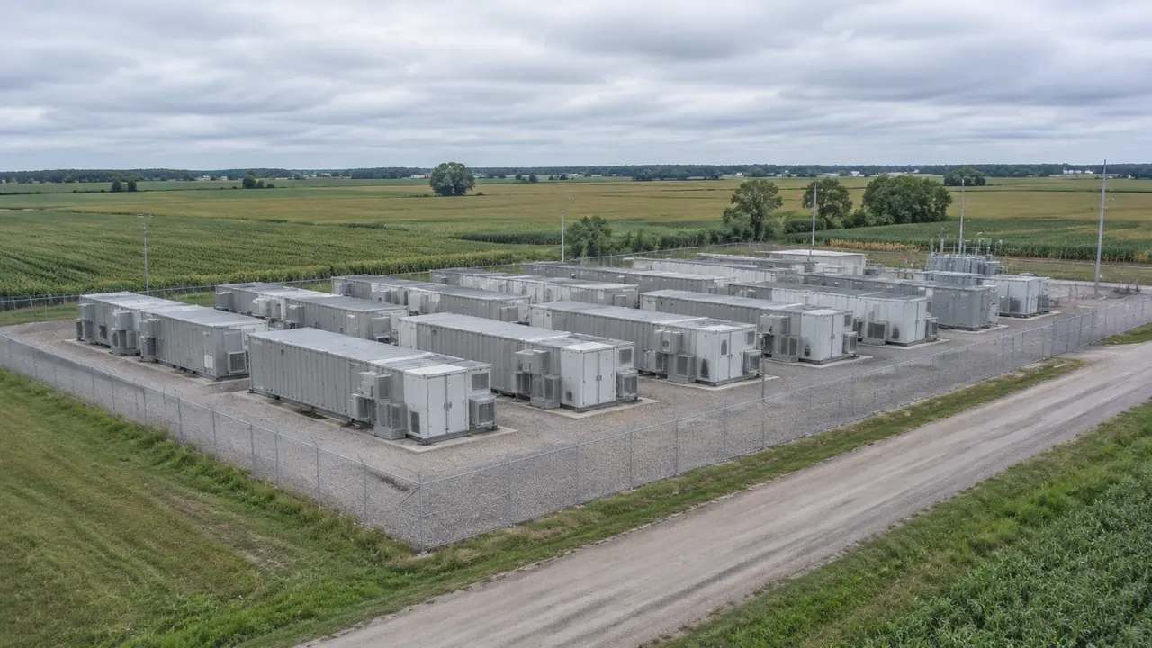
Battery storage projects live or die on the parcel. A team needs flat ground for containers, room for transformers and switchgear, a route the fire service can use, and a buffer that neighbors will accept. GenAnywhere can turn a map selection into an editable 3D site scene so those constraints can be compared side by side before drawings begin. The scene supports screening. It does not replace engineering, fire review, or interconnection studies.
1 The siting question behind every proposal
1.1 Which parcels meet the basic footprint?
A storage site needs a compact, level area for equipment, with room around it for access and separation. Brownfield land, industrial yards, and the unused edge of a substation parcel often come up early because they already have roads and power nearby. The question is whether the usable area survives after the access road, the fence, and the drainage are laid in. A parcel that looks generous on a map can shrink quickly once those pieces are placed.
Ground conditions matter as much as area. A site that drains poorly may need fill or a raised pad, and a parcel with a shallow water table can complicate the whole layout. Those questions belong to the civil engineer, but a site picture helps the team see where they will bite.
1.2 What separates a workable parcel from a difficult one?
Distance to a substation matters, but it is not the whole story. A parcel next to a school or a row of houses raises questions that a remote industrial lot avoids. A site in a floodplain adds another layer of review. So does a parcel with no direct road frontage or a steep grade that needs regrading. Teams usually compare these factors in a spreadsheet, which flattens the visual reality. A scene puts them back into proportion.
2 Reading a site for access and separation
2.1 How do access roads shape the layout?
The access route sets where the equipment yard can begin. Fire apparatus need a way in that does not depend on backing a long distance, and maintenance trucks need to reach each row without crossing live areas. A road that enters from the wrong side can push the equipment into the least useful corner of the parcel. Seeing the route in three dimensions makes that conflict obvious before a civil engineer spends time on it.
2.2 Where do buffers and setbacks fit?
Buffers are where visual and acoustic concerns meet the site plan. A row of containers close to a property line will be seen and heard differently from the same row set back behind existing trees. Local rules set the required distances, and those rules should be read carefully rather than guessed from a model. The scene helps a team test how a buffer looks and where planting would do the most work, then check the result against the ordinance.
Planting takes years to mature, so a buffer that looks solid in a rendering may be thin through its early winters. Teams should show the buffer at a realistic size and note the growth assumption.
3 Turning a map selection into a working scene
3.1 How does GenAnywhere generate the surrounding context?
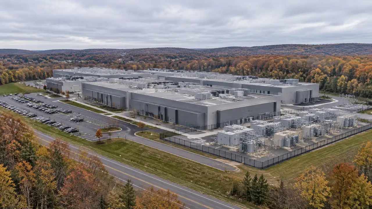
A user selects an area on the map, and GenAnywhere builds a 3D site model from satellite and map data. Buildings, terrain, water, and vegetation come into the scene, with terrain matched to the surrounding ground. Building footprints are recognized, heights estimated, and types inferred, so a neighboring warehouse reads as a warehouse rather than a block. Vegetation is analyzed in the same pass, which helps when a tree line is doing buffer work. This gives the team a context scene without waiting for a drone flight or a survey.
3.2 What can a team edit before sharing?
Individual buildings can be replaced, moved, rotated, or resized, and their heights and types adjusted. Layers for buildings, terrain, and vegetation can be previewed separately, so a team can look at the bare ground or study the tree cover on its own. The scene does not model battery containers as a product library, so teams usually represent equipment with simple massing. That is enough to test fit, access, and visual bulk, which is what a siting review needs at this stage.
Keep a simple legend in the scene so a viewer knows which shapes are real buildings and which are placeholders for equipment. Without that note, a massing block can be mistaken for a design that has been engineered. The legend is part of the deliverable, not decoration.
4 Comparing three parcels in one review
4.1 How do you keep the comparison consistent?
Use one camera height and one heading for every parcel, and note the direction of the nearest homes. Show the same equipment massing in the same arrangement at each site. Then add the access route and the buffer in the same style. Consistency is what turns three pretty pictures into a comparison a reviewer can trust. If the parcels are shown from different angles or at different times of day, the meeting drifts into aesthetics.
4.2 What deserves a second look?
Look again at the parcels where the equipment would sit closest to a property line, a road, or a waterway. Look at the ones where the access route crosses a slope or a drainage channel. Those are the places where a siting decision can become expensive later. A scene will not price the risk, but it will show where the risk sits. That is usually enough to decide which parcels deserve engineering time.
5 Where the scene ends and engineering begins
5.1 Which questions need fire and electrical review?
Separation distances, fire suppression, spill containment, and electrical clearances belong to specialists working from standards and local requirements. A visual model can show where equipment sits, but it cannot certify that the arrangement is safe. Teams should use the scene to prepare questions for those reviewers, not to answer them. A neat rendering can create false confidence if it is mistaken for a compliance check.
Local requirements vary by jurisdiction, and a reviewer who knows the local fire service will spot questions a national standard does not answer. Bring that person in early, with the scene as the starting point for the walk-through.
5.2 When is a site sketch not enough?
When the decision depends on soil bearing capacity, flood elevation, acoustic modeling, or grid capacity, the sketch has reached its limit. Those studies take time and specialized data. A team that keeps pushing the visual model to answer them will waste effort and mislead its audience. The useful move is to name the open question, assign it to the right specialist, and keep the scene as the shared frame around the answer.
6 Handing the scene to the design team
6.1 What format do downstream teams expect?
Exported GLB files can move into 3D, BIM, GIS, and game engine workflows, depending on the receiving team's pipeline. Some teams will open the file in Blender or Rhino; others will bring it into a GIS environment or a game engine for review. Export support varies by workflow, so confirm the format before the handoff. A short test import on the receiving side catches problems early.
6.2 What should accompany the export?
Send the scene with a note on sources, date, and estimated items, plus a simple plan showing the equipment layout and access route. Add the questions that remain open, especially the ones that could change the layout. The export carries a permanent commercial license under the platform's terms, but it should not be resold as a source file or used to train AI models. Check third-party data rights before publishing derived images.
6.3 How do you keep options traceable?
Number each option and keep a one-page summary with the date, the parcel, and the key assumption behind it. When a layout changes, create a new option rather than overwriting the old one. Traceability matters in siting work because the reason a parcel was dropped is often as important as the reason another was chosen. A simple log prevents the team from relitigating the same decision twice.
To screen a parcel of your own, open GenAnywhere in a browser and follow the site workflow walkthrough. The U.S. Department of Energy storage pages provide background on how storage projects are planned and reviewed.
7 FAQ
FAQ-1 Can GenAnywhere size a battery system?
No. The scene shows site context and massing, not electrical capacity or equipment sizing. System size depends on interconnection studies, load analysis, and the developer's commercial model. Use the scene to test where equipment would sit and how it would look from nearby properties. Keep sizing with the engineers who are responsible for it.
FAQ-2 Does the scene show fire access requirements?
It can show a proposed access route and the ground around it, but it does not apply fire code requirements. Local fire officials and code documents set those rules, and they should review any layout before it advances. A useful practice is to mark the proposed route in the scene and bring it to the fire service as a question, not as a finished plan.
FAQ-3 Can neighbors see what the site would look like?
Yes, that is one of the practical uses of the scene. A view from a nearby street or from an upstairs window shows the visual bulk of the equipment and the effect of a tree buffer. Teams should label the view with its location and note that equipment is represented as simple massing. That honesty keeps a visual aid from turning into a promise.
FAQ-4 What if the parcel has no map detail?
Some rural parcels have sparse building data, and the scene will reflect that. Terrain and vegetation still come through, which is often enough for a screening view. For a site with recent construction, check the map date and refresh the scene. If the detail is too thin for the decision, a site visit or survey is the next step.
Content and technical notes
This article was prepared by the GenAnywhere team with AI-assisted drafting and human review.
Product features, formats, and availability change as the platform evolves; refer to the official GenAnywhere website for current details.
For technical questions or corrections, contact support@genanywhere.com.
Last reviewed: 2026-11-15.