
BIM modeling early stages: where GenAnywhere fits a site study
What a project needs before any wall is modelled, and how a generated site scene supplies it.
BIM modeling early stages often start before anyone agrees on the building. The team needs a site, a set of neighbours and a way to test massing, and those questions arrive before a survey or a model exists. GenAnywhere generates that context from map and satellite data and exports it as a GLB, and this article explains where the scene fits and where authoring takes over.

1 What early BIM needs
1.1 Which decisions come before the model?
Three decisions come before a building model: where the building sits, how big it is and how it meets the street. All three are spatial, and none of them needs a wall assembly. A team that starts modelling before those decisions will rebuild the model later.
The site study also sets the reference that the model will use. A position, an orientation and a ground level give the authoring team something to build against, and the absence of that reference is a common source of rework.
A shared reference is not a small detail. It decides whether two files sit in the same place, and it is much easier to agree before either file exists than to correct after both have grown.

1.2 What does a site study add?
A site study adds context that a plot plan cannot show. It shows the neighbours, the slope and the way the street runs, all at a scale a client can read. That reading is what turns a brief into a scheme.
It also adds a shared picture for the team. Architects, engineers and the client can point at the same block and argue about the same thing, which is more productive than arguing about a description.
The study is cheap to change, which changes the tone of the discussion. A team that can move a block in a minute spends its time on the merits rather than on the cost of trying.
2 What the base provides
2.1 Which layers does the scene hold?
The scene holds buildings, terrain, water and vegetation in separate layers. Buildings can be replaced, moved, rotated and given a different height or type. The terrain is matched to the surrounding ground, and the vegetation band follows the pattern in the source.
That structure matters for BIM work because it keeps context separable from design. The team can show the district without the proposal, or the proposal without the trees, and each view answers a different question.
2.2 What is estimated?
Heights are estimated, building types are inferred and the vegetation band is generated rather than surveyed. Those values are useful for proportion and unreliable for documentation. The distinction belongs in the opening conversation with the authoring team.
A scene built from map data cannot carry the properties a building model needs. It carries shape, position and relationship, and those are the things an early study is trying to settle. Read how a map area becomes an editable site model when you need the detail behind that step.
3 Where it fits the workflow
3.1 How does it sit before authoring?
Before authoring, the scene is the working document. The team tests options against it, agrees a massing and records the reasons. When the model starts, the scene becomes the reference for position and context rather than the subject of the discussion.
That order saves modelling time. A massing that is tested in a scene is less likely to change after the walls are placed, and a change in a scene costs a few minutes rather than a rebuild.
It also gives the authoring team a clear starting point. They inherit an agreed position and an agreed massing, and their early work goes into the building rather than into another round of context.
3.2 How does it sit beside the model?
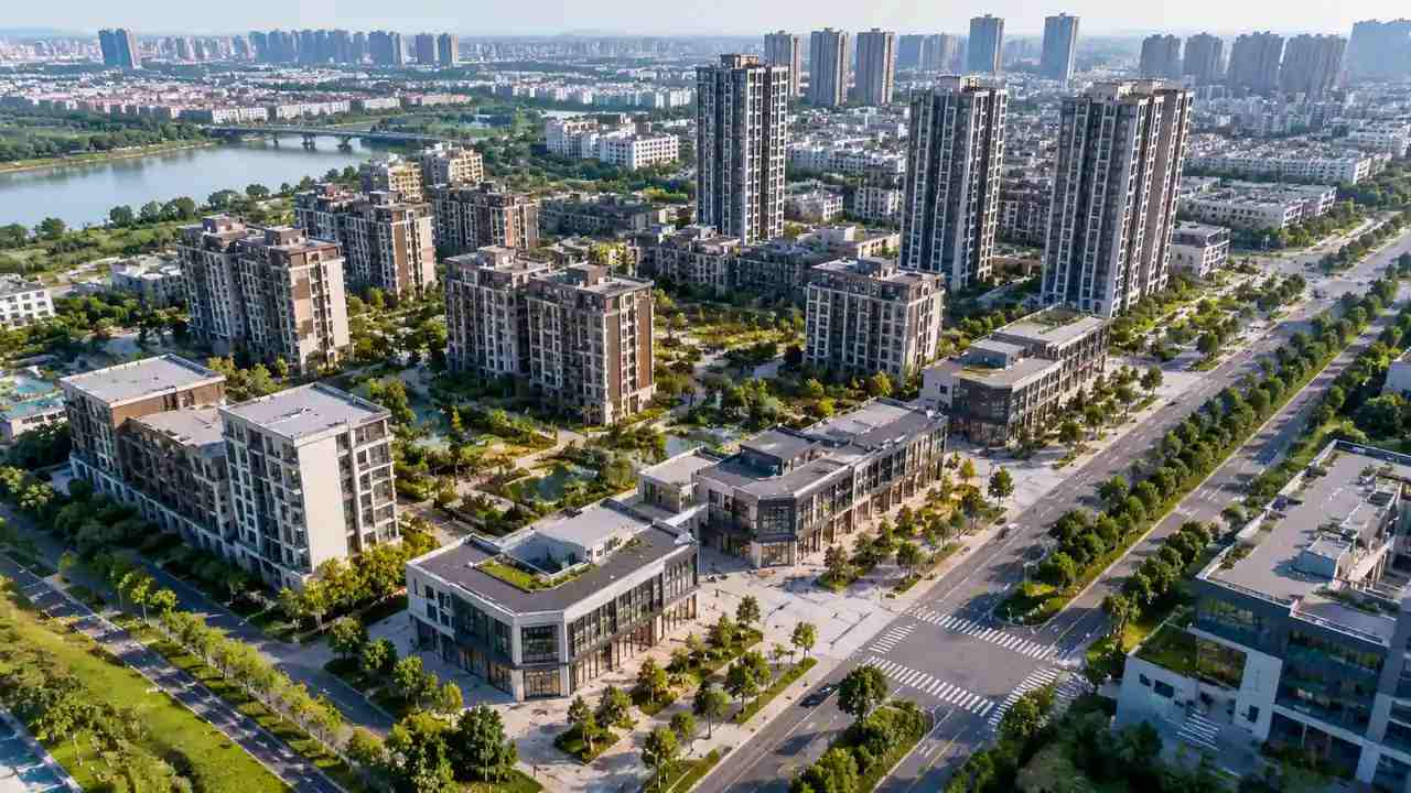
Beside the model, the scene explains the district to anyone who does not read plans. It is also a quick way to check a view or a neighbour relationship without loading the full model. The scene is lighter and faster, which matters in a meeting.
Industry frameworks such as the buildingSMART standards describe how building information is structured and exchanged. They help a team set expectations, and they also show why a context scene is a different kind of object from a building model.
4 Checks before handing over
4.1 How do you confirm scale and origin?
Import the GLB into the receiving tool and measure one known feature. A road width or a building footprint is enough to confirm the scale, and a failed check is much cheaper at this point than after a week of modelling. Write down the settings that worked.
Check the origin at the same time. A scene placed far from the world centre can behave oddly as the camera moves, and the fault looks like a rendering issue rather than a placement one.
4.2 What about layers and names?
Open the object list and see what survived. Some layers arrive separate, some merge and some names change. If the authoring team needs a context group for a linked model, that group is worth rebuilding and naming clearly.
Keep the naming plain. Context, ground and planting are easier to work with than layer one to layer four, and the names will travel into conversations where nobody remembers the export.
If the receiving tool has its own conventions, map the names once and write the mapping down. A one-page table is dull and it saves a recurring argument about which object is which.
5 What to record
5.1 What goes in the note?
The note names the source, the date, the area, the layers and the person who checked the import. It also says what the scene is for and what it does not carry. Five lines cover it, and those lines prevent most of the misunderstandings that follow a handover.
Add the import settings. A scale factor or an axis convention written down saves the next person a morning, and it makes the handover repeatable when the team changes.
Name the person who checked the scene, not the team. A name answers an email, and a handover with a name attached tends to stay in use.
5.2 How do you handle versions?
Give each export a date and keep the version that matches the current design. Move the rest to an archive folder rather than deleting them, because a question about an earlier option often arrives later.
Set up a site base in the GenAnywhere app before the authoring team begins, and the opening model will have a reference rather than an assumption.
6 When to move into authoring
6.1 When is the base enough?
The base is enough while the questions are about placement, massing and context. Once the team starts specifying walls, floors and services, the work has moved into authoring and the scene becomes a reference. Recognising that shift keeps both instruments honest.
6.2 When is a survey needed?
A survey is needed when a measured level, a boundary or an existing structure drives the design. The scene can frame the brief for that survey and cannot replace the result. Commission it before the model depends on a number the scene cannot supply.
6.3 When does the scene retire?
The scene retires when the design is documented and the site has changed enough that the context no longer matches. Keep the note with the file so the retirement is a decision rather than an accident.
7 FAQ
FAQ-1 Is this a BIM authoring tool?
No. GenAnywhere generates a context scene from map data and exports a general GLB. It does not author building elements or carry documented properties. Teams use it before authoring and beside the model, and the scene stays a reference rather than a model of record. That boundary is worth stating early.
FAQ-2 Can the GLB be linked into Revit?
It can be imported by tools that read GLB, and the workflow direction is listed on the site. What arrives is geometry with materials rather than native elements. Test the import in your own setup and confirm the link behaves as a reference before the team relies on it. The result is context, not a native model.
FAQ-3 How detailed should the context be?
Detailed enough to answer the early question and no more. A district of simple blocks with an accurate position is more useful than a heavy scene with every roof plant. Extra detail slows the file and rarely changes the massing decision. Add detail when a specific question asks for it.
FAQ-4 What if the site has changed?
Edit the buildings that changed, or draw a new area and generate again. Then update the note with the date and the edit. A scene that is silently out of date is worse than one that says when it was made and what was adjusted. Record the change while the reason is still fresh.
Content and technical notes
This article was prepared by the GenAnywhere team with AI-assisted drafting and human review.
Product features, formats, and availability change as the platform evolves; refer to the official GenAnywhere website for current details.
For technical questions or corrections, contact support@genanywhere.com.
Last reviewed: 2026-11-06.