
Station-area plans: what early site review adds with GenAnywhere
Why a shared three-dimensional baseline helps a transit team argue about the right things sooner.
A station-area plan lives or dies on context: how the platform sits in the neighborhood, which blocks can absorb growth, and how people reach the train without a car. A map-based site model gives the planning team a common baseline for those questions before any scenario is drawn. The model does not set policy, but it makes the physical facts of the place easier to see and harder to talk past.
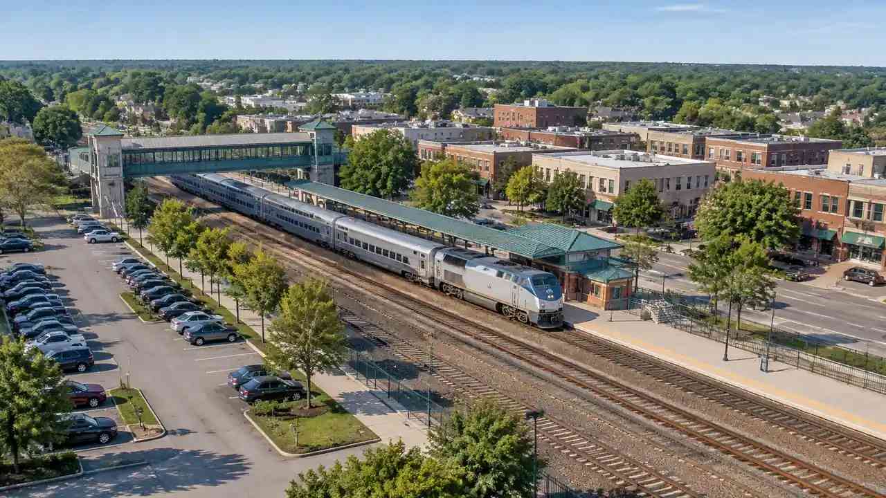
1 Frame the station area in three dimensions
1.1 What defines the station area boundary?
Most plans begin with a radius on a map. A radius is a useful starting point and a poor description of a place. Walking distance bends around rail yards, freeways, and fences, so the area people can actually reach is often smaller than the circle suggests.
A three-dimensional view shows those barriers as they are. Once the team sees the yard and the arterial cutting through the district, the boundary conversation becomes concrete. The plan can then define a study area that reflects routes people take rather than a shape chosen for convenience.
1.2 Which existing buildings shape the plan?
Station areas mix older commercial blocks, small apartment buildings, parking lots, and the occasional larger employer. Each type carries different assumptions about redevelopment, and the mix is easier to read when the buildings appear as volumes rather than dots on a land use map.
GenAnywhere builds those volumes from map data, with estimated heights and inferred building types. The estimates are a starting point for discussion, not a parcel-by-parcel inventory. Pair the scene with the city's own records before drawing conclusions about what could change.
2 Test access across modes
2.1 How do walking routes meet the platform?
The walk from a block to a platform is the heart of a station-area plan. A model that includes terrain and buildings lets the team trace a route and notice where a grade, a wall, or a parking deck interrupts it. Those interruptions rarely appear on a diagram of concentric circles.
Sketch two or three routes and compare them in the same view. The exercise reveals which corners need attention and which crossings deserve a closer look with the transit agency. It also gives residents something specific to react to during outreach.
2.2 Where do buses and bikes fit?
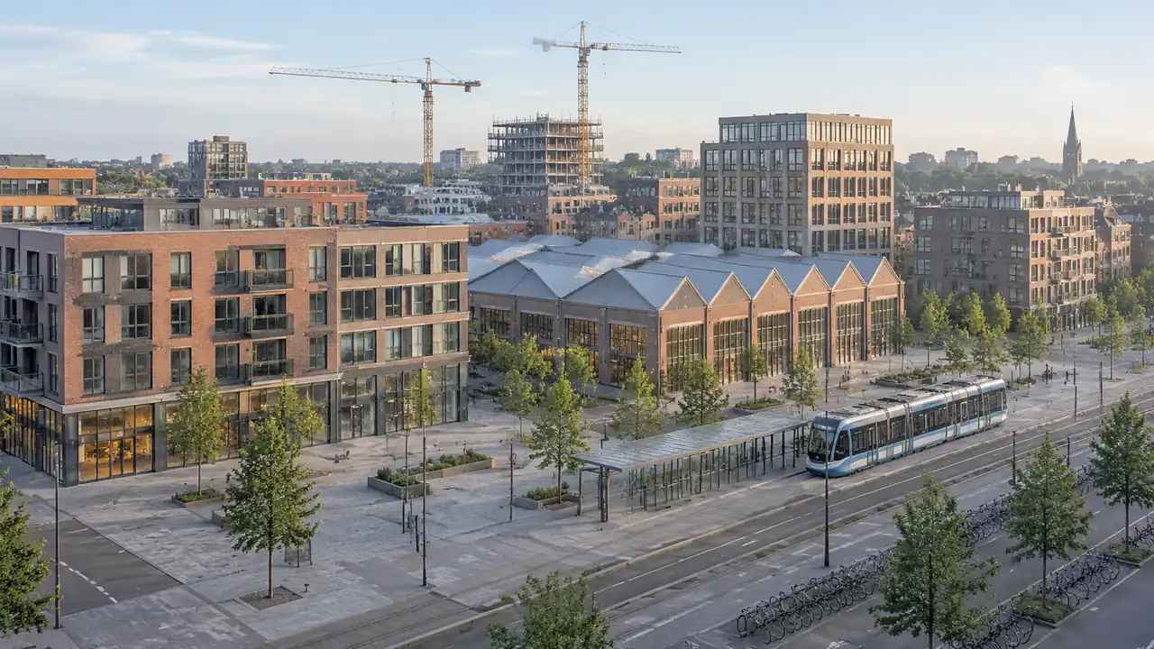
Bus circulation and bike access compete for the same curb space. A site model helps the team see how a bus loop would turn, where a bike lane could connect, and how much room remains for drop-off traffic. None of that settles the design, but it exposes conflicts early.
Bring the transit operator into the conversation with the scene open. Their constraints, from turning radii to layover space, will reshape the sketch, and it is easier to absorb those changes before the plan text is written. Federal transit planning guidance is a useful reference for how access and station area work are framed.
3 Read development capacity honestly
3.1 How much ground is actually buildable?
Gross acreage flatters a plan. Buildable area shrinks once you subtract the rail corridor, the floodplain edge, the street network, and the parcels that will not turn over. A model with terrain and existing buildings makes those deductions visible instead of leaving them to a footnote.
The team can then describe capacity in ranges tied to assumptions. That framing is more useful to a planning commission than a single number, and it invites a conversation about which constraints the plan intends to relax.
3.2 What do surrounding heights suggest?
Height is a sensitive topic in any station area, and a plan view flattens it. A perspective view shows how a six-story building reads next to a two-story main street, and how a taller block would sit against the neighborhood behind it. That reading matters for massing discussions and for public meetings.
Use the model to test a few height envelopes rather than to advocate for one. People need to see the difference, including the view from a nearby street, before positions harden.
4 Compare scenarios with the same baseline
4.1 How do you keep scenarios comparable?
Scenarios drift. One version uses a different base map, another assumes a road change, and the comparison collapses. Fixing a single site model as the baseline prevents that. Every scenario starts from the same terrain, buildings, and camera positions.
Save views for each scenario and label them by assumption, not by preference. When the planning commission asks why one option looks denser, the team can point to the specific blocks that changed. Working from one scene produces that kind of clarity.

4.2 What should a public exhibit show?
An exhibit for a station-area open house needs a recognizable view, a clear boundary, and enough context to orient someone who has never used a map like this. It does not need every parcel or every proposed floor. Choose two or three views that answer the questions residents actually ask about parking, shadows, and the walk to the platform.
Add a short note on what the model includes and what it leaves out. Honesty about the base data builds more trust than a polished image that implies certainty the plan does not have.
5 Fit the model to the planning stage
5.1 What belongs in early outreach?
Early outreach is about framing choices, not defending a design. A model with existing conditions and two rough alternatives is enough. It lets people point at a corner and say what worries them, which is more useful than a comment card with no spatial reference.
Leave detailed architecture for later phases. A concept scene that shows massing and access helps the public engage with the plan's logic without inviting a debate about window patterns that no one has designed yet.
5.2 What does the model not settle?
The model does not set zoning, determine entitlement, or predict ridership. It also does not capture ownership, tenant leases, or the politics of assembling parcels. Those factors often decide what happens, and they live outside the scene.
Say that at the start of every presentation. A planning team that names its blind spots keeps the conversation on the questions the model can inform, which are usually the physical ones a community can see for itself.
6 Put the preview to work
6.1 What should the team prepare?
GenAnywhere turns a map selection into an editable 3D site model, with buildings, terrain, water, and vegetation generated from map and satellite data. Buildings can be replaced, moved, rotated, or adjusted in height and type, and layers for each element can be toggled during review. For a station area, that means the blocks around the platform can be explored as a working model rather than a static aerial.
Layers can be toggled so the station, the streets, and the vegetation can be examined one at a time. Start with the existing condition and save it as the baseline. Then open the platform workflow with the team and agree on the two or three questions the scene must answer.
6.2 How does the scene reach urban designers?
Export the model as GLB for use in Revit, Rhino, SketchUp, Blender, Unity, Unreal Engine, or GIS tools such as ArcGIS Pro and GISBox. Designers can then test massing and street sections against the same site context the planners used. One scene, several disciplines, fewer arguments about whose base map is right.
Keep the export organized by layer so the designer can isolate terrain from buildings. A clean handoff saves the kind of rework that happens when each consultant rebuilds the district from scratch.
6.3 What limits should the plan state?
The model reflects map and satellite data at the time of generation, so it carries a date and a resolution that the plan should disclose. It is not a survey or a parcel map, and it does not replace the transit agency's engineering drawings of tracks and platforms.
Set those limits in the plan's methods note. Readers who understand the tool's boundaries are less likely to mistake a concept image for a commitment, and more likely to focus on the choices the plan actually makes.
Open a station area in GenAnywhere
Follow the site review steps for a transit plan
7 FAQ
FAQ-1 Can a site model show transit platforms and tracks?
Only in general terms. The platform generates buildings, terrain, water, and vegetation from map data, and rail corridors often appear as part of the surrounding context rather than as engineered trackwork. Detailed platform geometry, clearances, and signal infrastructure come from the transit agency. Use the model to show how the station sits in the district, and rely on agency drawings for anything that must match the operating railway.
FAQ-2 How does the model handle existing buildings?
Buildings are generated as editable volumes with estimated heights and inferred types. A planner can replace a single building, move or rotate it, and change its height or type to test a scenario. The estimates are useful for massing discussions and should be checked against local parcel and assessor records before they inform policy. Treat the scene as a conversation aid rather than an inventory.
FAQ-3 Can the model support public outreach?
Yes, with the right framing. A perspective view of the station area helps residents locate a proposal and react to massing, access, and the walk to the platform. Keep exhibits simple, label assumptions, and state the data date. The model cannot answer questions about rents, relocation, or school capacity, so route those to the staff who can and keep the visual conversation focused on physical context.
FAQ-4 What data should the team verify before using the scene?
Verify parcel boundaries, building heights, and recent construction against city records and current imagery. Check the rail corridor and street network with the transit agency and public works. Confirm any flood or environmental overlay with the responsible agency. The model is built from map data that changes over time, so a short verification pass protects the plan from visible errors during a public meeting.
Content and technical notes
This article was prepared by the GenAnywhere team with AI-assisted drafting and human review.
Product features, formats, and availability change as the platform evolves; refer to the official GenAnywhere website for current details.
For technical questions or corrections, contact support@genanywhere.com.
Last reviewed: 2026-11-10.