
Tower scene export: what GenAnywhere sends as GLB
The file leaving the platform carries the ground beneath a transmission line; the lattice towers and conductors come from the line design model.
A tower scene export is a GLB of the generated site, which means terrain, water, vegetation and nearby building masses. It does not contain lattice towers, conductors, insulators or foundations, because those are design assets that belong to the line model. What the file does provide is the landscape a line crosses, at a scale a route team can walk through before a tower position is fixed. Site then structure is the habit the export is built around.
1 What goes into the file
1.1 The generated surface
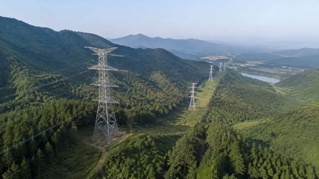
The export begins with terrain generated from map and satellite data, covering the corridor in the extent you selected. Slopes, field boundaries and the fall of the ground towards a valley all come from that surface. Water bodies appear where the imagery shows them, and vegetation is read from the same source. None of it is a survey product, and none of it carries the control points a line design team would expect on a topographic drawing. Treat the surface as a starting frame and check it against whatever control the project already holds.
1.2 Buildings and vegetation near the line
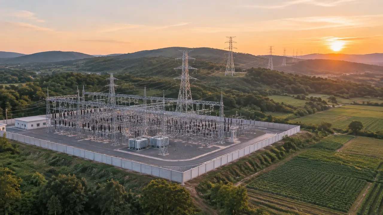
Buildings inside the corridor arrive as masses with footprints, estimated heights and inferred types. Farmsteads, sheds, barns and the occasional house are the usual findings along a rural route, and their positions matter when a tower has to sit between them. Vegetation arrives as coverage rather than as individual trees, which is enough to see where a wood blocks the view and not enough to measure a canopy. Both layers can be switched off while reviewing the ground. Turning vegetation off is the quickest way to see whether a building sits under the line or beside it.
2 What the line team brings
2.1 Towers, conductors and hardware
Lattice steel, poles, crossarms, insulators, dampers, conductors and earth wires are designed, not generated. They come from the line design model and are placed on the exported terrain in a downstream tool. That order matters: the site is settled at the start, then the structures are positioned against it. A team that expects towers in the GLB will spend the opening meeting looking for something that was never promised. Ask which line model holds the structures before the file is sent.
2.2 Foundations and access
Foundation types, access tracks, crane pads and construction laydown areas are design decisions with engineering behind them. The scene shows the ground those decisions sit on, including the slope that makes one foundation type cheaper than another. It does not draw a track, a pad or a clearing. Adding them in the design model keeps the reasoning visible, and it keeps the exported site reusable when the line moves a hundred metres. It also keeps the handover note short, because the design file already explains itself.
3 Reading terrain along a span
3.1 Slopes and ridge lines
A span crosses ground that a plan flattens. Walking the corridor at eye level shows a ridge that a map hides, and that ridge may be the reason one tower ends up taller than its neighbours. Orbit the scene from the side as well as from above. Line design guidance from bodies such as the IEEE Power & Energy Society treats terrain as an input to structure choice, which is a useful reminder that the scene supplies the input and not the choice. Walk the span from both ends before forming an opinion about the middle.
3.2 Water and wetland crossings
Water crossings are the places where a route review slows down, and the scene shows the water body, its width at the imagery date and the ground on both banks. It does not show flood levels, scour or the geotechnical conditions under the channel. Treat the crossing as a location to discuss rather than a condition to clear. If the span is long or the bank is soft, the engineering answer comes from a specialist study, and the scene just helps everyone find the place on the map. Bring the flood study to the same meeting and the conversation gets somewhere.
4 Limits of the export
4.1 No clearance, sag or electrical study
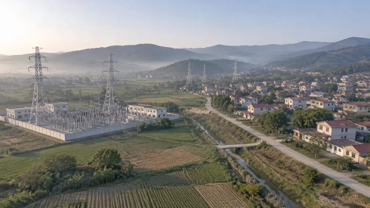
The file carries geometry, not calculations. Conductor sag, mid-span clearance, electromagnetic fields, insulation coordination and structural loading are all outside it, and so is any statement about whether a design meets a standard. Those questions need the line model, the design criteria and a qualified engineer. A scene that looks clear at eye level can still fail a clearance check, because the check measures against a conductor that is not in the file. Say that out loud when a viewer points at a gap in the picture.
4.2 Imagery date and vegetation growth
Trees grow and are felled, and the imagery behind the scene captures one moment. A wood that looks passable may have been clear-felled, and a clearing may have closed over since the capture. Check the imagery date before a corridor review relies on vegetation, and ask the landowner or the local team about recent change. The same caution applies to new buildings, which appear in a scene when the source data includes them. Recent clearances are worth a phone call, not an assumption.
5 Handover to the design tool
5.1 Preview and export
Preview the corridor before exporting. Check the ridge, the crossing and the buildings one by one, then fix what is wrong in the scene where the edit is quick. Export the GLB and open it in the receiving application before anyone else does. The platform overview sets out what a generated scene contains, which saves a round of questions when a new team joins the project. Ask the receiving team to open the file before the meeting, not during it.
5.2 Scale, origin and naming
A GLB lands in a target tool according to that tool's import settings, and a corridor that looks right can sit at the wrong origin once imported. Check position and scale against a known feature, such as a road junction or a building corner, before anyone measures a span from the file. Name the export by project, corridor and date. The name travels further than the email it arrived in. A version number helps when the corridor shifts twice in a month.
Open the GenAnywhere app and frame a transmission corridor
6 Before the export
6.1 Corridor extent
Decide how much of the route the review covers. A single crossing at good detail answers more than a hundred kilometres at poor detail, and a long corridor invites the audience to look at the wrong end of it. Generate separate scenes for separate decisions, and keep the camera height the same between them so the views can be compared. Write the extent in the note that travels with the file. One river crossing per scene is a reasonable rule of thumb.
6.2 Missing assets list
List what the file does not contain: towers, conductors, foundations, access tracks, construction areas and any survey control. Say where each will come from. That list is short and it prevents the most common misunderstanding in a corridor review, which is a viewer assuming the scene is the design. It also tells the audience which parts of the picture they are allowed to question. Keep the list to a page and it will be read.
6.3 Next step
Name the person who receives the file and the decision it supports. A route team may want the terrain under a proposed deviation; a stakeholder team may want the corridor for a visual session. If the answer is vague, the export can wait. A scene without a question behind it becomes a file nobody opens, and the next export starts from a weaker position. If the question changes, export again rather than explaining the old file.
7 FAQ
FAQ-1 Does the GLB include the towers?
No. Lattice towers, poles, conductors and insulators are design assets and stay in the line model. The export carries terrain, water, vegetation and building masses. Place the structures on the site in the downstream tool, then review the combination. Keeping the two apart means the site can be reused when the line changes, and the line can be revised without regenerating the ground. Write the split into the handover note and it survives the next handover.
FAQ-2 Can I check clearance in the scene?
Not in any engineering sense. Clearance depends on conductor position under load, on the structures and on the standard being applied, and none of that is in the file. The scene helps you see where a span crosses a building, a road or a wood. The measurement and the conclusion belong in the design tool with a qualified engineer. Use the scene to decide which span deserves that work.
FAQ-3 How wide should the corridor be?
Wide enough to include the buildings and water bodies that could affect a tower position, and no wider. A narrow strip makes the terrain easy to read; a generous one shows context but thins the detail once the file is opened on a modest machine. If the route bends, two scenes usually work better than one very wide one. For a corridor that turns a corner, frame the angle rather than the whole bend.
FAQ-4 What about vegetation under the line?
Vegetation appears as coverage read from the imagery, not as measured trees. It shows where a wood stands and how dense it looks from above. It does not give heights, species or growth rates, and it cannot tell you what a clearance envelope will meet in ten years. That analysis uses survey and growth data elsewhere. If growth matters to the decision, bring the growth study and the scene to the same table.
See how a generated corridor moves into a GLB workflow
Content and technical notes
This article was prepared by the GenAnywhere team with AI-assisted drafting and human review.
Product features, formats, and availability change as the platform evolves; refer to the official GenAnywhere website for current details.
For technical questions or corrections, contact support@genanywhere.com.
Last reviewed: 2026-11-13.