
Metro station generation: how GenAnywhere starts a site
Generation here means the site: the streets, blocks and ground around a station entrance, not the station or the line.
GenAnywhere starts a metro site the way it starts any other: you choose an area on the map, and the platform generates an editable 3D scene of the ground, the streets, the blocks and the planting inside it. Generation here means site generation. The station, the tracks and the tunnels are not produced by the platform, and a review that expects them will spend its time looking for something that was never going to appear.
1 The opening selection
1.1 What counts as the site around a station
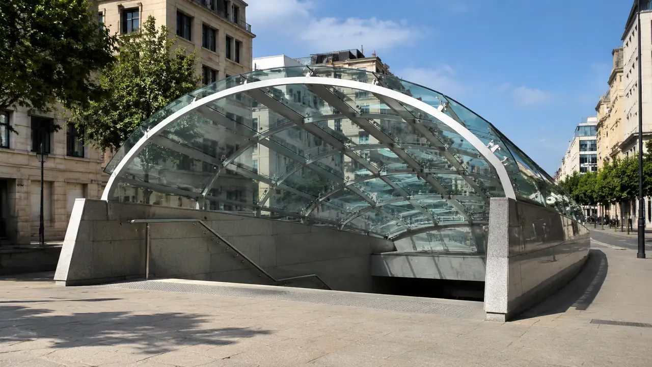
For a station job, the site is the surface around the entrance, not the station box. Start with the footprint of the existing entrance and the street it opens onto, then add the blocks people walk through to reach it. A station with no surrounds is a plan drawing; a station with three hundred metres of neighbourhood is a place where access and frontage can be discussed. That distinction decides the boundary before anything is generated, and it is worth settling with the person who will present the scene.
1.2 Drawing a boundary that holds
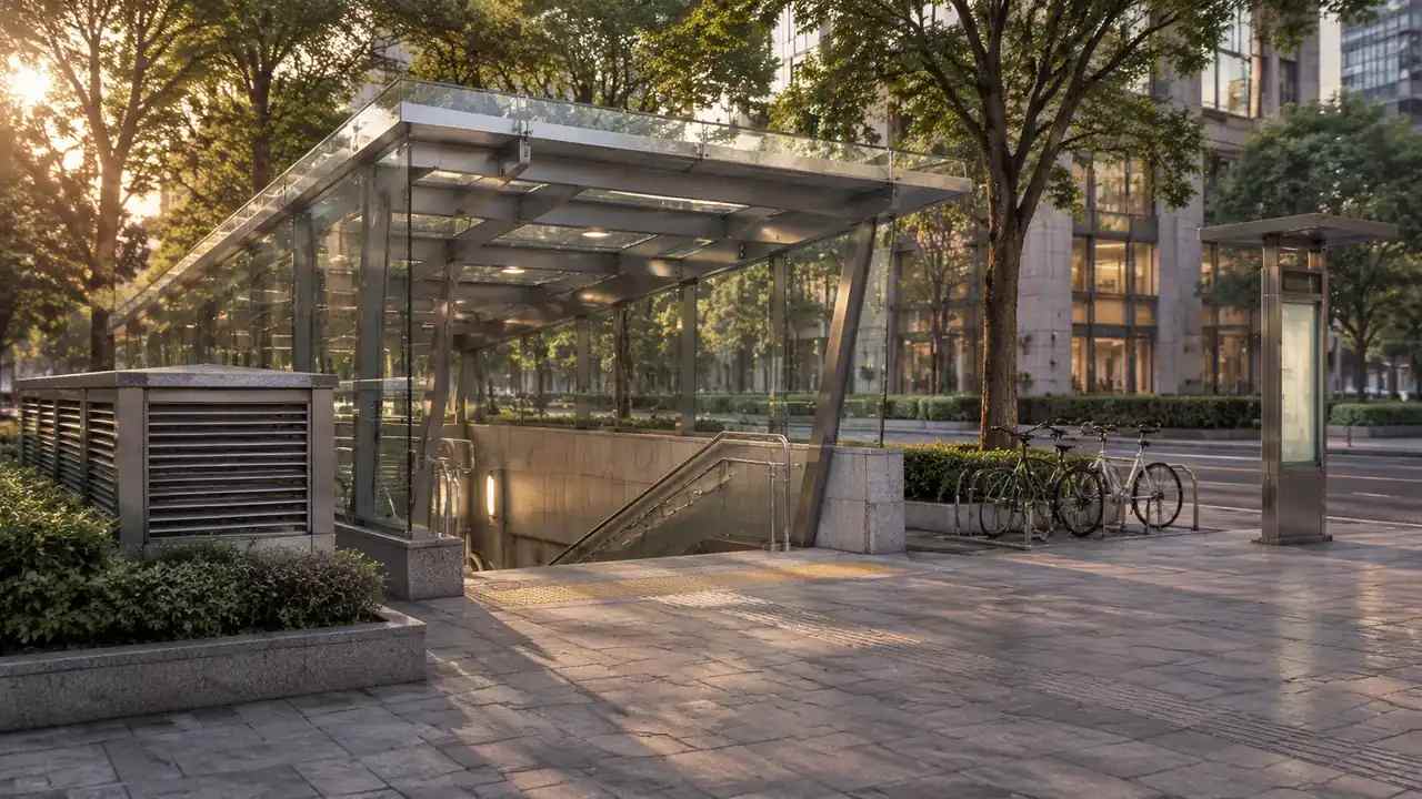
Draw the boundary a street or two beyond your opening guess. Objections at a metro review tend to arrive from the edge of the frame: a school crossing, a bus interchange, a blank wall that makes the walk unpleasant. A tight boundary removes those from the conversation. Keep the selection roughly square rather than following the line of the street, so the scene reads as a neighbourhood rather than a strip, and avoid long thin selections that thin the detail and load slowly.
2 What the opening scene holds
2.1 Ground, streets and building masses
The scene arrives with terrain from the mapped surface, streets as part of that surface, building masses with footprints from map data and estimated heights, and vegetation inferred from imagery. That set is the starting material for a site discussion. Heights are estimates, so a six storey block may read as five. Say so before anyone quotes a height from the screen, and correct the two or three buildings closest to the entrance, since a quick pass through the buildings the audience knows turns a generic scene into one they recognise.
2.2 The station mass, if the map carries one
Where the map data carries the station footprint, a mass appears with an estimated height. It marks the entrance in the street, gives the surrounding blocks something to relate to, and says nothing about what is inside or below. Platforms, concourses, escalators and tunnels have no representation at all. Treat the mass as a marker rather than a building, treat the rest of the station as design work that arrives in its own model, and name that gap in the opening minutes before someone reads it as an omission.
3 Reading the site before any design
3.1 Entrances and the street frontage
The frontage question is the one a starting scene answers quickly: how the entrance meets the pavement, what stands opposite, how far the nearest crossing sits. In the generated scene you can see all three without tracing a plan. Steps, ramps, canopies and signage are not modelled, so the entrance reads as a volume. For a conversation about visibility that is enough and for a conversation about accessibility it is not, so if the entrance has moved since the imagery, correct the mass and say so.
3.2 Neighbours and the levels between them
Neighbouring buildings carry estimated heights, and the ground carries the levels the map describes. Together they show whether the station sits above or below the street it serves, which is often the point somebody is trying to make with a section drawing. Correct the buildings that frame the entrance, since those shape the impression most. A block corrected to its real height is worth more in the room than a wider extent with nothing fixed, and the uncorrected ones should stay flagged.
4 Where the metro system stays out
4.1 Tracks, tunnels, platforms and trains
Tracks, tunnels, platforms, trains, signalling and fare equipment are not generated, and the platform does not attempt them. They are design and equipment items that come from the operator and its engineers. Organisations such as UITP publish material on how station and system planning is organised, and that work sits with the design team. Saying this at the opening of a session prevents a long search for a platform that was never in the file, and keeping the system conversation in a separate window keeps the boundary clear.
4.2 The station model arrives downstream
The station model is placed against the generated ground in a 3D tool, a BIM application or a GIS, usually as a separate file with its own version. The scene supplies the street, the levels and the neighbours, and the model supplies the station. When the two meet, check the entrance position against the mass in the scene. A station model set half a block off will make every frontage view wrong, and it is easier to fix at import than in front of an audience.
5 Starting again or extending the study
5.1 Correcting the base before it is shared
Fix the obvious errors before the scene leaves your desk. A demolished building, a new block, a closed entrance, a street pedestrianised since the imagery: each is a quick edit and each changes how the site reads. Note every change, because the scene will not tell the next reader which masses are original. A short list of corrections, dated against the imagery, does more for trust than a polished camera move, since a street that changed last year is the one people will ask about.
5.2 A second station in the same study
If the study covers more than one station, generate each as its own scene rather than stretching one boundary along the line. Separate scenes keep the detail consistent and let each station be discussed in its own street. Name them in the order the line runs, and keep the same camera height across the set. A set that shares its framing reads as one study, a set that does not reads as four unrelated pictures, so keep the numbering in the file names rather than just in the slides.
Open the GenAnywhere app and start a station site
6 Before the site leaves the platform
6.1 Extent, naming and the imagery date
Write the extent down before export: the streets at each edge, the imagery date, the buildings you corrected. A name built from the station and the area survives being forwarded; a name built from a date does not. If the review later needs a wider view, generate a second scene instead of rebuilding the one you have. The two files can sit side by side in the same folder without confusing anyone who opens them, especially if the note states the imagery date.
6.2 The station elements that are missing
List what the file does not hold: the station structure, platforms, tunnels, escalators, canopies, signage, street furniture and the trains. Each belongs to a design team, an operator or a supplier. The list stops a realistic image from being read as a station design and tells the receiving team what to prepare. Keep it with the export rather than in an email thread, name an owner for every line, and write unknown rather than leaving a line blank.
6.3 Export and an opening check in the receiving tool
Preview the scene and export a GLB, in which terrain, streets, buildings, vegetation and your edits travel, while the receiving application decides how they arrive. Open it once in that application before the meeting, check the scale against a building you know, and note what had to be adjusted. If the import fails, fix it now rather than in the room. The platform overview describes the generated content, and the licence allows permanent commercial use with limits on resale and model training.
7 FAQ
FAQ-1 What does generation mean for a metro station?
It means the site, not the station. The platform generates terrain, streets, building masses and vegetation from map data, and where a station footprint exists it appears as one of those masses. Platforms, tunnels, tracks and systems are outside the generated set. Read the scene as the surface setting a station sits in, bring the station design as a separate model from the team that owns it, and treat it as a setting rather than a substitute.
FAQ-2 Can I generate a whole metro line?
Not in one scene. A line drawn across a single wide selection loses the block detail that makes each station readable, so the work is split into station scenes with a consistent frame. Each scene holds one station and its surroundings. The alignment between them belongs to the line design, the track geometry is not generated at all, and numbering the scenes along the line keeps the set in order.
FAQ-3 The station is underground, so what shows?
The entrance, the ground around it, and the buildings above and beside it. An underground station with a surface entrance may appear as a small mass or not at all, depending on the map data. That is a boundary of the method rather than a fault in the scene. For anything below the surface, the design model and the section drawing are the documents to use, and the scene stays useful for everything above ground.
FAQ-4 What comes out at the end?
A previewable 3D scene and an exported GLB with terrain, streets, buildings, vegetation and your corrections. The station design, the platforms and the street furniture are not in it. Test the file in the receiving tool, note the extent and the imagery date, and keep the scene so the next review starts from the same base instead of a new selection. Formats vary with the application that opens it, so confirm the import before the review does.
See how a station site moves into a design workflow
Content and technical notes
This article was prepared by the GenAnywhere team with AI-assisted drafting and human review.
Product features, formats, and availability change as the platform evolves; refer to the official GenAnywhere website for current details.
For technical questions or corrections, contact support@genanywhere.com.
Last reviewed: 2026-11-13.