
Terminal GIS: can teams compare layouts in GenAnywhere?
Comparing terminal schemes by walking them, not by staring at two plan sets
Two terminal layouts can look equally reasonable on paper and feel completely different in use. One puts security at the center of the journey, the other at the edge. One gives arriving passengers a short walk to baggage, the other sends them through the retail spine. A 3D scene makes those differences visible before the design freezes. GenAnywhere builds the terminal and its apron from a map selection, so a layout comparison starts from the same context.

1 What layout comparison needs from a terminal view
1.1 The passenger path as the unit of comparison
The useful unit is not the square meter. It is the path a passenger walks from curb to gate, and from gate to curb. That path crosses the check-in hall, security, the retail area, and the pier. Each crossing is a decision about where the building puts its effort.
When two schemes are modeled in the same scene, the paths can be compared at eye level. The comparison is qualitative, and it is the one most operators actually make when they choose between options.
A path has a beginning that passengers remember, which is the curb and the walk from parking. It also has an end that shapes satisfaction, which is baggage claim and the exit. Comparing schemes by their paths pulls those two ends into the same conversation.
1.2 Where the building meets the apron
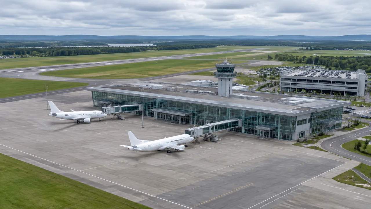
The landside and the airside meet along a line that is easy to draw and hard to get right. Gates need space for boarding, aircraft need room to maneuver, and the building needs a service route that does not cross the passenger flow. A plan shows the line. A scene shows the depth on both sides.
That depth is where layout schemes differ. A pier that looks efficient in plan can crowd the apron, and a wide apron can push the walk to the gate beyond what passengers will accept.
2 Building the terminal scene
2.1 Selecting an area around the terminal and apron
Select an area that includes the terminal, the apron, the landside roads, and the nearest parking. A boundary at the building edge hides the constraints that shape the layout. In GenAnywhere, the selection generates an editable model with the existing buildings, terrain, and vegetation in place.
Look at the apron before changing anything. The existing aircraft stands, service roads, and fuel positions are part of the problem, and a scheme that ignores them is not comparable.
The apron is also where the airport's own rules live: stand allocation, service roads, and fuel access. None of that is in the model, and the team should bring it to the session as a checklist.
2.2 Blocking out two layout schemes
Build each scheme from simple blocks: a check-in hall, a security zone, a retail spine, piers, and gate boxes. GenAnywhere lets you replace a building, move or rotate it, and change its height and type, so a scheme can be adjusted during a workshop without a modeling session.
Keep the two schemes in separate files with identical viewpoints. The comparison works when the camera and the context are the same. Otherwise the meeting debates the view instead of the layout.
3 Comparing schemes in the scene
3.1 Walking the departure path
Start at the curb and walk to a gate. Count the level changes, the turns, and the places where a passenger has to make a decision. A layout that requires a choice at every junction feels longer than its distance suggests.
Do the same walk in the second scheme from the same starting point. The differences that matter usually appear in the middle of the journey, not at the ends.
Wayfinding matters as much as distance. A passenger who can see the security hall from the entrance walks with more confidence than one who follows signs around a corner. The scene shows what is visible from where, which is a question plans answer poorly.
3.2 Reading the airside edge
Stand at a gate and look out. The aircraft stand, the service road, and the next pier are all in view. A scheme that puts a service route across the boarding area will show up here, and so will a pier that leaves no room for a wide-body.
The scene will not tell you whether the stand meets a certification standard. It will show whether the pieces fit together at the scale they will be built.
Wide-body stands are the usual stress test. If the pier leaves room for one, it will handle smaller aircraft with ease. If it does not, the scheme's growth path is closed.
4 Where the scene stops
4.1 Capacity, queues, and systems
Passenger forecasts, queue modeling, baggage system design, and security technology sit outside the scene. A layout can look spacious and still fail under a peak-hour load. The scene shows the space, not the throughput.
Treat capacity as a separate study. The scene's job is to make sure that study is asked about the right geometry.
Queues behave differently from space. A hall sized for an average hour can fail in the peak, and a hall sized for the peak can feel empty the rest of the day. That is a question for the queue model, not for the scene.
4.2 Presenting a comparison without overclaiming
Describe the schemes as massing comparisons. Say that the interior is blocked out and that the systems are not modeled. When an operator asks which scheme is better, the answer is that the scene shows the spatial consequences and the studies show the rest.
That restraint keeps the comparison credible. A team that claims too much in the room loses the argument when the numbers arrive.
Keep a written record of what the comparison covered. A later reviewer will want to know which scheme was compared against which assumptions, and the note takes a few minutes to write.
5 Handing the comparison to design and GIS teams
5.1 Exporting GLB into GIS and design tools
GenAnywhere exports a general GLB that opens in Unreal Engine, Unity, Blender, Revit, Rhino, SketchUp, ArcGIS Pro, and similar tools. A GIS team can place the terminal in its wider context, and a design team can use the massing as a starting point.
The export carries geometry and context, not attribute data. If a scheme needs asset records or operational layers, those come from the GIS side and should be joined in the tool that owns them.
5.2 Running a joint review
Bring the airport operator, the airline representatives, and the design team into one session. The operator sees the passenger path, the airline sees the stand and the gate, and the designer sees the building. A shared scene keeps the three conversations in the same room.
Agree on a decision rule before the session. If the group is choosing between two schemes, say what would make one preferable. Otherwise the meeting produces a list of observations and no direction.
Fix the viewpoints and keep the session short. The goal is a decision about the layout direction, not a review of the design.
6 Where this fits
6.1 Teams that benefit
Terminal planners, airport GIS teams, and consultants preparing an options report get value from a shared scene. So do operators who need to explain a layout change to airlines and tenants.
Airline station managers are another audience. They see the gate and the stand every day, and their objections tend to be about the parts of the layout that passengers never notice. Their view is worth having before the scheme hardens.
6.2 When a plan drawing is enough
If the schemes differ just in room sizes, a plan is faster. A scene earns its place when the differences involve height, walking distance, apron depth, or the relationship between landside and airside.
6.3 A short checklist
Confirm the terminal footprint, the apron, and the landside roads. Decide which two schemes you are comparing. Fix the viewpoints and note what is blocked out. Then build both schemes at the same level of detail.
You can build a comparison at the GenAnywhere app and see how scenes move into GIS and design tools on the workflow pages. For city model standards, OGC CityGML documents a context that a site scene does not replace.
7 FAQ
FAQ-1 Does the scene include interior layouts?
It includes the massing of the halls, piers, and gate areas, not the interior fit-out. Rooms, counters, and security lanes are not modeled. Use the scene to compare how the spaces relate, then move the interior question into a design tool. That split also keeps the comparison from turning into a design review.
FAQ-2 Can it compare two terminal schemes?
Yes, if both are built at the same scale with the same viewpoints. Separate files work better than one crowded scene, and switching between them is faster than rebuilding. Keep a note of what each scheme includes so the comparison stays fair, and record the differences before the files move on.
FAQ-3 Does it connect to GIS data?
The scene is built from map data and exports as a general GLB. It does not carry your GIS attribute tables. Teams that need asset records join them in their GIS environment after the export, where the data model and the update process already live. Join on a stable identifier such as the stand number.
FAQ-4 Can security screening be modeled?
The space for screening can be blocked out, and the path through it can be walked. The equipment, the queue, and the process are not modeled. Treat the screening area as a spatial allowance and let the security planners size it. The allowance is usually the part security planners want to revisit.
Content and technical notes
This article was prepared by the GenAnywhere team with AI-assisted drafting and human review.
Product features, formats, and availability change as the platform evolves; refer to the official GenAnywhere website for current details.
For technical questions or corrections, contact support@genanywhere.com.
Last reviewed: 2026-11-13.