
Urban planning for transit sites: what to check with GenAnywhere
A station-area checklist for massing, access and the walks that decide whether a transit site works.
A transit site is judged by the walk, not the parcel. The station may sit on the plot, but the value of the site depends on how people reach it, how they change between modes and how the streets around it feel at seven in the morning. A map-derived 3D scene helps a team check those relationships before the scheme is fixed.
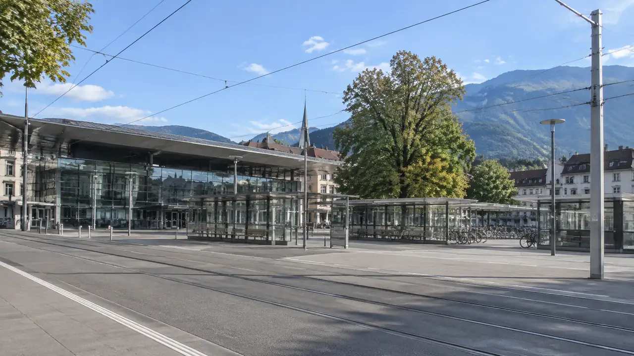
1 Begin with the station
1.1 What makes a transit site different?
The catchment is the product. A housing site sells homes; a transit site sells access, and the scheme has to protect the routes that produce it.
The station also has its own geometry: platforms, entrances, vent shafts, bus stands and taxi pick-up. These elements are fixed or expensive to move, and a proposal that ignores them creates problems no façade can solve.
Finally, the site has two audiences. Passengers pass through, residents stay, and the scheme has to work for both without letting one crowd out the other.
1.2 Which catchment matters?
Measure the walk, not the radius. A five-minute walk on a direct pavement is a different catchment from a five-minute walk that crosses two signalised junctions.
Look at the barriers: a rail line, a river, a arterial road. They cut a circle into a shape, and the shape is what the site actually serves.
Check the destinations at the other end. A station beside a school, a hospital or a retail street has a different pattern of use from one in a field, even at the same distance. The Institute for Transportation and Development Policy publishes guidance on station-area access that pairs well with a site model.
2 Map the access network
2.1 What does the scene show around a station?
GenAnywhere builds an editable site model from a drawn map area, with buildings, terrain, water and vegetation on separate layers. Around a station, that base carries the streets, the bridge, the embankment and the front row of blocks, which are the elements that shape access.
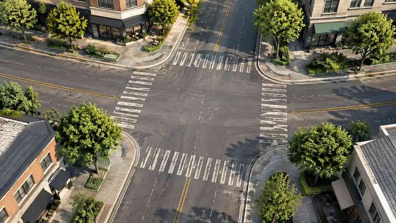
The scene shows geometry, not movement. It can tell you that a pavement is narrow or that a route climbs, but not how many people use it or how long they wait at a crossing.
Use it to ask better questions of the transport data. A model that shows a missing link makes the pedestrian count worth commissioning.
2.2 Which routes should be tested?
Test the route from each platform exit to the nearest destination, not just the main entrance. Stations often have a back door that serves half the catchment, and proposals tend to forget it.
Test the crossing points. A route that saves two minutes but crosses a fast road will not be used by families, whatever the drawing says.
Test the route in the rain. A covered walk and an open one serve different catchments, and the difference is visible in the scene once the building edges are in place.
3 Test the interchange
3.1 How do the modes meet?
Look at the distance between the train exit and the bus stand, and between the bus stand and the bike parking. A change that takes four minutes on foot feels like a different journey from one that takes one.
Look at the level changes. A flight of stairs between modes excludes people, and a ramp that is technically present but out of the way does the same.
Note the waiting space. A bus interchange with no shelter is a different offer from one with a canopy, and the difference shows in how the ground is used.
Test the signs. A passenger who cannot see the bus stand from the train exit will take the wrong route, and the fix may be a sightline rather than a sign. The scene shows what is visible from the doorway.
3.2 What about servicing and drop-off?
Check where the delivery vehicles go. A station needs deliveries, and a pedestrianised forecourt that ignores them will be invaded by vans at six in the morning.
Inspect the drop-off. A short stay bay in the wrong place creates a queue on the bus lane, and the queue is visible as a design problem once the lane is drawn.
Check the refuse and maintenance access. These routes are rarely shown in a consultation image and are often the thing that fails in operation.
4 Judge density around transit
4.1 How close is close enough?
Close enough is where the walk is direct and safe. A tower on the station roof and a block two streets away can have the same straight-line distance and very different access.
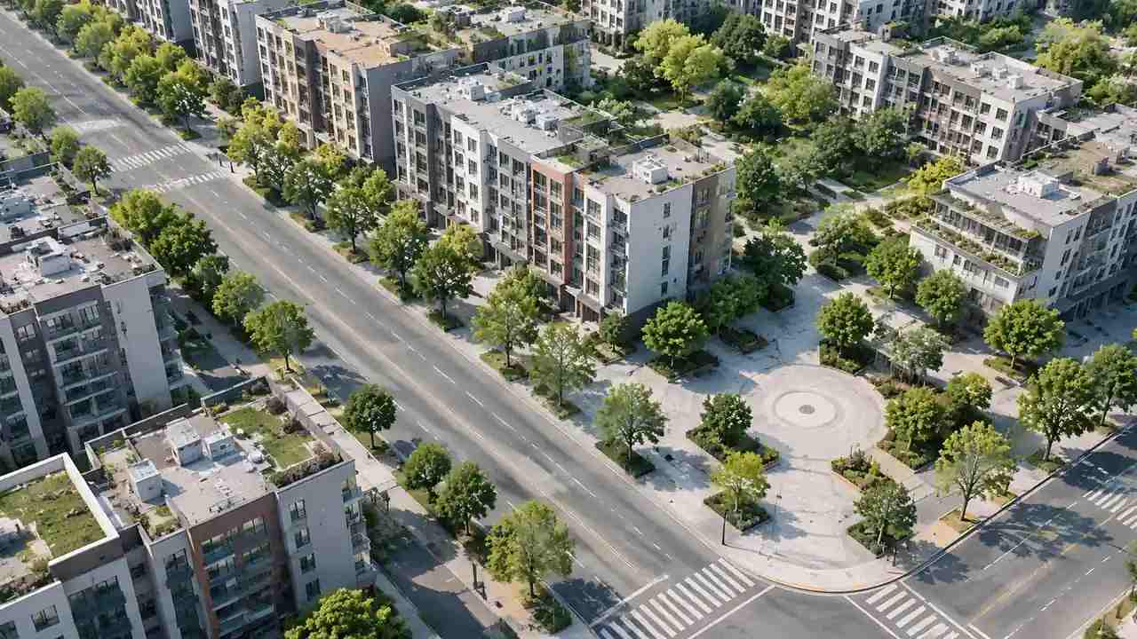
Look at the nearest 400 metres. That is where walking dominates and where the street design matters most. Beyond that, the catchment depends on buses, bikes and the quality of the route.
Do not assume that density alone produces ridership. The route, the fare and the destination set do the work, and the scene shows the physical part.
4.2 What does street level show?
Walk from the platform to the nearest corner. A blank wall, a car park edge or a level change can turn a short walk into an unpleasant one.
Look at the active frontages. A station forecourt with shops and doors feels safer than one with a fence, even when the distance is the same.
Note the evening view. A route that works at noon may be dark and empty at nine, and the lighting and frontage are part of the design.
Test the peak. A forecourt that feels generous at eleven in the morning can be crowded at eight, and the scene should be read with the peak flow in mind. The geometry does not change, but the judgement about width and waiting space does.
GenAnywhere keeps the station surroundings in separate layers, so the team can show the forecourt without the vegetation or the whole station without the new blocks. That makes a peak-hour discussion easier to follow.
5 Carry the scene into the study
5.1 What goes in the access note?
The station entrances tested, the routes measured, the crossings and the level changes. Add the scene date and the imagery date.
Note which routes are proposals and which are existing. A new cut-through is a commitment, not a context feature.
Note the questions the scene raised: a missing crossing, a narrow pavement, a service conflict. These become the brief for the transport work.
The scene can be edited as the design develops. A new entrance, a moved bus stand or a changed kerb line can be tested before the transport study is commissioned, provided the change is labelled as an assumption.
5.2 What needs a transport model?
Volumes, queues, signal timings and mode shift need a transport model, not a 3D scene. A site model can show where those questions arise, but it cannot answer them.
Pedestrian comfort needs observation and counts. A scene can show a narrow pavement; it cannot show how people actually use it at peak.
Accessibility needs an audit against the relevant standard. The scene can flag a level change; the audit decides whether the route complies.
6 Keep the scope honest
6.1 When is a site model not enough?
When the question is a business case. Ridership, revenue and land value depend on data the scene does not hold.
When the station itself is being rebuilt. Platform geometry, track alignment and signalling are engineering questions that need the operator's drawings.
When the site is a transport interchange with complex movements. A static scene cannot represent the timing that makes an interchange work.
6.2 What are the common data gaps?
Missing entrances. A station may have a side entrance that the map does not show, and that entrance changes the catchment.
Missing level changes. Steps, ramps and underpasses are often simplified, and they determine who can use a route.
Missing planned works. A new crossing or a closed street can change the picture, and the imagery date will not tell you about a scheme approved last month.
6.3 When should the team stop?
Stop when the access questions are answered and the remaining issues need traffic or pedestrian modelling.
Stop when the proposal moves to platform or track design, where the operator's geometry takes over.
Stop when the scene is being used to argue about ridership. That is a different study, and the model should not be stretched to cover it.
Draw the station area in the GenAnywhere app and walk the routes before the next access workshop.
7 FAQ
FAQ-1 Does GenAnywhere model transport networks?
No. It models buildings, terrain, water and vegetation from map data. Streets appear as geometry, not as a routed network. Transport modelling needs specialist tools and observed data. Use it to frame the access question, then commission the transport work with the scene as a shared reference. That division keeps both pieces honest.
FAQ-2 Can we show a new station entrance?
Yes, by editing the building or adding a volume at the entrance and exporting the scene. The model shows the physical relationship, not the operational feasibility. The station operator must confirm what can be built. Show the volume in the scene, then check the platform and track constraints with the operator before relying on it.
FAQ-3 How large an area should we model?
Start with the station plus the walks to the nearest destinations, usually a ten-minute radius with the barriers included. Expand when a route or a view runs beyond that edge. Include the barriers that shape the walks, even when they sit outside the station parcel. A rail line or a river changes the catchment more than a radius does.
FAQ-4 Is the model suitable for a business case?
It can illustrate the development concept, not support the ridership or revenue figures. Those need a transport model and a financial appraisal. Keep the scene as a spatial reference and label it as such. Keep the scene in the design appendix and put the ridership and revenue work in the business case.
See how a map area becomes an exported site scene in the GenAnywhere workflow.
Content and technical notes
This article was prepared by the GenAnywhere team with AI-assisted drafting and human review.
Product features, formats, and availability change as the platform evolves; refer to the official GenAnywhere website for current details.
For technical questions or corrections, contact support@genanywhere.com.
Last reviewed: 2026-11-06.