
Urban planning site analysis: where GenAnywhere fits a 3D review
A map-derived site model for the opening review, and the questions it leaves to a survey.
Urban planning site analysis usually starts with drawings, a map viewer and a visit, and each of those answers a different question. A map-derived 3D site model adds a shared spatial base that the whole team can orbit before design work begins. It helps a team agree on what is there; it does not replace a measured survey or a planning determination.
1 Frame the analysis before opening a model
1.1 What decision should the analysis support?
Write the decision at the top of the page. A team asking whether a district can absorb another two thousand homes needs different information from a team asking whether a bus can turn at a junction. The housing question needs block structure, massing and open space; the bus question needs road widths, corner geometry and kerb lines.
One decision per review keeps the work short. When a model is asked to answer five questions, the team studies the easiest one and guesses at the rest.
Use the same words each time the question comes back. A review described as "does the district work" in June and "is the density right" in September has become two projects, and the notes stop matching.
1.2 When does a 3D base help more than drawings?
A 3D base earns its place when the question involves relationships across space: how a tower sits against a terrace, whether a route feels overlooked, or where a new block would cut a view. Drawings describe each parcel well and the space between them poorly.
It also helps when the audience is mixed. Planners read plans, councillors read summaries, and residents read what they can see. A model gives all three the same object to point at, which shortens the argument about what a drawing means.
A model is less useful when the question is legal or numerical. Setbacks, floor area ratios and use classes come from the ordinance and the schedule, and no amount of geometry settles them. The American Planning Association publishes practice guidance on site analysis that is worth reading beside the model.
2 What a map-derived model contains
2.1 Which layers arrive with the scene?
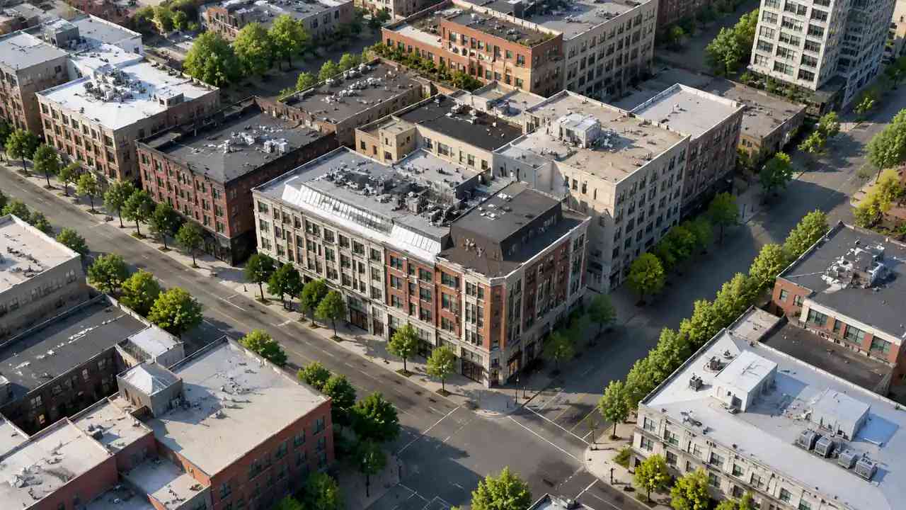
GenAnywhere builds an editable site model from a drawn map area, using satellite and map data. It identifies building footprints, estimates heights, infers building types and reads the surrounding vegetation. Buildings, terrain, water and vegetation arrive as separate layers that can be shown, hidden or edited.

That separation matters for analysis. A team can hide vegetation to study the street wall, or hide buildings to read the ground and the water. The layer list becomes a small checklist of what the scene does and does not represent.
Editing is deliberately simple. A single building can be replaced, moved or rotated, and its height or type can be changed. The site can serve two variants of a proposal before either variant is drawn properly.
2.2 How current is the source imagery?
The scene reflects the imagery the platform held when the area was processed, and that date is not the date the file was generated. Ask what the source shows whenever a recent change matters, such as a new footbridge, a cleared site or a closed street.
For an opening review, a small lag is usually acceptable. For a decision that turns on a change from the last year, the team needs a photograph, a site visit or a survey, and the model should be labelled as background.
Label the date and the source on the working note. A scene that looks convincing without a date invites the room to assume it is current, and that assumption travels into the report.
3 Fit the model to the decision
3.1 Which decisions can the scene support?
Massing studies are the natural fit. A team can test whether a block reads as a wall or a row of separate buildings, whether a corner needs a taller element, and whether a new volume blocks a view from the street. These are judgements about proportion and arrangement, and they survive a rough base.
Route and access questions also work at this stage. A drawn model shows where a service yard meets a street, how a path crosses a slope and where a entrance sits in relation to a junction. The team can walk the route in a viewer before anyone commits to a layout.
Public realm questions are weaker but still useful. A model shows the size and enclosure of a square, not the reason people will use it. Treat the scene as a way to test dimensions and sightlines, and leave behaviour to observation.
3.2 What should stay outside the model?
Keep legal and numerical conclusions out. The model does not decide zoning, permitted height, floor area, parking ratios or land use. Those answers come from the adopted plan and the development code, and the scene can show what a proposal would look like under them.
Keep engineering judgements out as well. Slope, drainage, retaining walls and structural spans need calculations the scene cannot supply. A visible slope is a prompt for an engineer, not a finding.
Finally, keep the model away from claims about how closely the scene matches the ground. The platform estimates heights and infers types, and the output is a general site context. Present it as a visual base with known limits, not as a measurement.
4 Review the scene with the team
4.1 Who should walk the site model?
Invite the people who will disagree. A planner, an urban designer, a transport officer and someone who knows the site will each notice a different error. Add a resident or a ward representative when the question affects a neighbourhood.
Four to six people is enough for an opening session. A larger room turns the review into a presentation, and the quiet people stop testing the scene.
Give each person one question to answer. The transport officer checks turning and access, the designer checks massing, and the resident checks whether the place is recognisable. Split attention produces better notes than a general discussion.
4.2 How do you keep the review honest?
Record the scene version beside every comment. A comment about a missing building is useless if nobody knows which generation it refers to.
Ask people to point at the screen. A vague objection becomes a location, and a location can be checked against imagery or a site visit.
End the session by reading the answers aloud. If two people describe the same problem in different words, the note should say so, because that repetition is the signal that survives the next design round.
5 Move from review to design
5.1 What survives into the design file?
The site arrangement survives: footprints, heights, terrain, water and vegetation, organised as layers. GenAnywhere previews the scene and exports a general GLB, and that file becomes a reference for the design team's own tools.
The reference is useful because it carries the awkward parts of a site, not just the hero plot. Service roads, back edges and odd levels are often what a hand-built context misses, and they are what the design has to answer.
Keep the export beside the project file rather than inside it. A separate reference makes it clear which geometry is context and which is proposal.
5.2 What does the team still need to verify?
Verify every dimension that a decision depends on. A street width taken from a generated scene should be checked against a survey, a drawing or a measured photograph before it becomes a design constraint.
Verify tenure and ownership separately. The model shows shapes, not title boundaries, and a site that looks like one parcel may be three.
Verify the planning position with the local authority. The scene can support a conversation about massing and access; it cannot confirm what the plan allows or what a committee will accept.
6 Set the boundaries before the next review
6.1 When is a 3D review the wrong opening step?
Skip the model when the question is a policy interpretation, a title dispute or a numerical test. A 3D scene adds cost and time without touching those answers.
Skip it when the site is changing weekly. A model built on imagery that no longer matches the ground will mislead the room, and a live site visit will be more honest.
Skip it when nobody will look at it. A model produced for a report and never opened is an illustration, and an illustration should not be described as analysis.
6.2 What should the note record?
Record the decision, the scene date, the source imagery date, the people in the room and the comments that changed something. Keep it to one page and store it with the model.
Note what the scene does not show. A list of omissions, from bus shelters to boundary walls, protects the next reader from assuming the model is complete.
Note the next action for each comment. A comment without an owner becomes a complaint in the following meeting.
6.3 When do you rebuild instead of edit?
Rebuild when the question moves to a different area or a different scale. Patching a district model to answer a street-level question leaves the team working at the wrong resolution.
Rebuild when the source imagery is out of date for the decision. Editing individual buildings cannot fix a base that no longer matches the site.
Rebuild when the layer structure has been lost. If buildings, terrain and vegetation have been merged into one mesh, the scene has stopped being an analysis tool and become a picture.
Draw the area in the GenAnywhere app and open the review with one question on the page.
7 FAQ
FAQ-1 Does GenAnywhere replace a site survey?
No. It builds a site model from map data for visual context, with estimated heights and inferred building types. A survey measures what is on the ground and carries a professional responsibility the platform does not claim. Use the model to frame questions, then commission a survey for the dimensions a decision depends on. For a planning review, that usually means a topographic survey and a measured building survey, depending on the question.
FAQ-2 Can the model show zoning or land use?
It can show buildings, terrain, water and vegetation, not the legal boundaries of a zoning district. A team can colour or annotate the scene in its own tools, but the adopted plan remains the source. Do not present a generated scene as evidence of what a site is zoned for. If the review needs the legal layer, ask the local authority for the adopted map and the relevant schedule.
FAQ-3 How large an area should we draw?
Draw the site plus the streets and blocks that shape it. A district review may need a ten-minute walk in every direction; a single junction needs less. Start with the decision, draw the smallest area that shows its consequences, and expand when a sightline or a route runs off the edge. Write the drawn boundary and the imagery date into the note so the next review can compare like with like.
FAQ-4 What format comes out?
A general GLB carrying buildings, terrain, water and vegetation on separate layers, previewed before download. It opens in common 3D, BIM and GIS tools, and the receiving team should check scale and units on import. The export is a reference, not a replacement for the design file. If the receiving tool needs a different format, convert the GLB and check the result against the scene before use.
See how a drawn area becomes an exported scene in the GenAnywhere workflow.
Content and technical notes
This article was prepared by the GenAnywhere team with AI-assisted drafting and human review.
Product features, formats, and availability change as the platform evolves; refer to the official GenAnywhere website for current details.
For technical questions or corrections, contact support@genanywhere.com.
Last reviewed: 2026-11-06.