
VR game terrain: how GenAnywhere builds slopes and water
What a generated ground surface gives a VR blockout, and where the checks have to land before a level gets built.
GenAnywhere builds slopes from the elevation data behind a mapped area and keeps water on a separate layer, so a hillside and a riverbank arrive as editable geometry instead of a flat plane. Both are context for a blockout, not a hydrological study. Take the ground as a starting surface, then check gradient, scale and water level against the site before anyone walks it in a headset.

1 Where the generated ground comes from
1.1 What elevation data sits behind a generated slope?
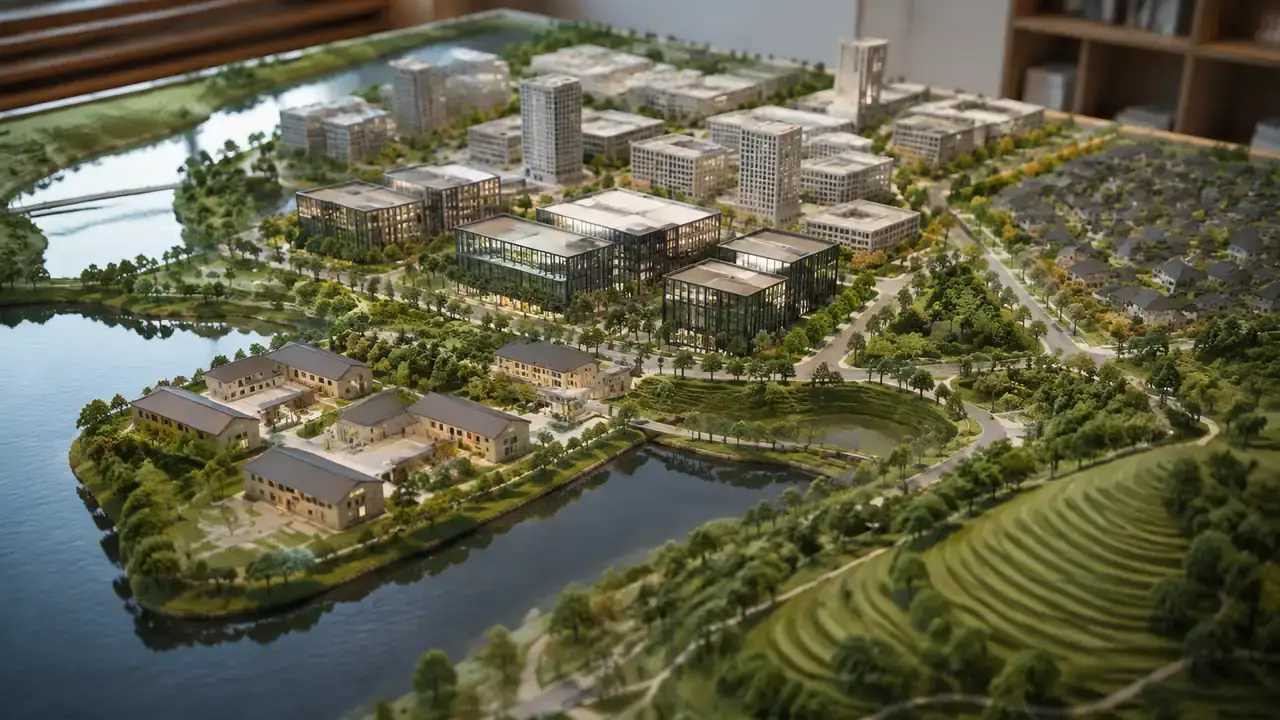
The input is a boundary drawn on the map. GenAnywhere reads the elevation and map data available for that area and runs AI 3D generation over it, producing a continuous ground surface matched to the buildings it places. Slopes therefore follow the broad shape of the real place: a rise behind a row of houses, a dip where a road crosses a stream, the long fall toward a shoreline. Terrain, buildings, water and vegetation stay on separate layers.
Read the result the way you read a topographic sketch rather than a levelling sheet. The overall form is usually good enough to decide where a path climbs and where a terrace sits. Heights are estimated, so a difference of a metre or two is normal, and that margin is enough to change how a ramp meets a doorway.
1.2 Why does the same slope feel different in a headset?
A player's eye sits at human height, roughly 1.6 to 1.8 metres above the surface, so a bank that looks mild in plan view becomes a wall of ground at close range. Walk the scene at eye height before approving any route across it.
Scale errors make this worse. Terrain imported in the wrong unit arrives as a pancake or as a mountain, and neither reads as the site the team discussed last week. Check one known distance, such as a building frontage, against the model before judging a gradient at all.
2 Water as a separate layer
2.1 How is water represented in the model?
Water bodies are generated on their own layer, so a river, a lake or a shoreline can be isolated while the ground stays visible. That separation earns its keep during design reviews, when a team wants to argue about a bank without a water surface hiding the terrain behind it. The surface follows mapped water features, and its level is estimated from the data behind the map.
Treat the plane as a reference for the conversation rather than a level to build against. A jetty, a slipway or a ford each depends on a figure that a flat surface cannot supply, and the designer who needs that figure should be told where to find it.
Separating themes has a long record in spatial data. The OGC CityGML standard treats terrain, water bodies and vegetation as distinct parts of a city model, which is the same reasoning a game team applies when it wants a riverbank readable without the water surface in the way.
2.2 What does a water layer leave out?
Depth, flow, flood extent and seasonal change are all missing. Those numbers come from hydrology and from the authority that keeps the river or coastal records, and no generated surface replaces them. A lake in the scene is a plane at an estimated level, and a plane cannot say where a bank will erode or how far a spring flood reached.
The gap matters most at the edges. Ask what happens to the water line in a wet month, then write the answer beside the layer so a level designer does not treat the plane as fixed ground.
3 Editing ground before it reaches VR
3.1 Which terrain changes are safe inside the scene?
Terrain matching follows the buildings placed on it, so a structure can be moved, rotated or given a new height and the ground adjusts around it. Replacing a single building is a matter of selecting it and trying another, and the result can be previewed before export. This is the cheap stage for decisions about where a mass sits on a slope.
Keep those edits reversible while the question is still open. Two variants of a hillside take a few minutes to compare in the source scene, and a day to unpick once an engine scene has been built around one of them.
3.2 How do you check a slope against the real site?
Pick three points you can find on both sides: a road junction, a doorway, a bridge abutment. Compare each one in the scene and write the difference down in plain numbers. Three points will not validate a hillside, yet they catch the two failures that matter early: a flipped axis and a unit error.
Then walk the route players will take, not the one the drawing shows. The path people use in practice often crosses a retaining wall or a fence line that the map does not carry, and a headset makes that detour obvious within a few steps.
4 Slopes and the person walking them
4.1 Why does gradient matter more in VR?
Comfort, mostly. Continuous motion over uneven ground is one of the harder experiences to endure in a headset, and a slope exaggerates it because the horizon tilts while the body stays still. A gentle grade along a main route gives the player something to read without testing their stomach.
Grade also shapes level design. A hill can hide a view, force a switchback or mark the edge of a district. Decide which of those you want before smoothing anything flat, since a levelled site gives none of them back.
4.2 Where should terrain interrupt a walkable route?
Steps, ramps, retaining walls and planted banks all slow a player down, and each costs geometry and comfort in return. A route that climbs without a break is tiring to walk and hard to pace, so give it a landing, a platform or a short descent that resets the rhythm.
Interruptions should carry meaning as well. A wall at the top of a slope tells the player they have arrived somewhere, while ground that rises for no reason reads as unfinished terrain.
Read the contours before placing anything. A path that crosses them at an angle feels like a traverse, while one that climbs straight up the fall line feels like a staircase. Neither is wrong, and the choice is easier to test in a headset than to argue about in a meeting.
5 What travels into an engine
5.1 What comes with the terrain in an export?
The general GLB carries the terrain surface as geometry alongside the buildings and water, with layer names a receiving team can read. Scale and origin travel with it, so check both straight after import, because a scene at the wrong size is a scene nobody can review. The file does not become an engine terrain, add collision or supply a water shader, and that work belongs to the level team.
5.2 Which terrain work belongs downstream?
Most of it. Splitting the surface into tiles, reducing the mesh, painting material blends, adding collision and scripting water behaviour are engine tasks, and each depends on what the target headset and the target scene size will carry. Leave room for that work in the plan, because it is rarely a single afternoon.
Hand the blockout to whoever owns the level and agree what the surface is for: layout, sightlines or a background vista. That answer decides how much of the original ground survives the build.

6 Keep the ground in proportion
6.1 When is generated terrain enough to start?
When the question is about arrangement. If the team needs to know where a path should climb, where a viewpoint sits or how a building meets a bank, a generated surface answers it with caveats attached. Mark the parts that came from generated data, and note in the file that heights are estimated.
Ask a blunter question as well: would a wrong answer here be expensive? A layout mistake costs a redesign of a blockout. A level mistake costs an argument about whether the ground is right, and that one is harder to settle once the level is under construction.
6.2 When does the team need a survey?
As soon as a decision depends on a level: a threshold, a flood line, a ramp gradient that has to meet a standard. A surveyor or an engineer should own that figure. The scene then holds their findings, and the terrain can be adjusted to match once the numbers arrive.
6.3 How should terrain revisions be tracked?
Keep one scene per site and record what changed: boundary, imagery date, buildings replaced, heights edited. A short note beside the file is enough. When a revision arrives, the older scene still explains why a decision was made, which is often the harder thing to recover.
Draw the site in the GenAnywhere app and walk the slope at eye height before the next review.
7 FAQ
FAQ-1 Does the GLB keep terrain and water as separate parts?
Check it after import rather than assuming. Layers are separate inside the platform, and the export is a general GLB that different tools read in different ways. Look for named objects in the imported hierarchy and rename them if the importer has merged everything into one mesh. Compare the water plane against the terrain edge at the same time, since that junction is where a merge error shows.
FAQ-2 What if the site has no mapped water at all?
Then the scene shows ground and buildings without a surface, and the design has to work from records instead. Small streams, drainage channels and seasonal ponds are often missing from map data, so collect local knowledge before the layout is fixed. Where water matters to the game, commission the survey or drop a labelled placeholder into the engine scene and treat it as a question for an engineer.
FAQ-3 Can the terrain change after the export?
Yes, at the source. Edits made in the platform are exported as a new file, and the old one keeps its value as a record of what the team reviewed. Re-export rather than hand-editing the file, because hand edits are the ones that go missing in a shared folder. Tell the team downstream which version the level is built on.
FAQ-4 Do we need a headset to review terrain?
Not for the opening pass. A desktop preview settles questions about layout, sightlines and where a path climbs, and it lets more people look at the same time. The headset earns its place when eye height or comfort decides the answer. One device and one honest reviewer are enough to start.
See how a drawn area becomes an exported file in the GenAnywhere workflow overview.
Content and technical notes
This article was prepared by the GenAnywhere team with AI-assisted drafting and human review.
Product features, formats, and availability change as the platform evolves; refer to the official GenAnywhere website for current details.
For technical questions or corrections, contact support@genanywhere.com.
Last reviewed: 2026-11-06.