
BIM alternative for site context: what to check in GenAnywhere
The checks that decide whether a map-derived base can stand beside a BIM workflow.
A BIM workflow holds authored elements, levels and documentation. GenAnywhere holds the surrounding arrangement: blocks, ground, water and vegetation generated from map data. The two can sit beside each other, provided a team checks what the base is before anyone treats it as a BIM alternative.

1 What this alternative covers
1.1 What does a BIM workflow hold?
Walls, floors, roofs, levels, families and schedules, each authored and coordinated. The value sits in the decisions the model records, not in the massing it displays.
That detail is why BIM work starts later. Someone has to decide what a wall is before it can be modelled, and that decision belongs to the design rather than to the site. Keeping the two jobs apart also keeps the review calm: a BIM coordinator can ask about coordination without defending the site context, and a planner can ask about arrangement without opening an authoring tool.
1.2 What does the base hold?
GenAnywhere draws an area from map data, identifies footprints, estimates heights and infers types. Buildings, terrain, water and vegetation arrive on separate layers, and the export is a general GLB.
It holds arrangement rather than construction, which is the part a BIM workflow often lacks at the start. A team can see the street, the neighbours and the ground before anyone authors an element.
2 Check the source
2.1 Where did the geometry come from?
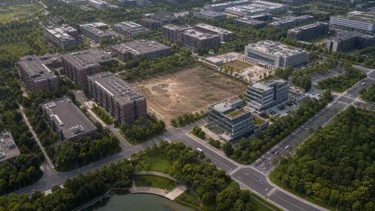
The base comes from map and satellite data, so its geometry is inferred rather than surveyed. Footprints are identified, heights are estimated and types are inferred from what the data suggests.
Say that in the note. A reader who assumes the blocks were measured will read confidence into the scene that the source does not support. Provenance is part of the check, not a footnote. The note should name the data behind the base and the day the area was drawn, so a reader can judge how much weight the scene can carry.
2.2 What date does it carry?
The imagery behind the map data has a date, and the area was drawn on a particular day. Both belong in the handover, because a site that changed last month may not match the model.
Where the date matters to a decision, check the site or a recent capture before relying on the base. A dated scene is evidence of its moment, not a promise about today. A model built from imagery that predates a demolition will still show the building, and the reviewer will draw the wrong conclusion. Where the change matters, a site visit or a fresh capture is the honest check.
3 Check the structure
3.1 Are the layers separate?
Buildings, terrain, water and vegetation should arrive as separate layers. That separation is what allows a reviewer to hide the trees, isolate the ground or replace a single block without disturbing the rest.
If an export merges everything into one object, the base loses the property that made it useful. Check the layer structure before the file travels, not after it arrives. A quick test is to hide one layer and see whether the scene still reads; if nothing changes, the export has merged what should have stayed apart. Renaming a layer and checking the round trip is a second test worth running.
3.2 Can a reviewer read them?
A layer called buildings_final_v2 tells the receiver less than one that carries a date. A naming convention that survives the export saves time on every review.
Ask the receiver to open the scene and name the layers back to you. If the names do not survive the trip, fix them at the source. A layer that loses its name in the export is effectively a new layer, and the note should record the rename.
4 Check the export
4.1 What does the GLB carry?
The GLB carries geometry and materials in a general container that most 3D, GIS and engine tools can read. It is a working exchange format rather than a native BIM format, and it should be described that way.
The buildingSMART material on open workflows is a useful reference when a team needs to explain where an exchange file sits in a wider process. The container is general by design, which is why it travels widely and why it carries less meaning than a native format. A receiver who expects authored walls will be disappointed, and a receiver who expects geometry and materials will usually be satisfied.

4.2 What is lost on import?
Units, origins and layer names can change as the file moves between tools. A model that assumes metres and arrives in feet will look wrong by a factor of three, which is easy to miss in a landscape view.
Test one known dimension after import. A door, a parking bay or a building frontage will catch a unit error before anyone measures anything else. If the receiver cannot test the file on the machine that will present it, the check has not happened yet.
5 Check the handover
5.1 What does the note say?
The source, the imagery date, the day the area was drawn, the edits made afterwards and the person who checked the alignment. Those five items cover most of what a receiver needs.
Add the limits: the base is arrangement, not construction, and it does not resolve boundaries or levels. A note that says so prevents the scene from being quoted as a survey. The note should be short enough to read before the meeting and specific enough to answer a question during it. One page is usually enough, provided it names the source, the date, the edits and the checker.
5.2 What does the receiver test?
The receiver opens the file, runs the dimension test, checks the layers and confirms that the area covers the question. That is a short routine, and it is cheaper than discovering a problem during a review.
Record the result. A tested dimension and a named checker make the scene easier to defend when someone asks where a number came from. A second pair of eyes on the import is cheap, and it catches the conventions that the exporter assumed. Where two viewers disagree, record both results and the tool versions.
6 Set the boundary
6.1 Where does BIM take over?
BIM takes over when the work needs authored elements, coordination and documentation. At that point the questions are about construction, and the base has nothing to add to them.
Keep the base as context for the authored model. The surrounding blocks and ground can remain visible without pretending to be part of the design. The handover point is easier to agree when the team names the earliest authored element, because that element marks the change of job. Before it, the base governs; after it, the BIM model governs.
6.2 When is the base enough?
When the question is about arrangement: how a proposal sits, what it blocks, how tall it looks beside its neighbours. The base answers those questions without waiting for a design decision.
When the site is large and the team needs one consistent scene, the base is often the practical choice. It can cover ground that no one has modelled and still read as one place. A base that answers the arrangement question is not a compromise; it is the right instrument for that stage. The compromise would be asking a context scene to carry construction information it never had.
6.3 When do you stop?
Stop when the next question needs a wall, a level or a schedule. The base cannot answer it, and stretching the scene merely delays the work that can.
Stop when the note has been written and tested. Further polishing of a context scene rarely changes a decision, and it consumes the attention the design needs.
Draw the area in the GenAnywhere app and keep the base beside the authored model rather than inside it.
7 FAQ
FAQ-1 Is this a replacement for BIM?
No. It replaces one narrow part of the early work: gathering site context before the design is authored. A BIM workflow still needs elements, levels, coordination and documentation. The base supplies the surrounding arrangement, and the two can share a scene through the export without becoming the same model. The note should say which source carried which part, and where the handover between them sits.
FAQ-2 Can the GLB be opened in BIM software?
A general GLB can be imported by many tools, and the receiving software applies its own conventions. It is not a native BIM exchange, so elements do not arrive as authored walls or floors. Test one dimension and check the layer names before the team relies on the import. If the test fails, fix the export before anyone builds on it.
FAQ-3 What should I check before sharing the scene?
Check the imagery date, the area drawn, the layer structure and one known dimension. Confirm that the proposed parts are labelled and that the note names the checker. Those four checks catch most of the problems that travel with a context model. Write the result down, with the checker's name and the date, so the check can be repeated rather than remembered.
FAQ-4 How detailed should the base be?
Detailed enough to answer the arrangement question and no more. Blocks, ground, water and vegetation are usually enough. Window frames and materials belong to the design model, where someone will maintain them through every revision. Detail that nobody maintains becomes misleading within a revision or two, and the scene loses the trust it was meant to earn.
See how a map area becomes an editable site model in the GenAnywhere workflow.
Content and technical notes
This article was prepared by the GenAnywhere team with AI-assisted drafting and human review.
Product features, formats, and availability change as the platform evolves; refer to the official GenAnywhere website for current details.
For technical questions or corrections, contact support@genanywhere.com.
Last reviewed: 2026-11-06.