
Model alternative for planning: how teams use GenAnywhere
What a committee can read, what a base can show, and where the visuals stop being evidence.
Planning conversations need a picture the room can read, a proposal it can locate and an honest account of what the picture does not show. A full model is one way to supply that; a generated base is another, cheaper way to get the arrangement into view. The difference matters most when the decision is still open.

1 What planning asks for
1.1 What does the room need?
A picture it can read, a proposal it can locate and an honest account of what the picture does not show. Planning conversations move between those three needs.
The picture has to be recognisable, which is why an aerial view often works better than a plan drawing. A plan is precise and abstract; an aerial view is readable and easy to over-read.
The proposal has to be separable from the setting. If the two look the same, the room cannot tell what exists and what is being asked for.
A room that cannot locate the site will not follow the argument. Orientation is part of the evidence, not a courtesy, and a plan drawing assumes knowledge that an aerial view supplies.
1.2 Where does the base help?
It holds the arrangement around the site: streets, blocks, ground, water and trees. That context is what a proposal is judged against.
It also allows a change to be shown in place. A height, a setback or a new block can be tested without redrawing the surrounding district.
And it keeps a record of what was shown, provided the version is kept. A scene overwritten in place cannot answer a later question. The same convention also allows two schemes to be compared without relearning the picture.
2 Build the base
2.1 How do you draw the area?
Start wider than the site. The next street, the riverbank or the rail line gives the room the context it needs to judge scale.
Include the awkward edges. A boundary that follows a fence is part of the argument, and a careless polygon smooths it away. A margin of one block is usually enough to show what the site is part of.
Decide the level of detail. A district review needs blocks and ground, not window frames, and detail is what makes a scene slow. The layers can be switched off one at a time, which lets the room study the street pattern without the trees.
2.2 What does GenAnywhere generate?
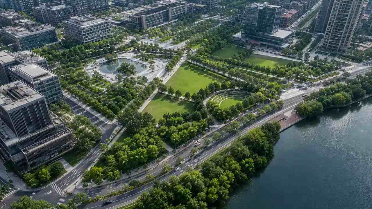
It identifies footprints, estimates heights, infers types and reads vegetation from map data. Buildings, terrain, water and vegetation arrive on separate layers.
A planner can hide the trees, replace a building or change a height without touching a mesh. The scene stays editable as an argument about arrangement.
The export is a general GLB for design, GIS and engine workflows, so the visual and the working model can stay related.
3 Test the massing
3.1 How do you test a proposal?
Place the proposal in the base and look from the viewpoints the decision will be argued from: the street, the opposite bank, the approach road.
Move a block, change a height, remove a storey. The room can see the consequence rather than imagine it.
Keep each option as a separate scene. A single scene edited live leaves nobody sure which version was approved. A change that cannot be seen from the standard view is often the one a neighbour will raise, so test that view before the meeting.
3.2 What should stay fixed?
The camera, the extent and the date should stay fixed while options change. Otherwise the comparison is about the presentation rather than the proposal.
The existing fabric should stay unchanged. A neighbour that moves between options undermines the comparison. A fixed frame also makes an accidental change obvious, and the settings belong in the note.
The labels should stay consistent. A proposal labelled in one scene and unlabelled in another invites confusion.
4 Show the proposal
4.1 How do you separate existing and proposed?
Keep the capture or the map base as existing, and style the proposal differently. Texture for what is there, flat material for what is proposed.
Label the proposed volumes and the illustrative parts. A label is cheaper than a correction later.
Avoid rendering the proposal as a photograph. It will be read as a picture of something that exists. A flat colour is enough, and the difference should be obvious at a glance.
4.2 What about the street view?
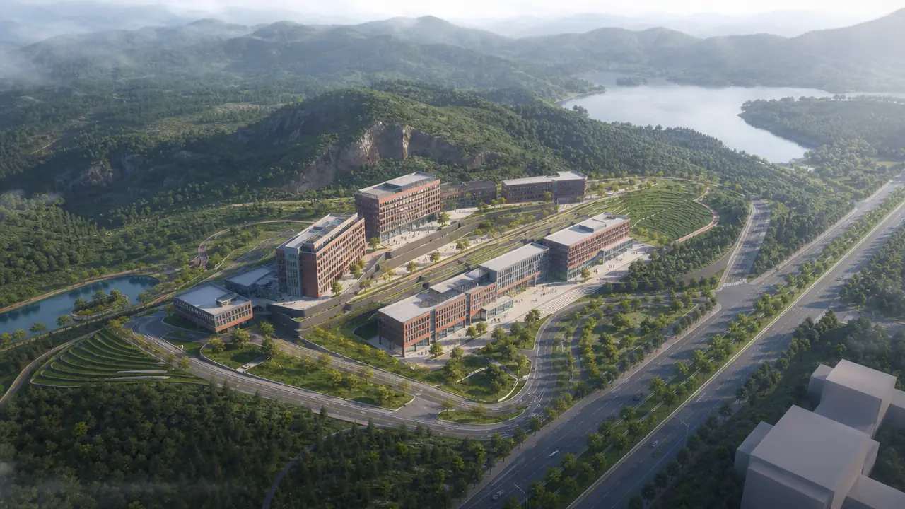
Someone will ask what it looks like from the pavement. A map-derived base can answer the massing part and cannot answer the material part.
Say which part is being answered. A height statement and a façade statement are different claims.
Where the answer depends on a surface, use a capture. Where it depends on arrangement, use the base. Saying which question is answered keeps the conversation on the drawing that can answer the rest.
5 Keep the record
5.1 What do you keep?
The base with its imagery date, the capture with its flight date and the version of the proposal that was shown.
The questions asked and the answers given. A consultation record is useful when the same question returns. The version that was shown matters as much as the version that was approved.
The gaps. A list of what the evidence did not cover protects the team that presented it.
5.2 How do you publish?
Images that show the arrangement clearly and do not imply a certainty the model lacks.
A note that says the visuals are illustrative and that dimensions come from the drawings.
Nothing that presents the base as a survey or a decision. The visual supports a conversation and does not replace the process. Small images also discourage the room from reading detail that is not there.
6 Set limits
6.1 What can this evidence not do?
It cannot determine an application, establish a boundary or certify a height. Those belong to the statutory process and the survey.
It cannot show condition where no capture exists. A plausible mass says nothing about a façade.
It cannot promise that the model matches the site today. Map data lags, and a site that has changed will not be reflected. The pack can still support a decision without pretending to make it.
6.2 When is the base enough?
When the question is about arrangement and the design is still open. A massing study can run on the base alone.
When the site is large and the room needs one consistent scene. A district review rarely needs surface texture.
When the meeting is about where rather than how. The base answers the earlier question well. A base asked to do less is easier to keep current and easier to explain.
6.3 When do you stop?
Stop when the room can answer the question it came with. More views do not make a settled point stronger.
Stop when the pack is longer than the discussion it supports.
Stop when the next question belongs to the design team. Hand over the record rather than stretching it. A short pack that is read is worth more than a long one that is skimmed.
Draw the area in the GenAnywhere app and present it beside the dated record rather than in place of it.
7 FAQ
FAQ-1 Is a GenAnywhere model acceptable as planning evidence?
It is a visual aid for discussing arrangement, not a statutory document. Applications rely on drawings, surveys and the formal process, and the model should be presented as illustrative material. Keep that distinction in the note. The RTPI publishes guidance on plan-making that is useful background when a team is deciding what to present.
FAQ-2 Can I show a proposal inside the base?
Yes, provided the proposal is styled and labelled so it cannot be mistaken for existing fabric. Keep the base and the proposal on separate layers, and keep the files separate for audit. A merged scene is convenient to present and hard to explain later. Name the version that was shown.
FAQ-3 How detailed should the model be?
Detailed enough to answer the arrangement questions the consultation will raise, and no more. Extra detail adds cost and invites questions the visual cannot answer. A model that answers three questions well is more useful than one that tries to answer everything. The aim is a conversation the room can follow.
FAQ-4 What should the visual note say?
That the model is built from map data, that heights are estimates, that any capture has a stated flight date, and that dimensions should be read from the project drawings. Four sentences usually cover it, and they protect both the team and the conversation. A short note travels further than a long one.
See how a map area becomes an editable site model in the GenAnywhere workflow.
Content and technical notes
This article was prepared by the GenAnywhere team with AI-assisted drafting and human review.
Product features, formats, and availability change as the platform evolves; refer to the official GenAnywhere website for current details.
For technical questions or corrections, contact support@genanywhere.com.
Last reviewed: 2026-11-06.