
Urban heritage planning: what GenAnywhere shows and what it cannot
A 3D setting study can show mass, view and context; it cannot decide what a place means.
Heritage planning asks two different questions. One is technical: what is designated, what is recorded and what change is proposed. The other is interpretive: what gives a place its significance and whether a proposal damages it. A map-derived 3D scene can serve the technical side and inform the interpretive one, but it cannot answer the interpretive question on its own.

1 Define the heritage question
1.1 What does a heritage review need?
It needs the record: the designation, the description of special interest, the conservation area appraisal and the historic mapping. It needs the proposal, drawn closely enough to compare.
It also needs a judgement about setting. Setting is not a fixed radius; it is the relationship between a heritage asset and the surroundings that contribute to its significance. The UNESCO Recommendation on the Historic Urban Landscape sets out a widely used framing for that judgement.
Separate those inputs before modelling. A scene can show the relationship; it cannot produce the designation or the statement of significance.
1.2 Where does a 3D scene help?
It helps with mass, silhouette and view. A new block behind a listed terrace may be invisible from the street and dominant from the river, and a scene shows both.
It helps with sequence. The experience of approaching a church through a lane is different from seeing it across a car park, and a walk through the model makes that difference discussable.
It also helps a team avoid obvious errors. A volume that cuts the tower from the market square is a problem that a plan view can hide.
2 Read the setting
2.1 What does the model show about context?
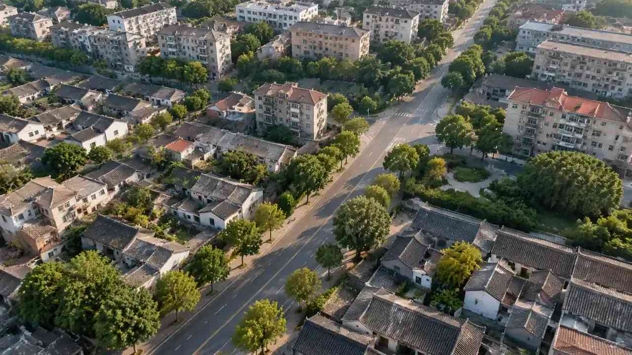
GenAnywhere builds an editable site model from map data, with buildings, terrain, water and vegetation on separate layers. Around a heritage asset, that gives the surrounding roofs, the street pattern and the tree canopy in one scene.
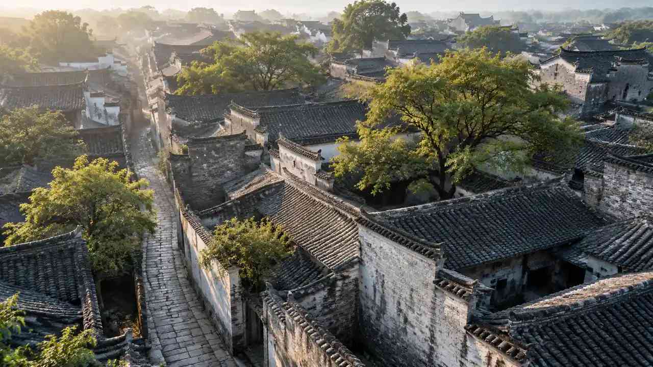
The layers are useful for setting studies. Hide the trees and the roofline changes; hide the modern blocks and the historic street wall appears. Each state is a different reading of the same place.
The model also shows the wider topography. A town on a slope reads differently from one on a plain, and the relationship between the asset and the valley is part of its setting.
2.2 What does it miss?
The model does not carry fabric, material or age. A rendered block and a stone wall can have the same shape and a completely different effect.
Use and sound are absent as well. A market square that is busy at noon is not the same place as an empty yard, and the scene shows neither.
The record is elsewhere. Statutory lists, historic maps and conservation area appraisals carry information the model does not, and they remain the primary evidence.
3 Test change carefully
3.1 How do you test a new volume?
Build the proposal as a simple mass before adding detail. Compare it from the key views: the approach, the square, the bridge and the most affected neighbour.
Then test the mass at the scale of the asset. A new building that is modest beside a tower may still overwhelm a two-storey cottage, and the comparison should use the right neighbour.
Keep the camera and the light constant between the existing and proposed views. A brighter proposal image is not evidence of a brighter place.
3.2 How do you show an absence?
Show what would be lost, not just what would be added. If a view would be blocked, render the view without the proposal and with it, from the same point.
Show the gap in the street wall if a building would be demolished. An empty site is a change, and a scene can make the loss visible.
Show the route that would disappear. A cut-through that closes is a heritage change as much as a façade, because it changes how the place is experienced.
4 Work with conservators
4.1 Who interprets significance?
The conservation officer, the historic buildings adviser and the local amenity society each hold part of the judgement. The model owner holds none of it.
Bring them in early, before the massing is fixed. A conservator who sees the volume at the start can say which view matters; one who sees it at the end can object.
Ask them to mark the views that matter on the scene. A marked camera is more useful than a paragraph about setting.
Keep the same camera and light when comparing the existing and proposed views. A brighter proposal image or a wider lens turns a heritage comparison into a marketing exercise.
4.2 How do you record the view?
Record the camera position, height, direction and date. A heritage view that cannot be reproduced is difficult to defend.
Record what the view shows beyond the proposal: the tree, the roof, the tower. Those are the elements that carry significance, and the note should name them.
Record the reaction of the adviser beside the image. The image shows the change; the note shows whether the change matters.
5 Keep the record
5.1 What belongs in the heritage note?
The asset, the designation, the views tested, the proposal version and the observations. Add the imagery date and any edits made to the context.
Note where the model is approximate. Estimated heights and simplified footprints can affect a setting judgement, and the reader needs to know.
Note the questions the scene cannot answer: fabric, archaeology, setting beyond the modelled area. These belong in the conservation statement.
5.2 What survives the project?
The scene survives as a record of what was tested. The exported GLB can sit beside the conservation statement and the planning application.
GenAnywhere exports the scene with buildings, terrain, water and vegetation on separate layers, which lets the conservation team isolate the roofline or the ground when a view is discussed. The file is a reference, and the statement remains the argument.
The views survive as a comparison set. They are useful at appeal, when the argument returns to what a proposal does to a particular prospect.
The notes survive longest. A model without a note becomes an attractive image with no argument attached.
6 Limits and judgement
6.1 When is a model inappropriate?
When the question is about fabric or archaeology. A massing model says nothing about historic brick, timber or buried deposits.
When the asset is primarily experienced through sound, smell or use. A market hall is not a shape, and a scene cannot represent its life.
When the community has no access to the tool. A paper view and a physical model may serve the room better than a file nobody can open.
6.2 What claims should be avoided?
Avoid saying the model shows the setting. It shows a portion of the setting from chosen views, at a chosen date, with simplified geometry.
Avoid saying a proposal is sympathetic because it matches the roofline. Significance is not a silhouette, and a matching cornice does not settle the effect on a view.
Avoid saying the scene proves no harm. It can show that a view is unaffected; it cannot conclude that significance is preserved.
Keep the distinction between effect and significance in the note. A new block may change a view without damaging significance, and it may preserve a view while harming the setting in another way. The scene records the effect; the assessment records the judgement.
GenAnywhere can show the surrounding roofs and the ground, and the exported GLB lets the conservation team open the same view in its own software. Neither replaces a measured drawing of the asset, and neither should be presented as one.
6.3 When do you commission a measured survey?
Commission one when a decision depends on a dimension, a level or a detail the map does not carry. Heritage projects often turn on a parapet height or a window rhythm.
Commission one when the building will be altered. The design team needs measured drawings, not an estimated shell.
Commission one when the record is disputed. A survey is evidence; a generated scene is context.
A short appendix that lists the views tested, with camera positions and dates, is often the most consulted part of a heritage file. It lets a new officer see what was compared without reopening the model.
Draw the asset and its surroundings in the GenAnywhere app and test the views before the conservation meeting.
7 FAQ
FAQ-1 Can GenAnywhere assess heritage significance?
No. Significance is a judgement based on the designation, the record and expert advice. The platform builds a visual site model from map data, which can support a setting discussion but cannot produce a statement of significance. Use the scene to frame the setting question, then let the conservation adviser answer it in writing.
FAQ-2 Does the model show listed buildings?
It shows buildings as footprints and estimated volumes. It does not carry designation or listing status. The historic record remains the source, and the scene should be labelled as context. Check the designation record before the session, because a listed building can look ordinary in a massing model, and an unlisted one can look historic.
FAQ-3 Can we use the scene in a heritage statement?
Yes, as an illustrative view with its limits stated. Label the imagery date, the estimated heights and the edits. The statement itself needs the designation, the assessment and the expert judgement. Attach the camera positions and the imagery date so the reader can see what was compared, and what was not.
FAQ-4 What if the asset is outside the drawn area?
Draw a wider area that includes the views that matter. Setting often extends beyond the immediate parcel, and a model cut too tight will miss the relationship the assessment depends on. If the asset sits at the edge, redraw the area rather than stretching the existing scene. A stretched scene distorts the relationship you are trying to test.
See how a map area becomes an exported scene in the GenAnywhere workflow.
Content and technical notes
This article was prepared by the GenAnywhere team with AI-assisted drafting and human review.
Product features, formats, and availability change as the platform evolves; refer to the official GenAnywhere website for current details.
For technical questions or corrections, contact support@genanywhere.com.
Last reviewed: 2026-11-06.