GenAnywhere Introduction
1. GenAnywhere Positioning
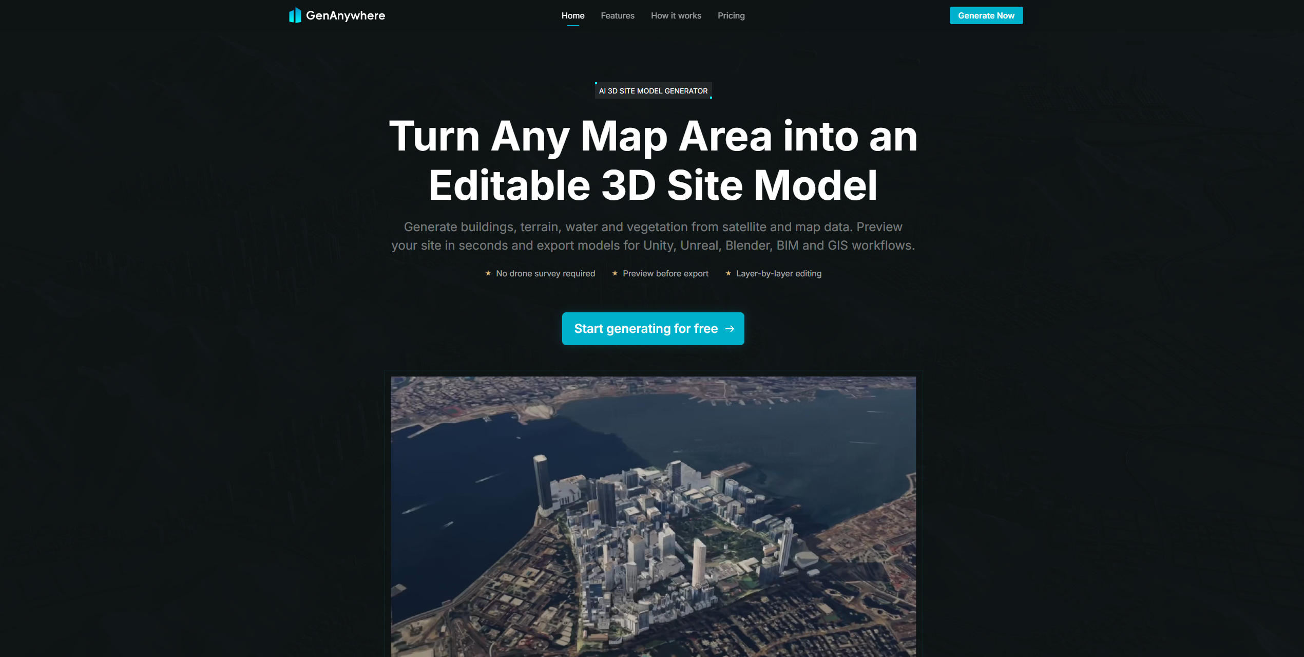
GenAnywhere is a lightweight tool that uses AI to generate 3D site models with just a few clicks on a map, without the need for aerial photography. It efficiently supports BIM modeling and provides a cost-effective alternative to traditional oblique photogrammetry. Simply select an area on the map, and GenAnywhere automatically generates a 3D model containing buildings, terrain, water bodies, trees, and other elements. By combining AI-powered recognition with precise manual editing capabilities, it enables users to quickly transform map data into deliverable 3D models. The generated models can be imported into multiple platforms and are widely applicable to digital twins, GIS, game engines, BIM, and other fields. Even users without professional 3D design experience can quickly build digital representations of real-world environments.
2. Core Features: Say Goodbye to Complex Workflows and Make 3D Design Accessible to Everyone
GenAnywhere combines AI-powered generation with flexible manual editing capabilities. Without mastering complex modeling skills, even ordinary users can quickly produce realistic 3D site models that closely resemble the real world:
2.1 End-to-End AI Building Recognition
Powered by AI technology, GenAnywhere automatically analyzes satellite imagery to accurately identify building footprints, estimate actual building heights, correct spatial positioning, and classify building types. It can also analyze vegetation information across the site, generating corresponding 3D models without requiring manual annotation.
2.2 Complete Site Reconstruction
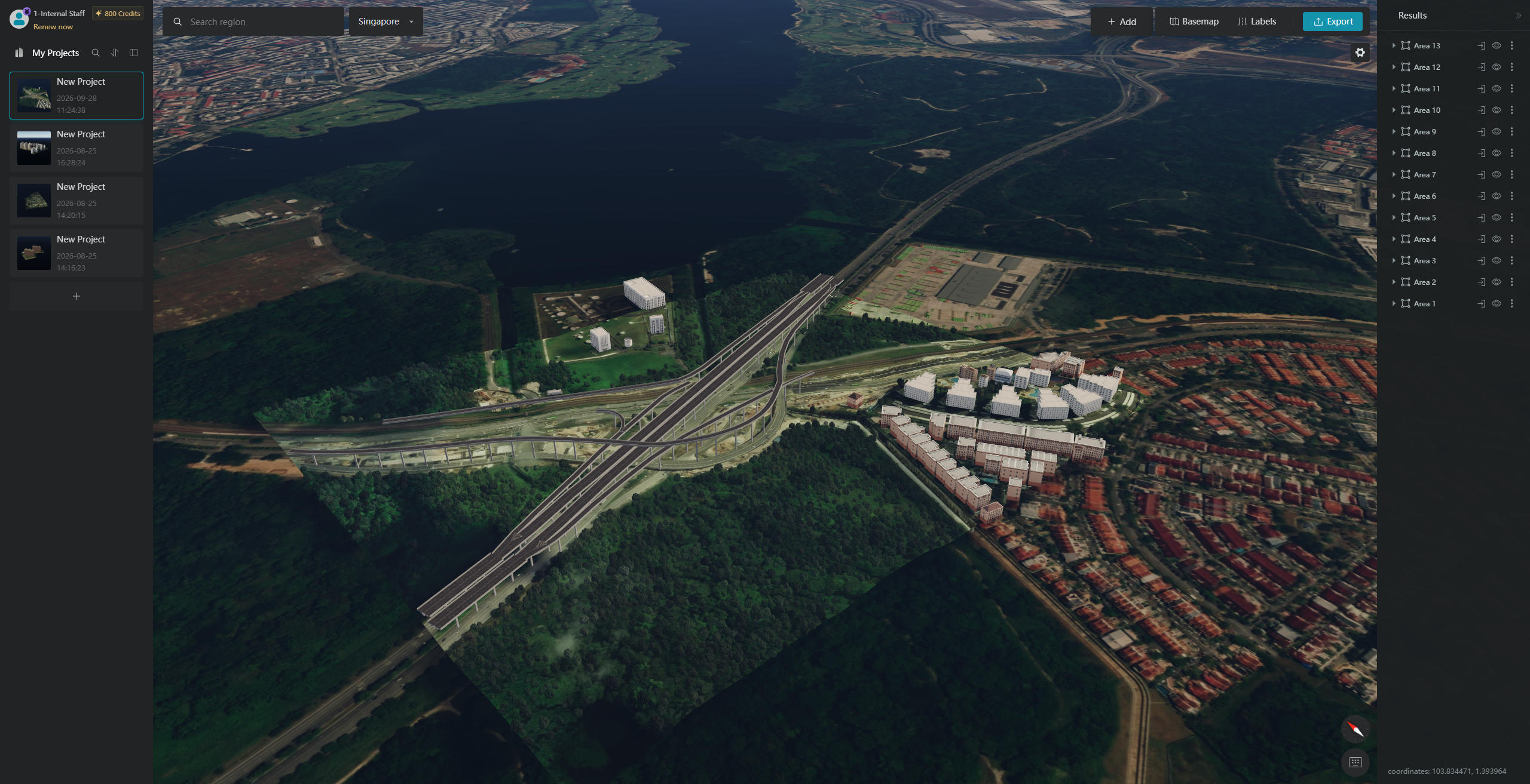
By integrating generated building and vegetation models with terrain data, GenAnywhere reconstructs complete 3D site environments with visual quality comparable to professional oblique photogrammetry. It can also automatically generate realistic water bodies and seamlessly integrate all scene elements with the terrain.
2.3 Comprehensive Manual Editing and Fine-Tuning
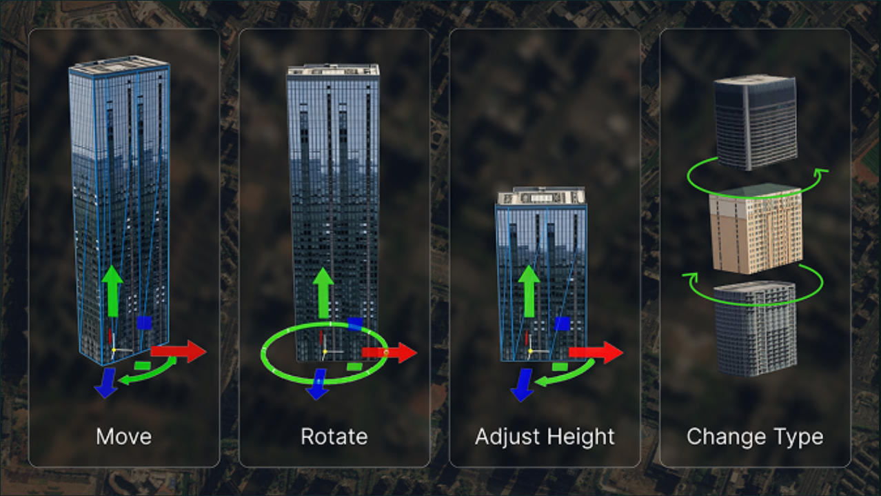
Users can manually adjust all key building parameters, including building type, position, rotation angle, and height, ensuring that the generated models accurately match real-world requirements.
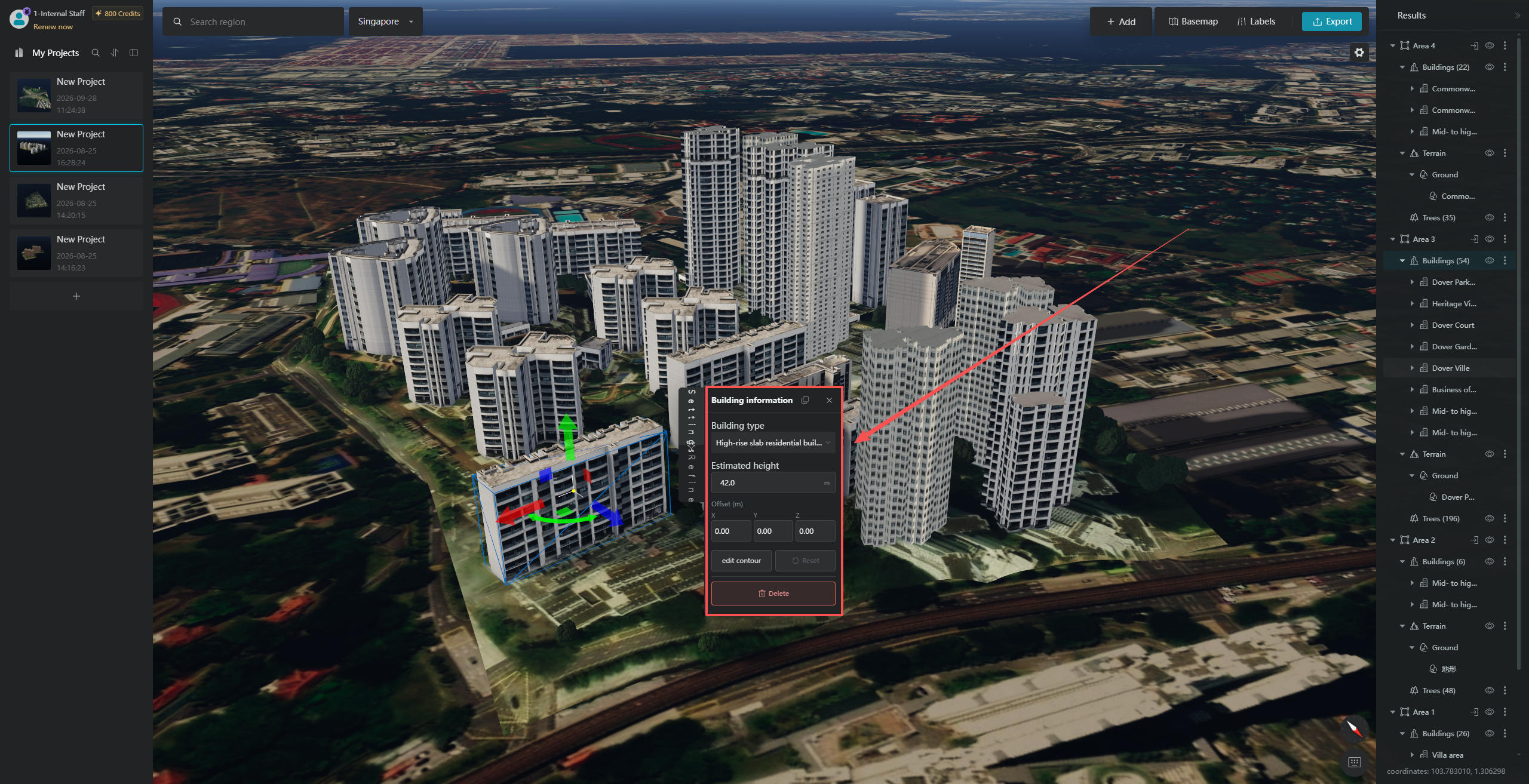
2.4 Independent Layer Management
Using AI algorithms, GenAnywhere identifies and separates buildings, terrain, water bodies, vegetation, and other scene elements into individual layers. Each layer can be independently previewed, exported, and edited, providing extensive customization flexibility.
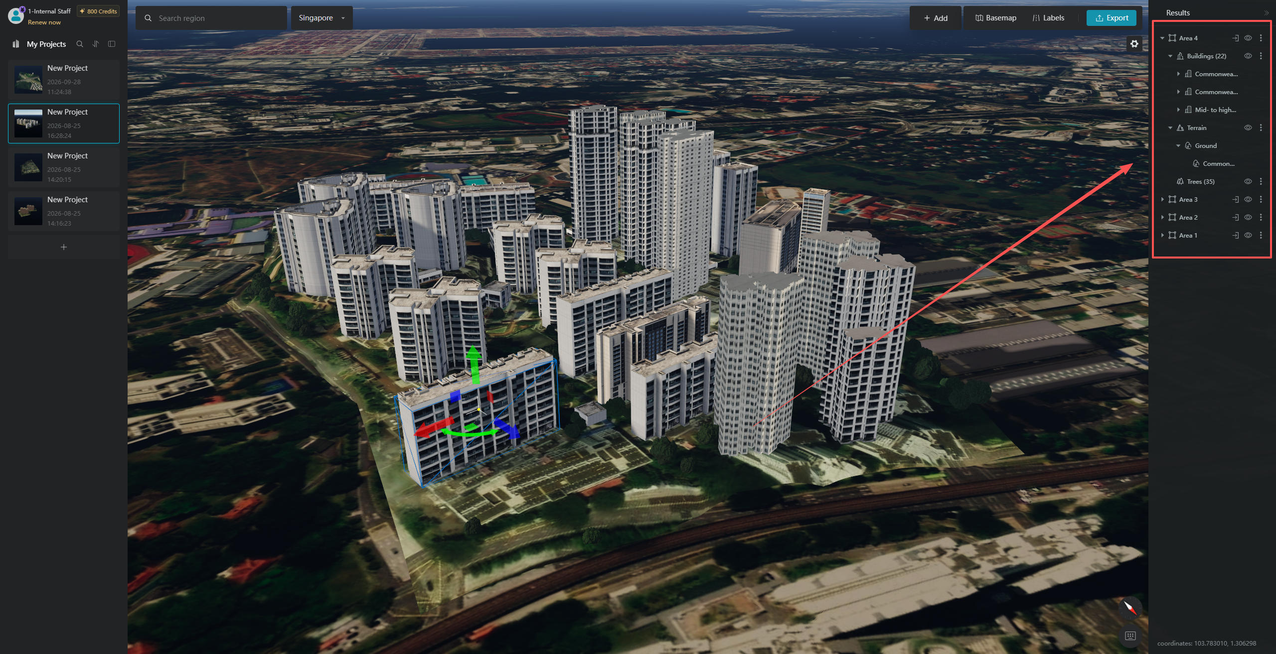
3. Complete Workflow: From Map Navigation to 3D Scene Generation
No professional experience is required. In just a few simple steps, users can transform 2D satellite imagery into detailed 3D building and site models:
Step 1: Quickly Locate Your Target Area
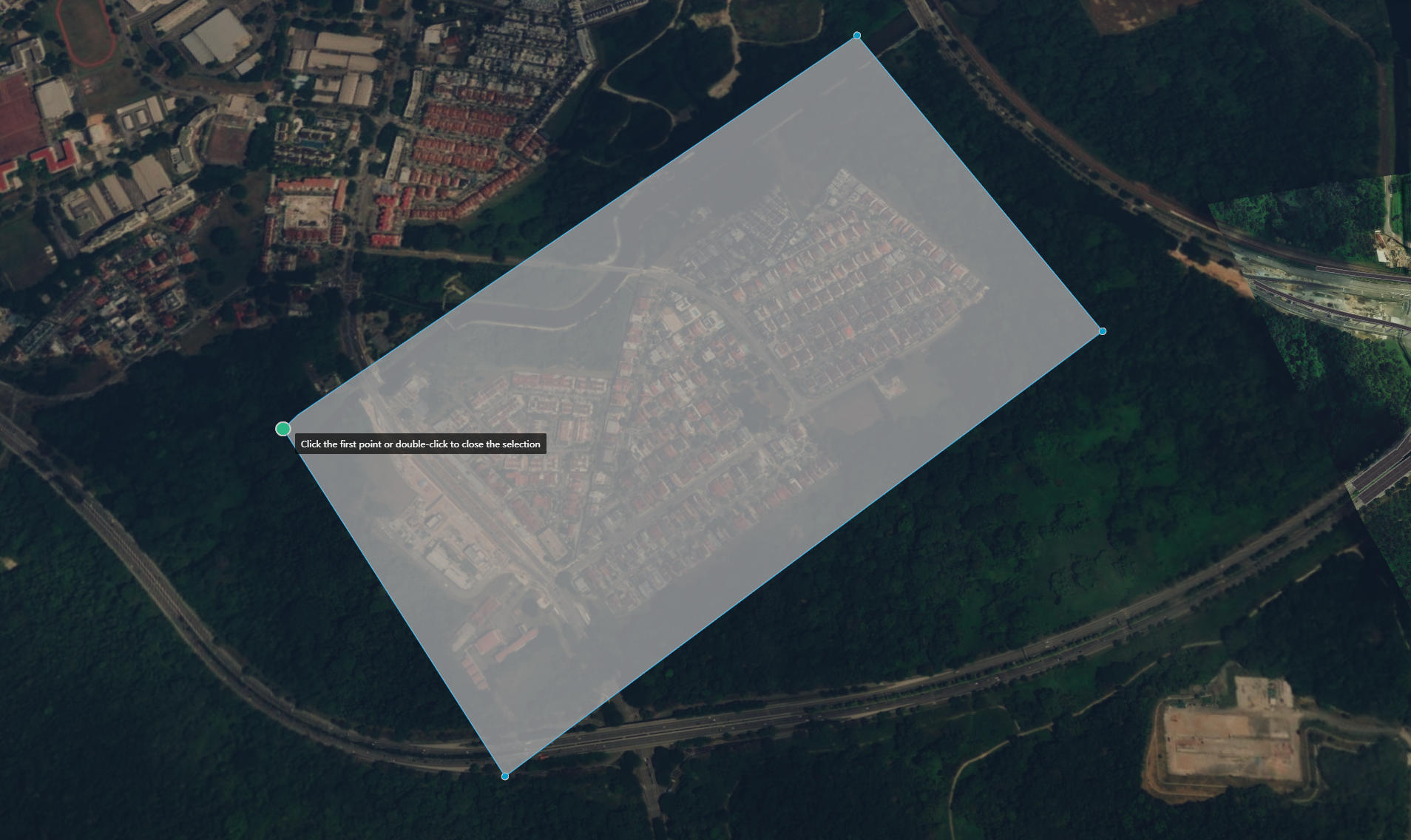
After visiting the GenAnywhere website, click "Generate Buildings for Free" to enter the map workspace:
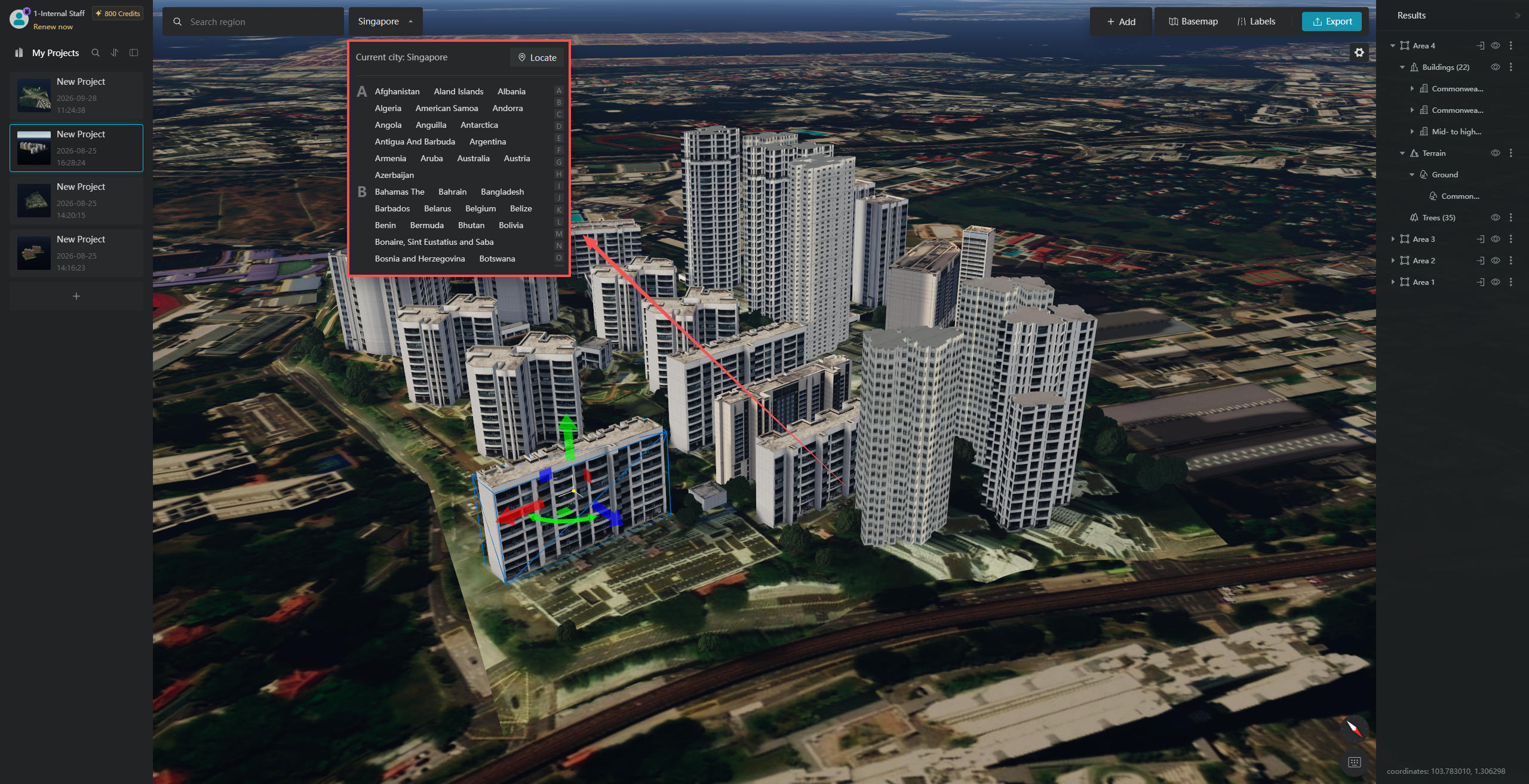
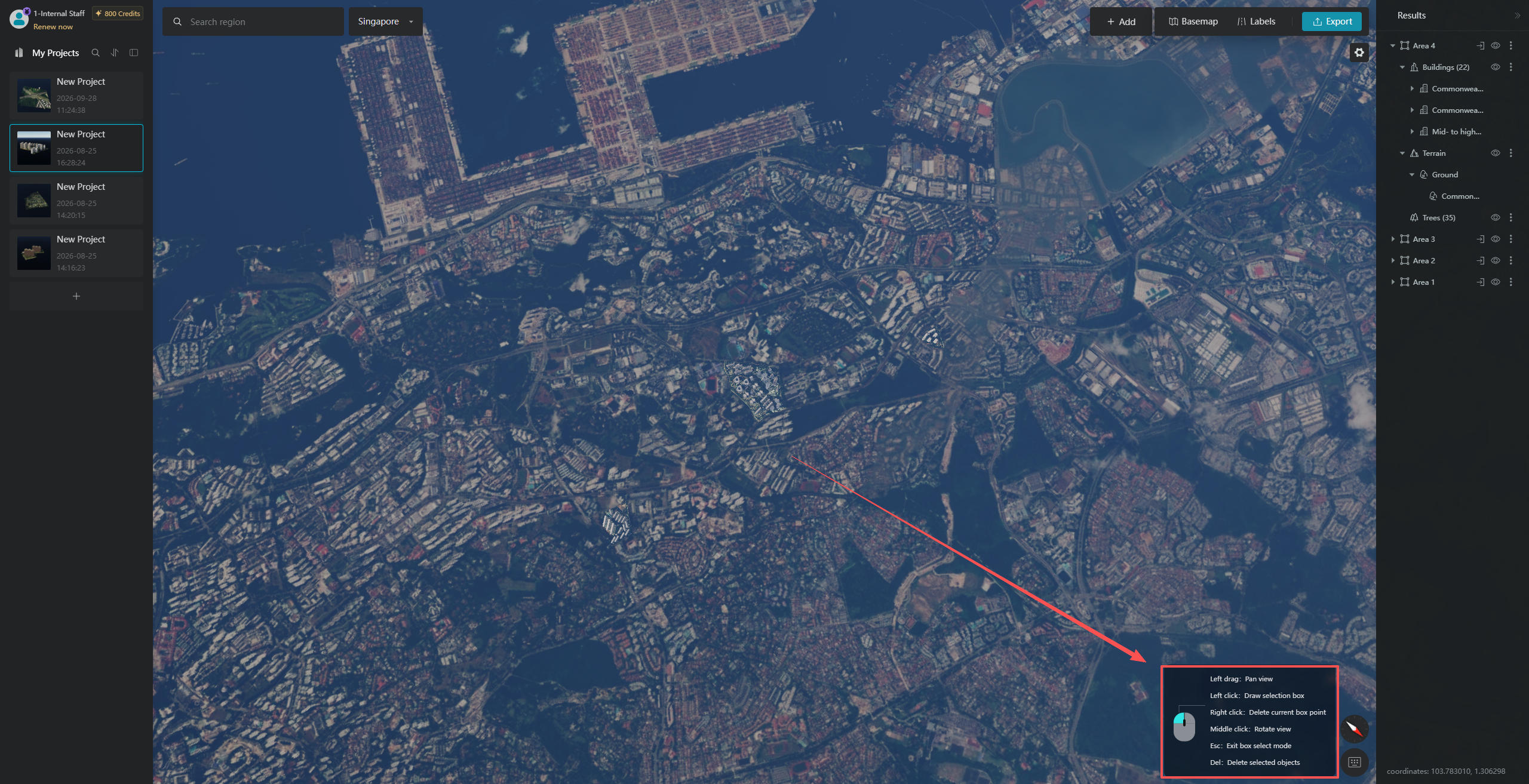
1. When you first open GenAnywhere, the system automatically detects your current location. If you click the "Select City" button at the top and enter your target city in the search box, the map will quickly navigate to the corresponding area.
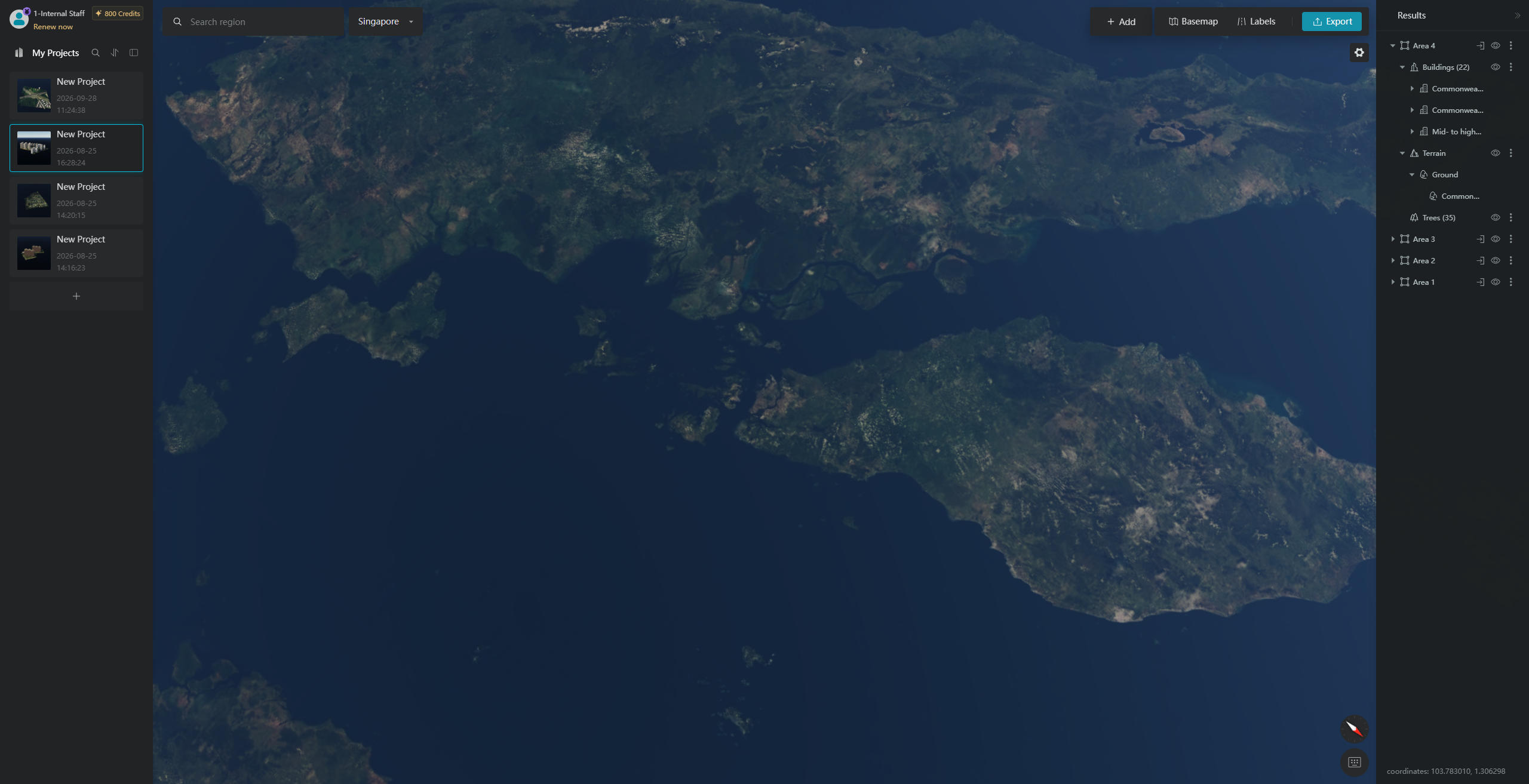
2. GenAnywhere supports free navigation across extensive map data covering most countries and regions worldwide. You can explore your target area by dragging, zooming, and rotating the map from different angles.
3. Use your mouse to freely draw a selection around the target area where you want to generate a 3D scene. For guidance on mouse operations, refer to the "Operation Tips" in the bottom-right corner of the interface.
Step 2: Generate a Complete Site Model with AI in Seconds
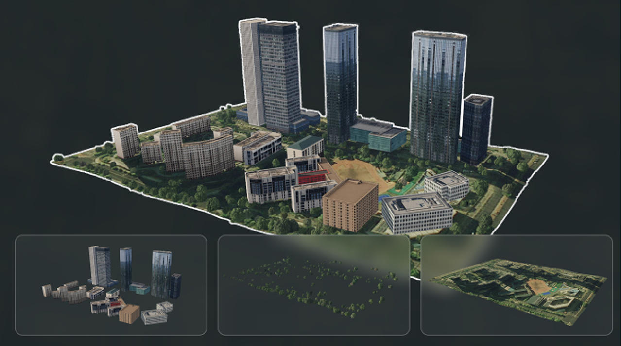
Once you have confirmed your selected area, simply trigger the AI generation process. Powered by GenAnywhere's built-in intelligent algorithms, a complete 3D environment can be generated in seconds:
1. A complete site model can be generated from a single satellite image, combining shadow analysis and perspective-based depth perception to accurately reconstruct real-world site details.
2. Compared with traditional manual modeling, the entire process can be up to thousands of times faster. There is no need to wait for lengthy aerial photography or post-processing, making it an efficient complementary solution to traditional oblique photogrammetry.
3. The system automatically handles the entire generation workflow, from building and vegetation modeling to water body generation and terrain integration, producing a complete initial 3D scene with just one click.
Step 3: Manually Refine and Optimize Scene Details
Once the initial model has been generated, you can customize and refine individual elements to make the scene better match real-world conditions:
1. Manually switch between different building types to match the functional characteristics of buildings within the site.
2. Manually modify building height parameters to correct minor AI recognition inaccuracies.
3. Freely adjust building positions and rotation angles to fine-tune the overall layout and make the scene more accurately reflect reality.
4. Previewing and Delivering Generated Models
Once the model adjustments are complete, you can use the built-in 3D viewer to inspect the results from every angle:
1. Supports freely rotating, zooming, and panning around the 3D scene, allowing you to examine every detail without blind spots.
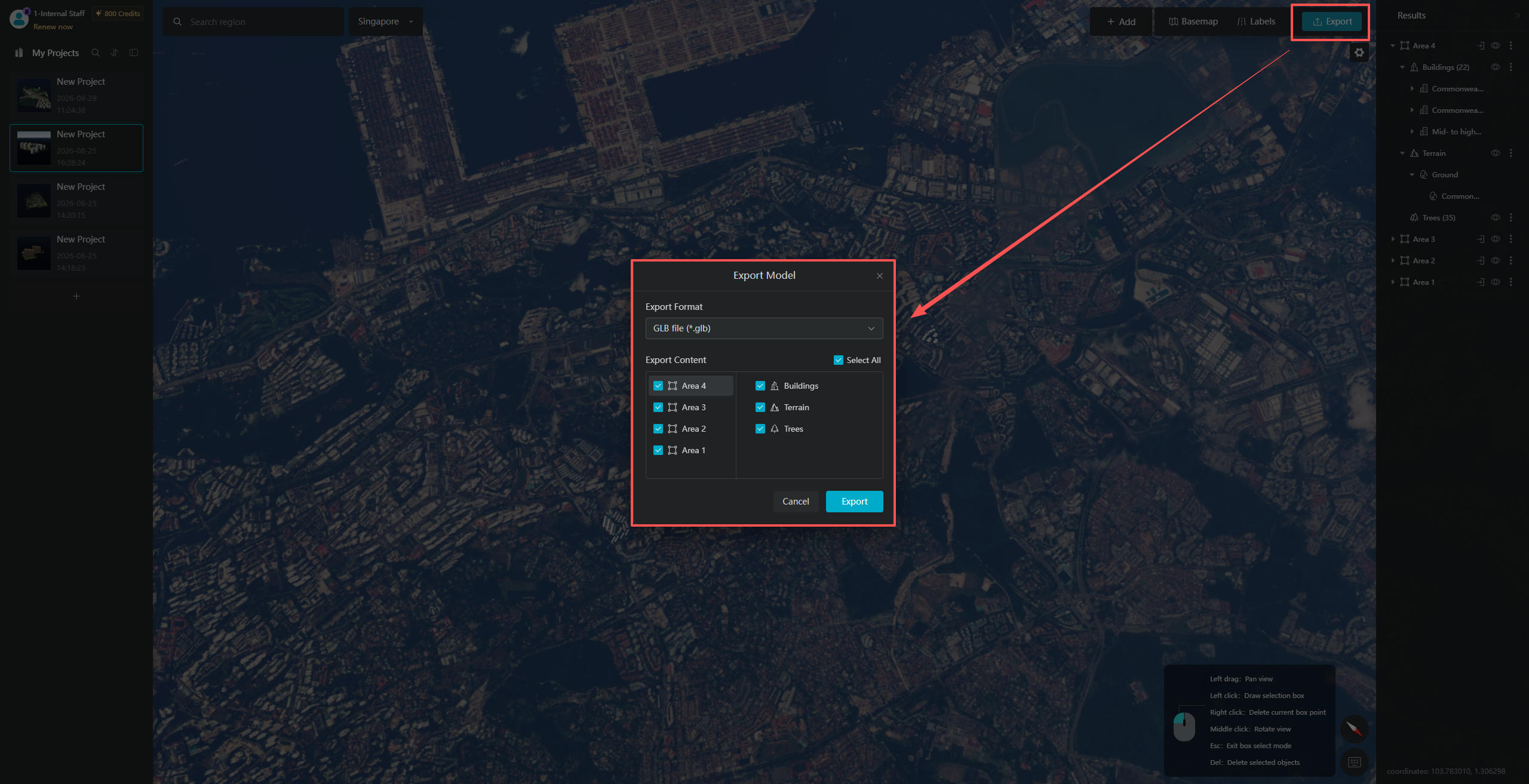
2. Models generated in different batches are automatically organized into independent layers, making it easy to switch between and compare different versions of the scene.
3. Supports exporting models in the universal GLB format. The files feature high compression with no loss of model quality, ensuring smooth transfer and compatibility across different platforms.
5. One-Click Import into Major 3D Platforms and Seamless Workflow Integration
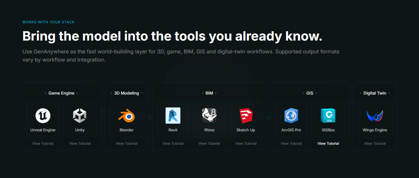
Models generated by GenAnywhere can be seamlessly integrated into almost all major 3D production platforms, supporting a wide range of applications across game development, BIM design, GIS development, and digital twins:
1. Game Engines
Supports importing models into Unreal Engine and Unity. The official website also provides step-by-step import tutorials to help you easily integrate generated models into your game development workflow.
2. 3D Modeling Software
Fully compatible with Blender, with dedicated tutorials to help you get started quickly.
3. BIM Applications
Generated models can be directly imported into Revit, Rhino, and SketchUp, seamlessly integrating with BIM workflows and significantly reducing the workload involved in preliminary site modeling.
4. GIS and Digital Twin Platforms
Compatible with ArcGIS and GISBox. GenAnywhere also supports integration with Shanhaijing Visualization, allowing users to quickly build digital twin scenes and establish a complete workflow from 3D model generation to practical application.